Fraud Blocker Skip to main content

Home > North America > United States of America > Maps

Maps Collection (#7)

Maps of the United States of America North America are detailed representations of the physical features and boundaries of the region

2,541 Items

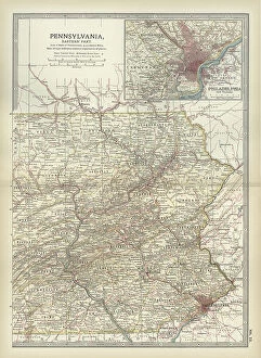
Background imageMaps Collection: Map of Pennsylvania with inset map of Philadelphia, c.1900 (engraving)

Map of Pennsylvania with inset map of Philadelphia, c.1900 (engraving)
533115 Map of Pennsylvania with inset map of Philadelphia, c.1900 (engraving); (add.info.: Map of eastern Pennsylvania with inset map of Philadelphia, circa 1902)

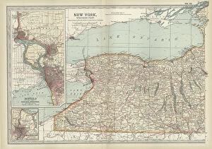
Background imageMaps Collection: Map of New York State, c.1900 (engraving)

Map of New York State, c.1900 (engraving)
533109 Map of New York State, c.1900 (engraving); (add.info.: Map of western New York State, with inset map of Buffalo, Niagara Frontier, and Rochester, circa 1902)

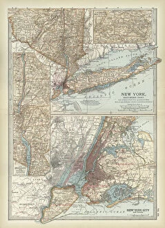
Background imageMaps Collection: Map of New York State, c.1900 (engraving)

Map of New York State, c.1900 (engraving)
533104 Map of New York State, c.1900 (engraving); (add.info.: Map of southern New York State, United States, insets map of New York City, the Hudson River, and the Catskill Mountains, circa 1902)

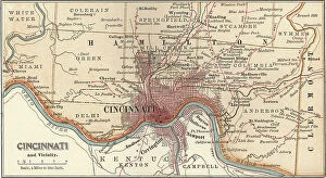
Background imageMaps Collection: Map of Cincinnati, c.1900 (engraving)

Map of Cincinnati, c.1900 (engraving)
532743 Map of Cincinnati, c.1900 (engraving); (add.info.: Map of Cincinnati, Ohio, circa 1900, from the 10th edition of Encyclopaedia Britannica.); Encyclopaedia Britannica/UIG

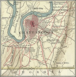
Background imageMaps Collection: Map of Chattanooga, c.1900 (engraving)

Map of Chattanooga, c.1900 (engraving)
532737 Map of Chattanooga, c.1900 (engraving); (add.info.: Map of Chattanooga, Tennessee, circa 1900, from the 10th edition of Encyclopaedia Britannica.); Encyclopaedia Britannica/UIG

Background imageMaps Collection: Map of Charleston, c.1900 (engraving)

Map of Charleston, c.1900 (engraving)
532734 Map of Charleston, c.1900 (engraving); (add.info.: Map of Charleston, South Carolina, circa 1900, from the 10th edition of Encyclopaedia Britannica.); Encyclopaedia Britannica/UIG

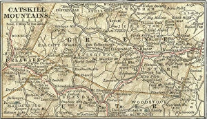
Background imageMaps Collection: Map of the Catskill Mountains, New York, c.1900 (engraving)

Map of the Catskill Mountains, New York, c.1900 (engraving)
533423 Map of the Catskill Mountains, New York, c.1900 (engraving); (add.info.: Map of Catskill Mountains, New York, circa 1902)

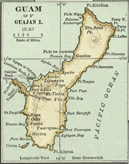
Background imageMaps Collection: Map of Guam, c.1900 (engraving)

Map of Guam, c.1900 (engraving)
533357 Map of Guam, c.1900 (engraving); (add.info.: Map of Guam or Guajan Island (U.S.), circa 1902, from the 10th edition of Encyclopaedia Britannica.); Encyclopaedia Britannica/UIG

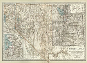
Background imageMaps Collection: Map of Nevada and Utah, c.1900 (engraving)

Map of Nevada and Utah, c.1900 (engraving)
533228 Map of Nevada and Utah, c.1900 (engraving); (add.info.: Map of Nevada and Utah, United States, with an inset map of Salt Lake City, circa 1902)

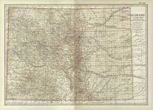
Background imageMaps Collection: Map of Colorado, c.1900 (engraving)

Map of Colorado, c.1900 (engraving)
533216 Map of Colorado, c.1900 (engraving); (add.info.: Map of Colorado, United States, circa 1902, from the 10th edition of Encyclopaedia Britannica.); Encyclopaedia Britannica/UIG

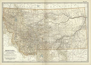
Background imageMaps Collection: Map of Montana, c.1900 (engraving)

Map of Montana, c.1900 (engraving)
533209 Map of Montana, c.1900 (engraving); (add.info.: Map of Montana, United States, circa 1902, from the 10th edition of Encyclopaedia Britannica.); Encyclopaedia Britannica/UIG

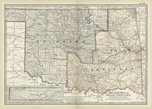
Background imageMaps Collection: Map of Oklahoma and the Indian Territory, c.1900 (engraving)

Map of Oklahoma and the Indian Territory, c.1900 (engraving)
533207 Map of Oklahoma and the Indian Territory, c.1900 (engraving); (add.info.: Map of Oklahoma and the Indian Territory, United States, circa 1902)

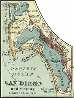
Background imageMaps Collection: Map of San Diego, c.1900 (engraving)

Map of San Diego, c.1900 (engraving)
532854 Map of San Diego, c.1900 (engraving); (add.info.: Map of San Diego, California, circa 1900, from the 10th edition of Encyclopaedia Britannica.); Encyclopaedia Britannica/UIG

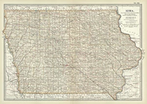
Background imageMaps Collection: Map of Iowa, c.1900 (engraving)

Map of Iowa, c.1900 (engraving)
533195 Map of Iowa, c.1900 (engraving); (add.info.: Map of Iowa, United States, circa 1902, from the 10th edition of Encyclopaedia Britannica.); Encyclopaedia Britannica/UIG

Background imageMaps Collection: Map of northern Ohio, c.1900 (engraving)

Map of northern Ohio, c.1900 (engraving)
533164 Map of northern Ohio, c.1900 (engraving); (add.info.: Map of the northern part of Ohio, United States, circa 1902, from the 10th edition of Encyclopaedia Britannica)

Background imageMaps Collection: Map of Alabama, c.1900 (engraving)

Map of Alabama, c.1900 (engraving)
533151 Map of Alabama, c.1900 (engraving); (add.info.: Map of Alabama, United States, circa 1902, from the 10th edition of Encyclopaedia Britannica.); Encyclopaedia Britannica/UIG

Background imageMaps Collection: Map of Pittsburgh, c.1900 (engraving)

Map of Pittsburgh, c.1900 (engraving)
532828 Map of Pittsburgh, c.1900 (engraving); (add.info.: Map of Pittsburgh, circa 1900, from the 10th edition of Encyclopaedia Britannica.); Encyclopaedia Britannica/UIG

Background imageMaps Collection: Map of Omaha, c.1900 (engraving)

Map of Omaha, c.1900 (engraving)
532813 Map of Omaha, c.1900 (engraving); (add.info.: Map of Omaha, Nebraska, circa 1902, from the 10th edition of Encyclopaedia Britannica.); Encyclopaedia Britannica/UIG

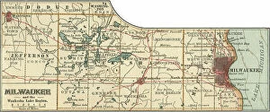
Background imageMaps Collection: Map of Milwaukee, c.1900 (engraving)

Map of Milwaukee, c.1900 (engraving)
532798 Map of Milwaukee, c.1900 (engraving); (add.info.: Map of Milwaukee, Wisconsin, circa 1900, from the 10th edition of Encyclopaedia Britannica.); Encyclopaedia Britannica/UIG

Background imageMaps Collection: French View of North America, 1762

French View of North America, 1762
2902787 French View of North America, 1762; (add.info.: North America from the Gulf of St. Lawrence to the Gulf of Mexico, west nearly to the Rocky Mountains.); Buyenlarge Archive/UIG

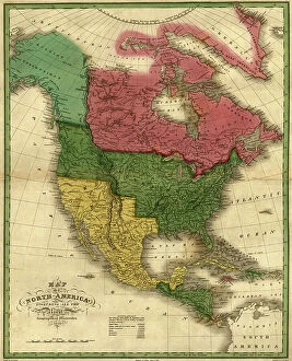
Background imageMaps Collection: North America, 1826

North America, 1826
2902785 North America, 1826; (add.info.: North America, 1826.); Buyenlarge Archive/UIG

Background imageMaps Collection: Northern Hemisphere, 1750

Northern Hemisphere, 1750
2902813 Northern Hemisphere, 1750; (add.info.: Northern Hemisphere, 1750.); Buyenlarge Archive/UIG

Background imageMaps Collection: Dominions of New Spain in North America, 1759

Dominions of New Spain in North America, 1759
2902801 Dominions of New Spain in North America, 1759; (add.info.: Dominions of New Spain in North America, 1759.); Buyenlarge Archive/UIG

Background imageMaps Collection: A Map of British - French Settlements in America, 1755

A Map of British - French Settlements in America, 1755
2902786 A Map of British - French Settlements in America, 1755; (add.info.: A Map of British - French Settlements in America, 1755.); Buyenlarge Archive/UIG

Background imageMaps Collection: North America, 1763

North America, 1763
2902783 North America, 1763; (add.info.: A New map of North America from the latest discoveries, 1763.); Buyenlarge Archive/UIG

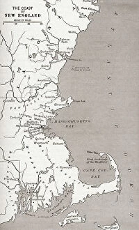
Background imageMaps Collection: Map showing the settlements in the New England Colonies, North America in the 17th century

Map showing the settlements in the New England Colonies, North America in the 17th century
2956605 Map showing the settlements in the New England Colonies, North America in the 17th century. From The History of Our Country, published 1899; Private Collection

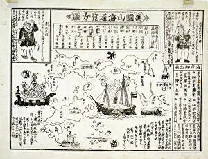
Background imageMaps Collection: Map of the world, 1875

Map of the world, 1875
1574249 Map of the world, 1875; (add.info.: Japanese print shows a map of the world with an American & Russian ship on the seas. Said to be from 1850-1900.); Universal History Archive/UIG

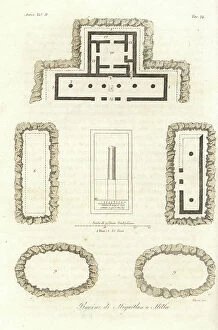
Background imageMaps Collection: Ruins of the tombs of Mitla or Miguitlan, Mexico City. Handcoloured copperplate engraving by

Ruins of the tombs of Mitla or Miguitlan, Mexico City. Handcoloured copperplate engraving by Verico from Giulio
FLO4622125 Ruins of the tombs of Mitla or Miguitlan, Mexico City. Handcoloured copperplate engraving by Verico from Giulio Ferrario's Ancient and Modern Costumes of all the Peoples of the World

Background imageMaps Collection: Universal Geography: Honduras and Salvador. Advertising images edited for the brand Louit

Universal Geography: Honduras and Salvador. Advertising images edited for the brand Louit. Debut 20th century
DUV4218167 Universal Geography: Honduras and Salvador. Advertising images edited for the brand Louit. Debut 20th century. (lithograph); 9.5x6.5 cm; Photo © Duvallon

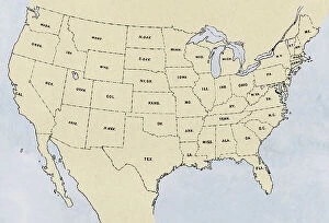
Background imageMaps Collection: USA map of lower 48 states - Map of the lower 48 states

USA map of lower 48 states - Map of the lower 48 states
NWI4712612 USA map of lower 48 states - Map of the lower 48 states.; (add.info.: USA map of lower 48 states - Map of the lower 48 states.); Photo © North Wind Pictures

Background imageMaps Collection: Routes of the great westward trails on an 1870s map of the US

Routes of the great westward trails on an 1870s map of the US
NWI4712693 Routes of the great westward trails on an 1870s map of the US.; (add.info.: Routes of the great westward trails on an 1870s map of the US.); Photo © North Wind Pictures

Background imageMaps Collection: Oregon Trail and California Trail routes on an 1870s map of the US

Oregon Trail and California Trail routes on an 1870s map of the US
NWI4712662 Oregon Trail and California Trail routes on an 1870s map of the US.; (add.info.: Oregon Trail and California Trail routes on an 1870s map of the US.); Photo © North Wind Pictures

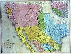
Background imageMaps Collection: Carte geographique de la Californie, Nouveau Mexique et Texas par Henry Schenk Tanner, 1849

Carte geographique de la Californie, Nouveau Mexique et Texas par Henry Schenk Tanner, 1849
UIG5333815 Carte geographique de la Californie, Nouveau Mexique et Texas par Henry Schenk Tanner, 1849.; Superstock/UIG

Background imageMaps Collection: Carte geographique du Texas aux Etats Unis. Gravure de Stephen F. Austin 1835

Carte geographique du Texas aux Etats Unis. Gravure de Stephen F. Austin 1835
UIG5333797 Carte geographique du Texas aux Etats Unis. Gravure de Stephen F. Austin 1835; Superstock/UIG

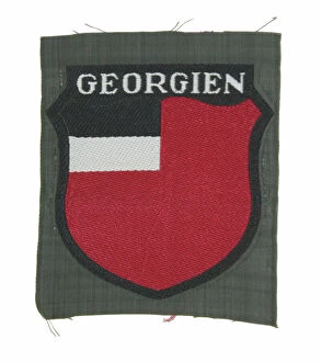
Background imageMaps Collection: Armshield for Georgian Volunteers in the German Army, c. 1939-45 (object)

Armshield for Georgian Volunteers in the German Army, c. 1939-45 (object)
7177606 Armshield for Georgian Volunteers in the German Army, c. 1939-45 (object); Private Collection; (add.info.: Cloth armshield for Georgian Volunteers in the German Army)

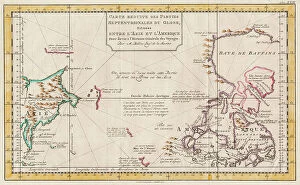
Background imageMaps Collection: Map of Asia and America, 1777 (coloured engraving)

Map of Asia and America, 1777 (coloured engraving)
7295385 Map of Asia and America, 1777 (coloured engraving) by Krevelt, Abram van (1732-84); 26x390 cm; National Maritime Museum, London

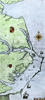
Background imageMaps Collection: Map of Virginia, 1585 (etching)

Map of Virginia, 1585 (etching)
7295569 Map of Virginia, 1585 (etching); 30x41.2 cm; National Maritime Museum, London, UK; (add.info.: This map was drawn by John White)

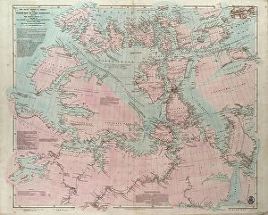
Background imageMaps Collection: The Arctic shores of America from Baffin Bay to Cape Bathurst, showing the coasts

The Arctic shores of America from Baffin Bay to Cape Bathurst, showing the coasts
7295391 The Arctic shores of America from Baffin Bay to Cape Bathurst, showing the coasts and rivers explored by the officers of the several British expeditions, between 1818 & 1859

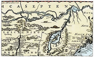
Background imageMaps Collection: Dutch geographic map of eastern North America, Great Lakes region, with description of colonies

Dutch geographic map of eastern North America, Great Lakes region, with description of colonies
NWI4846151 Dutch geographic map of eastern North America, Great Lakes region, with description of colonies: New Holland and New England, New France, 1670

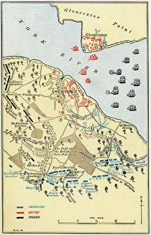
Background imageMaps Collection: United States of America Independence War (1775-1783): Map of the Battle of Yorktown where

United States of America Independence War (1775-1783): Map of the Battle of Yorktown where the English army was
NWI4840453 United States of America Independence War (1775-1783): Map of the Battle of Yorktown where the English army was defeated by the American-French alliance during the war, 1781

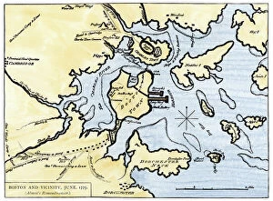
Background imageMaps Collection: Map of Boston, Massachusetts, Charlestown, Cambridge, Dorchester, and Vicinity, 1775

Map of Boston, Massachusetts, Charlestown, Cambridge, Dorchester, and Vicinity, 1775. Coloured water, 19th century
NWI4841059 Map of Boston, Massachusetts, Charlestown, Cambridge, Dorchester, and Vicinity, 1775. Coloured water, 19th century.; (add.info.: Map of Boston, Massachusetts, Charlestown, Cambridge)

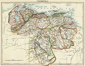
Background imageMaps Collection: Map of Venezuela, around 1870 - Lithography 19th century (Map of Venezuela)

Map of Venezuela, around 1870 - Lithography 19th century (Map of Venezuela)
NWI4876433 Map of Venezuela, around 1870 - Lithography 19th century (Map of Venezuela, 1870s - Color lithograph of a 19th-century illustration); (add.info.: Map of Venezuela)

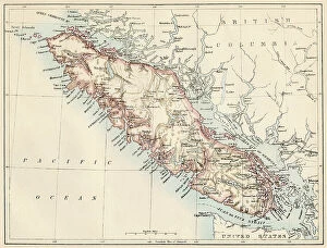
Background imageMaps Collection: Geographic map of Vancouver Island (British Columbia, Canada) and its coastline, 1887

Geographic map of Vancouver Island (British Columbia, Canada) and its coastline, 1887. Lithograph of the 19th century
NWI4867453 Geographic map of Vancouver Island (British Columbia, Canada) and its coastline, 1887. Lithograph of the 19th century; (add.info.: Geographic map of Vancouver Island (British Columbia)

Background imageMaps Collection: Geographic map of Argentina, Uruguay and Paraguay in South America, years 1870

Geographic map of Argentina, Uruguay and Paraguay in South America, years 1870. Colour engraving of the 19th century
NWI4876306 Geographic map of Argentina, Uruguay and Paraguay in South America, years 1870. Colour engraving of the 19th century.; (add.info.: Geographic map of Argentina)

Background imageMaps Collection: Map of the Province of Quebec (Canada) and Gaspe Peninsula (Gaspesie), circa 1870

Map of the Province of Quebec (Canada) and Gaspe Peninsula (Gaspesie), circa 1870. Color lithography, 19th century
NWI4867537 Map of the Province of Quebec (Canada) and Gaspe Peninsula (Gaspesie), circa 1870. Color lithography, 19th century.; (add.info)

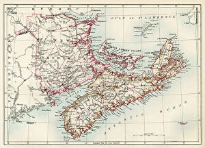
Background imageMaps Collection: Map of New Brunswick and Nova Scotia and Prince Edward Island (Canada) in the Atlantic Ocean

Map of New Brunswick and Nova Scotia and Prince Edward Island (Canada) in the Atlantic Ocean, circa 1870
NWI4867510 Map of New Brunswick and Nova Scotia and Prince Edward Island (Canada) in the Atlantic Ocean, circa 1870. Color lithography

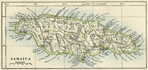
Background imageMaps Collection: Map of Jamaica, circa 1870 - Lithography - (Map of Jamaica, 1870s. Color lithograph)

Map of Jamaica, circa 1870 - Lithography - (Map of Jamaica, 1870s. Color lithograph)
NWI4866898 Map of Jamaica, circa 1870 - Lithography - (Map of Jamaica, 1870s. Color lithograph); (add.info.: Map of Jamaica, circa 1870 - Lithography - (Map of Jamaica, 1870s)

Background imageMaps Collection: Map of Virginia and Carolina coasts drawn up by John White where Roanoke Colony was located

Map of Virginia and Carolina coasts drawn up by John White where Roanoke Colony was located, 16th century
NWI4849927 Map of Virginia and Carolina coasts drawn up by John White where Roanoke Colony was located, 16th century. Colouring engraving of the 19th century.; (add.info)


All Professionally Made to Order for Quick Shipping


-

Maps Collection

Maps of the United States of America North America are detailed representations of the physical features and boundaries of the region. These maps provide an overview of the area, including major cities, rivers, lakes, mountains, and other geographical features. they also show state borders as well as international boundaries with Canada and Mexico and can be used for a variety of purposes such as planning trips or studying geography. Additionally, these maps may include information about population density and other demographic data and can essential tools for understanding our world and can help us make informed decisions about where to go or how to plan our lives.
+

Our beautiful Wall Art and Photo Gifts include Framed Prints, Photo Prints, Poster Prints, Canvas Prints, Jigsaw Puzzles, Metal Prints and so much more

Media Storehouse offers a collection of Maps of United States of America North America that showcases the beauty and diversity of this vast continent. Our collection features a range of maps, from vintage to modern, highlighting different regions and landmarks across the USA. These wall art and framed prints are perfect for those who love history, geography or simply want to add a touch of Americana to their home decor. The Maps of United States of America North America collection includes detailed topographical maps, city plans, antique maps featuring Native American tribes and early explorers' routes. The vibrant colors and intricate details make these prints stand out as unique pieces that can be used in any room or office space. Whether you're looking for an eye-catching centerpiece for your living room or a thoughtful gift for someone special, our Maps of United States of America North America collection has something to offer everyone who appreciates the beauty and complexity found within our country's borders.
+

What are Maps of United States of America North America art prints?

Maps of United States of America North America art prints are high-quality reproductions of maps that showcase the geography, topography, and landmarks of the United States. These art prints are created using advanced printing techniques that ensure accurate reproduction of every detail on the map. These maps can be used for a variety of purposes such as educational or decorative. They can help students learn about the geography and history of different regions in America while also serving as an attractive piece to display in homes or offices. The Maps of United States of America North America art prints come in various sizes and styles to fit any decor style. Some feature vintage designs with antique colors while others have modern graphics with bold colors. Whether you're looking for a unique gift idea or want to add some visual interest to your space, these art prints are an excellent choice. With their detailed depictions and stunning visuals, we offer a fascinating glimpse into American geography and history.
+

What Maps of United States of America North America art prints can I buy from Media Storehouse?

We offer a wide range of Maps of United States of America North America art prints that you can buy. These maps are available in various sizes and styles, including vintage, antique, modern, and colorful designs. You can choose from different types of maps such as topographical maps, road maps, political maps, and historical maps. The collection includes detailed city street plans for major cities like New York City or Los Angeles as well as state-specific map prints for all 50 states. Additionally there are regional US map posters showing the Midwest or the West Coast. You will find high-quality prints that are perfect for decorating your home or office space with an American theme. Whether you're looking to add some color to your walls or want a unique gift idea for someone who loves geography and history - Media Storehouse has something suitable for everyone's taste.
+

How do I buy Maps of United States of America North America art prints?

To purchase Maps of United States of America North America art prints from Media Storehouse, you can browse our collection online and select the print(s) that you like. Once you have chosen your preferred artwork, add it to your cart and proceed to checkout. During the checkout process, you will be prompted to enter your shipping information and payment details. We offer a variety of sizes for their art prints, so make sure to choose the size that best fits your needs. Additionally, we offer different framing options if you prefer a framed print. If you have any questions or concerns about purchasing Maps of United States of America North America art prints from Media Storehouse, don't hesitate to reach out to our customer service team for assistance. They are always happy to help.
+

How much do Maps of United States of America North America art prints cost?

The cost of Maps of United States of America North America art prints varies depending on the size, quality, and type of print. The price range can be quite broad, from affordable to expensive. It is important to note that different sellers may offer different prices for the same product. Factors such as the level of detail in the map, whether it is a vintage or modern design, and the printing technique used will all impact its cost. Additionally, limited edition prints or those signed by an artist may also come at a premium price. It is advisable to research various options before making a purchase decision so you can find a high-quality print that fits your budget. Many online stores offer discounts and promotions throughout the year which could help reduce costs further. Ultimately, it's worth investing in a good quality map print if you want something that will last for years to come and add character to any room in your home or office space.
+

How will my Maps of United States of America North America art prints be delivered to me?

Your Maps of United States of America North America art prints will be delivered to you in a safe and secure manner by Media Storehouse. The company takes great care in packaging your artwork so that it arrives at your doorstep in pristine condition. Your print will be carefully rolled and placed inside a sturdy tube, which is then sealed with protective caps on both ends. Media Storehouse uses reliable shipping carriers to ensure that your order is delivered promptly and efficiently. You can expect to receive updates on the status of your delivery via email or text message, depending on the carrier's tracking system. Once your package arrives, simply unroll the print and frame it according to your preference. With its high-quality printing technology, vibrant colors, and intricate details, you'll have a beautiful piece of art that captures the essence of North America's geography for years to come.