Fraud Blocker Skip to main content

Home > North America > United States of America > Maps

Maps Collection (#6)

Maps of the United States of America North America are detailed representations of the physical features and boundaries of the region

2,541 Items

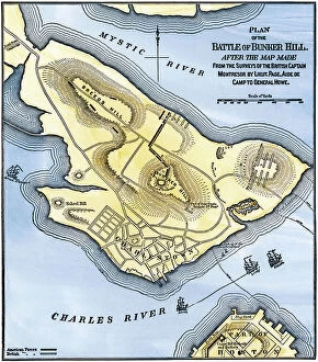
Background imageMaps Collection: United States of America Independence War (1775-1783): Map of the Battle of Bunker Hill after an

United States of America Independence War (1775-1783): Map of the Battle of Bunker Hill after an English map
NWI4841874 United States of America Independence War (1775-1783): Map of the Battle of Bunker Hill after an English map. Reproduction.; (add.info)

Background imageMaps Collection: War of Independence or American Revolution (1775-1783): Map of the vicinity of Philadelphia

War of Independence or American Revolution (1775-1783): Map of the vicinity of Philadelphia (Pennsylvania)
NWI4841014 War of Independence or American Revolution (1775-1783): Map of the vicinity of Philadelphia (Pennsylvania), Valley Forge and Brandywine

Background imageMaps Collection: Map of the inland territories of Maine, used by Benedict Arnold (1741-1801)

Map of the inland territories of Maine, used by Benedict Arnold (1741-1801), at the head of the continental army
NWI4840594 Map of the inland territories of Maine, used by Benedict Arnold (1741-1801), at the head of the continental army, for the invasion of Quebec (Canada), 1775

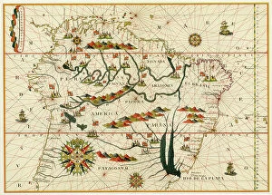
Background imageMaps Collection: Map of South America from a Spanish atlas made in Messina in 1582 by Joan Martines

Map of South America from a Spanish atlas made in Messina in 1582 by Joan Martines. Lithograph of the 19th century
NWI4846181 Map of South America from a Spanish atlas made in Messina in 1582 by Joan Martines. Lithograph of the 19th century.; (add.info)

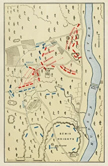
Background imageMaps Collection: United States of America Independence War (1775-1783): Map of the Second Battle of Freeman's Farm

United States of America Independence War (1775-1783): Map of the Second Battle of Freeman's Farm
NWI4843297 United States of America Independence War (1775-1783): Map of the Second Battle of Freeman's Farm, part of the Saratoga battlefield on October 7, 1777

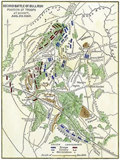
Background imageMaps Collection: American Civil War, 1861-1865: Map of the battlefield showing the positions of the troops

American Civil War, 1861-1865: Map of the battlefield showing the positions of the troops on August 29
NWI4829480 American Civil War, 1861-1865: Map of the battlefield showing the positions of the troops on August 29, 1862 during the Second Battle of Manassas

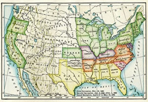
Background imageMaps Collection: American map showing the secession of states by date during the Secession War between 1860 and 1861

American map showing the secession of states by date during the Secession War between 1860 and 1861
NWI4830538 American map showing the secession of states by date during the Secession War between 1860 and 1861. Colouring engraving of the 19th century.; (add.info)

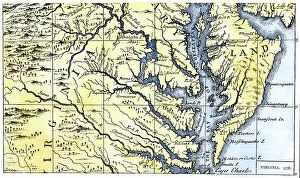
Background imageMaps Collection: United States, State of Virginia: Part of Maryland and Colonial Virginia in 1738

United States, State of Virginia: Part of Maryland and Colonial Virginia in 1738. Colour engraving of the 19th century
NWI4967573 United States, State of Virginia: Part of Maryland and Colonial Virginia in 1738. Colour engraving of the 19th century.; (add.info.: United States)

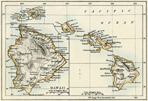
Background imageMaps Collection: United States, Hawai Island: Map of Hawai Islands, years 1870. 19th century color engraving

United States, Hawai Island: Map of Hawai Islands, years 1870. 19th century color engraving
NWI4965205 United States, Hawai Island: Map of Hawai Islands, years 1870. 19th century color engraving.; (add.info.: United States, Hawai Island: Map of Hawai Islands, years 1870)

Background imageMaps Collection: United States, New York: Map of Ratzer depicting Manhattan in New York, 1767

United States, New York: Map of Ratzer depicting Manhattan in New York, 1767. Colour engraving of the 19th century
NWI4966866 United States, New York: Map of Ratzer depicting Manhattan in New York, 1767. Colour engraving of the 19th century.; (add.info.: United States)

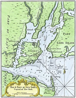
Background imageMaps Collection: United States, New York: Map of Bellin of New York Bay in 1764

United States, New York: Map of Bellin of New York Bay in 1764
NWI4966860 United States, New York: Map of Bellin of New York Bay in 1764.; (add.info.: United States, New York: Map of Bellin of New York Bay in 1764.); Photo © North Wind Pictures

Background imageMaps Collection: United States, New York: Map of John Hill from Manhattan to New York designed in 1782 draws in 1785

United States, New York: Map of John Hill from Manhattan to New York designed in 1782 draws in 1785
NWI4966854 United States, New York: Map of John Hill from Manhattan to New York designed in 1782 draws in 1785. Colour engraving of the 19th century.; (add.info.: United States)

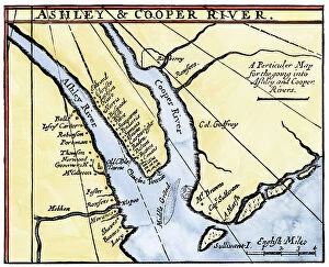
Background imageMaps Collection: United States, South Carolina: Colonial Map of the Ashley and Cooper Rivers, Charleston Site

United States, South Carolina: Colonial Map of the Ashley and Cooper Rivers, Charleston Site, South Carolina
NWI4967326 United States, South Carolina: Colonial Map of the Ashley and Cooper Rivers, Charleston Site, South Carolina, 17th century

Background imageMaps Collection: United States, South Carolina: Map of Carolina showing Charleston and Outer Banks

United States, South Carolina: Map of Carolina showing Charleston and Outer Banks, north to the right
NWI4967396 United States, South Carolina: Map of Carolina showing Charleston and Outer Banks, north to the right. Colour engraving after a 17th century map; (add.info.: United States)

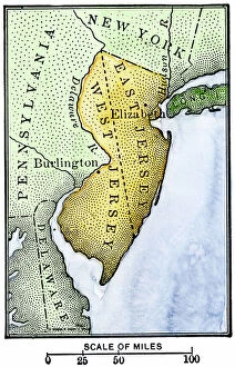
Background imageMaps Collection: United States, State of New Jersey: Map of East and West New Jersey Colonies, late 17th century

United States, State of New Jersey: Map of East and West New Jersey Colonies, late 17th century
NWI4966628 United States, State of New Jersey: Map of East and West New Jersey Colonies, late 17th century. Colour engraving of the 19th century.; (add.info.: United States)

Background imageMaps Collection: United States, Massachusetts: Plymouth Bay on the northern coast of Cape Cod, Massachusetts

United States, Massachusetts: Plymouth Bay on the northern coast of Cape Cod, Massachusetts
NWI4966172 United States, Massachusetts: Plymouth Bay on the northern coast of Cape Cod, Massachusetts. Colour engraving of the 19th century.; (add.info.: United States)

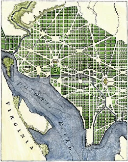
Background imageMaps Collection: USA, Washington DC: Washington DC as it was extended in the 1700s

USA, Washington DC: Washington DC as it was extended in the 1700s. Reproduction of an engraving from 1793
NWI4964847 USA, Washington DC: Washington DC as it was extended in the 1700s. Reproduction of an engraving from 1793.; (add.info.: USA, Washington DC: Washington DC as it was extended in the 1700s)

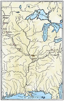
Background imageMaps Collection: Map of George Catlin (1796-1872) of the Mississippi Valley, with the Mississippi

Map of George Catlin (1796-1872) of the Mississippi Valley, with the Mississippi and Missouri rivers (USA)
NWI4898005 Map of George Catlin (1796-1872) of the Mississippi Valley, with the Mississippi and Missouri rivers (USA), showing the locations of the permanent villages of the Mandans Indians, 1837

Background imageMaps Collection: Geographic map of the Indian nations of southeastern North America (present-day states of Florida)

Geographic map of the Indian nations of southeastern North America (present-day states of Florida)
NWI4894139 Geographic map of the Indian nations of southeastern North America (present-day states of Florida, Georgia and North and South Carolina, around the Gulf of Mexico, USA), circa 1776

Background imageMaps Collection: History of Indigenous Peoples: Map of Six Iroquois Nations in Pennsylvania and New York, 1771

History of Indigenous Peoples: Map of Six Iroquois Nations in Pennsylvania and New York, 1771
NWI4894892 History of Indigenous Peoples: Map of Six Iroquois Nations in Pennsylvania and New York, 1771. Reproduction of an 18th century document.; (add.info.: History of Indigenous Peoples)

Background imageMaps Collection: French map of the Great Lakes (Upper Lake, Lake Huron, Lake Illinois)

French map of the Great Lakes (Upper Lake, Lake Huron, Lake Illinois) and Northern Mississippi at the border between
NWI4852510 French map of the Great Lakes (Upper Lake, Lake Huron, Lake Illinois) and Northern Mississippi at the border between Canada and the United States around 1700

Background imageMaps Collection: Map of the western borders of the territory of the United States of America, circa 1800

Map of the western borders of the territory of the United States of America, circa 1800
NWI4853201 Map of the western borders of the territory of the United States of America, circa 1800. Color lithography, 19th century.; (add.info)

Background imageMaps Collection: War of 1812 (Second War of Independence): Battle of Horseshoe Bend, March 27, 1814

War of 1812 (Second War of Independence): Battle of Horseshoe Bend, March 27, 1814
NWI4836991 War of 1812 (Second War of Independence): Battle of Horseshoe Bend, March 27, 1814. Map of the battlefield, site of Tukabatchi, the capital of the Creeks Indians

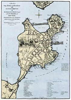
Background imageMaps Collection: Map of Boston (Massachusetts, USA), with British forces retreats, in 1775

Map of Boston (Massachusetts, USA), with British forces retreats, in 1775
NWI4843670 Map of Boston (Massachusetts, USA), with British forces retreats, in 1775. (War of Independence of the United States, 1776-1783)

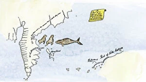
Background imageMaps Collection: Map of the voyage of Vitus Jonassen Bering (or Behring, 1681-1741)

Map of the voyage of Vitus Jonassen Bering (or Behring, 1681-1741), a Danish explorer in the service of the Russian
NWI4848395 Map of the voyage of Vitus Jonassen Bering (or Behring, 1681-1741), a Danish explorer in the service of the Russian Navy, departing from Kamchatka

Background imageMaps Collection: Universal Geography: United States of Venezuela. Advertising images edited for the brand Louit

Universal Geography: United States of Venezuela. Advertising images edited for the brand Louit. Debut 20th century
DUV4218161 Universal Geography: United States of Venezuela. Advertising images edited for the brand Louit. Debut 20th century. (lithograph); 9.5x6.5 cm; Photo © Duvallon

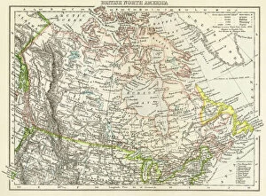
Background imageMaps Collection: Geographic map of the British-Dominion Territories of North America, c. 1870

Geographic map of the British-Dominion Territories of North America, c. 1870. Colour engraving, 19th century
NWI4867633 Geographic map of the British-Dominion Territories of North America, c. 1870. Colour engraving, 19th century.; (add.info)

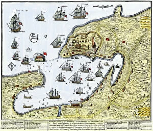
Background imageMaps Collection: Map showing Louisbourg, a Canadian city in the province of Nova Scotia, Canada

Map showing Louisbourg, a Canadian city in the province of Nova Scotia, Canada, under the British flag, 1745
NWI4867370 Map showing Louisbourg, a Canadian city in the province of Nova Scotia, Canada, under the British flag, 1745. Colouring engraving of the 19th century.; (add.info.: Map showing Louisbourg)

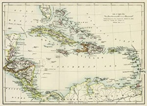
Background imageMaps Collection: Map of America with sea depth levels along the coasts of Mexico

Map of America with sea depth levels along the coasts of Mexico, the Caribbean Islands and the Caribbean
NWI4852948 Map of America with sea depth levels along the coasts of Mexico, the Caribbean Islands and the Caribbean. Color lithograph of the 19th century.; (add.info)

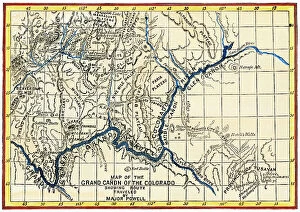
Background imageMaps Collection: Map of the Grand Canyon (USA) of the Geographic Expedition by John Wesley Powell (1834-1902)

Map of the Grand Canyon (USA) of the Geographic Expedition by John Wesley Powell (1834-1902)
NWI4853786 Map of the Grand Canyon (USA) of the Geographic Expedition by John Wesley Powell (1834-1902), 1869 - Colorisee engraving

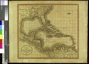
Background imageMaps Collection: Map of islands of the Caribbean Sea (or Caribbean Sea, Central America), circa 1870

Map of islands of the Caribbean Sea (or Caribbean Sea, Central America), circa 1870. Color lithography, 19th century
NWI4849885 Map of islands of the Caribbean Sea (or Caribbean Sea, Central America), circa 1870. Color lithography, 19th century.; (add.info.: Map of islands of the Caribbean Sea (or Caribbean Sea)

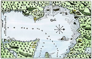
Background imageMaps Collection: The establishment of the French colony of Samuel de Champlain (1567-1635) at Quebec, on the St

The establishment of the French colony of Samuel de Champlain (1567-1635) at Quebec, on the St
NWI4849596 The establishment of the French colony of Samuel de Champlain (1567-1635) at Quebec, on the St. Lawrence River, New France (Canada), in 1613

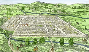
Background imageMaps Collection: Inca city of Cuzco or Cusco (Peru) in 1556 after the Spanish conquest

Inca city of Cuzco or Cusco (Peru) in 1556 after the Spanish conquest. Colourful engraving of the 19th century
NWI4848886 Inca city of Cuzco or Cusco (Peru) in 1556 after the Spanish conquest. Colourful engraving of the 19th century.; (add.info)

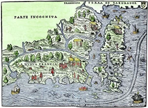
Background imageMaps Collection: Map of New France showing the coasts of Canada and the Gulf of St

Map of New France showing the coasts of Canada and the Gulf of St. Lawrence around 1550 (Map of New France, 1550)
NWI4901669 Map of New France showing the coasts of Canada and the Gulf of St. Lawrence around 1550 (Map of New France, 1550, showing coast of Canada and the St)

Background imageMaps Collection: Geography Atlas: representation of the Caribbean Sea region, the Caribbean (Cuba, Jamaica)

Geography Atlas: representation of the Caribbean Sea region, the Caribbean (Cuba, Jamaica, Hispaniola, Jamaica)
VEN5030043 Geography Atlas: representation of the Caribbean Sea region, the Caribbean (Cuba, Jamaica, Hispaniola, Jamaica), the Bahamas Islands, the Lesser Antilles

Background imageMaps Collection: Geography Atlas: description of the Caribbean Sea, Caribbean Sea (Cuba, Jamaica, Hispaniola)

Geography Atlas: description of the Caribbean Sea, Caribbean Sea (Cuba, Jamaica, Hispaniola, Jamaica)
VEN5030036 Geography Atlas: description of the Caribbean Sea, Caribbean Sea (Cuba, Jamaica, Hispaniola, Jamaica), the Bahamas Islands and the Lesser Antilles with map

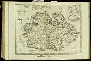
Background imageMaps Collection: Geography Atlas: representation of the island of Antigua in the Caribbean

Geography Atlas: representation of the island of Antigua in the Caribbean
VEN5030006 Geography Atlas: representation of the island of Antigua in the Caribbean. Map taken from "The west indian atlas or general description of west indies" by Thomas Jefferys

Background imageMaps Collection: Geography Atlas: representation of Tobago Island in the Lesser Antilles

Geography Atlas: representation of Tobago Island in the Lesser Antilles. Map taken from "The west indian atlas or
VEN5029619 Geography Atlas: representation of Tobago Island in the Lesser Antilles. Map taken from "The west indian atlas or general description of west indies" by Thomas Jefferys

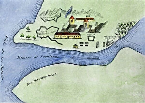
Background imageMaps Collection: Fort in Canada: View of Fort Frontenac on Lake Ontario built in the 17th century by the French in

Fort in Canada: View of Fort Frontenac on Lake Ontario built in the 17th century by the French in New France
NWI4902686 Fort in Canada: View of Fort Frontenac on Lake Ontario built in the 17th century by the French in New France (now Kingston, Canada). Engraving

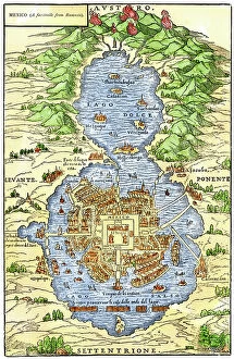
Background imageMaps Collection: Aztec City: Tenochtitlan, capital of Aztec Mexico, an island in Lake Texcoco

Aztec City: Tenochtitlan, capital of Aztec Mexico, an island in Lake Texcoco
NWI4902802 Aztec City: Tenochtitlan, capital of Aztec Mexico, an island in Lake Texcoco, at the time of the Spanish conquest of Cortes in the 16th century. Engraving

Background imageMaps Collection: Santa Fe Trail route on an 1870s map of the US

Santa Fe Trail route on an 1870s map of the US
NWI4712668 Santa Fe Trail route on an 1870s map of the US.; (add.info.: Santa Fe Trail route on an 1870s map of the US.); Photo © North Wind Pictures

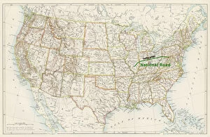
Background imageMaps Collection: National Road route on an 1870s map of the US

National Road route on an 1870s map of the US
NWI4712666 National Road route on an 1870s map of the US.; (add.info.: National Road route on an 1870s map of the US.); Photo © North Wind Pictures

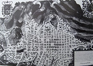
Background imageMaps Collection: Plan of San Francisco during the 18th Century

Plan of San Francisco during the 18th Century
3521880 Plan of San Francisco during the 18th Century; (add.info.: Plan of San Francisco during the 18th Century); Universal History Archive/UIG

Background imageMaps Collection: Female American mathematician and astronomer at work, at the Paris Observatory, 1850

Female American mathematician and astronomer at work, at the Paris Observatory, 1850
3478832 Female American mathematician and astronomer at work, at the Paris Observatory, 1850; (add.info.: Miss Klumpke an American mathematician and astronomer at work on the Carte du Ciel)

Background imageMaps Collection: Map of the northern part of Missouri, c.1900 (engraving)

Map of the northern part of Missouri, c.1900 (engraving)
533200 Map of the northern part of Missouri, c.1900 (engraving); (add.info.: Map of the northern part of Missouri with inset maps of Kansas City and St)

Background imageMaps Collection: Map of Nebraska with inset of Omaha, c.1900 (engraving)

Map of Nebraska with inset of Omaha, c.1900 (engraving)
533197 Map of Nebraska with inset of Omaha, c.1900 (engraving); (add.info.: Map of Nebraska, United States, with an inset map of Omaha, circa 1902)

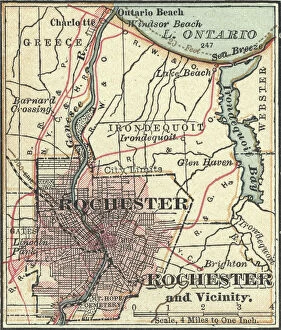
Background imageMaps Collection: Map of Rochester, c.1900 (engraving)

Map of Rochester, c.1900 (engraving)
532845 Map of Rochester, c.1900 (engraving); (add.info.: Map of Rochester, New York, circa 1900, from the 10th edition of Encyclopaedia Britannica.); Encyclopaedia Britannica/UIG

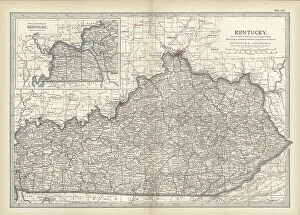
Background imageMaps Collection: Map of Kentucky, c.1900 (engraving)

Map of Kentucky, c.1900 (engraving)
533143 Map of Kentucky, c.1900 (engraving); (add.info.: Map of Kentucky, United States, circa 1902, from the 10th edition of Encyclopaedia Britannica.); Encyclopaedia Britannica/UIG


All Professionally Made to Order for Quick Shipping


-

Maps Collection

Maps of the United States of America North America are detailed representations of the physical features and boundaries of the region. These maps provide an overview of the area, including major cities, rivers, lakes, mountains, and other geographical features. they also show state borders as well as international boundaries with Canada and Mexico and can be used for a variety of purposes such as planning trips or studying geography. Additionally, these maps may include information about population density and other demographic data and can essential tools for understanding our world and can help us make informed decisions about where to go or how to plan our lives.
+

Our beautiful Wall Art and Photo Gifts include Framed Prints, Photo Prints, Poster Prints, Canvas Prints, Jigsaw Puzzles, Metal Prints and so much more

Media Storehouse offers a collection of Maps of United States of America North America that showcases the beauty and diversity of this vast continent. Our collection features a range of maps, from vintage to modern, highlighting different regions and landmarks across the USA. These wall art and framed prints are perfect for those who love history, geography or simply want to add a touch of Americana to their home decor. The Maps of United States of America North America collection includes detailed topographical maps, city plans, antique maps featuring Native American tribes and early explorers' routes. The vibrant colors and intricate details make these prints stand out as unique pieces that can be used in any room or office space. Whether you're looking for an eye-catching centerpiece for your living room or a thoughtful gift for someone special, our Maps of United States of America North America collection has something to offer everyone who appreciates the beauty and complexity found within our country's borders.
+

What are Maps of United States of America North America art prints?

Maps of United States of America North America art prints are high-quality reproductions of maps that showcase the geography, topography, and landmarks of the United States. These art prints are created using advanced printing techniques that ensure accurate reproduction of every detail on the map. These maps can be used for a variety of purposes such as educational or decorative. They can help students learn about the geography and history of different regions in America while also serving as an attractive piece to display in homes or offices. The Maps of United States of America North America art prints come in various sizes and styles to fit any decor style. Some feature vintage designs with antique colors while others have modern graphics with bold colors. Whether you're looking for a unique gift idea or want to add some visual interest to your space, these art prints are an excellent choice. With their detailed depictions and stunning visuals, we offer a fascinating glimpse into American geography and history.
+

What Maps of United States of America North America art prints can I buy from Media Storehouse?

We offer a wide range of Maps of United States of America North America art prints that you can buy. These maps are available in various sizes and styles, including vintage, antique, modern, and colorful designs. You can choose from different types of maps such as topographical maps, road maps, political maps, and historical maps. The collection includes detailed city street plans for major cities like New York City or Los Angeles as well as state-specific map prints for all 50 states. Additionally there are regional US map posters showing the Midwest or the West Coast. You will find high-quality prints that are perfect for decorating your home or office space with an American theme. Whether you're looking to add some color to your walls or want a unique gift idea for someone who loves geography and history - Media Storehouse has something suitable for everyone's taste.
+

How do I buy Maps of United States of America North America art prints?

To purchase Maps of United States of America North America art prints from Media Storehouse, you can browse our collection online and select the print(s) that you like. Once you have chosen your preferred artwork, add it to your cart and proceed to checkout. During the checkout process, you will be prompted to enter your shipping information and payment details. We offer a variety of sizes for their art prints, so make sure to choose the size that best fits your needs. Additionally, we offer different framing options if you prefer a framed print. If you have any questions or concerns about purchasing Maps of United States of America North America art prints from Media Storehouse, don't hesitate to reach out to our customer service team for assistance. They are always happy to help.
+

How much do Maps of United States of America North America art prints cost?

The cost of Maps of United States of America North America art prints varies depending on the size, quality, and type of print. The price range can be quite broad, from affordable to expensive. It is important to note that different sellers may offer different prices for the same product. Factors such as the level of detail in the map, whether it is a vintage or modern design, and the printing technique used will all impact its cost. Additionally, limited edition prints or those signed by an artist may also come at a premium price. It is advisable to research various options before making a purchase decision so you can find a high-quality print that fits your budget. Many online stores offer discounts and promotions throughout the year which could help reduce costs further. Ultimately, it's worth investing in a good quality map print if you want something that will last for years to come and add character to any room in your home or office space.
+

How will my Maps of United States of America North America art prints be delivered to me?

Your Maps of United States of America North America art prints will be delivered to you in a safe and secure manner by Media Storehouse. The company takes great care in packaging your artwork so that it arrives at your doorstep in pristine condition. Your print will be carefully rolled and placed inside a sturdy tube, which is then sealed with protective caps on both ends. Media Storehouse uses reliable shipping carriers to ensure that your order is delivered promptly and efficiently. You can expect to receive updates on the status of your delivery via email or text message, depending on the carrier's tracking system. Once your package arrives, simply unroll the print and frame it according to your preference. With its high-quality printing technology, vibrant colors, and intricate details, you'll have a beautiful piece of art that captures the essence of North America's geography for years to come.