
Maps Collection (#2)
Maps of the United States of America North America are detailed representations of the physical features and boundaries of the region
2,541 Items


All Professionally Made to Order for Quick Shipping
-
Maps Collection
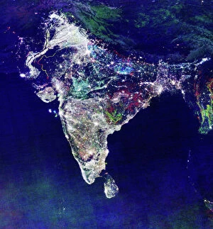
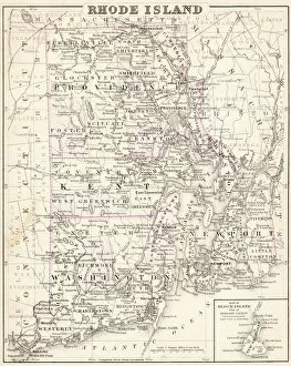
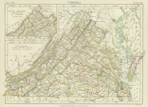
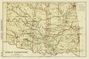
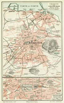
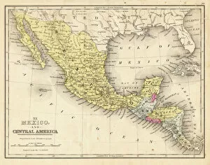
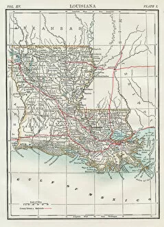
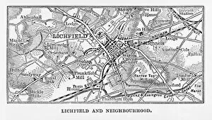
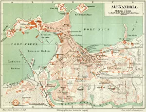
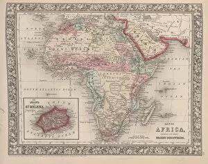
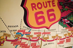
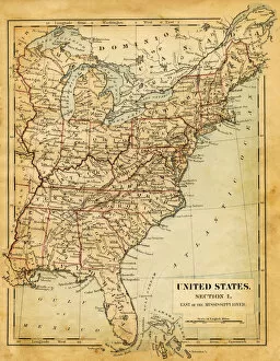
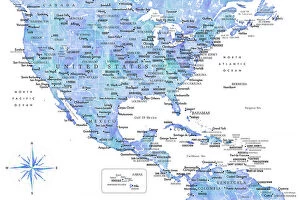
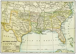
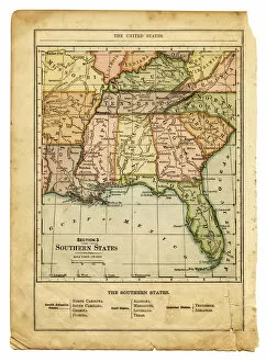
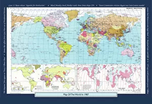
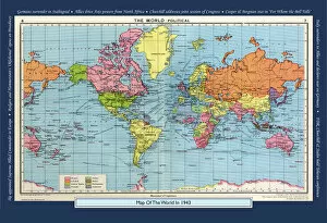
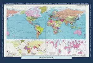
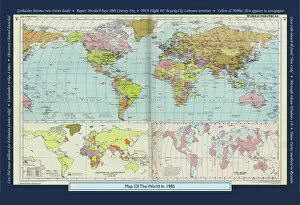
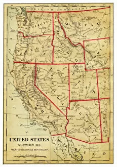
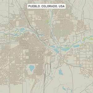
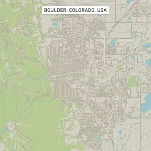
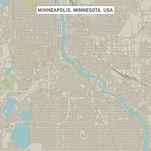
Maps of the United States of America North America are detailed representations of the physical features and boundaries of the region. These maps provide an overview of the area, including major cities, rivers, lakes, mountains, and other geographical features. they also show state borders as well as international boundaries with Canada and Mexico and can be used for a variety of purposes such as planning trips or studying geography. Additionally, these maps may include information about population density and other demographic data and can essential tools for understanding our world and can help us make informed decisions about where to go or how to plan our lives.
+
Our beautiful Wall Art and Photo Gifts include Framed Prints, Photo Prints, Poster Prints, Canvas Prints, Jigsaw Puzzles, Metal Prints and so much more
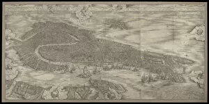
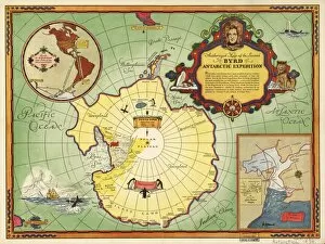
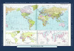
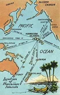
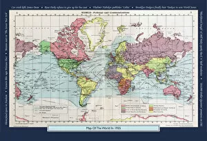
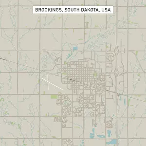
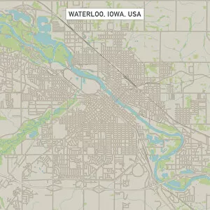
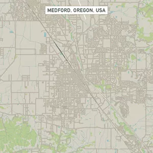
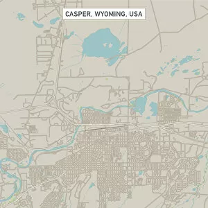
Media Storehouse offers a collection of Maps of United States of America North America that showcases the beauty and diversity of this vast continent. Our collection features a range of maps, from vintage to modern, highlighting different regions and landmarks across the USA. These wall art and framed prints are perfect for those who love history, geography or simply want to add a touch of Americana to their home decor. The Maps of United States of America North America collection includes detailed topographical maps, city plans, antique maps featuring Native American tribes and early explorers' routes. The vibrant colors and intricate details make these prints stand out as unique pieces that can be used in any room or office space. Whether you're looking for an eye-catching centerpiece for your living room or a thoughtful gift for someone special, our Maps of United States of America North America collection has something to offer everyone who appreciates the beauty and complexity found within our country's borders.
+
What are Maps of United States of America North America art prints?
Maps of United States of America North America art prints are high-quality reproductions of maps that showcase the geography, topography, and landmarks of the United States. These art prints are created using advanced printing techniques that ensure accurate reproduction of every detail on the map. These maps can be used for a variety of purposes such as educational or decorative. They can help students learn about the geography and history of different regions in America while also serving as an attractive piece to display in homes or offices. The Maps of United States of America North America art prints come in various sizes and styles to fit any decor style. Some feature vintage designs with antique colors while others have modern graphics with bold colors. Whether you're looking for a unique gift idea or want to add some visual interest to your space, these art prints are an excellent choice. With their detailed depictions and stunning visuals, we offer a fascinating glimpse into American geography and history.
+
What Maps of United States of America North America art prints can I buy from Media Storehouse?
We offer a wide range of Maps of United States of America North America art prints that you can buy. These maps are available in various sizes and styles, including vintage, antique, modern, and colorful designs. You can choose from different types of maps such as topographical maps, road maps, political maps, and historical maps. The collection includes detailed city street plans for major cities like New York City or Los Angeles as well as state-specific map prints for all 50 states. Additionally there are regional US map posters showing the Midwest or the West Coast. You will find high-quality prints that are perfect for decorating your home or office space with an American theme. Whether you're looking to add some color to your walls or want a unique gift idea for someone who loves geography and history - Media Storehouse has something suitable for everyone's taste.
+
How do I buy Maps of United States of America North America art prints?
To purchase Maps of United States of America North America art prints from Media Storehouse, you can browse our collection online and select the print(s) that you like. Once you have chosen your preferred artwork, add it to your cart and proceed to checkout. During the checkout process, you will be prompted to enter your shipping information and payment details. We offer a variety of sizes for their art prints, so make sure to choose the size that best fits your needs. Additionally, we offer different framing options if you prefer a framed print. If you have any questions or concerns about purchasing Maps of United States of America North America art prints from Media Storehouse, don't hesitate to reach out to our customer service team for assistance. They are always happy to help.
+
How much do Maps of United States of America North America art prints cost?
The cost of Maps of United States of America North America art prints varies depending on the size, quality, and type of print. The price range can be quite broad, from affordable to expensive. It is important to note that different sellers may offer different prices for the same product. Factors such as the level of detail in the map, whether it is a vintage or modern design, and the printing technique used will all impact its cost. Additionally, limited edition prints or those signed by an artist may also come at a premium price. It is advisable to research various options before making a purchase decision so you can find a high-quality print that fits your budget. Many online stores offer discounts and promotions throughout the year which could help reduce costs further. Ultimately, it's worth investing in a good quality map print if you want something that will last for years to come and add character to any room in your home or office space.
+
How will my Maps of United States of America North America art prints be delivered to me?
Your Maps of United States of America North America art prints will be delivered to you in a safe and secure manner by Media Storehouse. The company takes great care in packaging your artwork so that it arrives at your doorstep in pristine condition. Your print will be carefully rolled and placed inside a sturdy tube, which is then sealed with protective caps on both ends. Media Storehouse uses reliable shipping carriers to ensure that your order is delivered promptly and efficiently. You can expect to receive updates on the status of your delivery via email or text message, depending on the carrier's tracking system. Once your package arrives, simply unroll the print and frame it according to your preference. With its high-quality printing technology, vibrant colors, and intricate details, you'll have a beautiful piece of art that captures the essence of North America's geography for years to come.