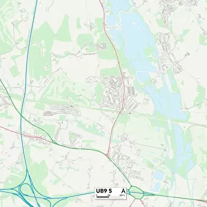
Premium Framed Print > North America > United States of America > New York > New York > Maps
Premium Framed Print : 1839, Bradford Map of New York City, New York, topography, cartography, geography


![]()
Framed Photos from Liszt Collection
1839, Bradford Map of New York City, New York, topography, cartography, geography
1839, Bradford Map of New York City, New York
Liszt Collection of nineteenth-century engravings and images to browse and enjoy
Media ID 14005082
© Artokoloro Quint Lox Limited
1839 Antique Map Latitude Longitude Mappa Mundi Old Antique Plan Old Antique View Ols Antique Map Rare Old Maps Topo
14"x16" Premium Frame
Contemporary style Premium Wooden Frame with 8"x10" Print. Complete with 2" White Mat and 1.25" thick MDF frame. Printed on 260 gsm premium paper. Glazed with shatter proof UV coated acrylic glass. Backing is paper covered backing with rubber bumpers. Supplied ready to hang with a pre-installed sawtooth/wire hanger. Care Instructions: Spot clean with a damp cloth. Securely packaged in a clear plastic bag and envelope in a reinforced cardboard shipper
FSC Real Wood Frame and Double Mounted with White Conservation Mountboard - Professionally Made and Ready to Hang
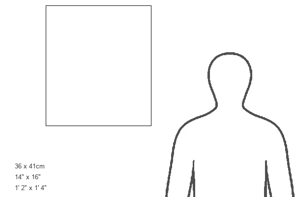
Estimated Image Size (if not cropped) is 20.3cm x 25.4cm (8" x 10")
Estimated Product Size is 35.6cm x 40.6cm (14" x 16")
These are individually made so all sizes are approximate
Artwork printed orientated as per the preview above, with portrait (vertical) orientation to match the source image.
FEATURES IN THESE COLLECTIONS
> Europe
> France
> Canton
> Landes
> Historic
> Space exploration
> Maps and Charts
> Early Maps
> Maps and Charts
> Related Images
> Maps and Charts
> World
> North America
> United States of America
> New York
> New York
> Maps
EDITORS COMMENTS
This print showcases the remarkable 1839 Bradford Map of New York City, a true masterpiece in the realms of topography, cartography, and geography. With its intricate details and precise measurements, this vintage map offers a fascinating glimpse into the city's past. The artistry behind this ancient piece is evident in its delicate illustrations and meticulous depiction of landforms. Every contour and curve has been carefully etched onto paper, creating an exquisite representation of New York City's geographical features. The grid lines marking latitude and longitude add to its precision while lending it a geometric charm. As we gaze upon this historic artifact, we are transported back in time to an era when navigation relied on such beautifully crafted maps. Its aged appearance adds to its allure, reminding us of the countless journeys undertaken by explorers who relied on these very maps for guidance. This rare gem from the Liszt Collection serves as a testament to human curiosity and our desire to understand our world better. It invites us to embark on a journey through history as we explore the region's past through cartographic lenses. Whether you are an avid collector or simply appreciate fine art with historical significance, this antique map is sure to captivate your imagination and spark conversations about New York City's rich heritage.
MADE IN THE USA
Safe Shipping with 30 Day Money Back Guarantee
FREE PERSONALISATION*
We are proud to offer a range of customisation features including Personalised Captions, Color Filters and Picture Zoom Tools
SECURE PAYMENTS
We happily accept a wide range of payment options so you can pay for the things you need in the way that is most convenient for you
* Options may vary by product and licensing agreement. Zoomed Pictures can be adjusted in the Cart.