Canvas Print > North America > United States of America > New York > New York > Maps
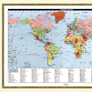
Canvas Print : 1839, Bradford Map of New York City, New York, topography, cartography, geography


![]()
Canvas Prints from Liszt Collection
1839, Bradford Map of New York City, New York, topography, cartography, geography
1839, Bradford Map of New York City, New York
Liszt Collection of nineteenth-century engravings and images to browse and enjoy
Media ID 14005082
© Artokoloro Quint Lox Limited
1839 Antique Map Latitude Longitude Mappa Mundi Old Antique Plan Old Antique View Ols Antique Map Rare Old Maps Topo
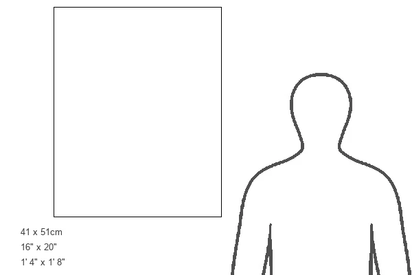
20"x16" (51x41cm) Canvas Print
Step back in time with our stunning Media Storehouse Canvas Print featuring the 1839 Bradford Map of New York City from the esteemed Liszt Collection. This exquisite piece of cartographic history showcases intricate topographical details and accurate geographical representations of New York City during that era. The vibrant colors and high-quality finish of our canvas prints bring out the rich textures and intricacies of this 19th-century map, making it a perfect addition to any home or office space. Transport yourself back in time and add a touch of history to your decor with our Bradford Map of New York City Canvas Print.
Delivered stretched and ready to hang our premium quality canvas prints are made from a polyester/cotton blend canvas and stretched over a 1.25" (32mm) kiln dried knot free wood stretcher bar. Packaged in a plastic bag and secured to a cardboard insert for safe transit.
Canvas Prints add colour, depth and texture to any space. Professionally Stretched Canvas over a hidden Wooden Box Frame and Ready to Hang
Estimated Product Size is 40.6cm x 50.8cm (16" x 20")
These are individually made so all sizes are approximate
Artwork printed orientated as per the preview above, with portrait (vertical) orientation to match the source image.
FEATURES IN THESE COLLECTIONS
> Europe
> France
> Canton
> Landes
> Historic
> Space exploration
> Maps and Charts
> Early Maps
> Maps and Charts
> Related Images
> Maps and Charts
> World
> North America
> United States of America
> New York
> New York
> Maps
EDITORS COMMENTS
This print showcases the remarkable 1839 Bradford Map of New York City, a true masterpiece in the realms of topography, cartography, and geography. With its intricate details and precise measurements, this vintage map offers a fascinating glimpse into the city's past. The artistry behind this ancient piece is evident in its delicate illustrations and meticulous depiction of landforms. Every contour and curve has been carefully etched onto paper, creating an exquisite representation of New York City's geographical features. The grid lines marking latitude and longitude add to its precision while lending it a geometric charm. As we gaze upon this historic artifact, we are transported back in time to an era when navigation relied on such beautifully crafted maps. Its aged appearance adds to its allure, reminding us of the countless journeys undertaken by explorers who relied on these very maps for guidance. This rare gem from the Liszt Collection serves as a testament to human curiosity and our desire to understand our world better. It invites us to embark on a journey through history as we explore the region's past through cartographic lenses. Whether you are an avid collector or simply appreciate fine art with historical significance, this antique map is sure to captivate your imagination and spark conversations about New York City's rich heritage.
MADE IN THE USA
Safe Shipping with 30 Day Money Back Guarantee
FREE PERSONALISATION*
We are proud to offer a range of customisation features including Personalised Captions, Color Filters and Picture Zoom Tools
SECURE PAYMENTS
We happily accept a wide range of payment options so you can pay for the things you need in the way that is most convenient for you
* Options may vary by product and licensing agreement. Zoomed Pictures can be adjusted in the Cart.