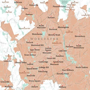
Mouse Mat > North America > United States of America > Massachusetts > Worcester
Mouse Mat : MA Worcester Northborough Vector Road Map

![]()
Home Decor from Fine Art Storehouse
MA Worcester Northborough Vector Road Map
MA Worcester Northborough Vector Road Map. All source data is in the public domain. U.S. Census Bureau Census Tiger. Used Layers: areawater, linearwater, roads, rails, cousub, pointlm, uac10
Unleash your creativity and transform your space into a visual masterpiece!
Frank Ramspott
Media ID 20691897
© Frank Ramspott, all rights reserved
City Map Computer Graphic County Digital Composite District Geographical Border Massachusetts Road Map Text Vector Worcester Digitally Generated Image West Village Woodside
Mouse Pad
Standard Size Mouse Pad 7.75" x 9..25". High density Neoprene w linen surface. Easy to clean, stain resistant finish. Rounded corners.
Archive quality photographic print in a durable wipe clean mouse mat with non slip backing. Works with all computer mice
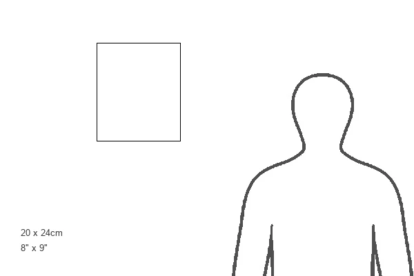
Estimated Product Size is 20.2cm x 23.7cm (8" x 9.3")
These are individually made so all sizes are approximate
Artwork printed orientated as per the preview above, with landscape (horizontal) or portrait (vertical) orientation to match the source image.
FEATURES IN THESE COLLECTIONS
> Fine Art Storehouse
> Map
> Reference Maps
> Animals
> Mammals
> Cats (Wild)
> Tiger
> Arts
> Contemporary art
> Digital artwork
> Street art
> Arts
> Street art graffiti
> Digital art
> Digital paintings
> Maps and Charts
> Related Images
> North America
> United States of America
> Massachusetts
> Worcester
> Popular Themes
> Lake District
EDITORS COMMENTS
This print showcases the MA Worcester Northborough Vector Road Map, a stunning piece of cartography art. Designed by Frank Ramspott, this digitally generated image beautifully captures the intricate details of Massachusetts' geography. The map incorporates various layers such as areawater, linearwater, roads, rails, cousub, pointlm, and uac10 sourced from the public domain U. S. Census Bureau Census Tiger data. In this colorful and vibrant city map, you can explore the charming cities and districts within Worcester County. From bustling urban areas like Worcester itself to serene lakeside communities like Woodside and Chapinville, every corner is meticulously depicted with precision. The inclusion of rivers and lakes adds an element of natural beauty to this digital composite artwork. The text on the map helps navigate through streets and highlights significant landmarks throughout the region. With no people in sight but bursting with life through its vivid colors and detailed design elements, this vector road map print is a must-have for any geography enthusiast or lover of fine art. It serves as both a functional tool for navigation purposes as well as an aesthetically pleasing piece that will enhance any space it graces
MADE IN THE USA
Safe Shipping with 30 Day Money Back Guarantee
FREE PERSONALISATION*
We are proud to offer a range of customisation features including Personalised Captions, Color Filters and Picture Zoom Tools
SECURE PAYMENTS
We happily accept a wide range of payment options so you can pay for the things you need in the way that is most convenient for you
* Options may vary by product and licensing agreement. Zoomed Pictures can be adjusted in the Cart.