Fine Art Print > Arts > Contemporary art > Digital artwork > Street art
Fine Art Print : MA Middlesex Reading Vector Road Map


![]()
Fine Art Prints from Fine Art Storehouse
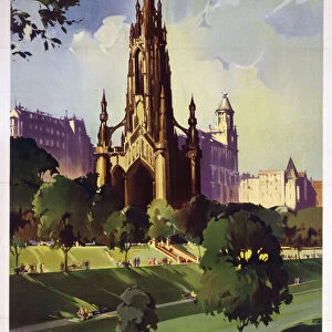
MA Middlesex Reading Vector Road Map
MA Middlesex Reading Vector Road Map. All source data is in the public domain. U.S. Census Bureau Census Tiger. Used Layers: areawater, linearwater, roads, rails, cousub, pointlm, uac10
Unleash your creativity and transform your space into a visual masterpiece!
Frank Ramspott
Media ID 20691121
© Frank Ramspott, all rights reserved
City Map Computer Graphic County Digital Composite District Geographical Border Massachusetts Middlesex Reading Road Map Text Vector Digitally Generated Image Wakefield West Village
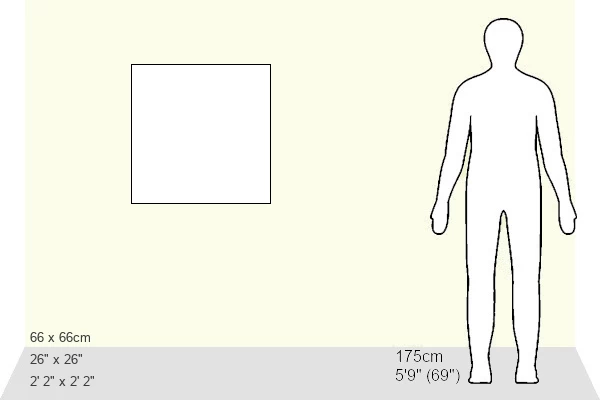
20"x20" (+3" Border) Fine Art Print
Discover the captivating blend of art and data with our MA Middlesex Reading Vector Road Map print by Frank Ramspott from the Media Storehouse Fine Art Prints collection. This unique piece transforms census data into a stunning visual representation of the Middlesex County area. With intricate detail and vibrant colors, the roads, rails, and waterways are brought to life in a way that is both informative and aesthetically pleasing. All source data is in the public domain and has been expertly layered to create this one-of-a-kind work of art. Add a touch of modern sophistication to your home or office decor with this thought-provoking and visually striking print.
20x20 image printed on 26x26 Fine Art Rag Paper with 3" (76mm) white border. Our Fine Art Prints are printed on 300gsm 100% acid free, PH neutral paper with archival properties. This printing method is used by museums and art collections to exhibit photographs and art reproductions.
Our fine art prints are high-quality prints made using a paper called Photo Rag. This 100% cotton rag fibre paper is known for its exceptional image sharpness, rich colors, and high level of detail, making it a popular choice for professional photographers and artists. Photo rag paper is our clear recommendation for a fine art paper print. If you can afford to spend more on a higher quality paper, then Photo Rag is our clear recommendation for a fine art paper print.
Estimated Image Size (if not cropped) is 50.8cm x 50.8cm (20" x 20")
Estimated Product Size is 66cm x 66cm (26" x 26")
These are individually made so all sizes are approximate
Artwork printed orientated as per the preview above, with landscape (horizontal) or portrait (vertical) orientation to match the source image.
FEATURES IN THESE COLLECTIONS
> Animals
> Mammals
> Cats (Wild)
> Tiger
> Arts
> Contemporary art
> Digital artwork
> Street art
> Arts
> Street art graffiti
> Digital art
> Digital paintings
> Europe
> United Kingdom
> England
> Middlesex
> Related Images
> Europe
> United Kingdom
> Scotland
> Highlands
> Related Images
> Maps and Charts
> Related Images
> Popular Themes
> Lake District
> Fine Art Storehouse
> Map
> Reference Maps
EDITORS COMMENTS
This vibrant and detailed print captures the essence of Middlesex County, Massachusetts with its MA Middlesex Reading Vector Road Map. Created by talented cartographer Frank Ramspott, this digitally generated image showcases the intricate road network, water bodies, and geographical borders of the region. The map is a testament to the power of technology and data accessibility as it utilizes public domain information from the U. S. Census Bureau Census Tiger. Various layers such as areawater, linearwater, roads, rails, cousub, pointlm, and uac10 have been skillfully combined to create this visually appealing composition. With no people present in the picture itself but an abundance of colorful elements like rivers and lakes depicted through vector graphics, this artwork focuses solely on showcasing the physical geography of Middlesex County. The inclusion of city names like Reading Highlands, Mishawum, Wakefield, and West Village adds a sense of familiarity for locals or those familiar with these areas. Whether you're a resident or simply fascinated by maps and design aesthetics, this print will surely make a striking addition to any space. Its computer-generated imagery highlights both functionality and beauty in equal measure while paying homage to the rich history and diverse landscapes that define Middlesex County.
MADE IN THE USA
Safe Shipping with 30 Day Money Back Guarantee
FREE PERSONALISATION*
We are proud to offer a range of customisation features including Personalised Captions, Color Filters and Picture Zoom Tools
SECURE PAYMENTS
We happily accept a wide range of payment options so you can pay for the things you need in the way that is most convenient for you
* Options may vary by product and licensing agreement. Zoomed Pictures can be adjusted in the Cart.