Jigsaw Puzzle > Europe > France > Canton > Landes
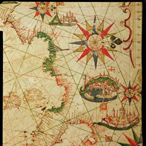
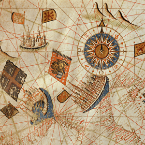
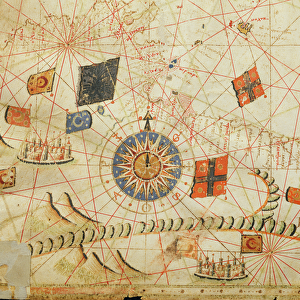
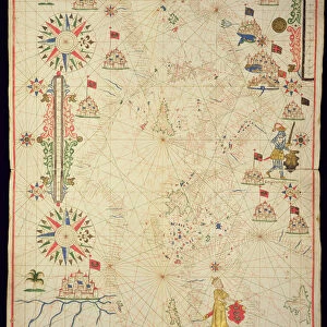
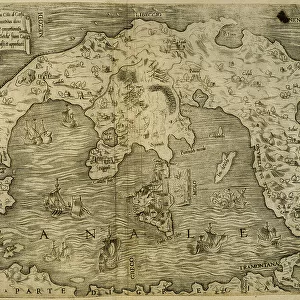
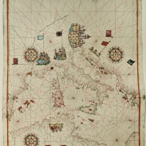
Jigsaw Puzzle : 17th Century nautical map of the Atlantic


![]()
Jigsaw Puzzles from Science Photo Library
17th Century nautical map of the Atlantic
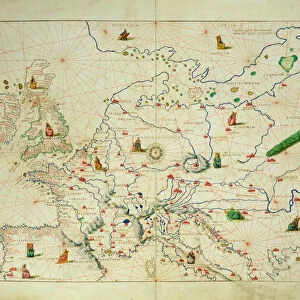
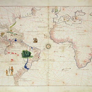
17th Century nautical map of the Atlantic Ocean. Historical portolan chart showing the Atlantic Ocean and adjacent continents. Portolan charts are navigational maps based on realistic descriptions of harbours and coasts. Along with the Atlantic, this chart shows the southeast Pacific Ocean, southwest Indian Ocean and the continents of South America, Africa, Europe, and parts of North America and Asia. Created by Pascal Roiz in 1633
Science Photo Library features Science and Medical images including photos and illustrations
Media ID 6333805
© LIBRARY OF CONGRESS/SCIENCE PHOTO LIBRARY
17th Century Africa African Atlantic Ocean Cartography Chart Diagram Indian Ocean Land Nautical Navigational North American Pacific Ocean South America South American 1633 Portolan
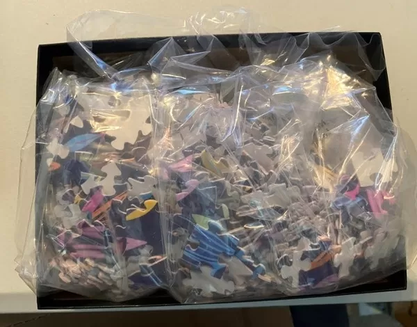
Jigsaw Puzzle (520 Pieces)
Discover the intrigue of the past with our Media Storehouse 17th Century Nautical Map of the Atlantic Jigsaw Puzzle. This captivating puzzle, featuring a historical portolan chart from the Science Photo Library, invites you on a journey back in time. Explore the Atlantic Ocean and adjacent continents as they appeared over 300 years ago. With intricate details and a rich historical context, this puzzle is not just a pastime but an educational experience. Delve into the mysteries of maritime exploration and add this magnificent piece to your collection. Solve the puzzle and unveil the secrets of the Atlantic's past.
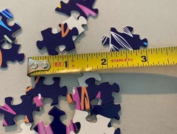
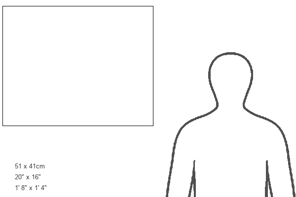
Made in the USA, 520-piece puzzles measure 16" x 20" (40.6 x 50.8 cm). Every puzzle is meticulously printed on glossy photo paper, which has a strong 1.33 mm thickness. Delivered in a black storage cardboard box, these puzzles are both stylish and practical. (Note: puzzles contain small parts and are not suitable for children under 3 years of age.)
Jigsaw Puzzles are an ideal gift for any occasion
Estimated Product Size is 50.8cm x 40.5cm (20" x 15.9")
These are individually made so all sizes are approximate
Artwork printed orientated as per the preview above, with landscape (horizontal) or portrait (vertical) orientation to match the source image.
FEATURES IN THESE COLLECTIONS
> Africa
> South Africa
> Maps
> Africa
> South Africa
> Related Images
> Animals
> Mammals
> Muridae
> Water Mouse
> Arts
> Artists
> O
> Oceanic Oceanic
> Europe
> France
> Canton
> Landes
> Maps and Charts
> Early Maps
> Maps and Charts
> Related Images
> South America
> Related Images
EDITORS COMMENTS
This 17th-century nautical map of the Atlantic Ocean takes us back in time to an era of exploration and discovery. Created by Pascal Roiz in 1633, this historical portolan chart offers a detailed depiction of the vast Atlantic and its neighboring continents. Portolan charts were renowned for their navigational accuracy, providing sailors with realistic descriptions of harbors and coastlines. In addition to showcasing the Atlantic Ocean, this remarkable artwork also encompasses parts of the southeast Pacific Ocean, southwest Indian Ocean, South America, Africa, Europe, as well as fragments of North America and Asia. With intricate illustrations and meticulous attention to detail, Roiz's masterpiece transports us into a world where landmasses are beautifully rendered alongside expansive bodies of water. This artful representation serves not only as a testament to cartography but also as a window into our rich maritime history. As we explore this ancient map's contours and study its geographical features—tracing trade routes or imagining daring voyages—we gain insight into the knowledge available during that period. It reminds us how far we have come in understanding our planet while honoring those intrepid explorers who braved uncharted waters centuries ago. Through Science Photo Library's print reproduction of this magnificent piece from their collection—not intended for commercial use—we can appreciate both the artistic beauty and scientific significance encapsulated within this 17th-century treasure.
MADE IN THE USA
Safe Shipping with 30 Day Money Back Guarantee
FREE PERSONALISATION*
We are proud to offer a range of customisation features including Personalised Captions, Color Filters and Picture Zoom Tools
SECURE PAYMENTS
We happily accept a wide range of payment options so you can pay for the things you need in the way that is most convenient for you
* Options may vary by product and licensing agreement. Zoomed Pictures can be adjusted in the Cart.