Fraud Blocker Skip to main content

Home > North America > The Bahamas > Related Images

Related Images Collection (#3)

2,030 Items

Background imageRelated Images Collection: Atlantic spotted dolphins. Bimini, Bahamas

Atlantic spotted dolphins. Bimini, Bahamas

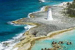
Background imageRelated Images Collection: Paradise Island Lighthouse, Nassau Harbour, New Providence Island, Bahamas

Paradise Island Lighthouse, Nassau Harbour, New Providence Island, Bahamas, West Indies, Central America

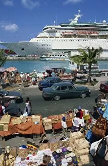
Background imageRelated Images Collection: Cruise ship dockside, Nassau, Bahamas, West Indies, Central America

Cruise ship dockside, Nassau, Bahamas, West Indies, Central America

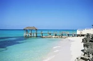
Background imageRelated Images Collection: Cable Beach, Nassau, New Providence, Bahamas, West Indies, Central America

Cable Beach, Nassau, New Providence, Bahamas, West Indies, Central America

Background imageRelated Images Collection: Red mangrove (Rhizophora mangle) propagules / plantlets which become fully mature plants

Red mangrove (Rhizophora mangle) propagules / plantlets which become fully mature plants before dropping off the parent tree to drift away and establish a new tree. Bahamas

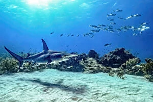
Background imageRelated Images Collection: Bahamas Reef shark

Bahamas Reef shark
Serge Melesan

Background imageRelated Images Collection: Bahamas in Blue

Bahamas in Blue
Serge Melesan

Background imageRelated Images Collection: Photocard, 1930s: Nassau, Bahamas (coloured photo)

Photocard, 1930s: Nassau, Bahamas (coloured photo)
8671660 Photocard, 1930s: Nassau, Bahamas (coloured photo) by English Photographer, (20th century); Private Collection; (add.info.: Nassau, Bahamas)

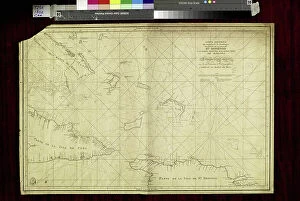
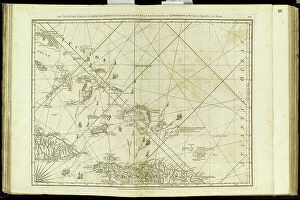
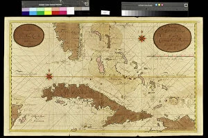
Background imageRelated Images Collection: Geography Atlas: representation of the Bahamas islands, northern Hispaniola (Santo Domingo)

Geography Atlas: representation of the Bahamas islands, northern Hispaniola (Santo Domingo)
VEN5031335 Geography Atlas: representation of the Bahamas islands, northern Hispaniola (Santo Domingo) and the Leewind Passage between Cuba and Hispaniola in the West Indies

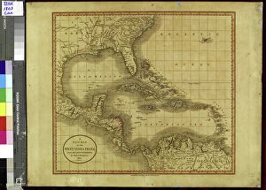
Background imageRelated Images Collection: Geography Atlas: representation of the Caribbean Sea region, the Caribbean (Cuba, Jamaica)

Geography Atlas: representation of the Caribbean Sea region, the Caribbean (Cuba, Jamaica, Hispaniola, Jamaica)
VEN5030043 Geography Atlas: representation of the Caribbean Sea region, the Caribbean (Cuba, Jamaica, Hispaniola, Jamaica), the Bahamas Islands, the Lesser Antilles

Background imageRelated Images Collection: Geography Atlas: description of the Caribbean Sea, Caribbean Sea (Cuba, Jamaica, Hispaniola)

Geography Atlas: description of the Caribbean Sea, Caribbean Sea (Cuba, Jamaica, Hispaniola, Jamaica)
VEN5030036 Geography Atlas: description of the Caribbean Sea, Caribbean Sea (Cuba, Jamaica, Hispaniola, Jamaica), the Bahamas Islands and the Lesser Antilles with map

Background imageRelated Images Collection: Billbush or mutton porridge, Phyllanthus epiphyllanthus, native to the Bahamas

Billbush or mutton porridge, Phyllanthus epiphyllanthus, native to the Bahamas
FLO4570060 Billbush or mutton porridge, Phyllanthus epiphyllanthus, native to the Bahamas. Handcoloured stipple engraving on copper by Barrois from a botanical illustration by Pancrace Bessa

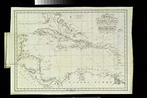
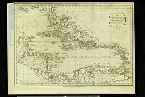
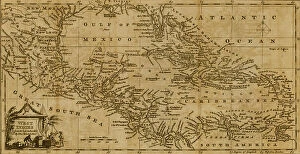
Background imageRelated Images Collection: Chart of the West Indies, 1796

Chart of the West Indies, 1796
2902871 Chart of the West Indies, 1796; (add.info.: Chart of the West Indies, 1796.); Buyenlarge Archive/UIG

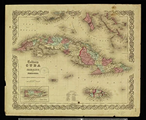
Background imageRelated Images Collection: Geography map: representation of the island of Cuba, Jamaica, Bahamas, South Florida

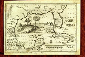
Geography map: representation of the island of Cuba, Jamaica, Bahamas, South Florida
VEN5030476 Geography map: representation of the island of Cuba, Jamaica, Bahamas, South Florida and Yucatan in the Gulf of Mexico from an Atlas made by the Italian cartographer Antonio Francesco

Background imageRelated Images Collection: Geography Atlas: representation of the island of Santo Domingo

Geography Atlas: representation of the island of Santo Domingo, the Bahamas of Puerto Rico to the West Indies
VEN5031345 Geography Atlas: representation of the island of Santo Domingo, the Bahamas of Puerto Rico to the West Indies. Map from an atlas of 1867

Background imageRelated Images Collection: Geography Atlas: description of the Caribbean Sea, Caribbean Sea (Cuba, Jamaica, Hispaniola)

Geography Atlas: description of the Caribbean Sea, Caribbean Sea (Cuba, Jamaica, Hispaniola, Jamaica)
VEN5031247 Geography Atlas: description of the Caribbean Sea, Caribbean Sea (Cuba, Jamaica, Hispaniola, Jamaica), the Bahamas Islands and the Lesser Antilles with map

Background imageRelated Images Collection: Geography Atlas: representation of the Caribbean archipelago (Cuba, Hispaniola, Puerto Rico)

Geography Atlas: representation of the Caribbean archipelago (Cuba, Hispaniola, Puerto Rico), the Bahamas Islands
VEN5030034 Geography Atlas: representation of the Caribbean archipelago (Cuba, Hispaniola, Puerto Rico), the Bahamas Islands. Map from a Spanish Atlas of 1825

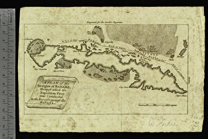
Background imageRelated Images Collection: Geography Atlas: representation of the Detroit of Bahamas and the island of Cuba

Geography Atlas: representation of the Detroit of Bahamas and the island of Cuba
VEN5029617 Geography Atlas: representation of the Detroit of Bahamas and the island of Cuba. Map printed in "London Magazine", 1763

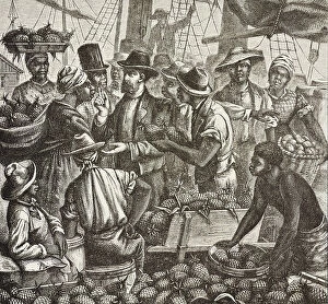
Background imageRelated Images Collection: History of England (C19th). Colonization (1880). Bahama selling pineapples

History of England (C19th). Colonization (1880). Bahama selling pineapples. English colony in New Providence Island
CUL4855793 History of England (C19th). Colonization (1880). Bahama selling pineapples. English colony in New Providence Island

Background imageRelated Images Collection: Native Bahamas family, as described by early explorers of the New World - Colorised engraving

Native Bahamas family, as described by early explorers of the New World - Colorised engraving
NWI4853722 Native Bahamas family, as described by early explorers of the New World - Colorised engraving, 19th century - Natives of the Bahamas as described by early explorers of the New World

Background imageRelated Images Collection: The Evening Post map of the West Indies, 1898

The Evening Post map of the West Indies, 1898
2902870 The Evening Post map of the West Indies, 1898; (add.info.: The Evening Post map of the West Indies, 1898.); Buyenlarge Archive/UIG

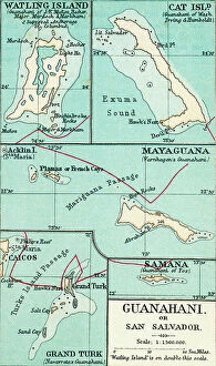
Background imageRelated Images Collection: Map of Guanahani or San Salvador showing Watling Island where Christopher Columbus made landfall

Map of Guanahani or San Salvador showing Watling Island where Christopher Columbus made landfall in 1492
2915316 Map of Guanahani or San Salvador showing Watling Island where Christopher Columbus made landfall in 1492. From the book Life of Christopher Columbus by Clements R

Background imageRelated Images Collection: Antonio de Herrera y Tordesillas map of the Bahamas, 1601. From the book Life of Christopher

Antonio de Herrera y Tordesillas map of the Bahamas, 1601. From the book Life of Christopher Columbus by Clements R
2915318 Antonio de Herrera y Tordesillas map of the Bahamas, 1601. From the book Life of Christopher Columbus by Clements R. Markham published 1892.; Photo © Hilary Morgan

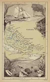
Background imageRelated Images Collection: Bahamas (engraving)

Bahamas (engraving)
8676275 Bahamas (engraving) by Pritchett, Robert (1828-1907); Private Collection; (add.info.: Bahamas. Illustration from In the Trades, the Tropics & the Roaring Forties)

Background imageRelated Images Collection: Italian explorer Christopher Columbus and his crew land at San Salvador on October 12, 1492, 1860

Italian explorer Christopher Columbus and his crew land at San Salvador on October 12, 1492, 1860
7125147 Italian explorer Christopher Columbus and his crew land at San Salvador on October 12, 1492, 1860; (add.info.: Italian explorer Christopher Columbus)

Background imageRelated Images Collection: Geography Atlas: representation of the Bahamas islands, northern Hispaniola (Santo Domingo)

Geography Atlas: representation of the Bahamas islands, northern Hispaniola (Santo Domingo)
VEN5029631 Geography Atlas: representation of the Bahamas islands, northern Hispaniola (Santo Domingo) and the Leewind Passage between Cuba and Hispaniola in the West Indies

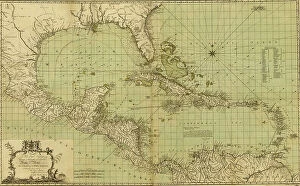
Background imageRelated Images Collection: Theatre or War, Mexican Archipelago - the Caribbean, 1757

Theatre or War, Mexican Archipelago - the Caribbean, 1757
2902869 Theatre or War, Mexican Archipelago - the Caribbean, 1757; (add.info.: Theatre or War, Mexican Archipelago - the Caribbean, 1757.); Buyenlarge Archive/UIG

Background imageRelated Images Collection: Geographic Atlas: representation of the Caribbean Sea and the Greater Antilles (Cuba, Hispaniola)

Geographic Atlas: representation of the Caribbean Sea and the Greater Antilles (Cuba, Hispaniola)
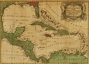
VEN5029600 Geographic Atlas: representation of the Caribbean Sea and the Greater Antilles (Cuba, Hispaniola, Puerto Rico and Jamaica), the Bahamas Islands, the South of the United States

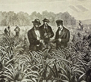
Background imageRelated Images Collection: England (C19th). Colonization (1880). Bahama pineapple planting

England (C19th). Colonization (1880). Bahama pineapple planting. English colony in New Providence Island
CUL4855764 England (C19th). Colonization (1880). Bahama pineapple planting. English colony in New Providence Island. Pineapples were one of the products for export from the port of Nassau

Background imageRelated Images Collection: Discover the New World: Christopher Columbus debark on the island of Guanahani (Bahamas)

Discover the New World: Christopher Columbus debark on the island of Guanahani (Bahamas) in 1492 in America. Engraving
NWI4901313 Discover the New World: Christopher Columbus debark on the island of Guanahani (Bahamas) in 1492 in America. Engraving

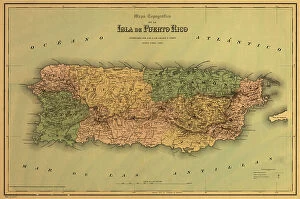
Background imageRelated Images Collection: Puerto Rico, 1886

Puerto Rico, 1886
2902875 Puerto Rico, 1886; (add.info.: Colton, Company.); Buyenlarge Archive/UIG

Background imageRelated Images Collection: The loss of HMS Conqueror, c.1862 (pen & wash)

The loss of HMS Conqueror, c.1862 (pen & wash)
7341722 The loss of HMS Conqueror, c.1862 (pen & wash) by Mends, George Pechell (1815-71); 17.9x22.5 cm; National Maritime Museum, London

Background imageRelated Images Collection: Geography map: representation of the coasts of Florida, the Bahamas Islands

Geography map: representation of the coasts of Florida, the Bahamas Islands
VEN5030120 Geography map: representation of the coasts of Florida, the Bahamas Islands, the island of Cuba and part of the island of Hispaniola (Santo Domingo and Haiti)

Background imageRelated Images Collection: Geography Atlas: representation of the Caribbean Sea, Caribbean Sea (Cuba, Jamaica, Hispaniola)

Geography Atlas: representation of the Caribbean Sea, Caribbean Sea (Cuba, Jamaica, Hispaniola), Bahamas Islands
VEN5029612 Geography Atlas: representation of the Caribbean Sea, Caribbean Sea (Cuba, Jamaica, Hispaniola), Bahamas Islands, South United States (Florida, Virginia, Carolina)

Background imageRelated Images Collection: Geography: map of the Greater Antilles (Cuba, Jamaica, Puerto Rico and the Bahamas) from an Atlas

Geography: map of the Greater Antilles (Cuba, Jamaica, Puerto Rico and the Bahamas) from an Atlas, 1855
VEN5031228 Geography: map of the Greater Antilles (Cuba, Jamaica, Puerto Rico and the Bahamas) from an Atlas, 1855, Bibliotheque Jose Marti, Havana

Background imageRelated Images Collection: The West Indies, 1782

The West Indies, 1782
2902873 The West Indies, 1782; (add.info.: Map of the West Indies.); Buyenlarge Archive/UIG

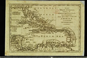
Background imageRelated Images Collection: West Indies and the adjacent parts of North and South America, 1755

West Indies and the adjacent parts of North and South America, 1755
2902872 West Indies and the adjacent parts of North and South America, 1755; (add.info.: West Indies and the adjacent parts of North and South America, 1755.); Buyenlarge Archive/UIG

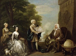
Background imageRelated Images Collection: Woodes Rogers (ca. 1679-1732), 1729 (oil on canvas)

Woodes Rogers (ca. 1679-1732), 1729 (oil on canvas)
MMM5464269 Woodes Rogers (ca. 1679-1732), 1729 (oil on canvas) by Hogarth, William (1697-1764); National Maritime Museum, London, UK; (add.info.: Woodes Rogers (ca)

Background imageRelated Images Collection: Geography Atlas: representation of the Caribbean Sea, Caribbean Sea (Cuba, Jamaica, Hispaniola)

Geography Atlas: representation of the Caribbean Sea, Caribbean Sea (Cuba, Jamaica, Hispaniola), Bahamas Islands
VEN5029608 Geography Atlas: representation of the Caribbean Sea, Caribbean Sea (Cuba, Jamaica, Hispaniola), Bahamas Islands, South United States (Florida, Virginia, Carolina)

Background imageRelated Images Collection: Geography Atlas: representation of the Caribbean Sea, Caribbean Sea (Cuba, Jamaica)

Geography Atlas: representation of the Caribbean Sea, Caribbean Sea (Cuba, Jamaica, Caiman Islands), Bahamas Islands
VEN5029603 Geography Atlas: representation of the Caribbean Sea, Caribbean Sea (Cuba, Jamaica, Caiman Islands), Bahamas Islands, South United States (Florida)

Background imageRelated Images Collection: The Debarkment of Christopher Columbus in San Salvador (Bahamas)

The Debarkment of Christopher Columbus in San Salvador (Bahamas) on 12/10/1492 - Engraving of the 19th century
XEE5027465 The Debarkment of Christopher Columbus in San Salvador (Bahamas) on 12/10/1492 - Engraving of the 19th century; (add.info)

Background imageRelated Images Collection: The town and port of Nassau, New Providence, Bahama Islands, 1864. Creator: Mason Jackson

The town and port of Nassau, New Providence, Bahama Islands, 1864. Creator: Mason Jackson
The town and port of Nassau, New Providence, Bahama Islands, 1864. Engraving from a sketch by an officer of the 1st West India Regiment

Background imageRelated Images Collection: Sky window

Sky window
Marcus Cederberg

Background imageRelated Images Collection: Up in the air (Bahamas)

Up in the air (Bahamas)
Roxana Labagnara

Background imageRelated Images Collection: Triple Power

Triple Power
Jennifer Lu

Background imageRelated Images Collection: Liverpool footballer Kevin Keegan and new wife Jean who will have a sunshine holiday in

Liverpool footballer Kevin Keegan and new wife Jean who will have a sunshine holiday in the Bahamas in the summer after the end of the football season

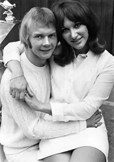
Background imageRelated Images Collection: The Bee Gees pop groups drummer Colin Petersen and his bride Joanne Newfield

The Bee Gees pop groups drummer Colin Petersen and his bride Joanne Newfield, posed for their wedding pictures in London on Tuesday - eleven days after the big day

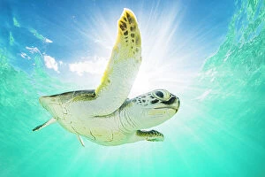
Background imageRelated Images Collection: Green sea turtle (Chelonia mydas) swimming near surface in halo of light. The Bahamas

Green sea turtle (Chelonia mydas) swimming near surface in halo of light. The Bahamas


All Professionally Made to Order for Quick Shipping


-

Why Choose Us?

We are a leading provider of Art Prints and Photo Gifts since 2003, working in partnership with a range of Sporting Clubs, Charities, Museums and Picture Libraries. A large share of profits from any of their images will go directly towards supporting that charity or club. Our archive of images is carefully curated to bring you a wide range of subjects, including landscapes, wildlife, architecture, and more. We ship from our partner labs in the UK, USA, EU (Netherlands) and Australia.
+

How do I place an order?

Ordering is quick & easy - Just follow 5 Simple Steps:
  1. Find your image: Use our search box or browse our online photo Collections to find the image you want.

  2. Choose your print format: Select your desired product and add it to your cart.

  3. Enter your details: If you're a returning customer, simply enter your email address and password, and we'll fill in your billing and shipping address details. All personal details are held securely and are fully GDPR compliant. As standard, we remove all Personally Identifiable Information after 12 months.

  4. Pay for your purchase: We use state-of-the-art security for online shopping and do not have access to your card details.

  5. Sit back and relax: We'll email you confirmation of your order and when it's dispatched. Registered customers can also track orders in the 'My Account' area.

+

How do I pay for an order?

You can pay for your order with most of the major credit and debit cards, or PayPal. For added security, major financial institutions process payment details separately and securely on our behalf. We do not have access to your online payment card details. Online payments are preferred however we do take phone orders. For UK customers only we accept cheques issued against a UK bank.
+

Is my data safe?

We take data security very seriously. We do not have access to your full card details and all payments are requested over a fully secure connection. Additionally, we fully comply with current European and GDPR legislation, and automatically remove all personal data after at most 12 months (unless you have an account with us and have signed in recently). We also have a strict opt-in policy and would never sell your personal details. Your data is only used to fulfill your order promptly and efficiently.
+

Is wall art ready to hang?

For quick and easy installation all wall art, including framed prints, canvas prints and metal prints are supplied with a ready to hang solution on the back. Generally, saw tooth hangers are applied as they allow wall art to hang flush against the wall. The serrated edge of the hanger prevents the frame from shifting or tilting when hung.
+

Are the photo prints fade resistant?

Yes, we use archival quality photo paper photographic paper for vivid reproduction Prints are an accurate representations of the original artwork, which is preserved for artistic character and authenticity. We guarantee they match previews shown on our web site