Metal Print > Europe > United Kingdom > Scotland > Maps
Metal Print : GGBR2A-00076


![]()
Metal Prints from North Wind
GGBR2A-00076
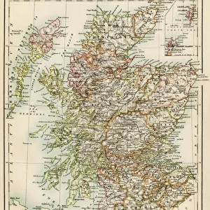
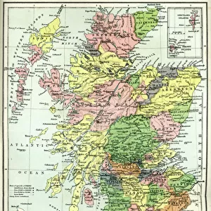
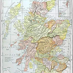
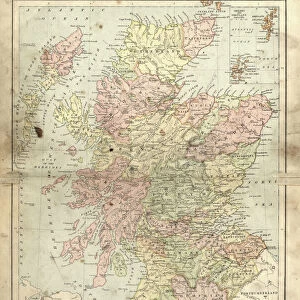
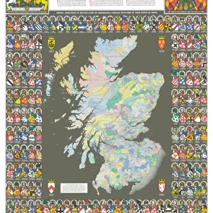
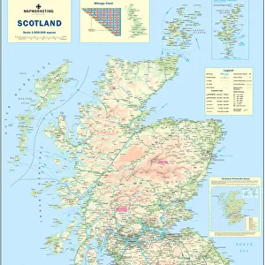
Map of Scotland in the 1520s, showing territories of the Highland Clans.
Printed color lithograph of a 19th century illustration
North Wind Picture Archives brings history to life with stock images and hand-colored illustrations
Media ID 5879160
© North Wind Picture Archives
1500s 16th Century British Europe Great Britain Medieval Scot Scot Land Scottish Territory Clan Highlander Scotch
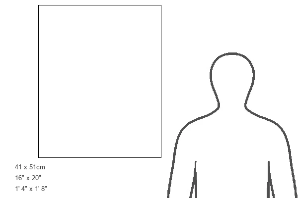
16"x20" (51x41cm) Metal Print
Discover the rich history of Scotland with our stunning Metal Prints from Media Storehouse, featuring the captivating map GGBR2A-00076 from North Wind Picture Archives. This color lithograph, originally illustrated in the 19th century, showcases the territories of the Highland Clans as they existed in the 1520s. Each Metal Print is meticulously crafted using high-quality materials and state-of-the-art printing techniques, ensuring vibrant colors and sharp details that bring history to life. Transform any space into a captivating gallery with this beautiful and intriguing piece of Scottish heritage. Order your Metal Print today and let the story of Scotland unfold before your eyes.
Made with durable metal and luxurious printing techniques, our metal photo prints go beyond traditional canvases, adding a cool, modern touch to your space. Wall mount on back. Eco-friendly 100% post-consumer recycled ChromaLuxe aluminum surface. The thickness of the print is 0.045". Featuring a Scratch-resistant surface and Rounded corners. Backing hangers are attached to the back of the print and float the print 1/2-inch off the wall when hung, the choice of hanger may vary depending on size and International orders will come with Float Mount hangers only. Finished with a brilliant white high gloss surface for unsurpassed detail and vibrance. Printed using Dye-Sublimation and for best care we recommend a non-ammonia glass cleaner, water, or isopropyl (rubbing) alcohol to prevent harming the print surface. We recommend using a clean, lint-free cloth to wipe off the print. The ultra-hard surface is scratch-resistant, waterproof and weatherproof. Avoid direct sunlight exposure.
Made with durable metal and luxurious printing techniques, metal prints bring images to life and add a modern touch to any space
Estimated Image Size (if not cropped) is 40.6cm x 50.8cm (16" x 20")
Estimated Product Size is 41.2cm x 51.4cm (16.2" x 20.2")
These are individually made so all sizes are approximate
Artwork printed orientated as per the preview above, with portrait (vertical) orientation to match the source image.
FEATURES IN THESE COLLECTIONS
> Arts
> Art Movements
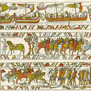
> Medieval Art
> Europe
> France
> Canton
> Landes
> Europe
> United Kingdom
> Scotland
> Highlands
> Related Images
> Europe
> United Kingdom
> Scotland
> Maps
> Europe
> United Kingdom
> Scotland
> Posters
> Europe
> United Kingdom
> Scotland
> Related Images
> Maps and Charts
> Related Images
> North Wind Picture Archives
> British history
> North Wind Picture Archives
> Maps
EDITORS COMMENTS
This 19th-century lithograph print takes us back in time to the 1520s, offering a glimpse into the territories of the Highland Clans in Scotland. The intricate map showcases the rich history and medieval heritage of this great nation. With its vibrant printed colors, every detail comes to life, transporting us to an era when clans and their territories played a significant role in Scottish society. The illustration provides a fascinating insight into the complex web of clan affiliations and territorial boundaries that defined Scotland during this period. It serves as a visual representation of power struggles, alliances, and cultural identities that shaped the destiny of these proud highlanders. As we explore this vintage artwork, one cannot help but marvel at how it captures both historical accuracy and artistic beauty. The meticulous craftsmanship transports us through time, allowing us to appreciate not only the geography but also the artistry behind cartography during those times. This remarkable piece is more than just an illustration; it is a testament to Scottish history and European artistry. It reminds us of our shared past while igniting curiosity about what life was like for these brave Scots who called themselves highlanders. Whether you are fascinated by genealogy or simply captivated by ancient maps, this print offers an enchanting window into Scotland's past - a treasure for any history enthusiast or lover of fine art alike.
MADE IN THE USA
Safe Shipping with 30 Day Money Back Guarantee
FREE PERSONALISATION*
We are proud to offer a range of customisation features including Personalised Captions, Color Filters and Picture Zoom Tools
SECURE PAYMENTS
We happily accept a wide range of payment options so you can pay for the things you need in the way that is most convenient for you
* Options may vary by product and licensing agreement. Zoomed Pictures can be adjusted in the Cart.