Jigsaw Puzzle > Aerial Photography > Related Images
Jigsaw Puzzle : Jonesboro Arkansas US City Street Map


![]()
Jigsaw Puzzles from Fine Art Storehouse
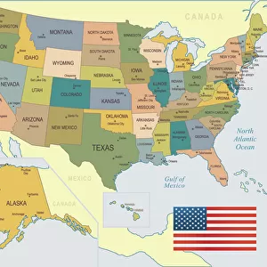
Jonesboro Arkansas US City Street Map
Vector Illustration of a City Street Map of Jonesboro, Arkansas, USA. Scale 1:60, 000.
All source data is in the public domain.
U.S. Geological Survey, US Topo
Used Layers:
USGS The National Map: National Hydrography Dataset (NHD)
USGS The National Map: National Transportation Dataset (NTD)
Unleash your creativity and transform your space into a visual masterpiece!
Frank Ramspott
Media ID 15192890
© Frank Ramspott, all rights reserved
Aerial View Arkansas City Map Computer Graphic Directly Above Downtown District Gray Road Map Text Digitally Generated Image Green Color White Color
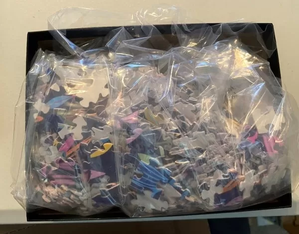
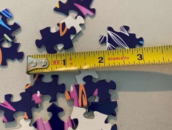
Jigsaw Puzzle (520 Pieces)
Discover the charm of Jonesboro, Arkansas with our intricately detailed Jigsaw Puzzle from Media Storehouse. This beautifully crafted puzzle, featuring a city street map by Frank Ramspott from Fine Art Storehouse, invites you to explore the vibrant streets of this US city. With a scale of 1:60,000 and source data from the public domain, this vector illustration puzzle offers an authentic and engaging experience for puzzle enthusiasts. Immerse yourself in the history and character of Jonesboro, Arkansas, one piece at a time.
Made in the USA, 520-piece puzzles measure 16" x 20" (40.6 x 50.8 cm). Every puzzle is meticulously printed on glossy photo paper, which has a strong 1.33 mm thickness. Delivered in a black storage cardboard box, these puzzles are both stylish and practical. (Note: puzzles contain small parts and are not suitable for children under 3 years of age.)
Jigsaw Puzzles are an ideal gift for any occasion
Estimated Product Size is 40.5cm x 50.8cm (15.9" x 20")
These are individually made so all sizes are approximate
Artwork printed orientated as per the preview above, with landscape (horizontal) or portrait (vertical) orientation to match the source image.
FEATURES IN THESE COLLECTIONS
> Fine Art Storehouse
> Map
> Street Maps
> Fine Art Storehouse
> Map
> USA Maps
> Aerial Photography
> Related Images
> Animals
> Insects
> Hemiptera
> Green Scale
> Arts
> Contemporary art
> Digital artwork
> Street art
> Arts
> Street art graffiti
> Digital art
> Digital paintings
> Arts
> Street art graffiti
> Digital art
> Vector illustrations
> Maps and Charts
> Geological Map
> Maps and Charts
> Related Images
> North America
> United States of America
> Arkansas
> Related Images
> North America
> United States of America
> Lakes
> Related Images
> North America
> United States of America
> Maps
EDITORS COMMENTS
This print showcases a meticulously detailed vector illustration of the charming city street map of Jonesboro, Arkansas, USA. With a scale of 1:60,000, every intricate aspect is brought to life in this visually stunning artwork. The source data used for this creation is all in the public domain and comes from reputable sources such as the U. S. Geological Survey and US Topo. The various layers utilized include the USGS National Hydrography Dataset (NHD) and National Transportation Dataset (NTD), ensuring accuracy and precision in depicting the city's hydrology and transportation networks. From its downtown district to its serene lake and river, every element that defines Jonesboro can be explored within this piece. Through expert cartography skills and digital generation techniques, Frank Ramspott has crafted an aerial view directly above Jonesboro with striking colors like gray, blue, white, and green dominating the composition. This computer-generated image beautifully captures both the physical geography of the area as well as its urban landscape. Perfectly suited for any space or decor style, this print offers a unique blend of artistry and functionality. Whether you are a resident or simply fascinated by maps and design, immerse yourself in this extraordinary representation of Jonesboro's streetscape - an exquisite testament to both creativity and geographic accuracy.
MADE IN THE USA
Safe Shipping with 30 Day Money Back Guarantee
FREE PERSONALISATION*
We are proud to offer a range of customisation features including Personalised Captions, Color Filters and Picture Zoom Tools
SECURE PAYMENTS
We happily accept a wide range of payment options so you can pay for the things you need in the way that is most convenient for you
* Options may vary by product and licensing agreement. Zoomed Pictures can be adjusted in the Cart.