Jigsaw Puzzle > Europe > Netherlands > Maps
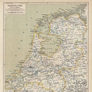
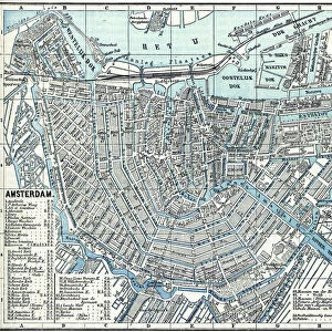
Jigsaw Puzzle : Holland map 1881


![]()
Jigsaw Puzzles From Fine Art Storehouse
Holland map 1881
Encyclopedia Britannica 9th Edition Vol XII Philadelphia j.M. Stoddart & Co 1881
Unleash your creativity and transform your space into a visual masterpiece!
THEPALMER
Media ID 13611533
© This content is subject to copyright
Holland Netherlands Paper World Map
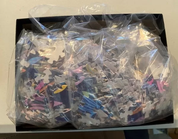
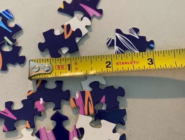
Jigsaw Puzzle (520 Pieces)
Discover the rich history of Holland with our captivating jigsaw puzzle from Media Storehouse, featuring the detailed and intriguing "Holland Map 1881" by THEPALMER from the Fine Art Storehouse. This exquisite puzzle is based on an authentic map from the Encyclopedia Britannica 9th Edition, published by J.M. Stoddart & Co in Philadelphia in 1881. Immerse yourself in the intricacies of this vintage map, which captures the geography and political landscape of Holland during that era. With each piece, you'll uncover intriguing historical details and engage in a delightful journey through time. Connect the past with the present as you bring this captivating puzzle to life – a perfect activity for history buffs, puzzle enthusiasts, or anyone looking to expand their knowledge and appreciation for the world around us.
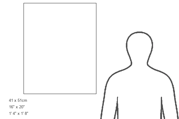
Made in the USA, 520-piece puzzles measure 16" x 20" (40.6 x 50.8 cm). Every puzzle is meticulously printed on glossy photo paper, which has a strong 1.33 mm thickness. Delivered in a black storage cardboard box, these puzzles are both stylish and practical. (Note: puzzles contain small parts and are not suitable for children under 3 years of age.)
Jigsaw Puzzles are an ideal gift for any occasion
Estimated Product Size is 40.5cm x 50.8cm (15.9" x 20")
These are individually made so all sizes are approximate
Artwork printed orientated as per the preview above, with landscape (horizontal) or portrait (vertical) orientation to match the source image.
FEATURES IN THESE COLLECTIONS
> Europe
> Netherlands
> Maps
> Europe
> Netherlands
> Posters
> Europe
> Netherlands
> Related Images
> Maps and Charts
> Netherlands
> Maps and Charts
> Related Images
> Maps and Charts
> World
> North America
> United States of America
> Maps
EDITORS COMMENTS
This print takes us back in time to the year 1881, as we explore a beautifully detailed map of Holland. A relic from the Encyclopedia Britannica's 9th Edition, this vintage piece was published by J. M. Stoddart & Co in Philadelphia, USA. The intricate engraving showcases the remarkable craftsmanship and dedication that went into creating such maps during that era. The map itself is a testament to both artistry and cartography, with its delicate lines and precise details capturing the essence of Holland's physical geography. From its iconic windmills dotting the landscape to its charming canals weaving through cities like Amsterdam and Rotterdam, every element is meticulously depicted on this antique illustration. As we gaze upon this vertical composition printed on high-quality paper, it transports us to an era when exploration and discovery were at their peak. It serves as a reminder of how far we have come in understanding our world while also appreciating the rich history that has shaped it. "TheHolland Map 1881" by THEPALMER offers not only a visual delight but also an opportunity for reflection on our ever-evolving relationship with geography and technology. Whether displayed in homes or offices, this timeless piece adds character and sophistication while inviting viewers to embark on their own journey through time.
MADE IN THE USA
Safe Shipping with 30 Day Money Back Guarantee
FREE PERSONALISATION*
We are proud to offer a range of customisation features including Personalised Captions, Color Filters and Picture Zoom Tools
SECURE PAYMENTS
We happily accept a wide range of payment options so you can pay for the things you need in the way that is most convenient for you
* Options may vary by product and licensing agreement. Zoomed Pictures can be adjusted in the Basket.