Fraud Blocker Skip to main content

Geographical Border Collection (#5)

"Exploring the Geographical Borders

Background imageGeographical Border Collection: MA Norfolk Vector Road Map

MA Norfolk Vector Road Map. All source data is in the public domain. U.S. Census Bureau Census Tiger. Used Layers: areawater, linearwater, roads, rails, cousub, pointlm, uac10

Background imageGeographical Border Collection: MA Worcester Douglas Vector Road Map

MA Worcester Douglas Vector Road Map. All source data is in the public domain. U.S. Census Bureau Census Tiger. Used Layers: areawater, linearwater, roads, rails, cousub, pointlm, uac10

Background imageGeographical Border Collection: MA Worcester Dudley Vector Road Map

MA Worcester Dudley Vector Road Map. All source data is in the public domain. U.S. Census Bureau Census Tiger. Used Layers: areawater, linearwater, roads, rails, cousub, pointlm, uac10

Background imageGeographical Border Collection: MA Worcester Fitchburg Vector Road Map

MA Worcester Fitchburg Vector Road Map. All source data is in the public domain. U.S. Census Bureau Census Tiger. Used Layers: areawater, linearwater, roads, rails, cousub, pointlm, uac10

Background imageGeographical Border Collection: MA Worcester Clinton Vector Road Map

MA Worcester Clinton Vector Road Map. All source data is in the public domain. U.S. Census Bureau Census Tiger. Used Layers: areawater, linearwater, roads, rails, cousub, pointlm, uac10

Background imageGeographical Border Collection: MA Worcester Hardwick Vector Road Map

MA Worcester Hardwick Vector Road Map. All source data is in the public domain. U.S. Census Bureau Census Tiger. Used Layers: areawater, linearwater, roads, rails, cousub, pointlm, uac10

Background imageGeographical Border Collection: MA Worcester Gardner Vector Road Map

MA Worcester Gardner Vector Road Map. All source data is in the public domain. U.S. Census Bureau Census Tiger. Used Layers: areawater, linearwater, roads, rails, cousub, pointlm, uac10

Background imageGeographical Border Collection: MA Worcester Lancaster Vector Road Map

MA Worcester Lancaster Vector Road Map. All source data is in the public domain. U.S. Census Bureau Census Tiger. Used Layers: areawater, linearwater, roads, rails, cousub, pointlm, uac10

Background imageGeographical Border Collection: MA Worcester Harvard Vector Road Map

MA Worcester Harvard Vector Road Map. All source data is in the public domain. U.S. Census Bureau Census Tiger. Used Layers: areawater, linearwater, roads, rails, cousub, pointlm, uac10

Background imageGeographical Border Collection: MA Worcester Hubbardston Vector Road Map

MA Worcester Hubbardston Vector Road Map. All source data is in the public domain. U.S. Census Bureau Census Tiger. Used Layers: areawater, linearwater, roads, rails, cousub, pointlm, uac10

Background imageGeographical Border Collection: MA Worcester Holden Vector Road Map

MA Worcester Holden Vector Road Map. All source data is in the public domain. U.S. Census Bureau Census Tiger. Used Layers: areawater, linearwater, roads, rails, cousub, pointlm, uac10

Background imageGeographical Border Collection: MA Worcester Millbury Vector Road Map

MA Worcester Millbury Vector Road Map. All source data is in the public domain. U.S. Census Bureau Census Tiger. Used Layers: areawater, linearwater, roads, rails, cousub, pointlm, uac10

Background imageGeographical Border Collection: MA Worcester Leicester Vector Road Map

MA Worcester Leicester Vector Road Map. All source data is in the public domain. U.S. Census Bureau Census Tiger. Used Layers: areawater, linearwater, roads, rails, cousub, pointlm, uac10

Background imageGeographical Border Collection: MA Worcester Barre Vector Road Map

MA Worcester Barre Vector Road Map. All source data is in the public domain. U.S. Census Bureau Census Tiger. Used Layers: areawater, linearwater, roads, rails, cousub, pointlm, uac10

Background imageGeographical Border Collection: MA Worcester Ashburnham Vector Road Map

MA Worcester Ashburnham Vector Road Map. All source data is in the public domain. U.S. Census Bureau Census Tiger. Used Layers: areawater, linearwater, roads, rails, cousub, pointlm, uac10

Background imageGeographical Border Collection: MA Worcester Auburn Vector Road Map

MA Worcester Auburn Vector Road Map. All source data is in the public domain. U.S. Census Bureau Census Tiger. Used Layers: areawater, linearwater, roads, rails, cousub, pointlm, uac10

Background imageGeographical Border Collection: MA Worcester Millville Vector Road Map

MA Worcester Millville Vector Road Map. All source data is in the public domain. U.S. Census Bureau Census Tiger. Used Layers: areawater, linearwater, roads, rails, cousub, pointlm, uac10

Background imageGeographical Border Collection: MA Worcester North Brookfield Vector Road Map

MA Worcester North Brookfield Vector Road Map. All source data is in the public domain. U.S. Census Bureau Census Tiger. Used Layers: areawater, linearwater, roads, rails, cousub, pointlm, uac10

Background imageGeographical Border Collection: MA Worcester New Braintree Vector Road Map

MA Worcester New Braintree Vector Road Map. All source data is in the public domain. U.S. Census Bureau Census Tiger. Used Layers: areawater, linearwater, roads, rails, cousub, pointlm, uac10

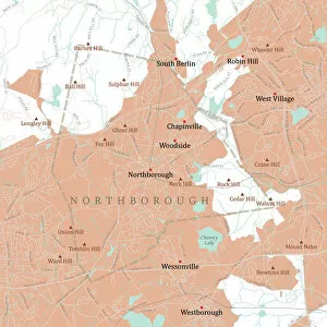
Background imageGeographical Border Collection: MA Worcester Northborough Vector Road Map

MA Worcester Northborough Vector Road Map. All source data is in the public domain. U.S. Census Bureau Census Tiger. Used Layers: areawater, linearwater, roads, rails, cousub, pointlm, uac10

Background imageGeographical Border Collection: MA Worcester Bolton Vector Road Map

MA Worcester Bolton Vector Road Map. All source data is in the public domain. U.S. Census Bureau Census Tiger. Used Layers: areawater, linearwater, roads, rails, cousub, pointlm, uac10

Background imageGeographical Border Collection: MA Worcester Blackstone Vector Road Map

MA Worcester Blackstone Vector Road Map. All source data is in the public domain. U.S. Census Bureau Census Tiger. Used Layers: areawater, linearwater, roads, rails, cousub, pointlm, uac10

Background imageGeographical Border Collection: MA Worcester East Brookfield Vector Road Map

MA Worcester East Brookfield Vector Road Map. All source data is in the public domain. U.S. Census Bureau Census Tiger. Used Layers: areawater, linearwater, roads, rails, cousub, pointlm, uac10

Background imageGeographical Border Collection: MA Worcester Hopedale Vector Road Map

MA Worcester Hopedale Vector Road Map. All source data is in the public domain. U.S. Census Bureau Census Tiger. Used Layers: areawater, linearwater, roads, rails, cousub, pointlm, uac10

Background imageGeographical Border Collection: MA Worcester Grafton Vector Road Map

MA Worcester Grafton Vector Road Map. All source data is in the public domain. U.S. Census Bureau Census Tiger. Used Layers: areawater, linearwater, roads, rails, cousub, pointlm, uac10

Background imageGeographical Border Collection: MA Worcester Paxton Vector Road Map

MA Worcester Paxton Vector Road Map. All source data is in the public domain. U.S. Census Bureau Census Tiger. Used Layers: areawater, linearwater, roads, rails, cousub, pointlm, uac10

Background imageGeographical Border Collection: MA Worcester Petersham Vector Road Map

MA Worcester Petersham Vector Road Map. All source data is in the public domain. U.S. Census Bureau Census Tiger. Used Layers: areawater, linearwater, roads, rails, cousub, pointlm, uac10

Background imageGeographical Border Collection: MA Worcester Oakham Vector Road Map

MA Worcester Oakham Vector Road Map. All source data is in the public domain. U.S. Census Bureau Census Tiger. Used Layers: areawater, linearwater, roads, rails, cousub, pointlm, uac10

Background imageGeographical Border Collection: MA Worcester Princeton Vector Road Map

MA Worcester Princeton Vector Road Map. All source data is in the public domain. U.S. Census Bureau Census Tiger. Used Layers: areawater, linearwater, roads, rails, cousub, pointlm, uac10

Background imageGeographical Border Collection: MA Worcester Oxford Vector Road Map

MA Worcester Oxford Vector Road Map. All source data is in the public domain. U.S. Census Bureau Census Tiger. Used Layers: areawater, linearwater, roads, rails, cousub, pointlm, uac10

Background imageGeographical Border Collection: MA Worcester Phillipston Vector Road Map

MA Worcester Phillipston Vector Road Map. All source data is in the public domain. U.S. Census Bureau Census Tiger. Used Layers: areawater, linearwater, roads, rails, cousub, pointlm, uac10

Background imageGeographical Border Collection: MA Worcester Leominster Vector Road Map

MA Worcester Leominster Vector Road Map. All source data is in the public domain. U.S. Census Bureau Census Tiger. Used Layers: areawater, linearwater, roads, rails, cousub, pointlm, uac10

Background imageGeographical Border Collection: MA Worcester Lunenburg Vector Road Map

MA Worcester Lunenburg Vector Road Map. All source data is in the public domain. U.S. Census Bureau Census Tiger. Used Layers: areawater, linearwater, roads, rails, cousub, pointlm, uac10

Background imageGeographical Border Collection: MA Worcester Mendon Vector Road Map

MA Worcester Mendon Vector Road Map. All source data is in the public domain. U.S. Census Bureau Census Tiger. Used Layers: areawater, linearwater, roads, rails, cousub, pointlm, uac10

Background imageGeographical Border Collection: MA Worcester Rutland Vector Road Map

MA Worcester Rutland Vector Road Map. All source data is in the public domain. U.S. Census Bureau Census Tiger. Used Layers: areawater, linearwater, roads, rails, cousub, pointlm, uac10

Background imageGeographical Border Collection: MA Worcester Spencer Vector Road Map

MA Worcester Spencer Vector Road Map. All source data is in the public domain. U.S. Census Bureau Census Tiger. Used Layers: areawater, linearwater, roads, rails, cousub, pointlm, uac10

Background imageGeographical Border Collection: MA Worcester Southborough Vector Road Map

MA Worcester Southborough Vector Road Map. All source data is in the public domain. U.S. Census Bureau Census Tiger. Used Layers: areawater, linearwater, roads, rails, cousub, pointlm, uac10

Background imageGeographical Border Collection: MA Worcester Sterling Vector Road Map

MA Worcester Sterling Vector Road Map. All source data is in the public domain. U.S. Census Bureau Census Tiger. Used Layers: areawater, linearwater, roads, rails, cousub, pointlm, uac10

Background imageGeographical Border Collection: MA Worcester Southbridge Town Vector Road Map

MA Worcester Southbridge Town Vector Road Map. All source data is in the public domain. U.S. Census Bureau Census Tiger. Used Layers: areawater, linearwater, roads, rails, cousub, pointlm, uac10

Background imageGeographical Border Collection: MA Worcester Sturbridge Vector Road Map

MA Worcester Sturbridge Vector Road Map. All source data is in the public domain. U.S. Census Bureau Census Tiger. Used Layers: areawater, linearwater, roads, rails, cousub, pointlm, uac10

Background imageGeographical Border Collection: MA Worcester Sutton Vector Road Map

MA Worcester Sutton Vector Road Map. All source data is in the public domain. U.S. Census Bureau Census Tiger. Used Layers: areawater, linearwater, roads, rails, cousub, pointlm, uac10

Background imageGeographical Border Collection: MA Worcester Upton Vector Road Map

MA Worcester Upton Vector Road Map. All source data is in the public domain. U.S. Census Bureau Census Tiger. Used Layers: areawater, linearwater, roads, rails, cousub, pointlm, uac10

Background imageGeographical Border Collection: MA Worcester Uxbridge Vector Road Map

MA Worcester Uxbridge Vector Road Map. All source data is in the public domain. U.S. Census Bureau Census Tiger. Used Layers: areawater, linearwater, roads, rails, cousub, pointlm, uac10

Background imageGeographical Border Collection: MA Worcester Royalston Vector Road Map

MA Worcester Royalston Vector Road Map. All source data is in the public domain. U.S. Census Bureau Census Tiger. Used Layers: areawater, linearwater, roads, rails, cousub, pointlm, uac10

Background imageGeographical Border Collection: MA Worcester West Boylston Vector Road Map

MA Worcester West Boylston Vector Road Map. All source data is in the public domain. U.S. Census Bureau Census Tiger. Used Layers: areawater, linearwater, roads, rails, cousub, pointlm, uac10

Background imageGeographical Border Collection: MA Worcester Winchendon Vector Road Map

MA Worcester Winchendon Vector Road Map. All source data is in the public domain. U.S. Census Bureau Census Tiger. Used Layers: areawater, linearwater, roads, rails, cousub, pointlm, uac10

Background imageGeographical Border Collection: MA Worcester Westborough Vector Road Map

MA Worcester Westborough Vector Road Map. All source data is in the public domain. U.S. Census Bureau Census Tiger. Used Layers: areawater, linearwater, roads, rails, cousub, pointlm, uac10

Background imageGeographical Border Collection: MA Worcester Webster Vector Road Map

MA Worcester Webster Vector Road Map. All source data is in the public domain. U.S. Census Bureau Census Tiger. Used Layers: areawater, linearwater, roads, rails, cousub, pointlm, uac10


All Professionally Made to Order for Quick Shipping

"Exploring the Geographical Borders: From Ancient Jerusalem to Modern Singapore" Embark on a captivating journey through geographical borders as we delve into diverse landscapes and historical realms. 🌍✈️ Starting with China's intricate map, witness the vastness of this ancient civilization that has stood the test of time. πŸ‡¨πŸ‡³ Next, trace the travels of The Apostle Paul through an enchanting map engraving, unraveling his remarkable journey across lands and seas. β›ͺοΈβš“οΈ Marvel at Ancient and Modern Jerusalem's transformation over centuries, depicted in a mesmerizing map engraving that showcases its rich cultural heritage. πŸ•ŒπŸ• Navigate through Massachusetts' Middlesex Westford Vector Road Map and Barnstable Town Vector Road Map to discover charming towns nestled within picturesque landscapes. πŸ—ΊοΈπŸžοΈ Experience the vibrant city-state of Singapore, where tradition meets modernity amidst stunning skyscrapers and lush greenery. πŸ™οΈπŸŒΏ Witness nature's breathtaking artistry as first light illuminates Bonneville Salt Flats near Utah-Nevada border, revealing delicate salt crystal patterns on its surface. β˜€οΈβ„οΈ Travel eastward to Romania, a land steeped in history and natural beauty; explore its hidden gems tucked away within majestic mountainscapes. πŸ°β›°οΈ Continue your expedition with MA Essex Swampscott Vector Road Map - uncover hidden coastal treasures along Massachusetts' scenic shoreline. β›΅πŸŒŠ Uncover Antique India Map's secrets as you traverse this culturally diverse nation brimming with architectural wonders and spiritual enlightenment. πŸ•Œβœ¨ Step back in time with London and Environs Historical Map Engraving from 1892 - immerse yourself in Victorian charm while exploring England's capital city.