Fraud Blocker Skip to main content

Geographical Border Collection (#2)

"Exploring the Geographical Borders

Background imageGeographical Border Collection: Map of the southwestern part of the German Empire, c.1900 (engraving)

Map of the southwestern part of the German Empire, c.1900 (engraving)
532961 Map of the southwestern part of the German Empire, c.1900 (engraving); (add.info.: Map of the southwestern German Empire, circa 1902)

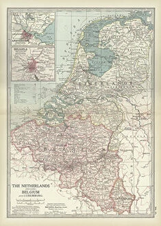
Background imageGeographical Border Collection: Map of Netherlands and Belgium, c.1900 (engraving)

Map of Netherlands and Belgium, c.1900 (engraving)
532956 Map of Netherlands and Belgium, c.1900 (engraving); (add.info.: Map showing the historical boundaries of Netherlands, Belgium, Luxemburg, with insets of Amsterdam and Brussels, circa 1902)

Background imageGeographical Border Collection: Map of Spain with Portugal and Andorra, c.1900 (engraving)

Map of Spain with Portugal and Andorra, c.1900 (engraving)
532952 Map of Spain with Portugal and Andorra, c.1900 (engraving); (add.info.: Map of Spain with Portugal and Andorra, with insets of the Azores Islands, Canary Islands, and Madeira Island)

Background imageGeographical Border Collection: Map of France, c.1900 (engraving)

Map of France, c.1900 (engraving)
532942 Map of France, c.1900 (engraving); (add.info.: Map of northern France with insets showing the provinces of France and Paris and Vicinity, circa 1902)

Background imageGeographical Border Collection: Map of South America, c.1900 (engraving)

Map of South America, c.1900 (engraving)
533256 Map of South America, c.1900 (engraving); (add.info.: Map of South America with inset maps of Isthmus of Panama, Galapagos Islands and Trinidad, circa 1902)

Background imageGeographical Border Collection: Map of Galveston Bay, Houston and vicinity, c.1900 (engraving)

Map of Galveston Bay, Houston and vicinity, c.1900 (engraving)
532761 Map of Galveston Bay, Houston and vicinity, c.1900 (engraving); (add.info.: Map of Galveston Bay, Houston, circa 1900)

Background imageGeographical Border Collection: Map of France in Provinces, c.1900 (engraving)

Map of France in Provinces, c.1900 (engraving)
533288 Map of France in Provinces, c.1900 (engraving); (add.info.: Map of the provinces of France before the French Revolution in 1789, circa 1902)

Background imageGeographical Border Collection: Map of Minnesota, c.1900 (engraving)

Map of Minnesota, c.1900 (engraving)
533188 Map of Minnesota, c.1900 (engraving); (add.info.: Map of Minnesota, United States, with inset maps of Duluth and Minneapolis, circa 1902)

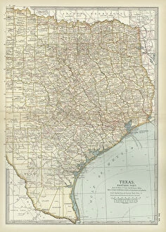
Background imageGeographical Border Collection: Map of eastern Texas, c.1900 (engraving)

Map of eastern Texas, c.1900 (engraving)
533161 Map of eastern Texas, c.1900 (engraving); (add.info.: Map of the eastern part of Texas, circa 1902, from the 10th edition of Encyclopaedia Britannica.); Encyclopaedia Britannica/UIG

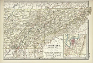
Background imageGeographical Border Collection: Map of eastern Tennessee, c.1900 (engraving)

Map of eastern Tennessee, c.1900 (engraving)
533145 Map of eastern Tennessee, c.1900 (engraving); (add.info.: Map of the eastern part of Tennessee with inset map of Chattanooga, circa 1902)

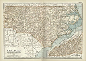
Background imageGeographical Border Collection: Map of North Carolina, c.1900 (engraving)

Map of North Carolina, c.1900 (engraving)
533130 Map of North Carolina, c.1900 (engraving); (add.info.: Map of North Carolina, United States, circa 1902, from the 10th edition of Encyclopaedia Britannica.); Encyclopaedia Britannica/UIG

Background imageGeographical Border Collection: Map of Canada, c.1900 (engraving)

Map of Canada, c.1900 (engraving)
533072 Map of Canada, c.1900 (engraving); (add.info.: Map showing historical boundaries of Canada and Newfoundland, circa 1902)

Background imageGeographical Border Collection: Map of colonial Africa, c.1900 (engraving)

Map of colonial Africa, c.1900 (engraving)
533053 Map of colonial Africa, c.1900 (engraving); (add.info.: Map of colonial Africa, with insets of Ascension Island, St)

Background imageGeographical Border Collection: Map of Australia and Tasmania. c1902 (engraving)

Map of Australia and Tasmania. c1902 (engraving)
533041 Map of Australia and Tasmania. c1902 (engraving); (add.info.: Map showing Australia with insets of Melbourne and Port Phillip, Tasmania, and Sydney and Vicinity, circa 1902)

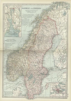
Background imageGeographical Border Collection: Map of Norway and Sweden, c.1900 (engraving)

Map of Norway and Sweden, c.1900 (engraving)
532971 Map of Norway and Sweden, c.1900 (engraving); (add.info.: Map of Norway, Sweden, with insets of Kristianiafjord and Stockholm, circa 1902)

Background imageGeographical Border Collection: Map of northern Illinois, c.1900 (engraving)

Map of northern Illinois, c.1900 (engraving)
533173 Map of northern Illinois, c.1900 (engraving); (add.info.: Map of the northern part of Illinois, United States, circa 1902)

Background imageGeographical Border Collection: Map of South Carolina with inset of Charleston, c.1900 (engraving)

Map of South Carolina with inset of Charleston, c.1900 (engraving)
533136 Map of South Carolina with inset of Charleston, c.1900 (engraving); (add.info.: Map showing the historical boundaries of South Carolina, United States, with an inset map of Charleston)

Background imageGeographical Border Collection: Map of Vermont and New Hampshire, c.1900 (engraving)

Map of Vermont and New Hampshire, c.1900 (engraving)
533091 Map of Vermont and New Hampshire, c.1900 (engraving); (add.info.: Map showing the historical boundaries of Vermont and New Hampshire, United States, circa 1902)

Background imageGeographical Border Collection: Map of Ontario, Canada, c.1900 (engraving)

Map of Ontario, Canada, c.1900 (engraving)
533076 Map of Ontario, Canada, c.1900 (engraving); (add.info.: Map of Ontario, Canada, with an inset of Toronto, circa 1902)

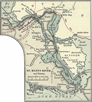
Background imageGeographical Border Collection: Map of St. Marys River and Sault Ste. Marie, MI, c.1900 (engraving)

Map of St. Marys River and Sault Ste. Marie, MI, c.1900 (engraving)
533450 Map of St. Marys River and Sault Ste. Marie, MI, c.1900 (engraving); (add.info.: Map of St. Marys River and Sault Ste)

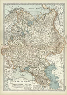
Background imageGeographical Border Collection: Map of Russia showing historical boundaries of Russia in Europe with Poland and Finland, circa 1902

Map of Russia showing historical boundaries of Russia in Europe with Poland and Finland, circa 1902
532992 Map of Russia showing historical boundaries of Russia in Europe with Poland and Finland, circa 1902; (add.info.: Map showing historical boundaries of Russia in Europe with Poland and Finland)

Background imageGeographical Border Collection: Map of Italy with Sicily and Naples, c.1900 (engraving)

Map of Italy with Sicily and Naples, c.1900 (engraving)
532989 Map of Italy with Sicily and Naples, c.1900 (engraving); (add.info.: Map of central and southern Italy with insets map of Sicily and Naples, circa 1902)

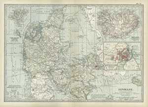
Background imageGeographical Border Collection: Map of Denmark, c.1900 (engraving)

Map of Denmark, c.1900 (engraving)
532967 Map of Denmark, c.1900 (engraving); (add.info.: Map of Denmark, with insets of Iceland, Copenhagen, and the Faeroe Islands, circa 1902)

Background imageGeographical Border Collection: Map of Wisconsin, c.1900 (engraving)

Map of Wisconsin, c.1900 (engraving)
533185 Map of Wisconsin, c.1900 (engraving); (add.info.: Map of Wisconsin, United States, with an inset map of Milwaukee and the Waukesha Lake Region, circa 1902)

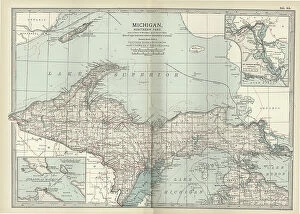
Background imageGeographical Border Collection: Map of the northern part of Michigan, c.1900 (engraving)

Map of the northern part of Michigan, c.1900 (engraving)
533181 Map of the northern part of Michigan, c.1900 (engraving); (add.info.: Map of the northern part of Michigan, United States, with inset maps of St)

Background imageGeographical Border Collection: Map of southern Ohio, c.1900 (engraving)

Map of southern Ohio, c.1900 (engraving)
533168 Map of southern Ohio, c.1900 (engraving); (add.info.: Map of the southern part of Ohio, United States, with inset maps of Cincinnati and Cleveland, circa 1902)

Background imageGeographical Border Collection: Map of Mississippi, c.1900 (engraving)

Map of Mississippi, c.1900 (engraving)
533154 Map of Mississippi, c.1900 (engraving); (add.info.: Map of Mississippi, United States, circa 1902, from the 10th edition of Encyclopaedia Britannica.); Encyclopaedia Britannica/UIG

Background imageGeographical Border Collection: Map of Georgia, c.1900 (engraving)

Map of Georgia, c.1900 (engraving)
533139 Map of Georgia, c.1900 (engraving); (add.info.: Map of Georgia, United States, with inset maps of Savannah and Chickamauga National Park, circa 1902)

Background imageGeographical Border Collection: Map of Maryland and Delaware, c.1900 (engraving)

Map of Maryland and Delaware, c.1900 (engraving)
533120 Map of Maryland and Delaware, c.1900 (engraving); (add.info.: Map of Maryland and Delaware, inset maps of District of Columbia and Baltimore, circa 1902)

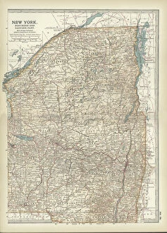
Background imageGeographical Border Collection: Map of New York State, c.1900 (engraving)

Map of New York State, c.1900 (engraving)
533105 Map of New York State, c.1900 (engraving); (add.info.: Map of north and eastern New York State, United States, circa 1902)

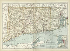
Background imageGeographical Border Collection: Map of Connecticut and Rhode Island, c.1900 (engraving)

Map of Connecticut and Rhode Island, c.1900 (engraving)
533101 Map of Connecticut and Rhode Island, c.1900 (engraving); (add.info.: Map of Connecticut and Rhode Island, United States, with an inset of Newport, circa 1902)

Background imageGeographical Border Collection: Map of Maine, c.1900 (engraving)

Map of Maine, c.1900 (engraving)
533088 Map of Maine, c.1900 (engraving); (add.info.: Map of Maine, United States, with inset map of Mount Desert Island, circa 1902)

Background imageGeographical Border Collection: Map of Hamburg, c.1900 (engraving)

Map of Hamburg, c.1900 (engraving)
532767 Map of Hamburg, c.1900 (engraving); (add.info.: Map of Hamburg, circa 1900, from the 10th edition of Encyclopaedia Britannica.); Encyclopaedia Britannica/UIG

Background imageGeographical Border Collection: map of Detroit, c.1900 (engraving)

map of Detroit, c.1900 (engraving)
532755 map of Detroit, c.1900 (engraving); (add.info.: Map of Detroit, Michigan, and the Detroit River, circa 1900, from the 10th edition of Encyclopaedia Britannica.); Encyclopaedia Britannica/UIG

Background imageGeographical Border Collection: Map of Dardanelles, c.1900 (engraving)

Map of Dardanelles, c.1900 (engraving)
532751 Map of Dardanelles, c.1900 (engraving); (add.info.: Map of Dardanelles, circa 1900, from the 10th edition of Encyclopaedia Britannica.); Encyclopaedia Britannica/UIG

Background imageGeographical Border Collection: Map of Persia with Afghanistan and Baluchistan, c.1900 (engraving)

Map of Persia with Afghanistan and Baluchistan, c.1900 (engraving)
533013 Map of Persia with Afghanistan and Baluchistan, c.1900 (engraving); (add.info.: Map showing the historical boundaries of Persia (now Iran), Afghanistan, and Baluchistan, circa 1902

Background imageGeographical Border Collection: Map of Turkey, c.1900 (engraving)

Map of Turkey, c.1900 (engraving)
532998 Map of Turkey, c.1900 (engraving); (add.info.: Map showing historical boundaries of the European portion of Turkey, circa 1902)

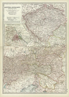
Background imageGeographical Border Collection: Map of Austria with Vienna, c.1900 (engraving)

Map of Austria with Vienna, c.1900 (engraving)
532980 Map of Austria with Vienna, c.1900 (engraving); (add.info.: Map showing Austria-Hungary, with an inset of Vienna, circa 1902)

Background imageGeographical Border Collection: Map of southern Illinois, c.1900 (engraving)

Map of southern Illinois, c.1900 (engraving)
533175 Map of southern Illinois, c.1900 (engraving); (add.info.: Map of the southern part of Illinois, United States, with an inset map of Chicago and Vicinity, circa 1902)

Background imageGeographical Border Collection: Map of Indiana, c.1900 (engraving)

Map of Indiana, c.1900 (engraving)
533170 Map of Indiana, c.1900 (engraving); (add.info.: Map of Indiana, United States, circa 1902, from the 10th edition of Encyclopaedia Britannica.); Encyclopaedia Britannica/UIG

Background imageGeographical Border Collection: Map of western Texas with Galveston, c.1900 (engraving)

Map of western Texas with Galveston, c.1900 (engraving)
533163 Map of western Texas with Galveston, c.1900 (engraving); (add.info.: Map of the western part of Texas with inset map of Galveston Bay, Galveston, Houston and Vicinity, circa 1902)

Background imageGeographical Border Collection: Map of Arkansas, c.1900 (engraving)

Map of Arkansas, c.1900 (engraving)
533157 Map of Arkansas, c.1900 (engraving); (add.info.: Map of Arkansas, United States, circa 1902, from the 10th edition of Encyclopaedia Britannica.); Encyclopaedia Britannica/UIG

Background imageGeographical Border Collection: Map of southeast Australia, c.1900 (engraving)

Map of southeast Australia, c.1900 (engraving)
533045 Map of southeast Australia, c.1900 (engraving); (add.info.: Map of southeast Australia with Victoria, New South Wales, and parts of South Australia and Queensland, circa 1902)

Background imageGeographical Border Collection: Map of the Chinese Empire, c.1900 (engraving)

Map of the Chinese Empire, c.1900 (engraving)
533025 Map of the Chinese Empire, c.1900 (engraving); (add.info.: Map showing the historical boundaries of the Chinese Empire, with insets of Hong Kong, Peking (now Beijing), and Tientsin

Background imageGeographical Border Collection: Map of Eastern India, c.1900 (engraving)

Map of Eastern India, c.1900 (engraving)
533022 Map of Eastern India, c.1900 (engraving); (add.info.: Map showing historical boundaries of eastern India, Burma, Siam and French Indo-China, circa 1902)

Background imageGeographical Border Collection: Map of Asia with Siberia and Central Asia, c.1900 (engraving)

Map of Asia with Siberia and Central Asia, c.1900 (engraving)
533003 Map of Asia with Siberia and Central Asia, c.1900 (engraving); (add.info.: Map of Asia, circa 1902, from the 10th edition of Encyclopaedia Britannica.); Encyclopaedia Britannica/UIG

Background imageGeographical Border Collection: Map of the eastern part of South America, c.1900 (engraving)

Map of the eastern part of South America, c.1900 (engraving)
533262 Map of the eastern part of South America, c.1900 (engraving); (add.info.: Map showing the historical boundaries of eastern South America, with an inset map of Rio de Janeiro, circa 1902)

Background imageGeographical Border Collection: Map of Kansas, c.1900 (engraving)

Map of Kansas, c.1900 (engraving)
533205 Map of Kansas, c.1900 (engraving); (add.info.: Map of Kansas, United States, circa 1902, from the 10th edition of Encyclopaedia Britannica.); Encyclopaedia Britannica/UIG


All Professionally Made to Order for Quick Shipping

"Exploring the Geographical Borders: From Ancient Jerusalem to Modern Singapore" Embark on a captivating journey through geographical borders as we delve into diverse landscapes and historical realms. 🌍✈️ Starting with China's intricate map, witness the vastness of this ancient civilization that has stood the test of time. πŸ‡¨πŸ‡³ Next, trace the travels of The Apostle Paul through an enchanting map engraving, unraveling his remarkable journey across lands and seas. β›ͺοΈβš“οΈ Marvel at Ancient and Modern Jerusalem's transformation over centuries, depicted in a mesmerizing map engraving that showcases its rich cultural heritage. πŸ•ŒπŸ• Navigate through Massachusetts' Middlesex Westford Vector Road Map and Barnstable Town Vector Road Map to discover charming towns nestled within picturesque landscapes. πŸ—ΊοΈπŸžοΈ Experience the vibrant city-state of Singapore, where tradition meets modernity amidst stunning skyscrapers and lush greenery. πŸ™οΈπŸŒΏ Witness nature's breathtaking artistry as first light illuminates Bonneville Salt Flats near Utah-Nevada border, revealing delicate salt crystal patterns on its surface. β˜€οΈβ„οΈ Travel eastward to Romania, a land steeped in history and natural beauty; explore its hidden gems tucked away within majestic mountainscapes. πŸ°β›°οΈ Continue your expedition with MA Essex Swampscott Vector Road Map - uncover hidden coastal treasures along Massachusetts' scenic shoreline. β›΅πŸŒŠ Uncover Antique India Map's secrets as you traverse this culturally diverse nation brimming with architectural wonders and spiritual enlightenment. πŸ•Œβœ¨ Step back in time with London and Environs Historical Map Engraving from 1892 - immerse yourself in Victorian charm while exploring England's capital city.