Framed Print > Asia > Bangladesh > Maps
Framed Print : Bangladesh country map


![]()
Framed Photos from Fine Art Storehouse
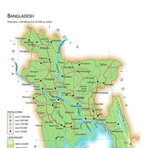
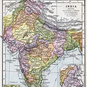
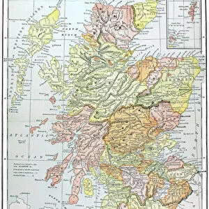
Bangladesh country map
2011 edition
Unleash your creativity and transform your space into a visual masterpiece!
Media ID 14432381
12"x10" Modern Frame
10x8 Print in an MDF Wooden Frame with 180 gsm Satin Finish Paper. Glazed using shatter proof thin plexi glass. Frame thickness is 1 inch and depth 0.75 inch. Fluted cardboard backing held with clips. Supplied ready to hang with sawtooth hanger and rubber bumpers. Spot clean with a damp cloth. Packaged foam wrapped in a card.
Contemporary Framed and Mounted Prints - Professionally Made and Ready to Hang
Estimated Image Size (if not cropped) is 25.4cm x 25.4cm (10" x 10")
Estimated Product Size is 25.4cm x 30.5cm (10" x 12")
These are individually made so all sizes are approximate
Artwork printed orientated as per the preview above, with landscape (horizontal) or portrait (vertical) orientation to match the source image.
FEATURES IN THESE COLLECTIONS
> Fine Art Storehouse
> Map
> Reference Maps
> Asia
> Bangladesh
> Maps
> Asia
> Bangladesh
> Related Images
> Maps and Charts
> Related Images
EDITORS COMMENTS
This print showcases the intricate details of the Bangladesh country map, specifically from the 2011 edition. With its vibrant colors and precise cartographic features, this artwork captures the essence of this beautiful South Asian nation. The map highlights Bangladesh's diverse topography, including its vast river systems like the Ganges-Brahmaputra-Meghna Delta, which is one of the largest in the world. The intricate network of rivers and waterways is depicted with stunning accuracy, showcasing their importance in shaping both the landscape and culture of this remarkable country. From bustling cities to serene rural landscapes, every corner of Bangladesh is meticulously illustrated on this print. It provides a comprehensive overview of major cities such as Dhaka, Chittagong, and Khulna while also highlighting smaller towns that contribute to Bangladesh's rich tapestry. Beyond geographical information, this artwork offers a glimpse into Bangladesh's cultural heritage by featuring iconic landmarks like historical mosques and ancient temples scattered throughout its territory. These architectural marvels serve as a testament to centuries-old traditions that have shaped Bangladeshi society. Whether you are an avid traveler or simply appreciate fine art prints that celebrate our world's diversity, this photograph beautifully encapsulates all that makes Bangladesh unique. Its meticulous attention to detail combined with artistic flair make it a perfect addition for any space seeking to showcase both beauty and knowledge about one of Asia's most fascinating countries.
MADE IN THE USA
Safe Shipping with 30 Day Money Back Guarantee
FREE PERSONALISATION*
We are proud to offer a range of customisation features including Personalised Captions, Color Filters and Picture Zoom Tools
SECURE PAYMENTS
We happily accept a wide range of payment options so you can pay for the things you need in the way that is most convenient for you
* Options may vary by product and licensing agreement. Zoomed Pictures can be adjusted in the Cart.