Fraud Blocker Skip to main content

Photo Mug > Europe > United Kingdom > Maps

Maps Photo Mug Collection (#9)

Discover the beauty of the United Kingdom and Europe with our Maps of United Kingdom, Europe collection of Photo Mugs from Media Storehouse. Each mug features intricately detailed maps of these beloved regions, showcasing their unique borders, cities, and landmarks. Perfect for your morning coffee or afternoon tea, these high-quality mugs are not only functional but also make for stunning decorative pieces. Bring a piece of Europe right into your home or office with our Maps of United Kingdom, Europe collection of Photo Mugs.

Maps of the United Kingdom and Europe are essential tools for travelers, businesses, and researchers

12,645 Photo Mugs

Background imageMaps Photo Mug Collection: Chart of the Southern Hemisphere showing pre-Cook journeys and discoveries, 1777 (engraving)

Chart of the Southern Hemisphere showing pre-Cook journeys and discoveries, 1777 (engraving)
7295408 Chart of the Southern Hemisphere showing pre-Cook journeys and discoveries, 1777 (engraving) by Cook, James (1728-79); 56x54 cm; National Maritime Museum, London

Background imageMaps Photo Mug Collection: Rear-Admiral Sir John Jervis, 1st Earl of St Vincent (1735-1823), 1806 (oil on canvas)

Rear-Admiral Sir John Jervis, 1st Earl of St Vincent (1735-1823), 1806 (oil on canvas)
7338043 Rear-Admiral Sir John Jervis, 1st Earl of St Vincent (1735-1823), 1806 (oil on canvas) by Pellegrini, Domenico (1759-1840); 237.5x147.5 cm; National Maritime Museum, London

Background imageMaps Photo Mug Collection: Formerly called Nevil Maskelyne, Astronomer Royal (1732-1811), 1779 (oil painting)

Formerly called Nevil Maskelyne, Astronomer Royal (1732-1811), 1779 (oil painting)
7337966 Formerly called Nevil Maskelyne, Astronomer Royal (1732-1811), 1779 (oil painting) by Downman, John (c.1750-1824); 91.4x71.1 cm; National Maritime Museum, London

Background imageMaps Photo Mug Collection: River Thames from London to Gravesend, 1830-33 (print)

River Thames from London to Gravesend, 1830-33 (print)
7337575 River Thames from London to Gravesend, 1830-33 (print) by Bullock, F. & Burstal, E. (fl.c.1830); National Maritime Museum, London, UK; (add.info.: Creator: Captain F. Bullock; Lieutenant E)

Background imageMaps Photo Mug Collection: Pair of maps of the Northern and Southern Celestial Hemispheres, 17th century (engraving)

Pair of maps of the Northern and Southern Celestial Hemispheres, 17th century (engraving)
7337557 Pair of maps of the Northern and Southern Celestial Hemispheres, 17th century (engraving) by Durer or Duerer, Albrecht (1471-1528); National Maritime Museum, London

Background imageMaps Photo Mug Collection: Trade in Holland: the salting of herring. Detail of a geographical map of Claes Jansz, 1608

Trade in Holland: the salting of herring. Detail of a geographical map of Claes Jansz, 1608
FGL5469929 Trade in Holland: the salting of herring. Detail of a geographical map of Claes Jansz, 1608; Fototeca Gilardi

Background imageMaps Photo Mug Collection: Celestial globe with table, supported by Hercules, c.1651 (ivory statuette and gilded copper)

Celestial globe with table, supported by Hercules, c.1651 (ivory statuette and gilded copper)
MMM5475237 Celestial globe with table, supported by Hercules, c.1651 (ivory statuette and gilded copper); National Maritime Museum, London, UK; (add.info.: Celestial globe with table)

Background imageMaps Photo Mug Collection: Plan Of Stonehenge As If Restored, Left. Plan Of Stonehenge As It Was

Plan Of Stonehenge As If Restored, Left. Plan Of Stonehenge As It Was. Both Plans From The Late 19Th Century
UIG5420285 Plan Of Stonehenge As If Restored, Left. Plan Of Stonehenge As It Was. Both Plans From The Late 19Th Century. From Our Own Country Published 1898 ©UIG/Leemage

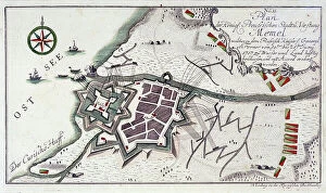
Background imageMaps Photo Mug Collection: Plan of Memel (present-day Klaipeda, Lithuania), during the surrender of the city

Plan of Memel (present-day Klaipeda, Lithuania), during the surrender of the city, 27 June to 5 July 1757
MMM5482024 Plan of Memel (present-day Klaipeda, Lithuania), during the surrender of the city, 27 June to 5 July 1757. Etching water in 1764 colors.; National Maritime Museum, London

Background imageMaps Photo Mug Collection: (Wind chart, showing winds for the four quarters of the year) Cape Horn (2) western vicinity

(Wind chart, showing winds for the four quarters of the year) Cape Horn (2) western vicinity, sold by J.D Potter, 31
7342744 (Wind chart, showing winds for the four quarters of the year) Cape Horn (2) western vicinity, sold by J.D Potter, 31, poultry, price one shilling, 1855 (print) by British School

Background imageMaps Photo Mug Collection: New Map of Europe Done from the most accurate observations communicated to the Royal Society's at

New Map of Europe Done from the most accurate observations communicated to the Royal Society's at London & Paris
7340918 New Map of Europe Done from the most accurate observations communicated to the Royal Society's at London & Paris, c.1720 (technical drawing) by Bowles

Background imageMaps Photo Mug Collection: Plan of Deptford Dockyard, 1774 (technical drawing)

Plan of Deptford Dockyard, 1774 (technical drawing)
7340916 Plan of Deptford Dockyard, 1774 (technical drawing) by Unknown artist, (18th century); National Maritime Museum, London, UK; (add.info.: Creator: unknown); © National Maritime Museum

Background imageMaps Photo Mug Collection: Volvelle giving the rules for predicting solar and lunar eclipses, 1540 (hand-coloured engraving)

Volvelle giving the rules for predicting solar and lunar eclipses, 1540 (hand-coloured engraving)
7340906 Volvelle giving the rules for predicting solar and lunar eclipses, 1540 (hand-coloured engraving) by Apianus, Petrus (1495-1552); National Maritime Museum, London

Background imageMaps Photo Mug Collection: Manta, 1685 (bound sheet)

Manta, 1685 (bound sheet)
7339729 Manta, 1685 (bound sheet) by Hack, William (17th Century); 40x50 cm; National Maritime Museum, London, UK; (add.info.: Creator: William Hack South America, the Pacific Coast and Ecuador)

Background imageMaps Photo Mug Collection: Bahia San Mateo, 1685 (bound sheet)

Bahia San Mateo, 1685 (bound sheet)
7339723 Bahia San Mateo, 1685 (bound sheet) by Hack, William (17th Century); 40x50 cm; National Maritime Museum, London, UK; (add.info.: Creator: William Hack South America)

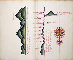
Background imageMaps Photo Mug Collection: Mount of Sapo, Punta Chame and La Chorrera, 1685 (bound sheet)

Mount of Sapo, Punta Chame and La Chorrera, 1685 (bound sheet)
7339709 Mount of Sapo, Punta Chame and La Chorrera, 1685 (bound sheet) by Hack, William (17th Century); 40x50 cm; National Maritime Museum, London

Background imageMaps Photo Mug Collection: The Bay of Escoria, 1685 (bound sheet)

The Bay of Escoria, 1685 (bound sheet)
7339708 The Bay of Escoria, 1685 (bound sheet) by Hack, William (17th Century); 40x50 cm; National Maritime Museum, London, UK; (add.info.: Creator: William Hack North America, the Pacific Coast)

Background imageMaps Photo Mug Collection: The Bay of Phillipina, 1685 (bound sheet)

The Bay of Phillipina, 1685 (bound sheet)
7339705 The Bay of Phillipina, 1685 (bound sheet) by Hack, William (17th Century); 40x50 cm; National Maritime Museum, London, UK; (add.info.: Creator: William Hack North America, the Pacific Coast)

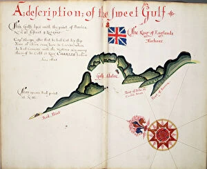
Background imageMaps Photo Mug Collection: A description of the Sweet Gulf, 1685 (bound sheet)

A description of the Sweet Gulf, 1685 (bound sheet)
7339702 A description of the Sweet Gulf, 1685 (bound sheet) by Hack, William (17th Century); 40x50 cm; National Maritime Museum, London, UK; (add.info.: Creator: William Hack North America)

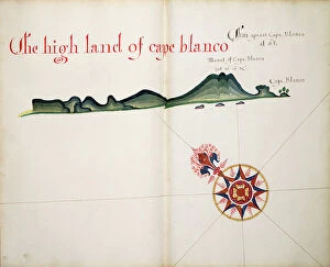
Background imageMaps Photo Mug Collection: The High Land of Cape Blanco, 1685 (bound sheet)

The High Land of Cape Blanco, 1685 (bound sheet)
7339699 The High Land of Cape Blanco, 1685 (bound sheet) by Hack, William (17th Century); 40x50 cm; National Maritime Museum, London, UK; (add.info.: Creator: William Hack North America)

Background imageMaps Photo Mug Collection: Cape Guyones, 1685 (bound sheet)

Cape Guyones, 1685 (bound sheet)
7339698 Cape Guyones, 1685 (bound sheet) by Hack, William (17th Century); 40x50 cm; National Maritime Museum, London, UK; (add.info.: Creator: William Hack North America, the Pacific Coast)

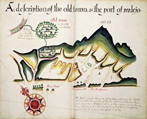
Background imageMaps Photo Mug Collection: A description of the Old Town & the Port of Realejo, 1685 (bound sheet)

A description of the Old Town & the Port of Realejo, 1685 (bound sheet)
7339692 A description of the Old Town & the Port of Realejo, 1685 (bound sheet) by Hack, William (17th Century); 40x50 cm; National Maritime Museum, London

Background imageMaps Photo Mug Collection: A description of the Plantations & Setlements in the Valley of Tepaca, 1685 (bound sheet)

A description of the Plantations & Setlements in the Valley of Tepaca, 1685 (bound sheet)
7339688 A description of the Plantations & Setlements in the Valley of Tepaca, 1685 (bound sheet) by Hack, William (17th Century); 40x50 cm; National Maritime Museum, London

Background imageMaps Photo Mug Collection: Paneca and Sonsonate, 1685 (bound sheet)

Paneca and Sonsonate, 1685 (bound sheet)
7339684 Paneca and Sonsonate, 1685 (bound sheet) by Hack, William (17th Century); 40x50 cm; National Maritime Museum, London, UK; (add.info.: Creator: William Hack North America, the Pacific Coast)

Background imageMaps Photo Mug Collection: Anabacas, 1685 (bound sheet)

Anabacas, 1685 (bound sheet)
7339682 Anabacas, 1685 (bound sheet) by Hack, William (17th Century); 40x50 cm; National Maritime Museum, London, UK; (add.info.: Creator: William Hack North America, the Pacific Coast)

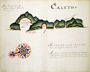
Background imageMaps Photo Mug Collection: Caleto, 1685 (bound sheet)

Caleto, 1685 (bound sheet)
7339673 Caleto, 1685 (bound sheet) by Hack, William (17th Century); 40x50 cm; National Maritime Museum, London, UK; (add.info.: Creator: William Hack North America, the Pacific Coast)

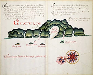
Background imageMaps Photo Mug Collection: Guatulco, 1685 (bound sheet)

Guatulco, 1685 (bound sheet)
7339672 Guatulco, 1685 (bound sheet) by Hack, William (17th Century); 40x50 cm; National Maritime Museum, London, UK; (add.info.: Creator: William Hack North America, the Pacific Coast)

Background imageMaps Photo Mug Collection: Vellum chart of Africa, India and the Mediterranean, 1554 (vellum)

Vellum chart of Africa, India and the Mediterranean, 1554 (vellum)
7339652 Vellum chart of Africa, India and the Mediterranean, 1554 (vellum) by Agnese, Battista (c.1500-64); 26x40 cm; National Maritime Museum, London

Background imageMaps Photo Mug Collection: Map of Das Heilige Land 1554 [Translation: The Holy land], 1554 (vellum)

Map of Das Heilige Land 1554 [Translation: The Holy land], 1554 (vellum)
7339649 Map of Das Heilige Land 1554 [Translation: The Holy land], 1554 (vellum) by Agnese, Battista (c.1500-64); 26x40 cm; National Maritime Museum, London

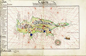
Background imageMaps Photo Mug Collection: Vellum chart of Cyprus, 1554 (vellum)

Vellum chart of Cyprus, 1554 (vellum)
7339648 Vellum chart of Cyprus, 1554 (vellum) by Agnese, Battista (c.1500-64); 26x40 cm; National Maritime Museum, London, UK; (add.info.: Creator: Battista Agnese); © National Maritime Museum

Background imageMaps Photo Mug Collection: Map of Creta 1554, 1554 (vellum)

Map of Creta 1554, 1554 (vellum)
7339647 Map of Creta 1554, 1554 (vellum) by Agnese, Battista (c.1500-64); 26x40 cm; National Maritime Museum, London, UK; (add.info.: Creator: Battista Agnese Bound sheet. Scale: [circa 1:3 000 000])

Background imageMaps Photo Mug Collection: Chart of Chius (Chios, Greece), 1554 (vellum)

Chart of Chius (Chios, Greece), 1554 (vellum)
7339646 Chart of Chius (Chios, Greece), 1554 (vellum) by Agnese, Battista (c.1500-64); 26x40 cm; National Maritime Museum, London, UK; (add.info.: Creator: Battista Agnese Scale circa 1:650000)

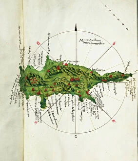
Background imageMaps Photo Mug Collection: Map of Cyprus, c.1485 (vellum)

Map of Cyprus, c.1485 (vellum)
7339636 Map of Cyprus, c.1485 (vellum) by Sonetti, Bartolomeo da li (fl.1485); 27.5x38 cm; National Maritime Museum, London, UK; (add.info.: Creator: Bartolommeo dalli Sonetti Bound sheets)

Background imageMaps Photo Mug Collection: Khios and adjacent mainland, c.1485 (vellum)

Khios and adjacent mainland, c.1485 (vellum)
7339635 Khios and adjacent mainland, c.1485 (vellum) by Sonetti, Bartolomeo da li (fl.1485); 27.5x19 cm; National Maritime Museum, London

Background imageMaps Photo Mug Collection: Astipalaia, c.1485 (vellum)

Astipalaia, c.1485 (vellum)
7339633 Astipalaia, c.1485 (vellum) by Sonetti, Bartolomeo da li (fl.1485); 27.5x19 cm; National Maritime Museum, London, UK; (add.info.: Creator: Bartolommeo dalli Sonetti Bound sheet. Col. ms)

Background imageMaps Photo Mug Collection: Kithira and Antikithira, 1485 (vellum)

Kithira and Antikithira, 1485 (vellum)
7339631 Kithira and Antikithira, 1485 (vellum) by Sonetti, Bartolomeo da li (fl.1485); 27x19 cm; National Maritime Museum, London

Background imageMaps Photo Mug Collection: A chart of Khios and adjacent mainland, c.1420 (Vellum)

A chart of Khios and adjacent mainland, c.1420 (Vellum)
7339628 A chart of Khios and adjacent mainland, c.1420 (Vellum) by Buondelmonti, Cristoforo (1385-1430); 25x18 cm; National Maritime Museum, London

Background imageMaps Photo Mug Collection: Naxos vellum chart, c.1420 (vellum)

Naxos vellum chart, c.1420 (vellum)
7339626 Naxos vellum chart, c.1420 (vellum) by Buondelmonti, Cristoforo (1385-1430); 25x18 cm; National Maritime Museum, London

Background imageMaps Photo Mug Collection: Lesser Antilles and Caribbean Sea, c.1550-60 (vellum)

Lesser Antilles and Caribbean Sea, c.1550-60 (vellum)
7339618 Lesser Antilles and Caribbean Sea, c.1550-60 (vellum) by Unknown Artist, (16th century); 24x17 cm; National Maritime Museum, London, UK; (add.info.: Creator: unkown Scale: circa 1:15 500 000)

Background imageMaps Photo Mug Collection: c.1550-60 (ink on vellum)

c.1550-60 (ink on vellum)
7339616 c.1550-60 (ink on vellum) by Unknown Artist, (16th century); 24x17 cm; National Maritime Museum, London, UK; (add.info.: Creator: unknown); © National Maritime Museum, Greenwich, London

Background imageMaps Photo Mug Collection: Britain and Ireland, c.1550 (vellum)

Britain and Ireland, c.1550 (vellum)
7339594 Britain and Ireland, c.1550 (vellum) by Martines, Joan (1556-1590); 1.6x19 cm; National Maritime Museum, London, UK; (add.info.: Creator: Joan Martines); © National Maritime Museum

Background imageMaps Photo Mug Collection: West coast of Africa, 1826-34 (print)

West coast of Africa, 1826-34 (print)
7339559 West coast of Africa, 1826-34 (print) by Walker, J. & C. (19th century); 21.5x54 cm; National Maritime Museum, London, UK; (add.info.: Creator: Hydrographic Office; E)

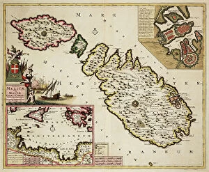
Background imageMaps Photo Mug Collection: Map of Malta, Gozo and Comino, 1707 (coloured engraving)

Map of Malta, Gozo and Comino, 1707 (coloured engraving)
7339536 Map of Malta, Gozo and Comino, 1707 (coloured engraving) by Wit, Frederick de (1630-1706); 46x57 cm; National Maritime Museum, London

Background imageMaps Photo Mug Collection: Macao. Key to town plan. From the Macartney expedition in the Lion and Hindostan, 1793. 1796 (print)

Macao. Key to town plan. From the Macartney expedition in the Lion and Hindostan, 1793. 1796 (print)
7339529 Macao. Key to town plan. From the Macartney expedition in the Lion and Hindostan, 1793. 1796 (print) by Baker, B. & Nichol, George (fl.1796); 77x56.5 cm; National Maritime Museum, London

Background imageMaps Photo Mug Collection: Chart of Sierra Leone, Africa, 1732 (engraving)

Chart of Sierra Leone, Africa, 1732 (engraving)
7339526 Chart of Sierra Leone, Africa, 1732 (engraving) by Kip, Johannes (c.1652-1722); 34x41 cm; National Maritime Museum, London, UK; (add.info.: Creator: J)

Background imageMaps Photo Mug Collection: Accurate Map of the Upland Shears with the Situation and Area around the Royal Swedish Capital

Accurate Map of the Upland Shears with the Situation and Area around the Royal Swedish Capital
7339510 Accurate Map of the Upland Shears with the Situation and Area around the Royal Swedish Capital and Resident City of Stockholm, c.1740 (coloured engraving) by Homann

Background imageMaps Photo Mug Collection: Chart of Plymouth Sound, from Greenville Collins's 1693 chart of the English Channel

Chart of Plymouth Sound, from Greenville Collins's 1693 chart of the English Channel, 1695 (coloured engraving)
7339508 Chart of Plymouth Sound, from Greenville Collins's 1693 chart of the English Channel, 1695 (coloured engraving) by Keulen, Gerard van (1678-1726); 51x60 cm; National Maritime Museum, London

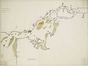
Background imageMaps Photo Mug Collection: A sketch of the River Tagus from the Bar of Alcacova up to Coffin's Hole, 1800 (pen, ink)

A sketch of the River Tagus from the Bar of Alcacova up to Coffin's Hole, 1800 (pen, ink)
7339373 A sketch of the River Tagus from the Bar of Alcacova up to Coffin's Hole, 1800 (pen, ink) by Unknown Artist, (19th century); 58x79 cm; National Maritime Museum, London


All Professionally Made to Order for Quick Shipping


-

Maps Photo Mug Collection

Maps of the United Kingdom and Europe are essential tools for travelers, businesses, and researchers. They provide an overview of the physical landscape as well as political boundaries. Maps of the UK include detailed road maps, topographic maps, and tourist maps. Maps of Europe show countries, cities, rivers and mountains in great detail. In addition to traditional paper maps there are digital versions available online that can be used on mobile devices or computers. With these digital versions users can zoom in to get a closer look at any area they wish to explore or research further and can an invaluable resource for understanding geography and planning trips around the world.
+

Our beautiful Wall Art and Photo Gifts include Framed Prints, Photo Prints, Poster Prints, Canvas Prints, Jigsaw Puzzles, Metal Prints and so much more

The Maps of United Kingdom Europe collection from Media Storehouse is a stunning range of wall art and framed prints that showcase the beauty and diversity of the European continent. Our collection features an extensive selection of maps, including antique maps, modern maps, topographical maps, and political maps. Each map has been carefully curated to provide a unique perspective on the geography and history of Europe. Whether you're looking for a vintage-style map to add character to your home decor or a contemporary map that showcases the latest geographic data, our collection has something for everyone. The Maps of United Kingdom Europe collection is perfect for anyone who loves travel, geography or history. These high-quality prints are available in various sizes and formats to suit any space. They make excellent gifts for friends and family members who share your passion for exploring new places or learning about different cultures. With its vast array of options, our collection is sure to inspire wanderlust in all those who view it.
+

What are Maps of United Kingdom Europe art prints?

Maps of United Kingdom Europe art prints are high-quality reproductions of antique and contemporary maps depicting the geography, topography, and landmarks of the UK and Europe. These prints showcase intricate details such as borders, cities, rivers, mountains, forests, and other natural features that make up these regions. These art prints are perfect for history buffs or anyone interested in exploring the rich cultural heritage of the UK and Europe. They can be used to decorate homes or offices with a unique touch of sophistication while also serving as educational tools for students studying geography or history. We offer a wide range of Maps of United Kingdom Europe art prints from various sources including museums, archives, libraries and private collections. The collection includes vintage maps dating back centuries ago to modern-day digital cartography created by skilled artists. Whether you're looking for an antique map to add character to your living room or a contemporary print for your office space Media Storehouse has something suitable for every taste.
+

What Maps of United Kingdom Europe art prints can I buy from Media Storehouse?

We offer a wide range of Maps of United Kingdom Europe art prints that are perfect for decorating your home or office. You can choose from vintage maps, modern maps, and even satellite images of the UK and Europe. These art prints come in various sizes to fit any space you have in mind. Some popular options include antique-style world maps with intricate details, colourful political maps showing country borders and capital cities, as well as topographic maps highlighting mountain ranges and rivers. Additionally, Media Storehouse also offers city street maps featuring London's famous landmarks or Paris' charming streets. Whether you're looking for a unique gift or want to add some character to your living space, we have plenty of Maps of United Kingdom Europe art prints to choose from. With high-quality printing on premium paper stock, these art prints will make a stunning addition to any room.
+

How do I buy Maps of United Kingdom Europe art prints?

To purchase Maps of United Kingdom Europe art prints from Media Storehouse, you can browse our extensive collection online. We offer a range of maps in different styles and sizes to suit your preferences. Once you have found the map that you would like to buy, simply add it to your cart and proceed to checkout. During the checkout process, you will be prompted to enter your payment details and shipping address. You can choose from a variety of payment options including credit card, PayPal or Apple Pay. We offer high-quality prints on premium paper using state-of-the-art printing technology. Their prints are produced using archival quality ink which ensures long-lasting color vibrancy. Once your order has been processed, it will be carefully packaged and shipped directly to your doorstep. If you have any questions about the ordering process or need assistance with selecting a print, our customer service team is available to help via email or phone.
+

How much do Maps of United Kingdom Europe art prints cost?

The cost of Maps of United Kingdom Europe art prints can vary depending on a number of factors. The size, quality, and type of paper used for printing are all factors that can affect the price. Additionally, the artist or publisher who created the print may also influence its cost. Generally speaking, smaller prints will be less expensive than larger ones. Prints made with lower-quality materials may also be cheaper than those made with higher-quality materials. However, it's important to note that some collectors and enthusiasts may place a premium on certain types of prints or artists. Ultimately, the best way to determine how much a Maps of United Kingdom Europe art print will cost is to research different options from various sources. By comparing prices and features across different retailers and publishers, you'll be able to find a print that fits your budget while still meeting your needs in terms of style and quality.
+

How will my Maps of United Kingdom Europe art prints be delivered to me?

Your Maps of United Kingdom Europe art prints will be delivered to you in a safe and secure manner. The prints are carefully packaged using high-quality materials to ensure that they arrive at your doorstep in pristine condition. Depending on the size and quantity of your order, the prints may be rolled up and shipped in a sturdy tube or flat-packed with additional protection. Media Storehouse takes great care when handling your artwork, so you can rest assured that it will arrive safely. Once dispatched, you will receive an email confirmation along with tracking information so that you can monitor the progress of your delivery. The company works with trusted shipping partners who have years of experience delivering fragile items such as artwork. They aim to deliver all orders promptly and efficiently while keeping their customers informed throughout the process. Media Storehouse ensures that your Maps of United Kingdom Europe art prints are delivered securely and reliably, giving you peace of mind knowing that your purchase is in good hands.