Jigsaw Puzzle > Europe > Related Images
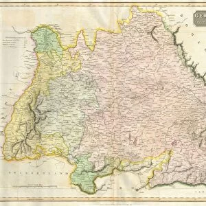
Jigsaw Puzzle : Bavaria, Germany, relief map


![]()
Jigsaw Puzzles from Science Photo Library
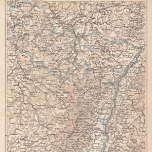
Bavaria, Germany, relief map
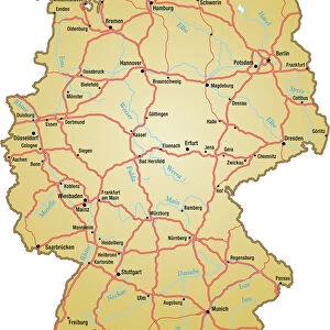
Bavaria, Germany. North is at top. Relief map compiled from satellite data, showing the state of Bavaria (yellow), Germany, with the surrounding German states shaded out (grey). The North Sea (blue, upper left) and Baltic Sea (blue, upper right) can also be seen. Germany is located in Western and Central Europe and is bordered by Denmark (top centre), Poland (upper right), the Czech Republic (right), Austria (bottom right), Switzerland (bottom left), France (lower left), Luxembourg (small, centre left), Belgium (left), and the Netherlands (upper left). Image compiled from data acquired by the LANDSAT 5 and 7 satellites, in 2000. Images highlighting all other regions of this country are available. For further information please contact SPL
Science Photo Library features Science and Medical images including photos and illustrations
Media ID 9215895
© PLANETOBSERVER/SCIENCE PHOTO LIBRARY
2000 Austria Baltic Sea Bavaria Belgium Birds Eye View Border Borders Boundaries Boundary Cartography Cloudless Coast Coastal Coastline Countries Country Czech Republic Denmark Earth Observation Environmental France From Above From Space Frontier Frontiers Germany Land Landsat 5 Landsat 7 Luxembourg Masked Nation Netherlands North Sea Poland Relief Map Satellite Satellite Image Shore Shoreline State States Switzerland Topographic Topography Western Europe
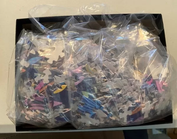
Jigsaw Puzzle (520 Pieces)
Discover the beauty of Bavaria, Germany with our captivating jigsaw puzzle from Media Storehouse. This intricately detailed puzzle, featuring a relief map of Bavaria compiled from satellite data, invites you on a journey through the diverse landscapes of this iconic German state. With the surrounding German states artfully shaded out, you'll be fully immersed in the unique topography of Bavaria. Challenge yourself or the whole family with this engaging puzzle, perfect for hours of fun and learning about geography.
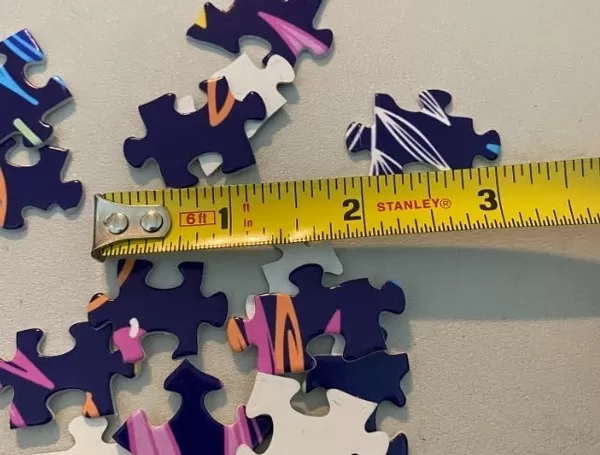
Made in the USA, 520-piece puzzles measure 16" x 20" (40.6 x 50.8 cm). Every puzzle is meticulously printed on glossy photo paper, which has a strong 1.33 mm thickness. Delivered in a black storage cardboard box, these puzzles are both stylish and practical. (Note: puzzles contain small parts and are not suitable for children under 3 years of age.)
Jigsaw Puzzles are an ideal gift for any occasion
Estimated Product Size is 40.5cm x 50.8cm (15.9" x 20")
These are individually made so all sizes are approximate
Artwork printed orientated as per the preview above, with landscape (horizontal) or portrait (vertical) orientation to match the source image.
EDITORS COMMENTS
This print showcases a relief map of Bavaria, Germany. The image, compiled from satellite data acquired by the LANDSAT 5 and 7 satellites in 2000, provides a bird's eye view of this stunning region. With North at the top, the state of Bavaria is highlighted in vibrant yellow against a backdrop of shaded out surrounding German states. The intricate details captured in this map allow us to explore Germany's geographical features and its position within Western and Central Europe. We can observe its borders with neighboring countries such as Denmark, Poland, Czech Republic, Austria, Switzerland, France, Luxembourg, Belgium, and the Netherlands. Notably visible are two bodies of water that grace Germany's coastline - the North Sea on the upper left side and the Baltic Sea on the upper right side. These blue expanses add an enchanting touch to this already mesmerizing image. As we delve into this photograph further, it becomes evident that every element has been meticulously represented: from mountain ranges to rivers and coastlines. This comprehensive depiction offers valuable insights into Bavaria's topography while also highlighting other regions within Germany. Whether you are fascinated by cartography or simply captivated by Earth observation from space imagery like this one – Science Photo Library presents an awe-inspiring visual representation for all nature enthusiasts to appreciate.
MADE IN THE USA
Safe Shipping with 30 Day Money Back Guarantee
FREE PERSONALISATION*
We are proud to offer a range of customisation features including Personalised Captions, Color Filters and Picture Zoom Tools
SECURE PAYMENTS
We happily accept a wide range of payment options so you can pay for the things you need in the way that is most convenient for you
* Options may vary by product and licensing agreement. Zoomed Pictures can be adjusted in the Cart.