Fraud Blocker Skip to main content

Home > Maps and Charts > Greece

Greece Collection (#2)

Greece is a country located in southeastern Europe, with a population of approximately 10.7 million people

1,412 Items

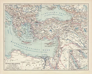
Background imageGreece Collection: Ottoman Empire, lithograph, published in 1878

Ottoman Empire, lithograph, published in 1878
Ancient map of Ottoman Empire. Lithograph, published in 1878

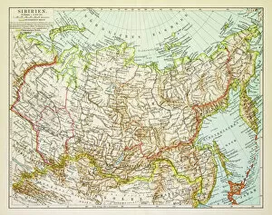
Background imageGreece Collection: Map of Siberia 1895

Map of Siberia 1895
Map of Siberia

Background imageGreece Collection: Ancient Greece map 1875

Ancient Greece map 1875
The Independent Course Comprehensive Geography by James Monteith, A.S. Barnes & Co, New York & Chicago 1875

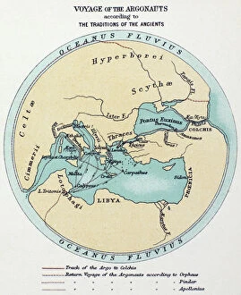
Background imageGreece Collection: VOYAGE OF THE ARGONAUTS. Voyage of the Argonauts according to Greek mythology

VOYAGE OF THE ARGONAUTS. Voyage of the Argonauts according to Greek mythology

Background imageGreece Collection: Map of Knossos buildings surrounding the Palace, circa 1903

Map of Knossos buildings surrounding the Palace, circa 1903
7310021 Map of Knossos buildings surrounding the Palace, circa 1903 by Fyfe, Theodore (1875-1945); 31x100 cm; Ashmolean Museum, University of Oxford

Background imageGreece Collection: Athena guiding Telemachus in his search for Odysseus (colour litho)

Athena guiding Telemachus in his search for Odysseus (colour litho)
7201988 Athena guiding Telemachus in his search for Odysseus (colour litho) by Bonamy, Armand Joseph (fl.1900-30); Private Collection; (add.info.: Athena, disguised as Mentor)

Background imageGreece Collection: Peloponnese Peninsula

Peloponnese Peninsula
A map of the The Peloponnese peninsula showing the mainland of southern Greece, the Cyclades (right) and the north-west tip of Crete (bottom, centre), circa 1790

Background imageGreece Collection: 1784, Bocage Map of the City of Athens in Ancient Greece, topography, cartography

1784, Bocage Map of the City of Athens in Ancient Greece, topography, cartography
1784, Bocage Map of the City of Athens in Ancient Greece

Background imageGreece Collection: The Island of Crete, from a nautical atlas, 1651 (ink on vellum) (detail from 330925)

The Island of Crete, from a nautical atlas, 1651 (ink on vellum) (detail from 330925)
XOT330926 The Island of Crete, from a nautical atlas, 1651 (ink on vellum) (detail from 330925) by Pietro Giovanni Prunes (fl. 17th Century); Museo Correr, Venice, Italy; Italian, out of copyright

Background imageGreece Collection: The French Coast, England, Scotland and Ireland, from a nautical atlas, 1520 (ink on vellum)

The French Coast, England, Scotland and Ireland, from a nautical atlas, 1520 (ink on vellum)
XOT330911 The French Coast, England, Scotland and Ireland, from a nautical atlas, 1520 (ink on vellum) (detail from 330910) by Giovanni Xenodocus da Corfu (fl)

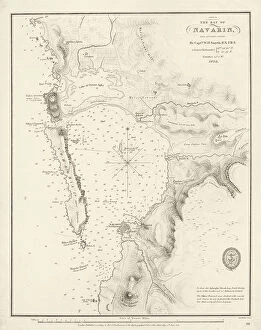
Background imageGreece Collection: Bay of Navarino, 1830 (print)

Bay of Navarino, 1830 (print)
7340652 Bay of Navarino, 1830 (print) by Smyth, William Henry (1788-1865); 32.5x25.5 cm; National Maritime Museum, London

Background imageGreece Collection: Greece, the Peiraeus or Port Drako surveyed by Commander Thomas Graves, H.M.S

Greece, the Peiraeus or Port Drako surveyed by Commander Thomas Graves, H.M.S. Beacon 1840, [Detail], 1843 (print)
7342579 Greece, the Peiraeus or Port Drako surveyed by Commander Thomas Graves, H.M.S. Beacon 1840, [Detail], 1843 (print) by Walker, J. & C

Background imageGreece Collection: Greece, the Peiraeus or Port Drako surveyed by Commander Thomas Graves, H.M.S

Greece, the Peiraeus or Port Drako surveyed by Commander Thomas Graves, H.M.S. Beacon 1840, 1843 (print)
7342578 Greece, the Peiraeus or Port Drako surveyed by Commander Thomas Graves, H.M.S. Beacon 1840, 1843 (print) by Walker, J. & C

Background imageGreece Collection: Archipeligo, Rhodes Island, town and ports of Rhodes surveyed by Commander Thomas Graves

Archipeligo, Rhodes Island, town and ports of Rhodes surveyed by Commander Thomas Graves, HMS Beacon 1838, 1844 (print)
7342500 Archipeligo, Rhodes Island, town and ports of Rhodes surveyed by Commander Thomas Graves, HMS Beacon 1838, 1844 (print) by Walker, J. & C

Background imageGreece Collection: Mediterranean archipelago Rhodes Island surveyed...under the direction of Com'r T Graves RN HMS

Mediterranean archipelago Rhodes Island surveyed...under the direction of Com'r T Graves RN HMS Beacon (1841)
7342521 Mediterranean archipelago Rhodes Island surveyed...under the direction of Com'r T Graves RN HMS Beacon (1841), 1862-1906 (engraving) by Walker, J. & C

Background imageGreece Collection: Chart of Negroponte, c.1485 (Vellum)

Chart of Negroponte, c.1485 (Vellum)
7340068 Chart of Negroponte, c.1485 (Vellum) by Sonetti, Bartolomeo da li (fl.1485); 27.5x19 cm; National Maritime Museum, London

Background imageGreece Collection: Map of Creta 1554, 1554 (vellum)

Map of Creta 1554, 1554 (vellum)
7339647 Map of Creta 1554, 1554 (vellum) by Agnese, Battista (c.1500-64); 26x40 cm; National Maritime Museum, London, UK; (add.info.: Creator: Battista Agnese Bound sheet. Scale: [circa 1:3 000 000])

Background imageGreece Collection: Chart of Chius (Chios, Greece), 1554 (vellum)

Chart of Chius (Chios, Greece), 1554 (vellum)
7339646 Chart of Chius (Chios, Greece), 1554 (vellum) by Agnese, Battista (c.1500-64); 26x40 cm; National Maritime Museum, London, UK; (add.info.: Creator: Battista Agnese Scale circa 1:650000)

Background imageGreece Collection: Khios and adjacent mainland, c.1485 (vellum)

Khios and adjacent mainland, c.1485 (vellum)
7339635 Khios and adjacent mainland, c.1485 (vellum) by Sonetti, Bartolomeo da li (fl.1485); 27.5x19 cm; National Maritime Museum, London

Background imageGreece Collection: Astipalaia, c.1485 (vellum)

Astipalaia, c.1485 (vellum)
7339633 Astipalaia, c.1485 (vellum) by Sonetti, Bartolomeo da li (fl.1485); 27.5x19 cm; National Maritime Museum, London, UK; (add.info.: Creator: Bartolommeo dalli Sonetti Bound sheet. Col. ms)

Background imageGreece Collection: Kithira and Antikithira, 1485 (vellum)

Kithira and Antikithira, 1485 (vellum)
7339631 Kithira and Antikithira, 1485 (vellum) by Sonetti, Bartolomeo da li (fl.1485); 27x19 cm; National Maritime Museum, London

Background imageGreece Collection: A chart of Khios and adjacent mainland, c.1420 (Vellum)

A chart of Khios and adjacent mainland, c.1420 (Vellum)
7339628 A chart of Khios and adjacent mainland, c.1420 (Vellum) by Buondelmonti, Cristoforo (1385-1430); 25x18 cm; National Maritime Museum, London

Background imageGreece Collection: Naxos vellum chart, c.1420 (vellum)

Naxos vellum chart, c.1420 (vellum)
7339626 Naxos vellum chart, c.1420 (vellum) by Buondelmonti, Cristoforo (1385-1430); 25x18 cm; National Maritime Museum, London

Background imageGreece Collection: Chart of the Promontory of Boodroom with the Karabaghla Islands

Chart of the Promontory of Boodroom with the Karabaghla Islands and the North Point of the Island of Kos
7339475 Chart of the Promontory of Boodroom with the Karabaghla Islands and the North Point of the Island of Kos... by Francis Beaufort F.R.S

Background imageGreece Collection: Map of northern and central Greece. From Cassell's Universal History, published 1888 (b/w engraving)

Map of northern and central Greece. From Cassell's Universal History, published 1888 (b/w engraving)
6867236 Map of northern and central Greece. From Cassell's Universal History, published 1888 (b/w engraving); (add.info.: Map of northern and central Greece)

Background imageGreece Collection: Map of Athens and Piraeus, Greece, mid 19th century. From The Imperial Bible Dictionary

Map of Athens and Piraeus, Greece, mid 19th century. From The Imperial Bible Dictionary, published 1889
955359 Map of Athens and Piraeus, Greece, mid 19th century. From The Imperial Bible Dictionary, published 1889.; Private Collection

Background imageGreece Collection: Map of the Wanderings of Aeneas and flight of Icarus (litho)

Map of the Wanderings of Aeneas and flight of Icarus (litho)
8634520 Map of the Wanderings of Aeneas and flight of Icarus (litho) by English School, (20th century); Private Collection; (add.info.: Map of the Wanderings of Aeneas and flight of Icarus)

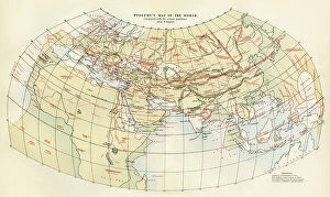
Background imageGreece Collection: World map of Claudius Ptolemaeus (Claude Ptolemee, 90-168 ap JC)

World map of Claudius Ptolemaeus (Claude Ptolemee, 90-168 ap JC), Greek astronomer and astrologer (in red)
NWI4852574 World map of Claudius Ptolemaeus (Claude Ptolemee, 90-168 ap JC), Greek astronomer and astrologer (in red), contrasted with the real positions of cities and countries (in black)

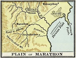
Background imageGreece Collection: Ancient Greece: Map showing the Marathon plain site where the battle of the Greeks against

Ancient Greece: Map showing the Marathon plain site where the battle of the Greeks against the Persians took place in
NWI4862915 Ancient Greece: Map showing the Marathon plain site where the battle of the Greeks against the Persians took place in 490 BC

Background imageGreece Collection: Sciences: Greek astronomer Hipparchus of Nicee, in ancient Greek (Hipparchus v.190-120 BC)

Sciences: Greek astronomer Hipparchus of Nicee, in ancient Greek (Hipparchus v.190-120 BC)
NWI4947964 Sciences: Greek astronomer Hipparchus of Nicee, in ancient Greek (Hipparchus v.190-120 BC), realising a map of the sky (plane of stars) in Alexandria, ancient Egypt

Background imageGreece Collection: Map of Greece and the coasts of Asia Minor from the Ionian revolt at the end of the Peloponnese War

Map of Greece and the coasts of Asia Minor from the Ionian revolt at the end of the Peloponnese War
ELD4924884 Map of Greece and the coasts of Asia Minor from the Ionian revolt at the end of the Peloponnese War and the liberation of Thebes

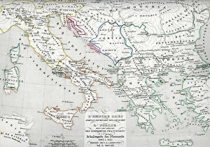
Background imageGreece Collection: Map of Italy and Greece around 774 - 900 (MAP of Italy and Greece, 8th-9th century)

Map of Italy and Greece around 774 - 900 (MAP of Italy and Greece, 8th-9th century)
ELD4928040 Map of Italy and Greece around 774 - 900 (MAP of Italy and Greece, 8th-9th century) Engraving from " Atlas Universel" by Houze

Background imageGreece Collection: Map of the island of Santorini (Greece), 1420 (parchment)

Map of the island of Santorini (Greece), 1420 (parchment)
MMM5474136 Map of the island of Santorini (Greece), 1420 (parchment) by Buondelmonti, Cristoforo (1385-1430); National Maritime Museum, London

Background imageGreece Collection: Geographical map of Italy. Miniature from the 15th century, based on the manuscript Geographia

Geographical map of Italy. Miniature from the 15th century, based on the manuscript Geographia (Geography)
BEN5469694 Geographical map of Italy. Miniature from the 15th century, based on the manuscript Geographia (Geography) by Claudius Ptolemaeus (Claudius Ptolemaeus, 90-168). Greek translation

Background imageGreece Collection: Map of the world according to Herodotus. From Cassell's Universal History

Map of the world according to Herodotus. From Cassell's Universal History, published 1888 (b/w engraving)
6867232 Map of the world according to Herodotus. From Cassell's Universal History, published 1888 (b/w engraving); (add.info.: Map of the world according to Herodotus)

Background imageGreece Collection: Ancient history sites Greece and Italy, 18th century (print)

Ancient history sites Greece and Italy, 18th century (print)
7315194 Ancient history sites Greece and Italy, 18th century (print); Private Collection; (add.info.: 18th century map of Italy and Greece showing major sites of ancient history)

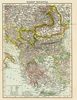
Background imageGreece Collection: Map of the peninsula of the Balkans, (Bosnia, Serbia, Moldova, Hungary, Montenegro, Bulgaria)

Map of the peninsula of the Balkans, (Bosnia, Serbia, Moldova, Hungary, Montenegro, Bulgaria, Romania)
NWI4871491 Map of the peninsula of the Balkans, (Bosnia, Serbia, Moldova, Hungary, Montenegro, Bulgaria, Romania, Greece and Turkey), circa 1870

Background imageGreece Collection: Portulan of the Mediterranean Sea and its coasts (Africa, Barbary, Europe, Middle East)

Portulan of the Mediterranean Sea and its coasts (Africa, Barbary, Europe, Middle East)
JEB4874759 Portulan of the Mediterranean Sea and its coasts (Africa, Barbary, Europe, Middle East). Nautical chart by Joan Oliva on parchment, 1593 preserved at the Municipal Library of Marseille

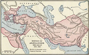
Background imageGreece Collection: Civilization of Antiquity: Map of the Empire of Alexander The Great, 323 BC

Civilization of Antiquity: Map of the Empire of Alexander The Great, 323 BC. Colour engraving of the 19th century
NWI4910220 Civilization of Antiquity: Map of the Empire of Alexander The Great, 323 BC. Colour engraving of the 19th century.; (add.info.: Civilization of Antiquity)

Background imageGreece Collection: Map of Greece from the invasion of the Dorians to the Medic War

Map of Greece from the invasion of the Dorians to the Medic War and of Italy after the founding of Rome
ELD4924944 Map of Greece from the invasion of the Dorians to the Medic War and of Italy after the founding of Rome, 1190-504 BC (Map of Greece and Italy)

Background imageGreece Collection: Map of Greece (at the time of Philip and Alexander the Great)

Map of Greece (at the time of Philip and Alexander the Great) and Italy during the wars against the Samnites
ELD4924869 Map of Greece (at the time of Philip and Alexander the Great) and Italy during the wars against the Samnites, 400-300 BC (Map of Greece and Italy)

Background imageGreece Collection: Map of the Greek Empire after the submission of Bulgaria and Italy under the reign of

Map of the Greek Empire after the submission of Bulgaria and Italy under the reign of the Franconian (Salian)
ELD4924843 Map of the Greek Empire after the submission of Bulgaria and Italy under the reign of the Franconian (Salian) emperors at the time of the Conquete of the Normans

Background imageGreece Collection: Map of the Byzantine Empire at the times of Justinian I and Ostrogothic Kingdom founded by

Map of the Byzantine Empire at the times of Justinian I and Ostrogothic Kingdom founded by Theoderic the Great
ELD4928064 Map of the Byzantine Empire at the times of Justinian I and Ostrogothic Kingdom founded by Theoderic the Great) Engraving from Houze's "Atlas Universale"

Background imageGreece Collection: Empire of Antiquity: Geographic map of ancient Greece and ancient colonies with the territories of

Empire of Antiquity: Geographic map of ancient Greece and ancient colonies with the territories of Asia Minor, Turkey
NWI4861853 Empire of Antiquity: Geographic map of ancient Greece and ancient colonies with the territories of Asia Minor, Turkey, Rhodes, Thrace, Peloponese and the Aegean Sea

Background imageGreece Collection: Archipelago Lemnos - Port Mudros (Port San Antonio) - from the latest information in

Archipelago Lemnos - Port Mudros (Port San Antonio) - from the latest information in the Hydrographic Department, 1893
7342741 Archipelago Lemnos - Port Mudros (Port San Antonio) - from the latest information in the Hydrographic Department, 1893, 1894-1918 (paper, ink) by British School

Background imageGreece Collection: Greek Archipelago, c.1620 (vellum)

Greek Archipelago, c.1620 (vellum)
7339784 Greek Archipelago, c.1620 (vellum) by Unknown Artist, (17th century); 41x60 cm; National Maritime Museum, London, UK; (add.info.: Creator)

Background imageGreece Collection: los map, c.1480 (vellum)

los map, c.1480 (vellum)
7339634 los map, c.1480 (vellum) by Sonetti, Bartolomeo da li (fl.1485); 60x42.3 cm; National Maritime Museum, London, UK; (add.info.: Creator: Bartolommeo dalli Sonetti Bound sheet. Col. ms)

Background imageGreece Collection: Chart of Antikithira, Ionian Sea, 1420 (vellum)

Chart of Antikithira, Ionian Sea, 1420 (vellum)
7339624 Chart of Antikithira, Ionian Sea, 1420 (vellum) by Buondelmonti, Cristoforo (1385-1430); 25x18 cm; National Maritime Museum, London


All Professionally Made to Order for Quick Shipping


-

Greece Collection

Greece is a country located in southeastern Europe, with a population of approximately 10.7 million people. The country has an area of 131,957 square kilometers and is divided into thirteen administrative regions. Greece's capital city is Athens, which is also the largest city in the country. The geography includes numerous islands scattered throughout the Aegean and Ionian Seas, as well as mountainous terrain on the mainland. The highest point is Mount Olympus at 2,917 meters. A rich history dating back to ancient times when it was home to some of the world's most famous philosophers and mathematicians such as Socrates, Plato, and Aristotle. Today, Greece remains an important cultural center with many historical landmarks including the Acropolis in Athens and Delphi archaeological site. Overall, maps and charts can provide valuable insights into various aspects of Greek society such as demographics or economic activity while also showcasing its unique geography and cultural heritage.
+

Our beautiful Wall Art and Photo Gifts include Framed Prints, Photo Prints, Poster Prints, Canvas Prints, Jigsaw Puzzles, Metal Prints and so much more

The Greece collection from Media Storehouse is a stunning assortment of wall art and framed prints that showcases the beauty, history, and culture of Greece. Our collection features an array of maps and charts that depict various regions, cities, islands, landmarks, and historical events in Greece. The maps are intricately detailed with accurate geographical information such as topography, rivers, mountains, coastlines etc., while the charts provide valuable insights into ancient Greek mythology, philosophy or architecture. These artworks are printed on high-quality paper using advanced printing technology to ensure vibrant colors and sharp details. They come in different sizes to suit any space or decor style. Whether you're a history buff or simply love the Mediterranean charm of Greece's landscapes and seascapes - our collection has something for everyone. Overall our collection offers a unique opportunity to bring some Greek heritage into your home or office space through beautiful artwork that captures its rich cultural legacy.
+

What are Greece (Maps and Charts) art prints?

Greece art prints are a collection of high-quality, visually stunning reproductions of maps and charts depicting the geography, history, culture, and landmarks of Greece. These art prints showcase the intricate details of ancient Greek architecture, mythology, and landscapes in vivid colors that capture the essence of this beautiful country. These prints are perfect for anyone who loves Greece or wants to learn more about its rich heritage. They make great gifts for travelers or those interested in history or geography. The collection includes a variety of styles from vintage to modern designs that will suit any decor style. Whether you're looking for a map to hang on your wall or an artistic representation of Greece's famous landmarks like the Acropolis or Santorini's blue-domed churches overlooking the Aegean Sea - these art prints are sure to impress with their attention to detail and quality craftsmanship.
+

What Greece (Maps and Charts) art prints can I buy from Media Storehouse?

We offer a wide variety of Greece art prints in the form of maps and charts. These prints showcase the beauty and history of Greece, including its stunning landscapes, ancient ruins, and iconic landmarks. Some popular options include detailed maps of Athens or Crete, vintage travel posters featuring Greek islands like Santorini or Mykonos, and historical charts depicting the mythology and gods of Ancient Greece. In addition to these traditional map and chart styles, Media Storehouse also offers modern interpretations that incorporate bold colors and abstract designs. Whether you're looking for a classic depiction of Greece's rich cultural heritage or a contemporary take on its natural wonders, there is sure to be an art print that suits your taste. All prints are available in various sizes to fit any space in your home or office. They are printed using high-quality materials to ensure vibrant colors and crisp details that will last for years to come.
+

How do I buy Greece (Maps and Charts) art prints?

To buy Greece art prints from Media Storehouse, you can browse our extensive collection of high-quality prints online. Simply search for the specific artwork or artist you are interested in, or explore their curated collections to discover new pieces. Once you have found a print that catches your eye, select the size and framing options that best suit your needs. You can choose from a range of materials and finishes to create a custom look that complements your decor. When you are ready to purchase, simply add the item to your cart and proceed through the checkout process. We accept various payment methods for easy and secure transactions. Whether you are looking for a unique piece of wall art for your home or office, or searching for a special gift for someone who loves Greece , we have something to suit every taste and budget.
+

How much do Greece (Maps and Charts) art prints cost?

We offer a wide range of Greece art prints at varying prices. Our collection includes high-quality prints featuring maps and charts of Greece that are perfect for adding a touch of sophistication to any room in your home or office. The cost of our Greece art prints depends on the size, framing options, and other customizations you choose. We take pride in offering affordable yet premium quality artwork that is sure to impress anyone who sees it. Whether you're looking for a small print to hang on your wall or a large canvas to make a statement piece, we have something for everyone's budget. Our team works hard to ensure that each order is processed quickly and efficiently so you can enjoy your new artwork as soon as possible. So if you're looking for beautiful Greece art prints at reasonable prices, look no further than Media Storehouse.
+

How will my Greece (Maps and Charts) art prints be delivered to me?

We take great care in ensuring that your Greece art prints are delivered to you safely and securely. We use high-quality packaging materials to protect your artwork during transit, so it arrives in pristine condition. Your prints will be carefully rolled and placed into a sturdy cardboard tube for delivery. This ensures that they remain flat and free from creases or damage during transportation. The tube is then sealed with tape to prevent any moisture or dust from entering. Once your order has been dispatched, you will receive an email confirmation with tracking information so you can monitor the progress of your delivery. Our shipping partners are reliable and efficient, ensuring that your package arrives on time. We pride ourselves on providing excellent customer service, so if there are any issues with the delivery of your Greece art prints, please do not hesitate to contact us.