Home > Asia > Turkey > Related Images
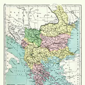
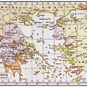
Map of the peninsula of the Balkans, (Bosnia, Serbia, Moldova, Hungary, Montenegro, Bulgaria, Romania, Greece and Turkey), circa 1870. 19th century lithography
, circa 1870. 19th century lithography")
![]()
Wall Art and Photo Gifts from Fine Art Finder
Map of the peninsula of the Balkans, (Bosnia, Serbia, Moldova, Hungary, Montenegro, Bulgaria, Romania, Greece and Turkey), circa 1870. 19th century lithography
NWI4871491 Map of the peninsula of the Balkans, (Bosnia, Serbia, Moldova, Hungary, Montenegro, Bulgaria, Romania, Greece and Turkey), circa 1870. 19th century lithography.; (add.info.: Map of the peninsula of the Balkans, (Bosnia, Serbia, Moldova, Hungary, Montenegro, Bulgaria, Romania, Greece and Turkey), circa 1870. 19th century lithography.); Photo © North Wind Pictures
Media ID 38426890
© © North Wind Pictures / Bridgeman Images
Balkans Bosnia Bosnia And Herzegovina Bosnia Herzegovina Bosnia Herzogovina Bosnian Bulgaria Bulgaria Bulgaria Bulgaria Bulgarian Bulgarian Bulgarians Herzegovina Hugarians Hungarian Hungarian Hungarian Hungarian Hungary Hungary Hungarian Magyar Montenegrin Montenegro Ottoman Empire Romania Romanian Romanians Serbia Serbian Serbs Turkish Culture Central Turkey Geographical Map Grece Greece Greek Turk
FEATURES IN THESE COLLECTIONS
> Asia
> Turkey
> Related Images
> Europe
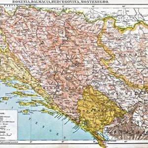
> Bosnia and Herzegovina
> Maps
> Europe
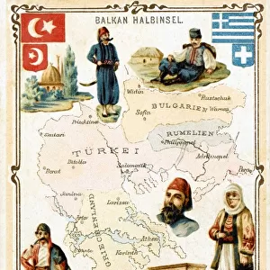
> Bulgaria
> Related Images
> Europe
> Greece
> Related Images
> Fine Art Finder
> Artists
> Unknown Artist
EDITORS COMMENTS
This stunning lithograph print from the 19th century showcases a detailed map of the Balkan Peninsula, including countries such as Bosnia, Serbia, Moldova, Hungary, Montenegro, Bulgaria, Romania, Greece and Turkey. The intricate details and vibrant colors bring this historical map to life, providing a glimpse into the geopolitical landscape of the region during that time period.
The borders and names of each country are clearly defined on the map, offering a visual representation of how these nations were situated in relation to one another in 1870. From the mountainous terrain of Montenegro to the coastal regions of Greece and Turkey, this map captures the diversity and complexity of the Balkans.
As you study this lithograph closely, you can appreciate the artistry and craftsmanship that went into creating such a precise depiction of these countries. Each line and symbol tells a story about the history and culture of this region, making it not just a geographical representation but also a piece of historical artwork.
Whether you have personal ties to any of these countries or simply have an interest in European history, this vintage map is sure to captivate your imagination and provide hours of exploration into the past.
MADE IN THE USA
Safe Shipping with 30 Day Money Back Guarantee
FREE PERSONALISATION*
We are proud to offer a range of customisation features including Personalised Captions, Color Filters and Picture Zoom Tools
SECURE PAYMENTS
We happily accept a wide range of payment options so you can pay for the things you need in the way that is most convenient for you
* Options may vary by product and licensing agreement. Zoomed Pictures can be adjusted in the Cart.