Home > North America > Dominican Republic > Dominican Republic Heritage Sites > Colonial City of Santo Domingo
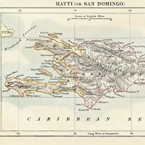
1800 Stockdale Map Of Hispaniola Or Santo Domingo

![]()
Wall Art and Photo Gifts from Universal Images Group (UIG)
1800 Stockdale Map Of Hispaniola Or Santo Domingo
1800, Stockdale Map of Hispaniola or Santo Domingo, West Indies, Haiti, Dominican Republic
Universal Images Group (UIG) manages distribution for many leading specialist agencies worldwide
Media ID 38548307
© Artokoloro Quint Lox Limited
1800 Dominican Republic Haiti West Indies Antique Map Latitude Longitude Mappa Mundi Old Antique Plan Old Antique View Ols Antique Map Rare Old Maps Topo
FEATURES IN THESE COLLECTIONS
> Europe
> France
> Canton
> Landes
> Historic
> Space exploration
> Maps and Charts
> Early Maps
> Maps and Charts
> Related Images
> Maps and Charts
> World
> North America
> Dominican Republic
> Dominican Republic Heritage Sites
> Colonial City of Santo Domingo
> North America
> Dominican Republic
> Maps
> North America
> Dominican Republic
> Related Images
> North America
> Dominican Republic
> Santo Domingo
> North America
> Haiti
> Maps
> Universal Images Group (UIG)
> History
> Historical Maps
EDITORS COMMENTS
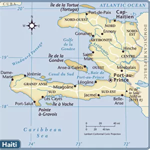
Step back in time to the early 19th century with this stunning print of the 1800 Stockdale Map of Hispaniola or Santo Domingo. This vintage map provides a fascinating glimpse into the geography and topography of the island, which is shared by Haiti and the Dominican Republic.
The intricate illustration depicts the mountainous terrain, rivers, and coastal regions of Hispaniola, showcasing its unique landscape. The map also highlights major cities, towns, and settlements, offering insight into the island's human geography.
This beautiful piece of cartography is not only a work of art but also a valuable historical resource for anyone interested in exploring the region's rich cultural heritage. The aged paper has developed a lovely patina over time, giving it an authentic charm that adds to its nostalgic appeal.
Whether you're an history buff, a geography enthusiast, or simply someone who appreciates vintage maps, this print is sure to captivate your imagination. It would make a wonderful addition to any room's decor or office space.
MADE IN THE USA
Safe Shipping with 30 Day Money Back Guarantee
FREE PERSONALISATION*
We are proud to offer a range of customisation features including Personalised Captions, Color Filters and Picture Zoom Tools
SECURE PAYMENTS
We happily accept a wide range of payment options so you can pay for the things you need in the way that is most convenient for you
* Options may vary by product and licensing agreement. Zoomed Pictures can be adjusted in the Cart.