Fraud Blocker Skip to main content

Home > North America > Honduras > Related Images

Related Images Collection (#2)

574 Items

Background imageRelated Images Collection: Keel-billed toucan (rainbow-billed toucan) (Ramphastos Sulfuratus), Macaw Mountain Bird Park

Keel-billed toucan (rainbow-billed toucan) (Ramphastos Sulfuratus), Macaw Mountain Bird Park, near Copan, Honduras, Central America

Background imageRelated Images Collection: Rangers Football Club: A Moment of Silence for Arnold Peralta at Ibrox Stadium - In Honor of

Rangers Football Club: A Moment of Silence for Arnold Peralta at Ibrox Stadium - In Honor of the 2003 Scottish Cup
Rangers players during the minutes silence for former player Arnold Peralta who was killed yesterday in Honduras

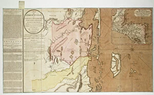
Background imageRelated Images Collection: A map of a part of Yucatan or of that part of the eastern shore within the Bay of Honduras alloted

A map of a part of Yucatan or of that part of the eastern shore within the Bay of Honduras alloted [sic] to Great
7340447 A map of a part of Yucatan or of that part of the eastern shore within the Bay of Honduras alloted [sic] to Great Britain for the cutting of logwood

Background imageRelated Images Collection: Lieutenant-General Sir George Arthur, 1st Baronet, 1784-1854

Lieutenant-General Sir George Arthur, 1st Baronet, 1784-1854
5614422 Lieutenant-General Sir George Arthur, 1st Baronet, 1784-1854; (add.info.: Lieutenant-General Sir George Arthur, 1st Baronet, 1784-1854)

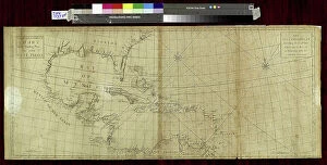
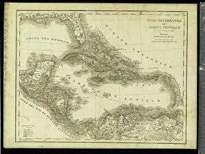
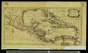
Background imageRelated Images Collection: Geography: map showing the Gulf of Mexico, the Caribbean Islands, Central America (Honduras)

Geography: map showing the Gulf of Mexico, the Caribbean Islands, Central America (Honduras, Costarica)
VEN5031255 Geography: map showing the Gulf of Mexico, the Caribbean Islands, Central America (Honduras, Costarica), northern South America (Venezuela) and southern United States

Background imageRelated Images Collection: Universal Geography: Honduras and Salvador. Advertising images edited for the brand Louit

Universal Geography: Honduras and Salvador. Advertising images edited for the brand Louit. Debut 20th century
DUV4218167 Universal Geography: Honduras and Salvador. Advertising images edited for the brand Louit. Debut 20th century. (lithograph); 9.5x6.5 cm; Photo © Duvallon

Background imageRelated Images Collection: Geography map: representation of southern Guatemala, Hondura

Geography map: representation of southern Guatemala, Hondura and northern Nicaragua in Central America from an Atlas
VEN5030457 Geography map: representation of southern Guatemala, Hondura and northern Nicaragua in Central America from an Atlas made by the Italian cartographer Antonio Francesco Lucini (born in 1605)

Background imageRelated Images Collection: Geography: map showing Central America (Mexico, Honduras, Yucatan)

Geography: map showing Central America (Mexico, Honduras, Yucatan) and the Caribbean Sea Islands (Antilles)
VEN5031211 Geography: map showing Central America (Mexico, Honduras, Yucatan) and the Caribbean Sea Islands (Antilles). Plate from a British Atlas of 1737

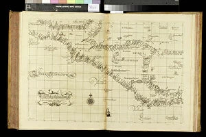
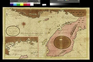
Background imageRelated Images Collection: A description of the Gulf of Ampall, 1685 (bound sheet)

A description of the Gulf of Ampall, 1685 (bound sheet)
7339689 A description of the Gulf of Ampall, 1685 (bound sheet) by Hack, William (17th Century); 40x50 cm; National Maritime Museum, London, UK; (add.info.: Creator: William Hack North America)

Background imageRelated Images Collection: Geography: map showing the Gulf of Mexico, the Caribbean Islands, Central America (Mexico)

Geography: map showing the Gulf of Mexico, the Caribbean Islands, Central America (Mexico, Yucatan, Salvador, Honduras)
VEN5031242 Geography: map showing the Gulf of Mexico, the Caribbean Islands, Central America (Mexico, Yucatan, Salvador, Honduras, Nicaragua, Costarica) and northern South America (Venezuela)

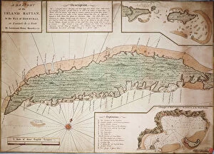
Background imageRelated Images Collection: Draught of the Island Rattan in the bay of Honduras in latitude 16 degrees 22 north by Lieutenant

Draught of the Island Rattan in the bay of Honduras in latitude 16 degrees 22 north by Lieutenant Henry Barnsley 1742
7339799 Draught of the Island Rattan in the bay of Honduras in latitude 16 degrees 22 north by Lieutenant Henry Barnsley 1742, 1742 (hand coloured engraving single sheet) by Barnsley

Background imageRelated Images Collection: Ceramic cylindrical polychrome vessel

Ceramic cylindrical polychrome vessel
5305163 Ceramic cylindrical polychrome vessel.; (add.info.: Ceramic cylindrical polychrome vessel from Honduras. Dated 8th Century BC.); Universal History Archive/UIG

Background imageRelated Images Collection: COLUMBUS, ChrIstopher (1451-1506). Sailor at the Catholic Monarchs service

COLUMBUS, ChrIstopher (1451-1506). Sailor at the Catholic Monarchs service, discoverer of America in 1492
AIS5392710 COLUMBUS, ChrIstopher (1451-1506). Sailor at the Catholic Monarchs service, discoverer of America in 1492. Natural coast of Honduras. Illustration of 1851. Engraving

Background imageRelated Images Collection: Ceramic cylindrical polychrome vessel

Ceramic cylindrical polychrome vessel
5305164 Ceramic cylindrical polychrome vessel.; (add.info.: Ceramic cylindrical polychrome vessel from Honduras. Dated 8th Century BC.); Universal History Archive/UIG

Background imageRelated Images Collection: Ladinos Indians - People of Central America (Guatemala, Honduras, Mexico) 1895

Ladinos Indians - People of Central America (Guatemala, Honduras, Mexico) 1895
JAB4120187 Ladinos Indians - People of Central America (Guatemala, Honduras, Mexico) 1895; (add.info.: Ladinos Indians - People of Central America (Guatemala, Honduras)

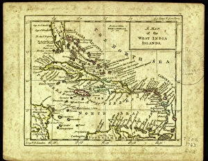
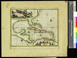
Background imageRelated Images Collection: Geography Atlas: representation of the Caribbean Sea region, the Caribbean (Cuba, Jamaica)

Geography Atlas: representation of the Caribbean Sea region, the Caribbean (Cuba, Jamaica, Hispaniola)
VEN5030063 Geography Atlas: representation of the Caribbean Sea region, the Caribbean (Cuba, Jamaica, Hispaniola, Jamaica) of the small Antilles of Honduras

Background imageRelated Images Collection: Geography: map showing Central America (Mexico, Yucatan, Honduras, Nicaragua, Costa Rica)

Geography: map showing Central America (Mexico, Yucatan, Honduras, Nicaragua, Costa Rica)
VEN5031262 Geography: map showing Central America (Mexico, Yucatan, Honduras, Nicaragua, Costa Rica), the Gulf of Mexico and the Caribbean Sea islands (Antilles)

Background imageRelated Images Collection: Geography: map showing the Gulf of Mexico, the Caribbean Islands, Central America (Mexico)

Geography: map showing the Gulf of Mexico, the Caribbean Islands, Central America (Mexico, Yucatan, Salvador, Honduras)
VEN5031245 Geography: map showing the Gulf of Mexico, the Caribbean Islands, Central America (Mexico, Yucatan, Salvador, Honduras, Nicaragua, Costarica)

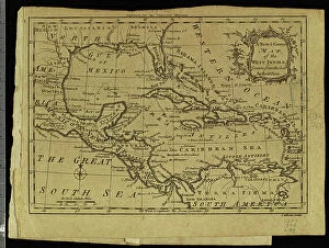
Background imageRelated Images Collection: Geography: map showing Central America (Mexico, Honduras, Yucatan)

Geography: map showing Central America (Mexico, Honduras, Yucatan) and the Caribbean Sea Islands (Antilles)
VEN5031197 Geography: map showing Central America (Mexico, Honduras, Yucatan) and the Caribbean Sea Islands (Antilles). Plate taken from an Atlas by Thomas Kitchin (1718-1784)

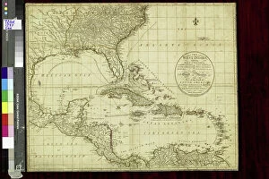
Background imageRelated Images Collection: Geography map: representation of Central America with Mexico, Yucatan, Honduras, Nicaragua

Geography map: representation of Central America with Mexico, Yucatan, Honduras, Nicaragua, Costa Rica
VEN5031137 Geography map: representation of Central America with Mexico, Yucatan, Honduras, Nicaragua, Costa Rica, Florida and North South America. The West Indies are also represented

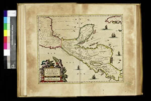
Background imageRelated Images Collection: Geography map: representation of Central America with Honduras, Guatemala

Geography map: representation of Central America with Honduras, Guatemala
VEN5030327 Geography map: representation of Central America with Honduras, Guatemala and the Yucatan Peninsula from an Atlas by Willem Janszoon Blaeu (1571-1638), approximately 1630

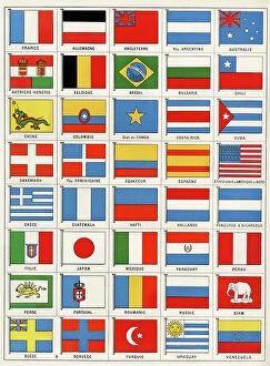
Background imageRelated Images Collection: Flags of forty countries, circa 1890. Colour lithography, 19th century

Flags of forty countries, circa 1890. Colour lithography, 19th century
NWI4851551 Flags of forty countries, circa 1890. Colour lithography, 19th century.; (add.info.: Flags of forty countries, circa 1890)

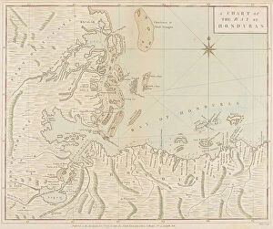
Background imageRelated Images Collection: A chart of the Bay of Honduras, 1773 (print)

A chart of the Bay of Honduras, 1773 (print)
7340634 A chart of the Bay of Honduras, 1773 (print) by Speer, Joseph Smith (fl.1773); 47x74x1 cm; National Maritime Museum, London, UK; (add.info.: Creator: Captain Joseph Smith Speer A chart)

Background imageRelated Images Collection: Architectural plans for the Comayagua Hospital

Architectural plans for the Comayagua Hospital
5304777 Architectural plans for the Comayagua Hospital.; (add.info.: Architectural plans for the Comayagua Hospital in Honduras. Dated 18th Century. 1783); Universal History Archive/UIG

Background imageRelated Images Collection: Geography map: representation of the Yucatan ratings in southern Mexico and the Honduras coasts

Geography map: representation of the Yucatan ratings in southern Mexico and the Honduras coasts
VEN5030127 Geography map: representation of the Yucatan ratings in southern Mexico and the Honduras coasts, made by Dutch cartographer Gerard van Keulen (1678-1726) 1709-1713

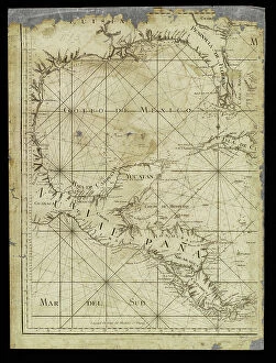
Background imageRelated Images Collection: Geography: map for navigators representing the Gulf of Mexico, Mexico, Yucatan, Honduras

Geography: map for navigators representing the Gulf of Mexico, Mexico, Yucatan, Honduras
VEN5031234 Geography: map for navigators representing the Gulf of Mexico, Mexico, Yucatan, Honduras, Nicaragua and Costarica from an Atlas of 1755, Bibliotheque Jose Marti, Havana

Background imageRelated Images Collection: Geography: map showing the Gulf of Mexico, the Caribbean Islands, Central America (Mexico)

Geography: map showing the Gulf of Mexico, the Caribbean Islands, Central America (Mexico, Yucatan, Honduras)
VEN5031226 Geography: map showing the Gulf of Mexico, the Caribbean Islands, Central America (Mexico, Yucatan, Honduras, Nicaragua and Costa Rica) part of the United States

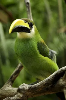
Background imageRelated Images Collection: Emerald toucanet (Aulacorhynchus prasinus) Rio Platano Biosphere Reserve and UNESCO

Emerald toucanet (Aulacorhynchus prasinus) Rio Platano Biosphere Reserve and UNESCO World Heritage Site, La Mosquitia, Honduras

Background imageRelated Images Collection: Bottlenose dolphins (Tursiops truncatus) swimming over a sandy bottom, Roatan Island

Bottlenose dolphins (Tursiops truncatus) swimming over a sandy bottom, Roatan Island, Bay Islands, Honduras Carribean. Captive dolphins used in spectacle; they go out the fence for some minutes a day

Background imageRelated Images Collection: Honduras with mask

Honduras with mask
Color satellite image of Honduras, with mask

Background imageRelated Images Collection: Honduras with borders

Honduras with borders
Color satellite image of Honduras and neighbouring countries, with borders

Background imageRelated Images Collection: Honduras with borders and mask

Honduras with borders and mask
Color satellite image of Honduras, with borders and mask

Background imageRelated Images Collection: Honduras

Honduras
Color satellite image of Honduras and neighbouring countries

Background imageRelated Images Collection: Honduras, Bay Islands, Roatan, West Bay, Jetty

Honduras, Bay Islands, Roatan, West Bay, Jetty

Background imageRelated Images Collection: Honduras, Copan Ruinas, Copan Ruins, West Court, Stela P

Honduras, Copan Ruinas, Copan Ruins, West Court, Stela P

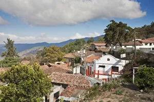
Background imageRelated Images Collection: Honduras, near Tegucigalpa, Santa Lucia, an old Spanish mining town

Honduras, near Tegucigalpa, Santa Lucia, an old Spanish mining town

Background imageRelated Images Collection: Honduras, Copan Ruinas, Copan Ruins, Cabeza, Old Mans head

Honduras, Copan Ruinas, Copan Ruins, Cabeza, Old Mans head

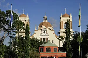
Background imageRelated Images Collection: Catedral San Pedro Sula at Parque Central, San Pedro Sula, Honduras, Central America

Catedral San Pedro Sula at Parque Central, San Pedro Sula, Honduras, Central America

Background imageRelated Images Collection: Honduras Turkeys, in the Gardens of the Zoological Society, Regent's Park, 1858. Creator: Unknown

Honduras Turkeys, in the Gardens of the Zoological Society, Regent's Park, 1858. Creator: Unknown
Honduras Turkeys, in the Gardens of the Zoological Society, Regent's Park, 1858. Two specimens, male and female, of that magnificent bird

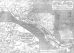
Background imageRelated Images Collection: Map of Central America shewing the Proposed Routes of Communication between the Atlantic & Pacific

Map of Central America shewing the Proposed Routes of Communication between the Atlantic & Pacific O Creator
Map of Central America shewing the Proposed Routes of Communication between the Atlantic & Pacific Oceans, 1856....and the Disputed Territories of British Honduras (Belize)

Background imageRelated Images Collection: The Burning of Greytown, 1854. Creator: Unknown

The Burning of Greytown, 1854. Creator: Unknown
The Burning of Greytown, 1854. Post-office and Mosquito flag-staff; Hanseatic Consulate; Lyons Hotel; American Consulate; British Consulate; house containing the powder'

Background imageRelated Images Collection: Tigre Island - the United States Garrison, 1850. Creator: Unknown

Tigre Island - the United States Garrison, 1850. Creator: Unknown
Tigre Island - the United States Garrison, 1850. Sketch by "a Traveller in Central America"...by no means a caricature picture of the United States garrison upon the Island

Background imageRelated Images Collection: Tigre Island, 1850. Creator: Unknown

Tigre Island, 1850. Creator: Unknown
Tigre Island, [now in Honduras], 1850. From "Illustrated London News", 1850. Sketch by "a Traveller in Central America"...of...the interior of the island

Background imageRelated Images Collection: The Northernmost Chincha (Guano) Island, 1850. Creator: Unknown

The Northernmost Chincha (Guano) Island, 1850. Creator: Unknown
The Northernmost Chincha (Guano) Island, [Peru], 1850. Sketch by "a Traveller in Central America". In 1840 attention was first drawn to guano for the purposes of agriculture in Europe

Background imageRelated Images Collection: Monument at Copan, 1849. Creator: Unknown

Monument at Copan, 1849. Creator: Unknown
Monument at Copan, 1849. Mayan sculpture at Copan in Honduras. From "Pictorial History of Mexico and the Mexican War", by John Frost, LL.D.. [Thomas, Cowperthwait and Co. Philadelphia, 1849]

Background imageRelated Images Collection: H.M.S. 'Sappho', on the Main Reef at Honduras, 1850. Creator: Unknown. H.M.S

H.M.S. "Sappho", on the Main Reef at Honduras, 1850. Creator: Unknown. H.M.S
H.M.S. "Sappho", on the Main Reef at Honduras, 1850. Small low islands are seen in the distance, and in the foreground are low rocks

Background imageRelated Images Collection: Large Log of Honduras Mahogany, sold at Birkenhead, 1850. Creator: Unknown

Large Log of Honduras Mahogany, sold at Birkenhead, 1850. Creator: Unknown
Large Log of Honduras Mahogany, sold at Birkenhead, 1850. Sale by Messrs. Holmes, Slater, and Crook, brokers. There was a company of about 160 at the sale, which commenced with American woods

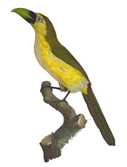
Background imageRelated Images Collection: South and Central America: Emerald Toucanet. Painting from Natural History of Birds of Paradise

South and Central America: Emerald Toucanet. Painting from Natural History of Birds of Paradise and Rollers, Toucans and Barbus by Jacques Barraband (1767-1809), 1806


All Professionally Made to Order for Quick Shipping


-

Why Choose Us?

We are a leading provider of Art Prints and Photo Gifts since 2003, working in partnership with a range of Sporting Clubs, Charities, Museums and Picture Libraries. A large share of profits from any of their images will go directly towards supporting that charity or club. Our archive of images is carefully curated to bring you a wide range of subjects, including landscapes, wildlife, architecture, and more. We ship from our partner labs in the UK, USA, EU (Netherlands) and Australia.
+

How do I place an order?

Ordering is quick & easy - Just follow 5 Simple Steps:
  1. Find your image: Use our search box or browse our online photo Collections to find the image you want.

  2. Choose your print format: Select your desired product and add it to your cart.

  3. Enter your details: If you're a returning customer, simply enter your email address and password, and we'll fill in your billing and shipping address details. All personal details are held securely and are fully GDPR compliant. As standard, we remove all Personally Identifiable Information after 12 months.

  4. Pay for your purchase: We use state-of-the-art security for online shopping and do not have access to your card details.

  5. Sit back and relax: We'll email you confirmation of your order and when it's dispatched. Registered customers can also track orders in the 'My Account' area.

+

How do I pay for an order?

You can pay for your order with most of the major credit and debit cards, or PayPal. For added security, major financial institutions process payment details separately and securely on our behalf. We do not have access to your online payment card details. Online payments are preferred however we do take phone orders. For UK customers only we accept cheques issued against a UK bank.
+

Is my data safe?

We take data security very seriously. We do not have access to your full card details and all payments are requested over a fully secure connection. Additionally, we fully comply with current European and GDPR legislation, and automatically remove all personal data after at most 12 months (unless you have an account with us and have signed in recently). We also have a strict opt-in policy and would never sell your personal details. Your data is only used to fulfill your order promptly and efficiently.
+

Is wall art ready to hang?

For quick and easy installation all wall art, including framed prints, canvas prints and metal prints are supplied with a ready to hang solution on the back. Generally, saw tooth hangers are applied as they allow wall art to hang flush against the wall. The serrated edge of the hanger prevents the frame from shifting or tilting when hung.
+

Are the photo prints fade resistant?

Yes, we use archival quality photo paper photographic paper for vivid reproduction Prints are an accurate representations of the original artwork, which is preserved for artistic character and authenticity. We guarantee they match previews shown on our web site