Fraud Blocker Skip to main content

Photographic Print > Maps and Charts > Poland

Poland Photographic Print Collection (#5)

Discover the rich history and culture of Poland through our stunning collection of photographic prints. Featuring breathtaking landscapes, iconic landmarks, and vibrant cityscapes, these high-quality prints showcase the beauty and diversity of Poland. Each print is meticulously crafted from carefully curated images, ensuring a beautiful addition to any home or office space. Transport yourself to the heart of Poland with these captivating and authentic representations.

Poland is a country located in Central Europe, bordered by Germany to the west, the Czech Republic and Slovakia to the south, Ukraine and Belarus to the east

249 Photographic Prints

Background imagePoland Photographic Print Collection: Poznan

Poznan
Ancient map of Poznan from 1898

Background imagePoland Photographic Print Collection: Parke of the Artillary (Aubry de La Mottrayes 'Travels throughout Europe

Parke of the Artillary (Aubry de La Mottrayes "Travels throughout Europe
Parke of the Artillary (Aubry de La Mottrayes " Travels throughout Europe, Asia and into Part of Africa... " London, 1724, vol. II, pl. 26B), 1723-24

Background imagePoland Photographic Print Collection: Westminster W1F 8 Map

Westminster W1F 8 Map
Postcode Sector Map of Westminster W1F 8

Background imagePoland Photographic Print Collection: Manchester M4 6 Map

Manchester M4 6 Map
Postcode Sector Map of Manchester M4 6

Background imagePoland Photographic Print Collection: Tameside M34 5 Map

Tameside M34 5 Map
Postcode Sector Map of Tameside M34 5

Background imagePoland Photographic Print Collection: Stratford-on-Avon CV37 8 Map

Stratford-on-Avon CV37 8 Map
Postcode Sector Map of Stratford-on-Avon CV37 8

Background imagePoland Photographic Print Collection: Hyndburn BB5 1 Map

Hyndburn BB5 1 Map
Postcode Sector Map of Hyndburn BB5 1

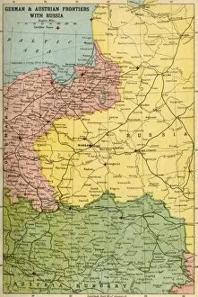
Background imagePoland Photographic Print Collection: German & Austrian Frontiers with Russia, First World War, (c1920). Creator: Unknown

German & Austrian Frontiers with Russia, First World War, (c1920). Creator: Unknown
German & Austrian Frontiers with Russia, First World War, (c1920). Map of eastern Europe and the Baltic coast. From "The Great World War: A History", Volume VII, edited by Frank A Mumby

Background imagePoland Photographic Print Collection: Map showing German & Austrian Armies facing Russian Armies before the Campaign of 1916, (c1920)

Map showing German & Austrian Armies facing Russian Armies before the Campaign of 1916, (c1920). Creator: Unknown
Map showing German & Austrian Armies facing Russian Armies before the Campaign of 1916, (c1920). Positions of the adversarial armies in eastern Europe during the First World War

Background imagePoland Photographic Print Collection: Map of Poland Showing Position of Conflicting Nations on July 24th, 1915, 1916. Creator: Unknown

Map of Poland Showing Position of Conflicting Nations on July 24th, 1915, 1916. Creator: Unknown
Map of Poland Showing Position of Conflicting Nations on July 24th, 1915, 1916. Because of its geographical position between fighting powers

Background imagePoland Photographic Print Collection: Map of Poland Showing Russian Territory Occupied by Germany in August, 1915, 1916

Map of Poland Showing Russian Territory Occupied by Germany in August, 1915, 1916. By the end of 1915, the Germans had occupied the entire Russian sector, including Warsaw

Background imagePoland Photographic Print Collection: Sketch Map to Illustrate the German Attack north of Warsaw in February, 1915, (c1920)

Sketch Map to Illustrate the German Attack north of Warsaw in February, 1915, (c1920). Map showing German positions near the Russo-German frontier during the First World War

Background imagePoland Photographic Print Collection: The Polish Campaign, 1914, (c1920). Creator: Unknown

The Polish Campaign, 1914, (c1920). Creator: Unknown
The Polish Campaign, 1914, (c1920)....map illustrating the struggle for Warsaw, October-December (1914), showing German and Austro-Hungarian lines of advance during the First World War

Background imagePoland Photographic Print Collection: Land taken by Germany from Russia, First World War, 1915, (c1920). Creator: Unknown

Land taken by Germany from Russia, First World War, 1915, (c1920). Creator: Unknown
Land taken by Germany from Russia, First World War, 1915, (c1920). The Germanic Slice out of Russian Territory to the end of the Summer Campaign of 1915...territory gained by the Germans

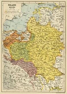
Background imagePoland Photographic Print Collection: Poland, 1815-1914, (c1920). Creator: John Bartholomew & Son

Poland, 1815-1914, (c1920). Creator: John Bartholomew & Son
Poland, 1815-1914, (c1920). Map showing Polish territory from the end of the 18th century until the First World War: Poland as constituted in 1815, and Poland before partition of 1772

Background imagePoland Photographic Print Collection: East-European Theatre of War, 1914-1918, (c1920). Creator: John Bartholomew & Son

East-European Theatre of War, 1914-1918, (c1920). Creator: John Bartholomew & Son
East-European Theatre of War, 1914-1918, (c1920). Map of Eastern Europe during the First World War, showing parts of Germany, Russia and Austria-Hungary

Background imagePoland Photographic Print Collection: Map of Russia and Poland, 1832. Creator: Arrowsmith, John (1790-1873)

Map of Russia and Poland, 1832. Creator: Arrowsmith, John (1790-1873)
Map of Russia and Poland, 1832. Private Collection

Background imagePoland Photographic Print Collection: Grodno (From: Civitates orbis terrarium), 1577. Artist: Braun, Georg (1541-1622)

Grodno (From: Civitates orbis terrarium), 1577. Artist: Braun, Georg (1541-1622)
Grodno (From: Civitates orbis terrarium), 1577. From a private collection

Background imagePoland Photographic Print Collection: Map of Central Europe, Showing the Principal Theatre of War, 1919

Map of Central Europe, Showing the Principal Theatre of War, 1919. Europe during the First World War, 1914-1919. From " The History of the Great European War: its causes and effects", Vol

Background imagePoland Photographic Print Collection: The Eastern Frontier, 1919. Creator: London Geographical Institute

The Eastern Frontier, 1919. Creator: London Geographical Institute
The Eastern Frontier, 1919. Map showing parts of Germany, Prussia, Russia and Austria during the First World War, 1914-1919, with fortified towns and main railway lines indicated

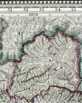
Background imagePoland Photographic Print Collection: The Carpathian Passes, 1919. Creator: Unknown

The Carpathian Passes, 1919. Creator: Unknown
The Carpathian Passes, 1919. Map showing mountain passes in the Carpathians, a mountain range which stretches from present-day Czech Republic, through Slovakia, Poland, Hungary, Ukraine

Background imagePoland Photographic Print Collection: Map of Silesia, former German Empire, today Poland, lithograph, 1897

Map of Silesia, former German Empire, today Poland, lithograph, 1897
Topographic map of Silesia, former territories of the German Empire, today Poland. Lithograph, published in 1897

Background imagePoland Photographic Print Collection: Province of Posen (German Empire, now Poland), lithograph, published 1897

Province of Posen (German Empire, now Poland), lithograph, published 1897
Historical map of the German province of Posen (Polish: Poznan) with the colored marking of the percentage of the Polish-speaking population at the end of the 19th century

Background imagePoland Photographic Print Collection: Map of the kingdom of Hungary, printed by Godfried (coloured engraving)

Map of the kingdom of Hungary, printed by Godfried (coloured engraving)
CZA229119 Map of the kingdom of Hungary, printed by Godfried (coloured engraving) by Lipszki, Jan (fl.1590-1610) (after); 69x46 cm; Czartoryski Museum, Cracow, Poland; Hungarian, out of copyright

Background imagePoland Photographic Print Collection: An imaginary map of Czartorysk (brush, pen & w / c on paper)

An imaginary map of Czartorysk (brush, pen & w / c on paper)
CZA228942 An imaginary map of Czartorysk (brush, pen & w/c on paper) by Kosciuszko, Tadeusz (1746-1817); 32.3x45.8 cm; Czartoryski Museum, Cracow, Poland; Polish, out of copyright

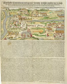
Background imagePoland Photographic Print Collection: View of the Siege of Polotsk by Stephen Bathory (1533-86) in 1579 (engraving)

View of the Siege of Polotsk by Stephen Bathory (1533-86) in 1579 (engraving)
CZA228782 View of the Siege of Polotsk by Stephen Bathory (1533-86) in 1579 (engraving) by Mack, Georg the elder (c.1556-1601); 44.8x35.2 cm; Czartoryski Museum, Cracow, Poland; German

Background imagePoland Photographic Print Collection: Map of the Russian Empire in Europe and Asia 1780

Map of the Russian Empire in Europe and Asia 1780
This is a map of the Russian Empire, a copperplate engraving from the Atlas de Toutes les Parties Connues du Globe Terrestre

Background imagePoland Photographic Print Collection: Battle of Heilsberg, 10th June 1807, (1896)

Battle of Heilsberg, 10th June 1807, (1896). The Battle of Heilsberg, Prussia, was fought between the French under Napoleon Bonaparte (1769-1821), and the Russians and Prussians

Background imagePoland Photographic Print Collection: Nicolaus Copernicus, Polish astronomer, (1660-1661). Artist: Andreas Cellarius

Nicolaus Copernicus, Polish astronomer, (1660-1661). Artist: Andreas Cellarius
Nicolaus Copernicus, Polish astronomer, (1660-1661). Detail from a map showing the Copernican system of planetary orbits (the Planisphaerium Copernicanum )

Background imagePoland Photographic Print Collection: Map of Warsaw

Map of Warsaw 1831

Background imagePoland Photographic Print Collection: Map of Europe at the Napoleonic Wars of Liberty (1813)

Map of Europe at the Napoleonic Wars of Liberty (1813)
Map of Central Europe at the beginning of the Napoleonic Wars of Liberty in 1813. Lithograph, published in 1897

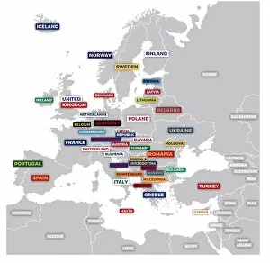
Background imagePoland Photographic Print Collection: Labeled European Map

Labeled European Map
Labeled European map concept showing countries with labels. EPS 10 file. Transparency effects used on highlight elements

Background imagePoland Photographic Print Collection: Anti-German cartoon, map of Europe, WW1

Anti-German cartoon, map of Europe, WW1
The tailors of strafe street. An anti-German cartoon showing the German Kaiser Wilhelm II and his son, Crown Prince Wilhelm, in a tailors shop during the First World War

Background imagePoland Photographic Print Collection: Antique Map of Europe 1744

Antique Map of Europe 1744
An engraved map of Europe with ornamental cartouche and relief shown pictorially by Emanuel Bowen 1744, London, Geographer to His Majesty

Background imagePoland Photographic Print Collection: 17th century map of Russia and surrounding countries by Dutch artist, engraver

17th century map of Russia and surrounding countries by Dutch artist, engraver, publisher and cartographer Nicolaes Visscher I, 1618 -1679

Background imagePoland Photographic Print Collection: The Galician Campaign, First World War, c1915, (c1920). Creator: Unknown

The Galician Campaign, First World War, c1915, (c1920). Creator: Unknown
The Galician Campaign, First World War, c1915, (c1920). Part of Russian Poland, Galicia, the Carpathian Mountains and the Austrian border

Background imagePoland Photographic Print Collection: Map of Russia and Poland, 1832. Creator: Arrowsmith, John (1790-1873)

Map of Russia and Poland, 1832. Creator: Arrowsmith, John (1790-1873)
Map of Russia and Poland, 1832. Private Collection

Background imagePoland Photographic Print Collection: A 1930s Map Of Germany, Poland And Czechoslovakia

A 1930s Map Of Germany, Poland And Czechoslovakia

Background imagePoland Photographic Print Collection: Copernican (heliocentric / Sun-centred) system of the Universe, 1708

Copernican (heliocentric / Sun-centred) system of the Universe, 1708
Copernican (heliocentric/Sun-centred) system of the Universe, 1761. Illustration showing ecliptic and the orbit of the Earth and the planets

Background imagePoland Photographic Print Collection: Map of Germany, after the Peace of Westphalia in 1648

Map of Germany, after the Peace of Westphalia in 1648. Lithograph, published in 1897

Background imagePoland Photographic Print Collection: Poland map

Poland map

Background imagePoland Photographic Print Collection: North German lowland map, 19th century view, lithograph, published 1884

North German lowland map, 19th century view, lithograph, published 1884
Old Topographic map of the North German lowland in German language. Lithograph, published in 1884

Background imagePoland Photographic Print Collection: Teutonic Order state (1525), the country of origin of Prussia

Teutonic Order state (1525), the country of origin of Prussia
Teutonic Order state in 1525 - the country of origin of Prussia. Lithograph, published in 1884

Background imagePoland Photographic Print Collection: City map of Breslau, (today Wroclaw, Poland), lithograph, published 1897

City map of Breslau, (today Wroclaw, Poland), lithograph, published 1897
City map of Breslau, Prussia, Germany (today Wroclaw, Poland). Lithograph, published in 1897

Background imagePoland Photographic Print Collection: Poland. Warsaw. 16th century. Engraving

Poland. Warsaw. 16th century. Engraving
Poland. Warsaw. 16th century. By Georg Braun (1541-1622) and Franz Hogenberg (1536-1590). Alte Europaische Stadtebilder. Civitates Orbis Terrarum

Background imagePoland Photographic Print Collection: Times War Atlas - WWI maps

Times War Atlas - WWI maps
The Times War Atlas. The atlas contains the following loose maps - 1) Map of the North Sea. 2) Map of the frontiers of France. 3) Map of the North Eastern Theatre of War. 4) Map of the Balkans

Background imagePoland Photographic Print Collection: Victorian Map of Europe

Victorian Map of Europe
Engraved illustrations of Europe in the Time of Charlemagne from Iconographic Encyclopedia of Science, Literature and Art, Published in 1851. Copyright has expired on this artwork. Digitally restored

Background imagePoland Photographic Print Collection: Silesia and Poznan, lithograph, published in 1878

Silesia and Poznan, lithograph, published in 1878
Ancient map of Silesia and Poznan, former territories of the German Empire, today Poland. Lithograph, published in 1878


All Professionally Made to Order for Quick Shipping


-

Poland Photographic Print Collection

Poland is a country located in Central Europe, bordered by Germany to the west, the Czech Republic and Slovakia to the south, Ukraine and Belarus to the east, and Lithuania and Russia to the northeast. The country has a population of over 38 million people with Warsaw as its capital city. Poland's economy is one of the fastest-growing in Europe due to its skilled workforce, strategic location, and diversified industries such as agriculture, manufacturing, and services. The country also boasts numerous natural attractions including mountains, forests, lakes, rivers which make it an ideal destination for tourists seeking adventure or relaxation. Maps and charts are useful tools for navigating Poland's diverse landscapes while exploring its rich cultural heritage.
+

Our beautiful Wall Art and Photo Gifts include Framed Prints, Photo Prints, Poster Prints, Canvas Prints, Jigsaw Puzzles, Metal Prints and so much more

The Poland collection from Media Storehouse is a stunning compilation of vintage maps and charts that showcase the rich history, culture, and geography of Poland. Our collection features a wide range of maps and charts dating back to the 16th century, including detailed topographical maps, city plans, historical maps, and nautical charts. Each map or chart in our collection has been carefully selected for its artistic value as well as its historical significance. They are printed on high-quality paper using state-of-the-art printing technology to ensure that every detail is captured with precision. Whether you're looking to decorate your home or office with unique wall art or searching for an educational resource for students studying Polish history or geography, our collection offers something for everyone. From intricate city plans of Warsaw to colorful regional maps depicting the diverse landscapes of Poland's countryside, these prints are sure to impress anyone who appreciates fine art and cultural heritage.
+

What are Poland (Maps and Charts) art prints?

Poland art prints are a collection of high-quality, visually stunning prints that showcase the beauty and history of Poland. These prints feature detailed maps and charts that depict various regions, cities, landmarks, and historical events in Poland. They are perfect for anyone who loves Polish culture or wants to learn more about this fascinating country. The Poland art prints come in a variety of sizes and styles to suit any taste or decor. Whether you prefer vintage-style maps or modern abstract designs, there is something for everyone in this collection. These art prints are printed on premium quality paper using state-of-the-art printing technology to ensure vibrant colors and sharp details. They make great gifts for friends or family members who have an interest in Polish history or geography. If you're looking for beautiful artwork that celebrates the rich heritage of Poland, then the Poland art print collection is definitely worth checking out.
+

What Poland (Maps and Charts) art prints can I buy from Media Storehouse?

We offer a wide variety of Poland Maps and Charts art prints that are perfect for adding a touch of history and culture to your home or office decor. From vintage maps dating back centuries, to modern-day charts showcasing the country's topography, we have something for everyone. Some popular options include antique maps featuring the cities of Warsaw and Krakow, as well as detailed charts highlighting the natural beauty of Poland's forests, lakes, and mountains. Additionally, there are prints available that showcase important moments in Polish history such as the Battle of Grunwald or the Solidarity movement. Whether you're looking to add some historical flair to your living room or want to show off your love for all things Polish in your office space, we have plenty of options available. With high-quality printing techniques used on premium materials like fine art paper or canvas, these prints will be sure to impress anyone who sees them.
+

How do I buy Poland (Maps and Charts) art prints?

To purchase Poland art prints from Media Storehouse, you can browse our extensive collection of high-quality images online. Once you have found the print that you would like to purchase, simply select the size and framing options that suit your needs. We offer a range of different sizes for their art prints, so you can choose the perfect dimensions for your space. We also offer a variety of framing options to complement your decor style. Once you have made your selections, add the item to your cart and proceed to checkout. You will be prompted to enter your shipping information and payment details before completing your order. Buying Poland art prints from Media Storehouse is a simple process that allows you to bring beautiful artwork into your home or office with ease.
+

How much do Poland (Maps and Charts) art prints cost?

We offer a wide range of Poland art prints at varying prices. Our collection includes high-quality reproductions of vintage maps and charts that showcase the rich history and culture of Poland. The cost of each print depends on factors such as size, framing options, and printing materials. We take pride in providing our customers with affordable yet premium-quality art prints that are perfect for home or office decor. Whether you're looking to add a touch of elegance to your living space or want to give a unique gift to someone special, our Poland art prints are an excellent choice. Our team is committed to delivering exceptional customer service and ensuring that every purchase meets your expectations. So if you're interested in purchasing one of our beautiful Poland art prints, please browse through our collection today.
+

How will my Poland (Maps and Charts) art prints be delivered to me?

We take great care in delivering your Poland art prints to you. We use high-quality packaging materials to ensure that your print is protected during transit. Depending on the size of your order, we may ship it flat or rolled in a sturdy tube. When you receive your package, please inspect it carefully for any damage that may have occurred during shipping. If there are any issues with your order, please contact us immediately so we can assist you. We offer worldwide delivery options for our customers' convenience. Our team works hard to ensure that all orders are processed and shipped as quickly as possible. Please note that delivery times may vary depending on the destination country and shipping method selected at checkout. We hope you enjoy displaying your Poland art prints in your home or office.