Fraud Blocker Skip to main content

Home > Maps and Charts > India

India Collection (#5)

India is a country located in South Asia, bordered by Pakistan to the west, China and Nepal to the north, Bhutan to the northeast

691 Items

Background imageIndia Collection: 1777 Rennell Dury Wall Map Of Delhi And Agra

1777 Rennell Dury Wall Map Of Delhi And Agra
1777, Rennell, Dury Wall Map of Delhi and Agra, India

Background imageIndia Collection: 1780 Bonne Map Of Southern India Ceylon And The Maldives

1780 Bonne Map Of Southern India Ceylon And The Maldives
1780, Bonne Map of Southern India, Ceylon, and the Maldives, Rigobert Bonne 1727 - 1794, one of the most important cartographers of the late 18th century

Background imageIndia Collection: 1776 Rennell Dury Wall Map Of Bihar And Bengal

1776 Rennell Dury Wall Map Of Bihar And Bengal
1776, Rennell, Dury Wall Map of Bihar and Bengal, India

Background imageIndia Collection: 1770 Bonne Map Of Southern India Sri Lanka Ceylon

1770 Bonne Map Of Southern India Sri Lanka Ceylon
1770, Bonne Map of Southern India, Sri Lanka, Ceylon, the Maldives, and the Indian Ocean, Rigobert Bonne 1727 - 1794, one of the most important cartographers of the late 18th century

Background imageIndia Collection: 1770 Bonne Map Of India Southeast Asia And The East Indies

1770 Bonne Map Of India Southeast Asia And The East Indies
1770, Bonne Map of India, Southeast Asia and The East Indies, Thailand, Borneo, Singapore, Rigobert Bonne 1727 - 1794, one of the most important cartographers of the late 18th century

Background imageIndia Collection: 1770 Bonne Map Of Northern India Burma And Pakistan

1770 Bonne Map Of Northern India Burma And Pakistan
1770, Bonne Map of Northern India, Burma and Pakistan, Rigobert Bonne 1727 - 1794, one of the most important cartographers of the late 18th century

Background imageIndia Collection: 1759 La Rouge Map Of Eastern India Or Coromandel

1759 La Rouge Map Of Eastern India Or Coromandel
1759, La Rouge Map of Eastern India or Coromandel, Madras and Pondicherry

Background imageIndia Collection: 1764 Bellin Map Of Bombay Mumbai India Topography

1764 Bellin Map Of Bombay Mumbai India Topography
1764, Bellin Map of Bombay, Mumbai India

Background imageIndia Collection: 1756 Bellin Map Of Kollam Fort Kerala India Topography

1756 Bellin Map Of Kollam Fort Kerala India Topography
1756, Bellin Map of Kollam Fort, Kerala, India

Background imageIndia Collection: 1740 Seutter Map Of India Pakistan Tibet And Afghanistan

1740 Seutter Map Of India Pakistan Tibet And Afghanistan
1740, Seutter Map of India, Pakistan, Tibet and Afghanistan

Background imageIndia Collection: INDIA: MAP, 19th CENTURY. Map of India depicting the seven ethnological classifications developed

INDIA: MAP, 19th CENTURY. Map of India depicting the seven ethnological classifications developed by Sir Herbert Hope Risley (1851-1911)

Background imageIndia Collection: Plan and arrangements of the rifle-shooting contest on Wimbledon Common, 1860. Creator: Unknown

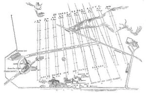
Plan and arrangements of the rifle-shooting contest on Wimbledon Common, 1860. Creator: Unknown
Plan and arrangements of the rifle-shooting contest on Wimbledon Common, 1860. National Rifle Association event in London

Background imageIndia Collection: Theatrum Orbis Terrarium, 1592. Creator: Unknown

Theatrum Orbis Terrarium, 1592. Creator: Unknown
Theatrum Orbis Terrarium, 1592. Called the first modern atlas, adapted from Mercator's world map; large coloured atlas with Ptolemy's Geographia, 1592; continents, including America (Novis Orbis)

Background imageIndia Collection: The siege of the city of Machilipatnam (Masulipatnam), 1675-1725. Creator: Anon

The siege of the city of Machilipatnam (Masulipatnam), 1675-1725. Creator: Anon
The siege of the city of Machilipatnam (Masulipatnam), 1675-1725. View of the city of Machilipatnam (Masulipatnam) on the Coromandel coast, India. Ships with Dutch flags at sea

Background imageIndia Collection: Relative position of the proposed India Museum and other public institutions, 1876. Creator: Unknown

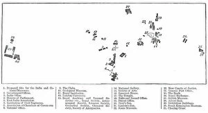
Relative position of the proposed India Museum and other public institutions, 1876. Creator: Unknown
Relative position of the proposed India Museum and other public institutions, 1876. 1. Proposed Site for the India and Colonial Museums; 2. Government Offices; 3. India Office; 4

Background imageIndia Collection: Map of the Tirah Campaign, c1900. Creator: Unknown

Map of the Tirah Campaign, c1900. Creator: Unknown
Map of the Tirah Campaign, c1900. The Tirah expedition was an Indian frontier campaign from September 1897 to April 1898. Tirah is a mountainous tract of country in what was formally known as

Background imageIndia Collection: The World at the Beginning of the 20th Century Showing British Possessions, c1900

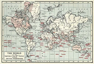
The World at the Beginning of the 20th Century Showing British Possessions, c1900. Creator: Artists Illustrators Ltd
The World at the Beginning of the 20th Century Showing British Possessions [in pink], c1900. From "Cassell's History of England, Vol. IX"

Background imageIndia Collection: Plan of the Attack on Delhi, 1857. Creator: Unknown

Plan of the Attack on Delhi, 1857. Creator: Unknown
Plan of the Attack on Delhi, 1857. Map of the city during the period of the Indian Mutiny, showing Ludlow Castle, the River Jumna, Custom House, and section of ditch and rampart

Background imageIndia Collection: Map of India, 1857. Creator: Unknown

Map of India, 1857. Creator: Unknown
Map of India, 1857. Map of the Indian subcontinent during the British colonial period, showing Kingdoms, States, Provinces &c...Principal Rivers...Bays, Gulfs &c...Principal Cities, Towns

Background imageIndia Collection: Map of the island of Dieuw or DieWij on the Coromandel coast, India, 1675-1725. Creator: Anon

Map of the island of Dieuw or DieWij on the Coromandel coast, India, 1675-1725. Creator: Anon
Map of the island of Dieuw or DieWij on the Coromandel coast, India, 1675-1725. River delta and various settlements with names

Background imageIndia Collection: Amsterdam as the Centre of World Trade, c.1604-c.1607. Creator: Pieter Isaacsz

Amsterdam as the Centre of World Trade, c.1604-c.1607. Creator: Pieter Isaacsz
Amsterdam as the Centre of World Trade, c.1604-c.1607. Other Title(s): Painting on a harpsichord lid with an Allegory of Amsterdam as the center of world trade

Background imageIndia Collection: Johan Boudaen Courten (1635-1716), Lord of St Laurens, Schellach and Popkensburg, 1668

Johan Boudaen Courten (1635-1716), Lord of St Laurens, Schellach and Popkensburg, 1668
Johan Boudaen Courten (1635-1716), Lord of St Laurens, Schellach and Popkensburg. Councillor of Middelburg and Director of the East India Company, 1668

Background imageIndia Collection: Port of London Authority - Map, 1937. Creator: Unknown

Port of London Authority - Map, 1937. Creator: Unknown
Port of London Authority - Map, 1937. The River Thames in London, showing Extensions & Improvements...1909-1937...New Docks, Deepened Docks, Deepened River Channel, New and Reconditioned Buildings

Background imageIndia Collection: Port of London Authority - Map, 1937. Creator: Unknown

Port of London Authority - Map, 1937. Creator: Unknown
Port of London Authority - Map, 1937. The River Thames in London, showing Tower Bridge, the Tower of London, St Katharine Docks, Western and Eastern Docks, West India Docks, Blackwall Basin

Background imageIndia Collection: 1 Maps 2 23

1 Maps 2 23
Emiliano Deificus

Background imageIndia Collection: 1 Maps 2 24

1 Maps 2 24
Emiliano Deificus

Background imageIndia Collection: Agra, Taj Mahal (City Breaks)

Agra, Taj Mahal (City Breaks)
Simon Goggin

Background imageIndia Collection: Taj Mahal, Agra (City Breaks)

Taj Mahal, Agra (City Breaks)
Simon Goggin

Background imageIndia Collection: Karta I?A?kutskoi? oblasti chasti Olekminskago okruga i Irkutskoi? guberni¯i? Kirenskogo... 1853

Karta I?A?kutskoi? oblasti chasti Olekminskago okruga i Irkutskoi? guberni¯i? Kirenskogo... 1853. Creator: Unknown
Karta I?A?kutskoi? oblasti chasti Olekminskago okruga i Irkutskoi? guberni¯i? Kirenskogo [sic] chast okrugas pokazani¯em zolotosoderzhashchikh pri¯i?skov razrabatyvaemyi?a? : gg

Background imageIndia Collection: Map of California shown as an island, c 1650. Creator: Johannes Vingboons

Map of California shown as an island, c 1650. Creator: Johannes Vingboons
Map of California shown as an island, c 1650. This map from around 1650 shows California as an island. A half-century would pass before Spanish explorers determined with certainty that California was

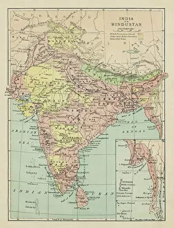
Background imageIndia Collection: Map of India and Hindustan

Map of India and Hindustan
Marcus Ward's Home Atlas - London, 1894

Background imageIndia Collection: Old map of India, showing the British possessions in 1780-1800

Old map of India, showing the British possessions in 1780-1800
Antique Illustration, Copyright has expired on this artwork. From my own archives, digitally restored

Background imageIndia Collection: Story of the Bengal Partition and its reversal

Story of the Bengal Partition and its reversal
Page from The Graphic showing two maps of North East India. The top map shows Bengal partitioned in 1905, when a large part of its former area in the east was united with Assam to form the new

Background imageIndia Collection: Map, Millwall Docks (Harrow Lane) and Poplar, East London

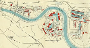
Map, Millwall Docks (Harrow Lane) and Poplar, East London, with railway lines and links. Date: 1906

Background imageIndia Collection: Overland Route to India 1851

Overland Route to India 1851
A fine facimile artworked from an antique original map of the Overland Route to India, issued as part of the 1851 edition of John Tallis and Companys " The Illustrated Atlas

Background imageIndia Collection: Northern India 1851

Northern India 1851
A fine facimile artworked from an antique original map of Northern India, issued as part of the 1851 edition of John Tallis and Companys " The Illustrated Atlas

Background imageIndia Collection: Renfrewshire PA4 9 Map

Renfrewshire PA4 9 Map
Postcode Sector Map of Renfrewshire PA4 9

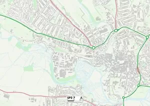
Background imageIndia Collection: Wiltshire SP2 7 Map

Wiltshire SP2 7 Map
Postcode Sector Map of Wiltshire SP2 7

Background imageIndia Collection: Comhairle nan Eilean Siar HS1 2 Map

Comhairle nan Eilean Siar HS1 2 Map
Postcode Sector Map of Comhairle nan Eilean Siar HS1 2

Background imageIndia Collection: Edinburgh EH3 6 Map

Edinburgh EH3 6 Map
Postcode Sector Map of Edinburgh EH3 6

Background imageIndia Collection: Tower Hamlets E14 8 Map

Tower Hamlets E14 8 Map
Postcode Sector Map of Tower Hamlets E14 8

Background imageIndia Collection: Croydon CR0 6 Map

Croydon CR0 6 Map
Postcode Sector Map of Croydon CR0 6

Background imageIndia Collection: Blackburn with Darwen BB3 2 Map

Blackburn with Darwen BB3 2 Map
Postcode Sector Map of Blackburn with Darwen BB3 2

Background imageIndia Collection: Antique map of Southern India and Sri Lanka, 19th Century

Antique map of Southern India and Sri Lanka, 19th Century
Vintage engraving of a Antique map of Southern India and Sri Lanka, 19th Century

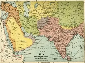
Background imageIndia Collection: India and the Campaigns of the Middle East, First World War, 1914-1918, (c1920)

India and the Campaigns of the Middle East, First World War, 1914-1918, (c1920). Map showing British India coloured pink as part of the British Empire, Afghanistan, Persia, Asia Minor, Arabia

Background imageIndia Collection: Map of India, Showing the British Possessions in 1780, 1800, and at the Present Time, 1890

Map of India, Showing the British Possessions in 1780, 1800, and at the Present Time, 1890. From " Cassells Illustrated Universal History, Vol. IV - Modern History", by Edmund Ollier

Background imageIndia Collection: Sketch of the Battle of Cawnpore, 1857, (1901). Creator: Unknown

Sketch of the Battle of Cawnpore, 1857, (1901). Creator: Unknown
Sketch of the Battle of Cawnpore, 1857, (1901). Fought on the 6th of December 1857 by the British Forces under the command of His Excellency Sir Colin Campbell, G.C.B

Background imageIndia Collection: Map to Illustrate the Mesopotamian Expedition, 1919. Creator: George Philip & Son Ltd

Map to Illustrate the Mesopotamian Expedition, 1919. Creator: George Philip & Son Ltd
Map to Illustrate the Mesopotamian Expedition, 1919. Showing the Middle Eastern theatre of World War I, including the Turkish or Ottoman Empire, and parts of Russia, Persia and Egypt


All Professionally Made to Order for Quick Shipping


-

India Collection

India is a country located in South Asia, bordered by Pakistan to the west, China and Nepal to the north, Bhutan to the northeast, Bangladesh and Myanmar to the east and has a population of over 1.3 billion people with Hindi being its official language. India's economy is one of the fastest-growing economies in the world with agriculture as its main source of income for many rural areas. The country has a diverse culture that includes various religions such as Hinduism, Islam, Christianity and Sikhism among others. It also boasts several famous landmarks including Taj Mahal and Red Fort which attract millions of tourists every year.
+

Our beautiful Wall Art and Photo Gifts include Framed Prints, Photo Prints, Poster Prints, Canvas Prints, Jigsaw Puzzles, Metal Prints and so much more

The India collection from Media Storehouse offers a diverse range of wall art and framed prints that showcase the rich cultural heritage of India. Our collection features an extensive selection of vintage maps, charts, and illustrations that depict various regions, cities, landmarks, and historical events in India. From ancient temples to bustling marketplaces, our collection captures the vibrant colors and intricate details of Indian culture. Whether you're looking for a stunning piece to adorn your home or office space or searching for a unique gift for someone special, our collection has something to offer. Each print is carefully crafted using high-quality materials to ensure longevity and durability. With its wide range of styles and sizes available at affordable prices, the India collection from Media Storehouse is an excellent choice for anyone who wants to add some Indian flair to their decor.
+

What are India (Maps and Charts) art prints?

India art prints are a collection of high-quality, visually stunning prints that showcase the diverse geography and rich history of India. These prints feature detailed maps, charts, and illustrations that depict various regions, cities, landmarks, and historical events in India. These art prints are perfect for anyone who is interested in Indian culture or history. They can be used to decorate homes or offices with an exotic touch or as educational tools for schools or libraries. The vibrant colors and intricate details make them ideal conversation starters. We offer a wide range of India art prints that cater to different tastes and preferences. From vintage-style maps to modern-day illustrations, there is something for everyone. All our art prints are printed on high-quality paper using state-of-the-art printing technology to ensure maximum clarity and durability. India art prints are beautiful works of art that capture the essence of India's geography and history in a visually appealing way.
+

What India (Maps and Charts) art prints can I buy from Media Storehouse?

We offer a wide range of India maps and charts art prints that are perfect for decorating your home or office. You can choose from vintage maps, antique charts, and modern designs that showcase the beauty and diversity of India's geography. Some popular options include detailed topographical maps of regions like the Himalayas, Rajasthan, and Kerala. These prints feature intricate contour lines that highlight the country's mountain ranges, rivers, lakes, and forests. You can also find colorful political maps that show India's states and territories along with major cities and landmarks. These prints are great for educational purposes or as a unique gift for someone who loves geography. In addition to traditional map designs, Media Storehouse also offers artistic interpretations of India's landscapes such as abstract paintings inspired by the Taj Mahal or vibrant illustrations depicting wildlife in national parks. There is something for everyone when it comes to India maps and charts art prints at Media Storehouse.
+

How do I buy India (Maps and Charts) art prints?

To buy India art prints from Media Storehouse, you can browse our extensive collection of artwork online. Once you have found the print that you like, simply add it to your cart and proceed to checkout. You will be prompted to enter your shipping information and payment details. We offer a variety of sizes for each print, so make sure to select the size that best suits your needs. We also offer framing options if you prefer a ready-to-hang piece of art. Their India art prints are high-quality reproductions of vintage maps and charts, perfect for adding a touch of history and culture to any room in your home or office. Buying India art prints from Media Storehouse is easy and convenient. With their vast selection of artwork available at your fingertips, you're sure to find the perfect piece for your space.
+

How much do India (Maps and Charts) art prints cost?

India art prints are a popular choice for those who want to add an exotic touch to their home or office décor. The cost of these prints can vary depending on the size, quality, and type of paper used. Generally speaking, larger prints will be more expensive than smaller ones, while high-quality papers such as archival or museum-grade may also increase the price. It's important to note that India art prints come in a variety of styles and designs, so prices can differ based on the specific artwork being purchased. Some prints may feature intricate details or vibrant colors that make them stand out from others. Ultimately, the cost of India art prints is determined by several factors including size, quality, design complexity among other things. However it is possible to find affordable options without compromising on quality if you shop around carefully.
+

How will my India (Maps and Charts) art prints be delivered to me?

Your India art prints will be delivered to you in a safe and secure manner by our trusted delivery partners. We take great care in packaging your artwork to ensure that it arrives at your doorstep in pristine condition. Your print will be carefully rolled up and placed inside a sturdy cardboard tube, which is then sealed with tape to prevent any damage during transit. Once your order has been dispatched, we will provide you with a tracking number so that you can monitor the progress of your delivery online. You can expect your artwork to arrive within the estimated timeframe provided at checkout. We pride ourselves on providing excellent customer service, so if for any reason you are not satisfied with the condition of your print upon arrival, please do not hesitate to contact us and we will work with you to resolve the issue as quickly as possible.