Home > Animals > Farm > Cattle > Related Images
Wakefield WF11 9 Map

![]()
Wall Art and Photo Gifts from Map Marketing
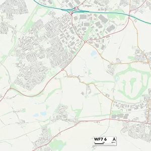
Wakefield WF11 9 Map
Postcode Sector Map of Wakefield WF11 9
Media ID 19980740
Aire Street Belmont Bridge Lane Buckingham Way Chapel Street Church Street Cow Lane Crawford Close Croft Avenue Croftlands Cromwell Close Cross Hill Field View Garden Lane Great North Road Green Lane Hall Court Hanover Place High Street Hillside Intake Lane Low Street Manor Court Marlborough Avenue Marsh Lane Newton Lane Norfolk Close North Road Park Gardens Primrose Hill Ramsden Close Roberts Close Rockwood Close Roe Lane Rope Walk Sandringham Road Silver Street St Edwards Close Summerfield Close Summerfield Drive Sunny Bank Sutton Sutton Lane The Croft The Island The Paddock The Rise Wakefield Waterside Willow Road Birkin Fairburn Knottingley
FEATURES IN THESE COLLECTIONS
> Animals
> Farm
> Cattle
> Related Images
> Animals
> Insects
> Flies
> House Fly
> Animals
> Insects
> Spiders
> Silver Garden
> Arts
> Artists
> F
> Newton Fielding
> Arts
> Artists
> H
> Robert Hills
> Europe
> United Kingdom
> England
> Norfolk
> High Green
> Europe
> United Kingdom
> England
> Norfolk
> Low Street
> Europe
> United Kingdom
> England
> Norfolk
> Newton
> Europe
> United Kingdom
> England
> Norfolk
> North End
> Map Marketing
> Postcode Sector Maps
> WF - Wakefield
> Map Marketing
> UK Maps
MADE IN THE USA
Safe Shipping with 30 Day Money Back Guarantee
FREE PERSONALISATION*
We are proud to offer a range of customisation features including Personalised Captions, Color Filters and Picture Zoom Tools
SECURE PAYMENTS
We happily accept a wide range of payment options so you can pay for the things you need in the way that is most convenient for you
* Options may vary by product and licensing agreement. Zoomed Pictures can be adjusted in the Cart.