Home > Europe > United Kingdom > England > London > Boroughs > Camden
Walsall WS1 4 Map

![]()
Wall Art and Photo Gifts from Map Marketing
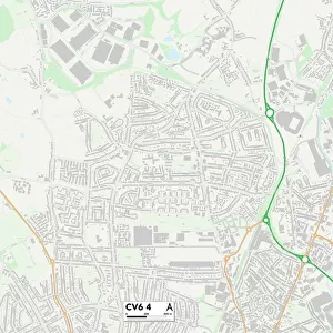
Walsall WS1 4 Map
Postcode Sector Map of Walsall WS1 4
Media ID 19980814
Alexandra Road Arundel Street Britannia Road Cambridge Street Camden Street Cobden Street Collins Street Cornmill Close Dale Street Dorothy Street Duchess Road Earl Street Junction Street King Street Lord Street Love Lane Milton Close Milton Place Milton Street South Street Spout Lane Sun Street Tame Street Thorpe Road Victor Street Villiers Street Walsall Watery Lane Weston Close Weston Street Whitehall Road Windsor Street Palfrey
FEATURES IN THESE COLLECTIONS
> Europe
> United Kingdom
> England
> London
> Boroughs
> Camden
> Map Marketing
> Postcode Sector Maps
> WS - Walsall
> Maps and Charts
> Related Images
> Services
> British Army
> Royal Scots Greys
MADE IN THE USA
Safe Shipping with 30 Day Money Back Guarantee
FREE PERSONALISATION*
We are proud to offer a range of customisation features including Personalised Captions, Color Filters and Picture Zoom Tools
SECURE PAYMENTS
We happily accept a wide range of payment options so you can pay for the things you need in the way that is most convenient for you
* Options may vary by product and licensing agreement. Zoomed Pictures can be adjusted in the Cart.