Fraud Blocker Skip to main content

Text Collection (#100)

"From Ancient Scrolls to Modern Messages: The Power of Text" Text has played a significant role in various aspects of human history and culture

Background imageText Collection: CT Hartford Manchester Vector Road Map

CT Hartford Manchester Vector Road Map. All source data is in the public domain. U.S. Census Bureau Census Tiger. Used Layers: areawater, linearwater, roads, rails, cousub, pointlm, uac10

Background imageText Collection: CT Hartford Hartland Vector Road Map

CT Hartford Hartland Vector Road Map. All source data is in the public domain. U.S. Census Bureau Census Tiger. Used Layers: areawater, linearwater, roads, rails, cousub, pointlm, uac10

Background imageText Collection: CT Hartford City Vector Road Map

CT Hartford City Vector Road Map. All source data is in the public domain. U.S. Census Bureau Census Tiger. Used Layers: areawater, linearwater, roads, rails, cousub, pointlm, uac10

Background imageText Collection: CT Hartford Granby Vector Road Map

CT Hartford Granby Vector Road Map. All source data is in the public domain. U.S. Census Bureau Census Tiger. Used Layers: areawater, linearwater, roads, rails, cousub, pointlm, uac10

Background imageText Collection: CT Hartford Newington Vector Road Map

CT Hartford Newington Vector Road Map. All source data is in the public domain. U.S. Census Bureau Census Tiger. Used Layers: areawater, linearwater, roads, rails, cousub, pointlm, uac10

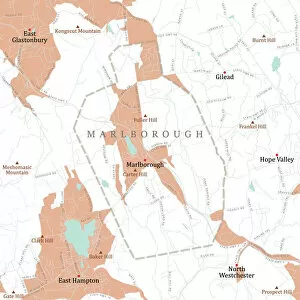
Background imageText Collection: CT Hartford Marlborough Vector Road Map

CT Hartford Marlborough Vector Road Map. All source data is in the public domain. U.S. Census Bureau Census Tiger. Used Layers: areawater, linearwater, roads, rails, cousub, pointlm, uac10

Background imageText Collection: CT Hartford Plainville Vector Road Map

CT Hartford Plainville Vector Road Map. All source data is in the public domain. U.S. Census Bureau Census Tiger. Used Layers: areawater, linearwater, roads, rails, cousub, pointlm, uac10

Background imageText Collection: CT Hartford Windsor Locks Vector Road Map

CT Hartford Windsor Locks Vector Road Map. All source data is in the public domain. U.S. Census Bureau Census Tiger. Used Layers: areawater, linearwater, roads, rails, cousub, pointlm, uac10

Background imageText Collection: CT Hartford Wethersfield Vector Road Map

CT Hartford Wethersfield Vector Road Map. All source data is in the public domain. U.S. Census Bureau Census Tiger. Used Layers: areawater, linearwater, roads, rails, cousub, pointlm, uac10

Background imageText Collection: CT Hartford Windsor Vector Road Map

CT Hartford Windsor Vector Road Map. All source data is in the public domain. U.S. Census Bureau Census Tiger. Used Layers: areawater, linearwater, roads, rails, cousub, pointlm, uac10

Background imageText Collection: CT Hartford West Hartford Vector Road Map

CT Hartford West Hartford Vector Road Map. All source data is in the public domain. U.S. Census Bureau Census Tiger. Used Layers: areawater, linearwater, roads, rails, cousub, pointlm, uac10

Background imageText Collection: CT Hartford Suffield Vector Road Map

CT Hartford Suffield Vector Road Map. All source data is in the public domain. U.S. Census Bureau Census Tiger. Used Layers: areawater, linearwater, roads, rails, cousub, pointlm, uac10

Background imageText Collection: CT Litchfield Cornwall Vector Road Map

CT Litchfield Cornwall Vector Road Map. All source data is in the public domain. U.S. Census Bureau Census Tiger. Used Layers: areawater, linearwater, roads, rails, cousub, pointlm, uac10

Background imageText Collection: CT Litchfield Harwinton Vector Road Map

CT Litchfield Harwinton Vector Road Map. All source data is in the public domain. U.S. Census Bureau Census Tiger. Used Layers: areawater, linearwater, roads, rails, cousub, pointlm, uac10

Background imageText Collection: CT Litchfield Kent Vector Road Map

CT Litchfield Kent Vector Road Map. All source data is in the public domain. U.S. Census Bureau Census Tiger. Used Layers: areawater, linearwater, roads, rails, cousub, pointlm, uac10

Background imageText Collection: CT Litchfield Bethlehem Vector Road Map

CT Litchfield Bethlehem Vector Road Map. All source data is in the public domain. U.S. Census Bureau Census Tiger. Used Layers: areawater, linearwater, roads, rails, cousub, pointlm, uac10

Background imageText Collection: CT Litchfield Bridgewater Vector Road Map

CT Litchfield Bridgewater Vector Road Map. All source data is in the public domain. U.S. Census Bureau Census Tiger. Used Layers: areawater, linearwater, roads, rails, cousub, pointlm, uac10

Background imageText Collection: CT Litchfield Barkhamsted Vector Road Map

CT Litchfield Barkhamsted Vector Road Map. All source data is in the public domain. U.S. Census Bureau Census Tiger. Used Layers: areawater, linearwater, roads, rails, cousub, pointlm, uac10

Background imageText Collection: CT Litchfield Colebrook Vector Road Map

CT Litchfield Colebrook Vector Road Map. All source data is in the public domain. U.S. Census Bureau Census Tiger. Used Layers: areawater, linearwater, roads, rails, cousub, pointlm, uac10

Background imageText Collection: CT Litchfield Canaan Vector Road Map

CT Litchfield Canaan Vector Road Map. All source data is in the public domain. U.S. Census Bureau Census Tiger. Used Layers: areawater, linearwater, roads, rails, cousub, pointlm, uac10

Background imageText Collection: CT Litchfield Goshen Vector Road Map

CT Litchfield Goshen Vector Road Map. All source data is in the public domain. U.S. Census Bureau Census Tiger. Used Layers: areawater, linearwater, roads, rails, cousub, pointlm, uac10

Background imageText Collection: CT Litchfield Torrington Vector Road Map

CT Litchfield Torrington Vector Road Map. All source data is in the public domain. U.S. Census Bureau Census Tiger. Used Layers: areawater, linearwater, roads, rails, cousub, pointlm, uac10

Background imageText Collection: CT Litchfield Thomaston Vector Road Map

CT Litchfield Thomaston Vector Road Map. All source data is in the public domain. U.S. Census Bureau Census Tiger. Used Layers: areawater, linearwater, roads, rails, cousub, pointlm, uac10

Background imageText Collection: CT Litchfield Sharon Vector Road Map

CT Litchfield Sharon Vector Road Map. All source data is in the public domain. U.S. Census Bureau Census Tiger. Used Layers: areawater, linearwater, roads, rails, cousub, pointlm, uac10

Background imageText Collection: CT Litchfield Roxbury Vector Road Map

CT Litchfield Roxbury Vector Road Map. All source data is in the public domain. U.S. Census Bureau Census Tiger. Used Layers: areawater, linearwater, roads, rails, cousub, pointlm, uac10

Background imageText Collection: CT Litchfield Plymouth Vector Road Map

CT Litchfield Plymouth Vector Road Map. All source data is in the public domain. U.S. Census Bureau Census Tiger. Used Layers: areawater, linearwater, roads, rails, cousub, pointlm, uac10

Background imageText Collection: CT Litchfield New Hartford Vector Road Map

CT Litchfield New Hartford Vector Road Map. All source data is in the public domain. U.S. Census Bureau Census Tiger. Used Layers: areawater, linearwater, roads, rails, cousub, pointlm, uac10

Background imageText Collection: CT Litchfield Litchfield Town Vector Road Map

CT Litchfield Litchfield Town Vector Road Map. All source data is in the public domain. U.S. Census Bureau Census Tiger. Used Layers: areawater, linearwater, roads, rails, cousub, pointlm, uac10

Background imageText Collection: CT Litchfield New Milford Vector Road Map

CT Litchfield New Milford Vector Road Map. All source data is in the public domain. U.S. Census Bureau Census Tiger. Used Layers: areawater, linearwater, roads, rails, cousub, pointlm, uac10

Background imageText Collection: CT Litchfield Morris Vector Road Map

CT Litchfield Morris Vector Road Map. All source data is in the public domain. U.S. Census Bureau Census Tiger. Used Layers: areawater, linearwater, roads, rails, cousub, pointlm, uac10

Background imageText Collection: CT Litchfield Norfolk Vector Road Map

CT Litchfield Norfolk Vector Road Map. All source data is in the public domain. U.S. Census Bureau Census Tiger. Used Layers: areawater, linearwater, roads, rails, cousub, pointlm, uac10

Background imageText Collection: CT Litchfield North Canaan Vector Road Map

CT Litchfield North Canaan Vector Road Map. All source data is in the public domain. U.S. Census Bureau Census Tiger. Used Layers: areawater, linearwater, roads, rails, cousub, pointlm, uac10

Background imageText Collection: CT Litchfield Salisbury Vector Road Map

CT Litchfield Salisbury Vector Road Map. All source data is in the public domain. U.S. Census Bureau Census Tiger. Used Layers: areawater, linearwater, roads, rails, cousub, pointlm, uac10

Background imageText Collection: CT Middlesex Durham Vector Road Map

CT Middlesex Durham Vector Road Map. All source data is in the public domain. U.S. Census Bureau Census Tiger. Used Layers: areawater, linearwater, roads, rails, cousub, pointlm, uac10

Background imageText Collection: CT Middlesex East Haddam Vector Road Map

CT Middlesex East Haddam Vector Road Map. All source data is in the public domain. U.S. Census Bureau Census Tiger. Used Layers: areawater, linearwater, roads, rails, cousub, pointlm, uac10

Background imageText Collection: CT Middlesex Deep River Vector Road Map

CT Middlesex Deep River Vector Road Map. All source data is in the public domain. U.S. Census Bureau Census Tiger. Used Layers: areawater, linearwater, roads, rails, cousub, pointlm, uac10

Background imageText Collection: CT Middlesex Cromwell Vector Road Map

CT Middlesex Cromwell Vector Road Map. All source data is in the public domain. U.S. Census Bureau Census Tiger. Used Layers: areawater, linearwater, roads, rails, cousub, pointlm, uac10

Background imageText Collection: CT Litchfield Winchester Vector Road Map

CT Litchfield Winchester Vector Road Map. All source data is in the public domain. U.S. Census Bureau Census Tiger. Used Layers: areawater, linearwater, roads, rails, cousub, pointlm, uac10

Background imageText Collection: CT Litchfield Washington Vector Road Map

CT Litchfield Washington Vector Road Map. All source data is in the public domain. U.S. Census Bureau Census Tiger. Used Layers: areawater, linearwater, roads, rails, cousub, pointlm, uac10

Background imageText Collection: CT Litchfield Watertown Vector Road Map

CT Litchfield Watertown Vector Road Map. All source data is in the public domain. U.S. Census Bureau Census Tiger. Used Layers: areawater, linearwater, roads, rails, cousub, pointlm, uac10

Background imageText Collection: CT Litchfield Warren Vector Road Map

CT Litchfield Warren Vector Road Map. All source data is in the public domain. U.S. Census Bureau Census Tiger. Used Layers: areawater, linearwater, roads, rails, cousub, pointlm, uac10

Background imageText Collection: CT Litchfield Woodbury Vector Road Map

CT Litchfield Woodbury Vector Road Map. All source data is in the public domain. U.S. Census Bureau Census Tiger. Used Layers: areawater, linearwater, roads, rails, cousub, pointlm, uac10

Background imageText Collection: CT Middlesex Chester Vector Road Map

CT Middlesex Chester Vector Road Map. All source data is in the public domain. U.S. Census Bureau Census Tiger. Used Layers: areawater, linearwater, roads, rails, cousub, pointlm, uac10

Background imageText Collection: CT Middlesex Clinton Vector Road Map

CT Middlesex Clinton Vector Road Map. All source data is in the public domain. U.S. Census Bureau Census Tiger. Used Layers: areawater, linearwater, roads, rails, cousub, pointlm, uac10

Background imageText Collection: MA Worcester Northbridge Vector Road Map

MA Worcester Northbridge Vector Road Map. All source data is in the public domain. U.S. Census Bureau Census Tiger. Used Layers: areawater, linearwater, roads, rails, cousub, pointlm, uac10

Background imageText Collection: MA Berkshire Dalton Vector Road Map

MA Berkshire Dalton Vector Road Map. All source data is in the public domain. U.S. Census Bureau Census Tiger. Used Layers: areawater, linearwater, roads, rails, cousub, pointlm, uac10

Background imageText Collection: MA Berkshire Lanesborough Vector Road Map

MA Berkshire Lanesborough Vector Road Map. All source data is in the public domain. U.S. Census Bureau Census Tiger. Used Layers: areawater, linearwater, roads, rails, cousub, pointlm, uac10

Background imageText Collection: MA Norfolk Weymouth Town Vector Road Map

MA Norfolk Weymouth Town Vector Road Map. All source data is in the public domain. U.S. Census Bureau Census Tiger. Used Layers: areawater, linearwater, roads, rails, cousub, pointlm, uac10


All Professionally Made to Order for Quick Shipping

"From Ancient Scrolls to Modern Messages: The Power of Text" Text has played a significant role in various aspects of human history and culture. In Jewish prayers, the Torah scroll takes center stage during the ritual of Torah reading, symbolizing tradition and spirituality. This sacred object connects generations and serves as a guide for religious practices. Moving to Europe, we encounter Al-Idrisi's world map from 1154. Through intricate text and illustrations, this map provided valuable geographical knowledge during medieval times, shaping our understanding of the world. Fast forward to 1960s America, where political sentiments were expressed through powerful posters. An anti-Nixon poster questioned his trustworthiness with the provocative question: "Would YOU buy a used car from this man?" Such visual texts reflected public distrust towards Richard Nixon during his presidential campaign. In another American poster from 1911, a capitalist pyramid was depicted as an expression of socialist ideology. This thought-provoking image aimed to critique economic disparities by highlighting how wealth is concentrated at the top. During World War II, Winston Churchill's speech inspired resilience against adversity. A powerful poster featuring his words - "We shall not flag" - served as a rallying cry that united people in their fight for freedom and victory. The arts also embraced text as seen in Gilbert & Sullivan's first production poster for H. M. S Pinafore in 1878 or Puccini's Tosca poster from 1900. These captivating visuals combined with textual elements invited audiences into enchanting worlds created by these renowned composers and has been instrumental in advocating for human rights throughout history. Eleanor Roosevelt holding a Universal Declaration of Human Rights poster exemplified her dedication to equality and justice during her time as First Lady. Beyond politics and activism lies Hollywood Hills' iconic sign standing tall amidst nature's beauty—a symbol recognized worldwide thanks to its textual representation on countless screens over decades—an emblematic landmark representing dreams realized and stories told. Even ancient civilizations recognized the power of text.