Fraud Blocker Skip to main content

Surveying Instrument Collection

"PSCI2A-00073

Background imageSurveying Instrument Collection: PSCI2A-00073

PSCI2A-00073
Greek astronomer Hipparchus mapping the stars over Alexandria, ancient Egypt. Hand-colored woodcut of a 19th-century illustration

Background imageSurveying Instrument Collection: 4th grade students of the Irkutsk Mining School with a teacher, 1914. Creator: Unknown

4th grade students of the Irkutsk Mining School with a teacher, 1914. Creator: Unknown
4th grade students of the Irkutsk Mining School with a teacher, 1914. From a collection of 136 photographs of Irkutsk from the late nineteenth and early twentieth centuries

Background imageSurveying Instrument Collection: Panama Canal, 1913. Creator: Harris & Ewing. Panama Canal, 1913. Creator: Harris & Ewing

Panama Canal, 1913. Creator: Harris & Ewing. Panama Canal, 1913. Creator: Harris & Ewing
Panama Canal, 1913. The Panama Canal project was one of the largest and most difficult engineering projects ever undertaken

Background imageSurveying Instrument Collection: The moment of carrying out triangulation measurements under a tower on the river bank, 1909

The moment of carrying out triangulation measurements under a tower on the river bank, 1909. Amur Oblast Museum of Regional History and Folklife

Background imageSurveying Instrument Collection: Surveyors Compass, c. 1937. Creator: Archie Thompson

Surveyors Compass, c. 1937. Creator: Archie Thompson
Surveyors Compass, c. 1937

Background imageSurveying Instrument Collection: Surveyor, ca. 1854. Creator: Unknown

Surveyor, ca. 1854. Creator: Unknown
Surveyor, ca. 1854

Background imageSurveying Instrument Collection: Return of Commander Selfridge and his Reconnaissance Party from an Expedition in the

Return of Commander Selfridge and his Reconnaissance Party from an Expedition in the Interior of Darien, 1870

Background imageSurveying Instrument Collection: F. Debenham, 9 September 1911, (1913). Artist: Herbert Ponting

F. Debenham, 9 September 1911, (1913). Artist: Herbert Ponting
F. Debenham, 9 September 1911, (1913). Geologist Frank Debenham (1883-1965) with a plane table, used in surveying to provide a solid and level surface on which to make field drawings

Background imageSurveying Instrument Collection: The Lower Koettlitz Glacier, 1911, (1913). Artist: Frank Debenham

The Lower Koettlitz Glacier, 1911, (1913). Artist: Frank Debenham
The Lower Koettlitz Glacier, 1911, (1913). Camp in pinnacled ice at mouth of Koettlitz Glacier, geologist Raymond Priestley takes a reading from a piece of scientific equipment on a tripod

Background imageSurveying Instrument Collection: Lieut. E. R. G. R. Evans Surveying With The Four-Inch Theodolite, October 1911, (1913)

Lieut. E. R. G. R. Evans Surveying With The Four-Inch Theodolite, October 1911, (1913)
Lieut. E. R. G. R. Evans Surveying With The Four-Inch Theodolite Which Was Used To Locate The South Pole, October 1911, (1913)

Background imageSurveying Instrument Collection: Lieutenant Evans surveying in the Antarctic, 1911-1912. Artist: Herbert Ponting

Lieutenant Evans surveying in the Antarctic, 1911-1912. Artist: Herbert Ponting
Lieutenant Evans surveying in the Antarctic, 1911-1912. Evans using the 4 inch theodolite used to locate the South Pole on Captain Scotts Antarctic expedition of 1910-1913

Background imageSurveying Instrument Collection: Sir Christopher Wren, 1711. Artist: Sir Godfrey Kneller

Sir Christopher Wren, 1711. Artist: Sir Godfrey Kneller
Sir Christopher Wren, 1711. Wren (1632-1723) is best remembered for his rebuilding of St Pauls Cathedral and numerous other churches destroyed in the Great Fire of London (1666)

Background imageSurveying Instrument Collection: Crugers azimuth quadrant, 1673 (1956). Artist: A Steck

Crugers azimuth quadrant, 1673 (1956). Artist: A Steck
Crugers azimuth quadrant, 1673 (1956). Peter Cruger (1580-1639) was a German mathematician, astronomer and polymath. He taught the Polish astronomer Johannes Hevelius

Background imageSurveying Instrument Collection: Five inch theodolite, 1866

Five inch theodolite, 1866. A print from Cyclopaedia of Useful Arts, Mechanical and Chemical, Manufactures, Mining, and Engineering, edited by Charles Tomlinson, Volume II, Virtue and Co, London, 1866

Background imageSurveying Instrument Collection: Surveying, early 17th century

Surveying, early 17th century. Method of using a quadrant fitted with a plumb line and marked with shadow scales to measure the depth of a well. From Utriusque cosmi... historia by Robert Fludd


All Professionally Made to Order for Quick Shipping

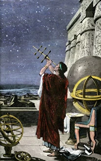
"PSCI2A-00073: A Glimpse into the World of Surveying Instruments" Step back in time and explore the fascinating world of surveying instruments with these captivating hints. Delve into history as we uncover remarkable devices that have shaped the field of surveying. Dating back to 1937, Archie Thompson's Surveyors Compass stands as a testament to precision and accuracy. This instrument, meticulously crafted, aided countless surveyors in their quest for precise measurements. Travel further down memory lane to 1854, where an unknown creator brought forth a Surveyor's portrait. Through this artwork, we catch a glimpse of the dedication and expertise required by those who ventured into uncharted territories. Witness Commander Selfridge's triumphant return from an expedition through F. Debenham's masterpiece from 1911. The artist Herbert Ponting immortalizes this momentous occasion when explorers conquered new frontiers using their trusty surveying instruments. Marvel at Lieutenant E. R. G. R Evans skillfully utilizing the four-inch Theodolite during his Antarctic exploration in October 1911. Herbert Ponting captures Lieutenant Evans' determination as he surveys amidst icy landscapes, showcasing the vital role played by these instruments even in extreme conditions. Venture even further back to Sir Christopher Wren's era in 1711; Sir Godfrey Kneller immortalizes him with his signature style. Wren’s genius architectural designs were made possible through meticulous surveys conducted with advanced tools available at that time. Discover Crugers azimuth quadrant from 1673 - a true work of art created by A Steck - which revolutionized angle measurement techniques during its time. This instrument paved the way for accurate mapping and navigation across vast terrains. The five-inch Theodolite from 1866 takes us closer to modern times while still embracing traditional craftsmanship. Witness how advancements in technology allowed for more precise measurements and improved efficiency within surveying practices.