Home > North America > United States of America > Illinois > Springfield
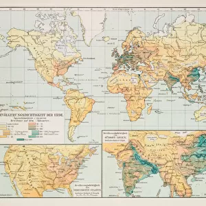
Map of Illinois 1883

![]()
Wall Art and Photo Gifts from Fine Art Storehouse
Map of Illinois 1883
Map of the state of Illinois
Unleash your creativity and transform your space into a visual masterpiece!
THEPALMER
Media ID 21177787
© Roberto A Sanchez
Chicago Illinois Illinois North America Ohio Cleveland Ohio Retro Styled
FEATURES IN THESE COLLECTIONS
> Europe
> United Kingdom
> England
> Cleveland
> Fine Art Storehouse
> Map
> Historical Maps
> Maps and Charts
> Related Images
> North America
> United States of America
> Illinois
> Chicago
> North America
> United States of America
> Illinois
> Related Images
> North America
> United States of America
> Illinois
> Springfield
> North America
> United States of America
> Maps
> North America
> United States of America
> Ohio
> Cleveland
> North America
> United States of America
> Ohio
> Related Images
> Posters
> Movie Posters
> In Old Chicago
EDITORS COMMENTS
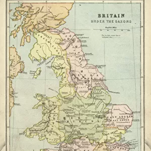
This print showcases a beautifully detailed "Map of Illinois 1883" taking us back in time to the rich history of this great state. The retro-styled cartography, with its antique charm and old-fashioned aesthetic, transports us to an era when maps were meticulously hand-drawn works of art. The focal point of the image is Springfield, Illinois, the capital city that served as a hub for political and social activities during that period. As our eyes wander across the map's intricate lines and labels, we are reminded of the physical geography that defines this region - from rolling plains to majestic rivers. Chicago, another prominent city on this vintage map, stands out with its bustling urban layout even in those early years. This snapshot into Chicago's past allows us to appreciate how it has evolved over time into one of America's most vibrant metropolises. Beyond Illinois' borders lie neighboring states like Ohio; Cleveland appears prominently on this map as well. It serves as a reminder that these regions were interconnected hubs within North America during an era where transportation was still evolving. "The Map of Illinois 1883" by THEPALMER captures not only historical significance but also evokes nostalgia for simpler times when paper maps guided explorers through uncharted territories. With its meticulous attention to detail and timeless appeal, this print is sure to be cherished by history enthusiasts or anyone seeking a unique piece of artwork steeped in Midwestern heritage.
MADE IN THE USA
Safe Shipping with 30 Day Money Back Guarantee
FREE PERSONALISATION*
We are proud to offer a range of customisation features including Personalised Captions, Color Filters and Picture Zoom Tools
SECURE PAYMENTS
We happily accept a wide range of payment options so you can pay for the things you need in the way that is most convenient for you
* Options may vary by product and licensing agreement. Zoomed Pictures can be adjusted in the Cart.