Home > Asia > China > Maps
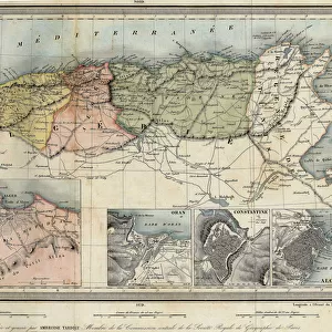
Theory of Round Earth: Map of the world drawn up from the discoveries of Christopher Columbus (1451-1506) and Vasco Nunez de Balboa, Spanish conquistador (1475-1519) showing the idde according to which South America
 and Vasco Nunez de Balboa, Spanish conquistador (1475-1519) showing the idde according to which South America")
![]()
Wall Art and Photo Gifts from Fine Art Finder
Theory of Round Earth: Map of the world drawn up from the discoveries of Christopher Columbus (1451-1506) and Vasco Nunez de Balboa, Spanish conquistador (1475-1519) showing the idde according to which South America
NWI4848339 Theory of Round Earth: Map of the world drawn up from the discoveries of Christopher Columbus (1451-1506) and Vasco Nunez de Balboa, Spanish conquistador (1475-1519) showing the idde according to which South America, Florida and the islands were attached to China and that only the Atlantic Ocean existed. Colourful engraving, 19th century.; (add.info.: Theory of Round Earth: Map of the world drawn up from the discoveries of Christopher Columbus (1451-1506) and Vasco Nunez de Balboa, Spanish conquistador (1475-1519) showing the idde according to which South America, Florida and the islands were attached to China and that only the Atlantic Ocean existed. Colourful engraving, 19th century.); Photo © North Wind Pictures
Media ID 38426532
© © North Wind Pictures / Bridgeman Images
Atlantic Ocean Chineze Christopher Colombus Discoverers Explorers Latin America Planisphere 15th 15 Xv Xvth Fifteenth Century Asiae Asian Asian C16h Chineses Geographical Map Latine America
FEATURES IN THESE COLLECTIONS
> Arts
> Artists
> O
> Oceanic Oceanic
> Europe
> Spain
> Related Images
> Fine Art Finder
> Artists
> Unknown Artist
> Maps and Charts
> Italy
> Maps and Charts
> Related Images
EDITORS COMMENTS
This colorful 19th-century engraving depicts the Theory of Round Earth as understood by Christopher Columbus and Vasco Nunez de Balboa. The map shows a unique perspective in which South America, Florida, and various islands are depicted as being attached to China. This portrayal reflects the limited knowledge of geography during this time period, with only the Atlantic Ocean being recognized.
The image captures the imagination and curiosity of early explorers like Columbus and Balboa, who were driven by a desire to discover new lands and expand their understanding of the world. It serves as a reminder of how perceptions of geography have evolved over time, shaped by exploration, scientific discovery, and cultural exchange.
As we gaze upon this historical artifact, we are transported back to an era when maps were filled with unknown territories waiting to be explored. It is a testament to human ingenuity and determination in seeking out new horizons beyond what was previously thought possible.
Through this print, we are reminded of the enduring legacy of these intrepid explorers who dared to challenge conventional wisdom and push the boundaries of knowledge. Their discoveries paved the way for future generations to continue unraveling the mysteries of our planet's vast landscapes and interconnected civilizations.
MADE IN THE USA
Safe Shipping with 30 Day Money Back Guarantee
FREE PERSONALISATION*
We are proud to offer a range of customisation features including Personalised Captions, Color Filters and Picture Zoom Tools
SECURE PAYMENTS
We happily accept a wide range of payment options so you can pay for the things you need in the way that is most convenient for you
* Options may vary by product and licensing agreement. Zoomed Pictures can be adjusted in the Cart.