Home > North America > United States of America > Maps
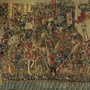
Geography map: representation of South America from an Atlas by Charles Price, beginning of the 18th century. Biblioteca Angelica, Rome

![]()
Wall Art and Photo Gifts from Fine Art Finder
Geography map: representation of South America from an Atlas by Charles Price, beginning of the 18th century. Biblioteca Angelica, Rome
VEN5030268 Geography map: representation of South America from an Atlas by Charles Price, beginning of the 18th century. Biblioteca Angelica, Rome; (add.info.: Geography map: representation of South America from an Atlas by Charles Price, beginning of the 18th century. Biblioteca Angelica, Rome); © Marage Photos
Media ID 38484898
© © Marage Photos / Bridgeman Images
Amerique Du Nord Amerique Du Sud Carte Geographique Etats Unis Geographie Latin America Latinamerica Southamerica Stockravenna 18eme Siecle Geographical Map Latine America
FEATURES IN THESE COLLECTIONS
> Europe
> Italy
> Lazio
> Rome
> Fine Art Finder
> Artists
> Pasquier (workshop of) Grenier
> Maps and Charts
> Early Maps
> Maps and Charts
> Related Images
> North America
> Related Images
> North America
> United States of America
> Maps
> South America
> Related Images
EDITORS COMMENTS
This stunning print of a geography map depicting South America from an atlas by Charles Price at the beginning of the 18th century is a true masterpiece. The intricate details and accuracy in representing the continent showcase the skill and expertise of cartographers during that time period.
The map, housed in Biblioteca Angelica in Rome, offers a glimpse into how South America was perceived and understood centuries ago. From the Amazon rainforest to the Andes mountains, every feature is meticulously illustrated, providing valuable insight into the geographical landscape of this diverse region.
As one gazes upon this historical artifact, they are transported back in time to an era when exploration and discovery were paramount. The Latin American continent comes alive through this engraving, highlighting its importance in shaping world history.
Whether you are a scholar studying early cartography or simply appreciate fine art, this print is sure to captivate your imagination. It serves as a reminder of our connection to the past and how far we have come in understanding our world.
In conclusion, this geography map by Charles Price is not just a representation of South America; it is a window into our collective heritage and an enduring symbol of human curiosity and ingenuity.
MADE IN THE USA
Safe Shipping with 30 Day Money Back Guarantee
FREE PERSONALISATION*
We are proud to offer a range of customisation features including Personalised Captions, Color Filters and Picture Zoom Tools
SECURE PAYMENTS
We happily accept a wide range of payment options so you can pay for the things you need in the way that is most convenient for you
* Options may vary by product and licensing agreement. Zoomed Pictures can be adjusted in the Cart.