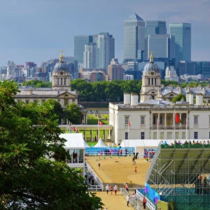
Home > Europe > United Kingdom > England > London > Museums > National Maritime Museum
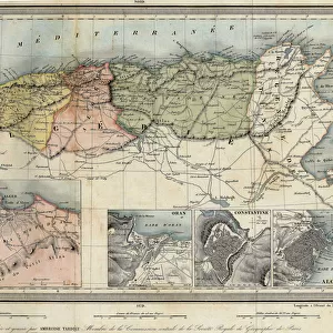
Map of Asia from the Blaeu Atlas, 1662-65 (print)
")
![]()
Wall Art and Photo Gifts from Fine Art Finder
Map of Asia from the Blaeu Atlas, 1662-65 (print)
7339178 Map of Asia from the Blaeu Atlas, 1662-65 (print) by Unknown Artist, (17th century); National Maritime Museum, London, UK; (add.info.: Creator: unknown
Map of Asia from the Blaeu Atlas, 1662-1665); © National Maritime Museum, Greenwich, London
Media ID 38516518
© © National Maritime Museum, Greenwich, London / Bridgeman Images
FEATURES IN THESE COLLECTIONS
> Arts
> Artists
> Related Images
> Europe
> United Kingdom
> England
> London
> Boroughs
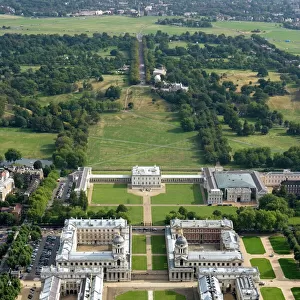
> Greenwich
> Europe
> United Kingdom
> England
> London
> Museums
> Greenwich Heritage Centre
> Europe
> United Kingdom
> England
> London
> Museums
> National Maritime Museum
> Europe
> United Kingdom
> England
> London
> Towns
> Greenwich
> Europe
> United Kingdom
> Heritage Sites
> Maritime Greenwich
> Europe
> United Kingdom
> Maps
> Fine Art Finder
> Artists
> J. Fairburn
> Fine Art Finder
> Artists
> Unknown Artist
> Maps and Charts
> Early Maps
> Maps and Charts
> Related Images
EDITORS COMMENTS
This stunning print of the Map of Asia from the Blaeu Atlas, dating back to 1662-65, is a true masterpiece of cartography. Created by an unknown artist in the 17th century, this intricate map showcases the vast and diverse continent of Asia in exquisite detail.
The vibrant colors and meticulous attention to geographical accuracy make this print a valuable historical artifact. From the deserts of Arabia to the mountains of Tibet, every corner of Asia is represented with precision and beauty.
As you study this map closely, you can't help but marvel at the skill and artistry that went into its creation over three centuries ago. The intricate borders, elaborate illustrations, and elegant calligraphy all contribute to making this map a work of art in its own right.
Whether you are a history buff or simply appreciate fine craftsmanship, this print is sure to captivate your imagination and transport you back in time to an era when exploration and discovery were at their peak. Display it proudly in your home or office as a conversation piece that will spark curiosity and admiration for generations to come.
MADE IN THE USA
Safe Shipping with 30 Day Money Back Guarantee
FREE PERSONALISATION*
We are proud to offer a range of customisation features including Personalised Captions, Color Filters and Picture Zoom Tools
SECURE PAYMENTS
We happily accept a wide range of payment options so you can pay for the things you need in the way that is most convenient for you
* Options may vary by product and licensing agreement. Zoomed Pictures can be adjusted in the Cart.