
Satellite Imagery Collection (#2)
Satellite imagery is a type of that involves the use of satellites to capture images of Earth from space
129 Items


All Professionally Made to Order for Quick Shipping
-
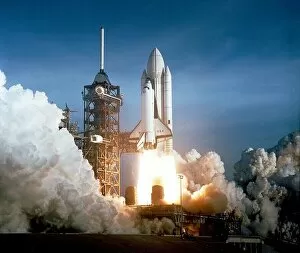
Satellite Imagery Collection
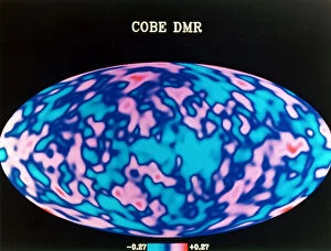
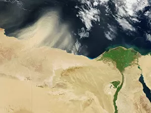
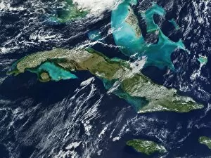
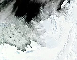
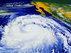
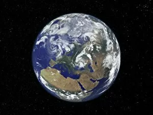
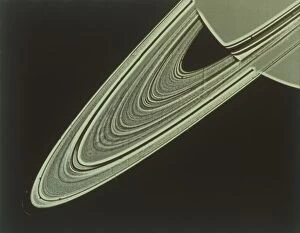
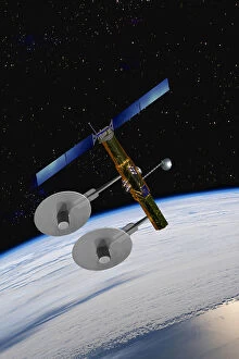
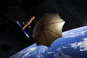
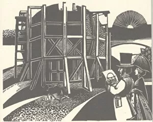
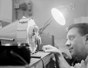
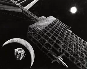
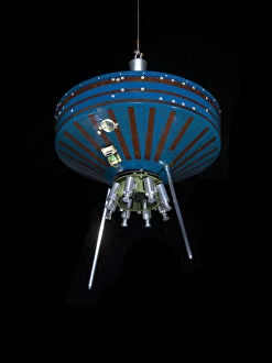
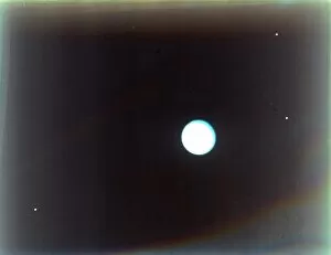
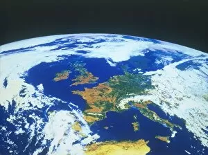
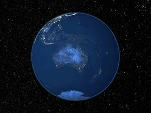
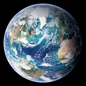
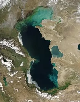
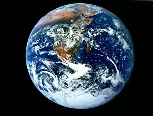
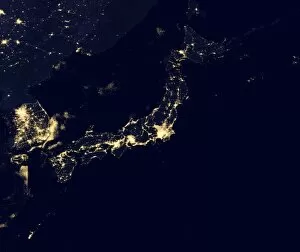
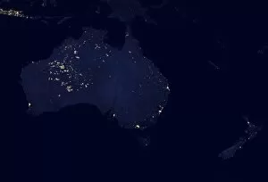
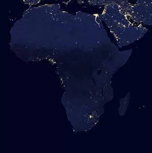
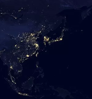
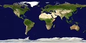
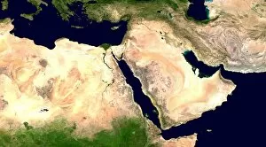
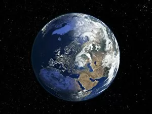
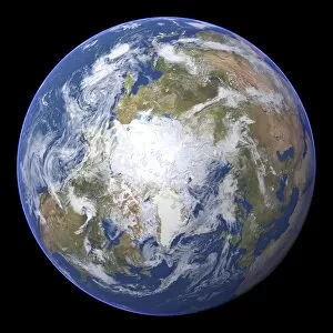
Satellite imagery is a type of that involves the use of satellites to capture images of Earth from space. These images are used for a variety of purposes, such as mapping, monitoring natural disasters, and tracking changes in land use, and are be used to detect changes in the environment over time, such as deforestation or urbanization and can also be used to monitor weather patterns and track storms. Additionally, often used for military surveillance and intelligence gathering. Satellite imagery has revolutionized our understanding of Earth's surface features and processes by providing detailed information about our planet's surface from a global perspective. With advances in technology, it has become an invaluable tool for scientists studying climate change and other environmental issues.
+
Our beautiful Wall Art and Photo Gifts include Framed Prints, Photo Prints, Poster Prints, Canvas Prints, Jigsaw Puzzles, Metal Prints and so much more
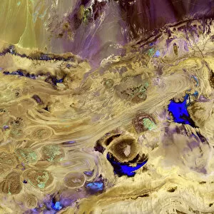
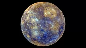
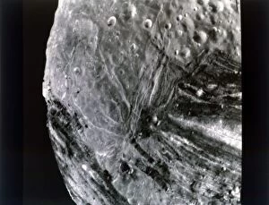
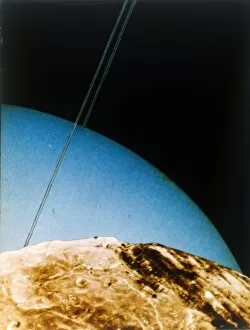
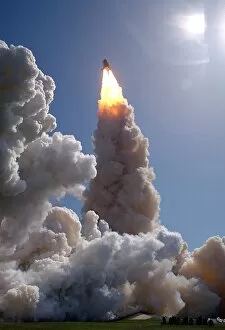
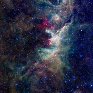
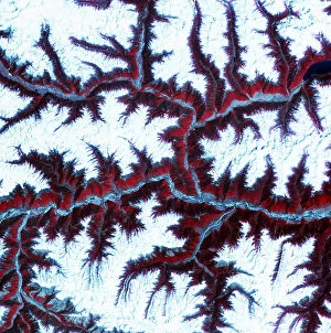
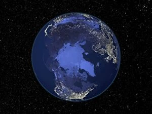
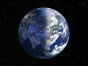
Media Storehouse offers a collection of satellite imagery that showcases the beauty and complexity of our planet from above. Our collection features stunning photographs captured by satellites orbiting Earth, providing a unique perspective on natural phenomena such as hurricanes, volcanic eruptions, and wildfires. The images are available as wall art and framed prints in various sizes to suit different spaces. The Satellite Imagery collection is an excellent resource for those interested in space exploration science or simply seeking visually striking artwork for their homes or offices. The images offer a glimpse into the vastness of space while highlighting the intricate details of our planet's landscapes and weather patterns. Whether you're looking to decorate your home with beautiful artwork or seeking inspiration for scientific research projects, our Satellite Imagery collection has something to offer. With its high-quality prints and diverse range of subjects, our collection is sure to impress anyone who appreciates the beauty of our world from above.
+
What are Satellite Imagery (Space Exploration Science) art prints?
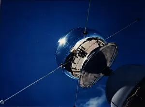
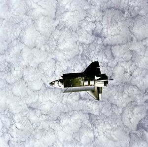
Satellite Imagery art prints are high-quality reproductions of satellite images captured by various space exploration missions. These stunning prints showcase the beauty and complexity of our planet, as well as other celestial bodies in our solar system. The images used for these prints are obtained through advanced imaging technologies that capture data from satellites orbiting Earth or other planets. This data is then processed to create detailed visual representations of the terrain, weather patterns, and other features of these locations. These art prints offer a unique perspective on our world and beyond, allowing us to appreciate the intricate details and natural wonders that can only be seen from space. They make great additions to any home or office decor, providing a conversation piece that inspires curiosity about science and exploration. Whether you're interested in astronomy, geography, or simply enjoy beautiful artwork, Satellite Imagery art prints are an excellent choice for anyone looking to add some out-of-this-world flair to their living space.
+
What Satellite Imagery (Space Exploration Science) art prints can I buy from Media Storehouse?
We offer a wide range of Satellite Imagery art prints that are perfect for space exploration enthusiasts. These prints showcase stunning images captured by satellites orbiting the Earth, providing a unique perspective on our planet and beyond. Some of the popular Satellite Imagery art prints available at Media Storehouse include satellite imagery of cities, landscapes, oceans, and even weather patterns. You can also find prints featuring iconic landmarks such as the Great Barrier Reef or Mount Everest. These high-quality art prints are produced using state-of-the-art printing technology to ensure exceptional clarity and detail. They come in various sizes to suit your needs and preferences. Whether you're looking to decorate your home or office with beautiful space-themed artwork or searching for a unique gift for someone special, we have something for everyone. With its vast collection of Satellite Imagery art prints, you're sure to find the perfect piece that captures your imagination.
+
How do I buy Satellite Imagery (Space Exploration Science) art prints?
To buy Satellite Imagery art prints from Media Storehouse, you can browse our extensive collection of high-quality images online. Simply search for the specific image or topic that interests you and select the size and format of print that you prefer. You can choose from a range of options including canvas, framed prints, posters, and photographic prints. Once you have selected your preferred product type and size, simply add it to your cart and proceed to checkout. You will be prompted to enter your shipping information as well as payment details. We offer a wide selection of satellite imagery art prints featuring stunning views of our planet Earth from space. These images are perfect for anyone interested in science or astronomy, or those who simply appreciate beautiful artwork inspired by space exploration. Buying Satellite Imagery art prints from Media Storehouse is an easy process that allows you to enjoy high-quality artwork in the comfort of your own home.
+
How much do Satellite Imagery (Space Exploration Science) art prints cost?
Satellite Imagery art prints can vary in price depending on the size and type of print. There are a variety of options available, from smaller poster-sized prints to larger canvas prints. The cost may also depend on the quality of the image and whether it is a limited edition or not. It's important to note that Satellite Imagery art prints are not just decorative pieces, but they can also serve as educational tools for those interested in space exploration and science. They provide an opportunity to appreciate the beauty and complexity of our universe while learning about different celestial bodies. If you're interested in purchasing Satellite Imagery art prints, there are many options available at varying prices. It's worth doing some research to find a high-quality print that fits your budget and interests.
+
How will my Satellite Imagery (Space Exploration Science) art prints be delivered to me?
We take great care in delivering your Satellite Imagery art prints to you. We use high-quality packaging materials to ensure that your artwork arrives safely and undamaged. Depending on the size of your print, it will be shipped either flat or rolled up in a sturdy tube. We work with trusted shipping partners who provide reliable and efficient delivery services worldwide. Once your order has been processed, we will send you an email confirmation with tracking information so that you can monitor the progress of your shipment. We understand how important it is for our customers to receive their orders promptly and in perfect condition. That's why we go above and beyond to ensure that every aspect of our delivery process is carefully managed and executed. So sit back, relax, and let us take care of everything – from printing your beautiful Satellite Imagery art prints to delivering them right to your doorstep.