Fraud Blocker Skip to main content

Home > Science > Space Exploration > Satellite Imagery

Satellite Imagery Collection (#3)

Satellite imagery is a type of that involves the use of satellites to capture images of Earth from space

129 Items

Background imageSatellite Imagery Collection: Apollo 11, Close-Up, Cloud, Color Image, Environment, Exploration, Globe, Gulf Of Mexico

Apollo 11, Close-Up, Cloud, Color Image, Environment, Exploration, Globe, Gulf Of Mexico, Horizon, Infinity, Land, Majestic, Mexico, No People, North America, Pacific Ocean, Part Of, Photography

Background imageSatellite Imagery Collection: 2001, Antarctica, Astronomy, City, Color Image, Digital Composite, Environment

2001, Antarctica, Astronomy, City, Color Image, Digital Composite, Environment, Exploration, Globe, Hemisphere, Horizontal, Infinity, Light, Majestic, Maps And Globes, Night, No People, Photography

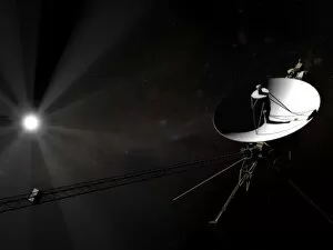
Background imageSatellite Imagery Collection: Voyager 1 leaving the solar system

Voyager 1 leaving the solar system

Background imageSatellite Imagery Collection: Orion Nebula star formation, satellite view

Orion Nebula star formation, satellite view
Taken form NASAs Hubble Space Telescope

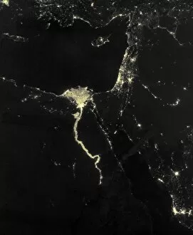
Background imageSatellite Imagery Collection: Nile at night, satellite image

Nile at night, satellite image
Nile at night. Black marble satellite image of the Nile at night. The Nile is illuminated by the many boats along its length

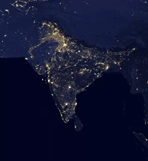
Background imageSatellite Imagery Collection: India at night, satellite image

India at night, satellite image
India at night. Black marble satellite image of India at night. More densely populated areas are brighter. The nocturnal glow produced by the Earths atmosphere is shown as well as man-made light

Background imageSatellite Imagery Collection: Tarantula Nebula, composite image

Tarantula Nebula, composite image
Tarantula Nebula (30 Doradus). Combined optical and infrared image of the large star-forming region known as the Tarantula Nebula

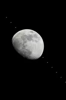
Background imageSatellite Imagery Collection: ISS crossing the Moon C013 / 5150

ISS crossing the Moon C013 / 5150
ISS crossing the Moon, time-lapse image. The International Space Station (ISS; upper left, lower right, and crossing the Moon) is orbiting the Earth here at an altitude of around 390 kilometres

Background imageSatellite Imagery Collection: Typhoon Tokage

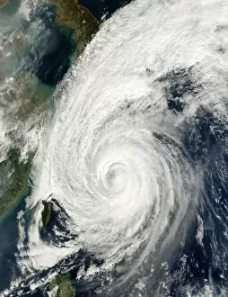
Typhoon Tokage. Satellite image of Typhoon Tokage (centre) hitting the western coast of Japan (upper left) on 19 October 2004 at 0215 GMT. The typhoon produced winds of 225 kilometres per hour

Background imageSatellite Imagery Collection: Ozone hole over Antarctica

Ozone hole over Antarctica
Satellite map showing a severe depletion or " hole" in the ozone layer over Antarctica on October 3rd, 1990. The hole is believed to be due to pollution of the atmosphere by

Background imageSatellite Imagery Collection: River Nile, Luxor, Egypt

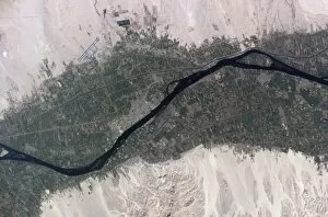
River Nile, Luxor, Egypt, as seen from the International Space Station (ISS). North is towards bottom left. Agricultural fields (green) are sustained by the waters of the Nile (dark blue)

Background imageSatellite Imagery Collection: High-altitude clouds, satellite image

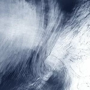
High-altitude clouds, satellite image. These swirling clouds are being shaped by high-altitude winds. They are over the Mediterranean Sea, just north of the coast of Morocco

Background imageSatellite Imagery Collection: Blue Marble image of Earth (2005)

Blue Marble image of Earth (2005)
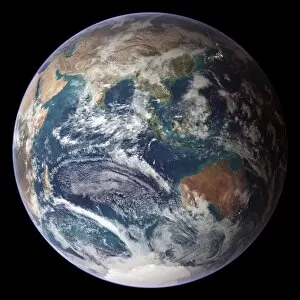
Blue Marble image of Earth. Composite satellite image of Earths eastern hemisphere, centred on the Indian Ocean. North is at top

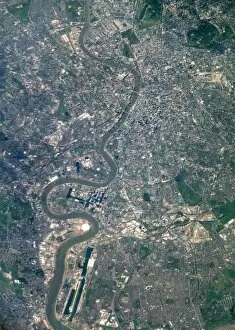
Background imageSatellite Imagery Collection: London from the ISS

London from the ISS
London, UK, photographed from theInternational Space Station. North is at right.The River Thames flows eastwards down centre. Thebright white circle at lower left is theMillennium Dome

Background imageSatellite Imagery Collection: Yucatan peninsula, south-eastern Mexico, separating the Gulf of Mexico from the Caribbean

Yucatan peninsula, south-eastern Mexico, separating the Gulf of Mexico from the Caribbean Sea photographed by Satellite. Credit NASA. Science Earth Geology Oceanography

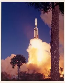
Background imageSatellite Imagery Collection: First Titan-Centaur Launch Test

First Titan-Centaur Launch Test
The first Titan/Centaur lifted off from Complex 41 at Cape Kennedy Air Force Station at 9:48 AM EDT. The Titan stages burned as programmed, but when the Centaur stage failed to ignite

Background imageSatellite Imagery Collection: Armed and Ready

Armed and Ready
STS-49 Mission Specialist Pierre Thuot is perched on the end effector of the Robot Arm (Remote Manipulator System/RMS), with the Intelsat VI capture bar

Background imageSatellite Imagery Collection: Satellites For Sale

Satellites For Sale
Astronaut Dale A. Gardner, having just completed the major portion of his second extravehicular activity (EVA) period in three days

Background imageSatellite Imagery Collection: Detail of Triton

Detail of Triton
This color photo of Neptunes large satellite Triton was obtained on Aug. 24 1989 at a range of 530, 000 kilometers (330, 000 miles)

Background imageSatellite Imagery Collection: Dr. Goddard Transports Rocket

Dr. Goddard Transports Rocket
Dr. Robert H. Goddard tows his rocket to the launching tower behind a Model A Ford truck, 15 miles northwest of Roswell, New Mexico. 1930- 1932. Dr

Background imageSatellite Imagery Collection: Launch Preparation

Launch Preparation
Inside the nose cone of this Delta rocket is Goddards geophysics research satellite, a 906-lb. (411-kg) satellite that looked more like a dimpled cosmic golf ball

Background imageSatellite Imagery Collection: ER-2 Airborne Science Aircraft

ER-2 Airborne Science Aircraft
First acquired in 1981, NASA has been using two ER-2 Airborne Science aircraft as flying laboratories. The aircraft once based at Ames Research Center now fly out of Dryden Flight Research Center in

Background imageSatellite Imagery Collection: STS-66 Atlantis Landing and Chute Deployment at Edwards

STS-66 Atlantis Landing and Chute Deployment at Edwards
The Space Shuttle Atlantis lands with its drag chute deployed on runway 22 at Edwards, California, to complete the STS-66 mission dedicated to the third flight of the Atmospheric Laboratory for

Background imageSatellite Imagery Collection: STS-66 Atlantis Landing Approach at Edwards

STS-66 Atlantis Landing Approach at Edwards
The Space Shuttle Atlantis approaches runway 22 at Edwards, California, to complete the STS-66 mission dedicated to the third flight of the Atmospheric Laboratory for Applications and Science-3

Background imageSatellite Imagery Collection: Satellite photograph of Great Namaland, Namibia, 1972

Satellite photograph of Great Namaland, Namibia, 1972. Photographed by Landsat 1. The satellites multispectral scanner reveals lithologic and structural features with clarity

Background imageSatellite Imagery Collection: Death Valley, California, USA, 1982-1993

Death Valley, California, USA, 1982-1993. First full scene from the Thematic Mapper on Landsat 4. The vegetation-sparse terrain is dominated by landforms and other geological features

Background imageSatellite Imagery Collection: The Alps from space. NASA photograph

The Alps from space. NASA photograph
The Alps from space

Background imageSatellite Imagery Collection: Andromeda Galaxy

Andromeda Galaxy. Infrared image made by IRAS (Infrared Astronomical Satellite). A spiral galaxy, and the nearest neighbour to our own Milky Way

Background imageSatellite Imagery Collection: Astronaut on Shuttle mission 41-C, 1984

Astronaut on Shuttle mission 41-C, 1984. Shuttle astronaut with Solar Maximum Satellite in the hold of the Space Shuttle Challenger

Background imageSatellite Imagery Collection: Cryostat for COBE satellite, 1989, USA

Cryostat for COBE satellite, 1989, USA. The cryostat uses helium to maintain the extremely low temperatures that allow the satellite to function

Background imageSatellite Imagery Collection: Composite Landsat false colour image of Greater London, 1979

Composite Landsat false colour image of Greater London, 1979. This image was processed by the Space Department at the Royal Aircraft Establishment, Farnborough

Background imageSatellite Imagery Collection: Landsat image of Manhattan, New York, USA, 1980s

Landsat image of Manhattan, New York, USA, 1980s
Landsat image of Manhattan, New York, USA, at 30m spatial resolution, 1980s. Seven Landsats have been launched between 1972

Background imageSatellite Imagery Collection: Drawing of Hubble Telescope, 1980s

Drawing of Hubble Telescope, 1980s. Artists impression of the exchange of information via Hubble, Tracking and Data Relay Satellites (TRDS) and ground stations


All Professionally Made to Order for Quick Shipping


-

Satellite Imagery Collection

Satellite imagery is a type of that involves the use of satellites to capture images of Earth from space. These images are used for a variety of purposes, such as mapping, monitoring natural disasters, and tracking changes in land use, and are be used to detect changes in the environment over time, such as deforestation or urbanization and can also be used to monitor weather patterns and track storms. Additionally, often used for military surveillance and intelligence gathering. Satellite imagery has revolutionized our understanding of Earth's surface features and processes by providing detailed information about our planet's surface from a global perspective. With advances in technology, it has become an invaluable tool for scientists studying climate change and other environmental issues.
+

Our beautiful Wall Art and Photo Gifts include Framed Prints, Photo Prints, Poster Prints, Canvas Prints, Jigsaw Puzzles, Metal Prints and so much more

Media Storehouse offers a collection of satellite imagery that showcases the beauty and complexity of our planet from above. Our collection features stunning photographs captured by satellites orbiting Earth, providing a unique perspective on natural phenomena such as hurricanes, volcanic eruptions, and wildfires. The images are available as wall art and framed prints in various sizes to suit different spaces. The Satellite Imagery collection is an excellent resource for those interested in space exploration science or simply seeking visually striking artwork for their homes or offices. The images offer a glimpse into the vastness of space while highlighting the intricate details of our planet's landscapes and weather patterns. Whether you're looking to decorate your home with beautiful artwork or seeking inspiration for scientific research projects, our Satellite Imagery collection has something to offer. With its high-quality prints and diverse range of subjects, our collection is sure to impress anyone who appreciates the beauty of our world from above.
+

What are Satellite Imagery (Space Exploration Science) art prints?

Satellite Imagery art prints are high-quality reproductions of satellite images captured by various space exploration missions. These stunning prints showcase the beauty and complexity of our planet, as well as other celestial bodies in our solar system. The images used for these prints are obtained through advanced imaging technologies that capture data from satellites orbiting Earth or other planets. This data is then processed to create detailed visual representations of the terrain, weather patterns, and other features of these locations. These art prints offer a unique perspective on our world and beyond, allowing us to appreciate the intricate details and natural wonders that can only be seen from space. They make great additions to any home or office decor, providing a conversation piece that inspires curiosity about science and exploration. Whether you're interested in astronomy, geography, or simply enjoy beautiful artwork, Satellite Imagery art prints are an excellent choice for anyone looking to add some out-of-this-world flair to their living space.
+

What Satellite Imagery (Space Exploration Science) art prints can I buy from Media Storehouse?

We offer a wide range of Satellite Imagery art prints that are perfect for space exploration enthusiasts. These prints showcase stunning images captured by satellites orbiting the Earth, providing a unique perspective on our planet and beyond. Some of the popular Satellite Imagery art prints available at Media Storehouse include satellite imagery of cities, landscapes, oceans, and even weather patterns. You can also find prints featuring iconic landmarks such as the Great Barrier Reef or Mount Everest. These high-quality art prints are produced using state-of-the-art printing technology to ensure exceptional clarity and detail. They come in various sizes to suit your needs and preferences. Whether you're looking to decorate your home or office with beautiful space-themed artwork or searching for a unique gift for someone special, we have something for everyone. With its vast collection of Satellite Imagery art prints, you're sure to find the perfect piece that captures your imagination.
+

How do I buy Satellite Imagery (Space Exploration Science) art prints?

To buy Satellite Imagery art prints from Media Storehouse, you can browse our extensive collection of high-quality images online. Simply search for the specific image or topic that interests you and select the size and format of print that you prefer. You can choose from a range of options including canvas, framed prints, posters, and photographic prints. Once you have selected your preferred product type and size, simply add it to your cart and proceed to checkout. You will be prompted to enter your shipping information as well as payment details. We offer a wide selection of satellite imagery art prints featuring stunning views of our planet Earth from space. These images are perfect for anyone interested in science or astronomy, or those who simply appreciate beautiful artwork inspired by space exploration. Buying Satellite Imagery art prints from Media Storehouse is an easy process that allows you to enjoy high-quality artwork in the comfort of your own home.
+

How much do Satellite Imagery (Space Exploration Science) art prints cost?

Satellite Imagery art prints can vary in price depending on the size and type of print. There are a variety of options available, from smaller poster-sized prints to larger canvas prints. The cost may also depend on the quality of the image and whether it is a limited edition or not. It's important to note that Satellite Imagery art prints are not just decorative pieces, but they can also serve as educational tools for those interested in space exploration and science. They provide an opportunity to appreciate the beauty and complexity of our universe while learning about different celestial bodies. If you're interested in purchasing Satellite Imagery art prints, there are many options available at varying prices. It's worth doing some research to find a high-quality print that fits your budget and interests.
+

How will my Satellite Imagery (Space Exploration Science) art prints be delivered to me?

We take great care in delivering your Satellite Imagery art prints to you. We use high-quality packaging materials to ensure that your artwork arrives safely and undamaged. Depending on the size of your print, it will be shipped either flat or rolled up in a sturdy tube. We work with trusted shipping partners who provide reliable and efficient delivery services worldwide. Once your order has been processed, we will send you an email confirmation with tracking information so that you can monitor the progress of your shipment. We understand how important it is for our customers to receive their orders promptly and in perfect condition. That's why we go above and beyond to ensure that every aspect of our delivery process is carefully managed and executed. So sit back, relax, and let us take care of everything – from printing your beautiful Satellite Imagery art prints to delivering them right to your doorstep.