Fraud Blocker Skip to main content

Home > Maps and Charts > Germany

Germany Collection (#6)

Germany is a country located in central Europe with a population of over 83 million people and has a diverse landscape

6,586 Items

Background imageGermany Collection: First World War: Patriotic map showing a young Alsatian enniving a German soldier while her little

First World War: Patriotic map showing a young Alsatian enniving a German soldier while her little brother steals
LUX4744632 First World War: Patriotic map showing a young Alsatian enniving a German soldier while her little brother steals the soldier's weapon to kill him and titled Little Heros

Background imageGermany Collection: First World War: Patriotic map showing a young Alsatian refusing the advances of a German soldier

First World War: Patriotic map showing a young Alsatian refusing the advances of a German soldier to accept that of a
LUX4744575 First World War: Patriotic map showing a young Alsatian refusing the advances of a German soldier to accept that of a French soldier and titled Germans Ever, Francaise toujours

Background imageGermany Collection: First World War: Patriotic map showing France coming to fetch an Alsatian

First World War: Patriotic map showing France coming to fetch an Alsatian and Lorraine in traditional regional costume
LUX4744398 First World War: Patriotic map showing France coming to fetch an Alsatian and Lorraine in traditional regional costume

Background imageGermany Collection: First World War: France, Patriotic map showing a little boy and a little girl in Kepi

First World War: France, Patriotic map showing a little boy and a little girl in Kepi
LUX4738282 First World War: France, Patriotic map showing a little boy and a little girl in Kepi and Phrygian hat holding the German eagle by the paste, 1916

Background imageGermany Collection: Elevations and plans of the Eddystone Rock lighthouse, built with dovetailed granite

Elevations and plans of the Eddystone Rock lighthouse, built with dovetailed granite
FLO4591503 Elevations and plans of the Eddystone Rock lighthouse, built with dovetailed granite and blocks by John Smeaton in 1759. Copperplate engraving by Wilson Lowry after a drawing by J

Background imageGermany Collection: Short-nosed echydnee (Tachyglossus aculeatus) or Australian echydne, excavating the ground

Short-nosed echydnee (Tachyglossus aculeatus) or Australian echydne, excavating the ground
FLO4639264 Short-nosed echydnee (Tachyglossus aculeatus) or Australian echydne, excavating the ground. Species of mammals of the order of monotremes, ie laying eggs

Background imageGermany Collection: Old coral reef, now extinct. Colour illustration by Heinrich Harder (1858-1935)

Old coral reef, now extinct. Colour illustration by Heinrich Harder (1858-1935)
FLO4639234 Old coral reef, now extinct. Colour illustration by Heinrich Harder (1858-1935), in " Tiere der Urwelt" (Animals of Prehistory), texts by Wilhelm Bolsche (1861-1939), 1916

Background imageGermany Collection: Hesperornis regalis, a kind of non-flying waterfowl that lived in the Upper Cretace

Hesperornis regalis, a kind of non-flying waterfowl that lived in the Upper Cretace
FLO4639149 Hesperornis regalis, a kind of non-flying waterfowl that lived in the Upper Cretace. Colour illustration by Heinrich Harder (1858-1935)

Background imageGermany Collection: Giant turtle of Rodrigues Island (Indian Ocean), species extirpated in the 18th century

Giant turtle of Rodrigues Island (Indian Ocean), species extirpated in the 18th century
FLO4639018 Giant turtle of Rodrigues Island (Indian Ocean), species extirpated in the 18th century. Chromolithography, based on an illustration by F

Background imageGermany Collection: Dinotherium, (Deinotherium giganteum) animal close to the elephant, with canine defences curved down

Dinotherium, (Deinotherium giganteum) animal close to the elephant, with canine defences curved down
FLO4638995 Dinotherium, (Deinotherium giganteum) animal close to the elephant, with canine defences curved down. Colour illustration by Heinrich Harder (1858-1935)

Background imageGermany Collection: Iguanodons, herbivorous dinosaurs who lived in the middle of the Jurassic period until the end of

Iguanodons, herbivorous dinosaurs who lived in the middle of the Jurassic period until the end of Cretace
FLO4639532 Iguanodons, herbivorous dinosaurs who lived in the middle of the Jurassic period until the end of Cretace. Colour illustration by Heinrich Harder (1858-1935)

Background imageGermany Collection: Map of the port of Le Havre de Grace (Normandy, France). Lithograph (23.7 x 38.7 cm), 1764

Map of the port of Le Havre de Grace (Normandy, France). Lithograph (23.7 x 38.7 cm), 1764
MMM5482019 Map of the port of Le Havre de Grace (Normandy, France). Lithograph (23.7 x 38.7 cm), 1764, published in Nuremberg (Germany).; 23.7x38.7 cm; National Maritime Museum, London

Background imageGermany Collection: Detail of a globe, on Martinus (eastern Spain), 1908 (globe)

Detail of a globe, on Martinus (eastern Spain), 1908 (globe)
MMM5475132 Detail of a globe, on Martinus (eastern Spain), 1908 (globe) by Behaim, Martin (1459-1507); National Maritime Museum, London, UK; (add.info.: Detail of a globe)

Background imageGermany Collection: Plan of the Black Forest Railway

Plan of the Black Forest Railway
5312114 Plan of the Black Forest Railway; (add.info.: Plan of the Black Forest Railway. Dated 19th century.); Universal History Archive/UIG

Background imageGermany Collection: A map of the Moon

A map of the Moon
5312011 A map of the Moon; (add.info.: Engraving depicting a map of the Moon based on observations by Giovanni Battista Riccioli, Giovanni Domenico Cassini, Christian Mayer and others)

Background imageGermany Collection: Trench map of 7th Division frontage of attack at the Battle of Loos, 1915 (paper)

Trench map of 7th Division frontage of attack at the Battle of Loos, 1915 (paper)
5926810 Trench map of 7th Division frontage of attack at the Battle of Loos, 1915 (paper); National Army Museum, London; (add.info)

Background imageGermany Collection: Map showing the placings in Canada of The Tolpuddle Martyrs, a group of 19th-century Dorset

Map showing the placings in Canada of The Tolpuddle Martyrs, a group of 19th-century Dorset agricultural labourers who
5614436 Map showing the placings in Canada of The Tolpuddle Martyrs, a group of 19th-century Dorset agricultural labourers who were arrested for

Background imageGermany Collection: Great Battle on the Sambre, Germany invaded by the Russians, 1914 (print)

Great Battle on the Sambre, Germany invaded by the Russians, 1914 (print)
PCT5618366 Great Battle on the Sambre, Germany invaded by the Russians, 1914 (print); (add.info.: First World War 14-18 (1914 - 1918)

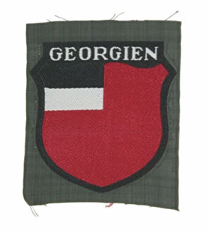
Background imageGermany Collection: Armshield for Georgian Volunteers in the German Army, c. 1939-45 (object)

Armshield for Georgian Volunteers in the German Army, c. 1939-45 (object)
7177606 Armshield for Georgian Volunteers in the German Army, c. 1939-45 (object); Private Collection; (add.info.: Cloth armshield for Georgian Volunteers in the German Army)

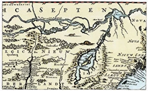
Background imageGermany Collection: Dutch geographic map of eastern North America, Great Lakes region, with description of colonies

Dutch geographic map of eastern North America, Great Lakes region, with description of colonies
NWI4846151 Dutch geographic map of eastern North America, Great Lakes region, with description of colonies: New Holland and New England, New France, 1670

Background imageGermany Collection: Kaiser Wilhelm II (left) and Field Marshal von Hindeburg studying maps during the First World War

Kaiser Wilhelm II (left) and Field Marshal von Hindeburg studying maps during the First World War
3058415 Kaiser Wilhelm II (left) and Field Marshal von Hindeburg studying maps during the First World War. Wilhelm II, Frederick William Victor Albert of Prussia, 1859 - 1941

Background imageGermany Collection: Geographic map of England and France during the Angevins dynasty, 12th-15th century

Geographic map of England and France during the Angevins dynasty, 12th-15th century. Lithograph of the 19th century
NWI4874543 Geographic map of England and France during the Angevins dynasty, 12th-15th century. Lithograph of the 19th century.; (add.info)

Background imageGermany Collection: Map of the Earl of Westmorland (England), circa 1870. 19th century lithography

Map of the Earl of Westmorland (England), circa 1870. 19th century lithography
NWI4875494 Map of the Earl of Westmorland (England), circa 1870. 19th century lithography.; (add.info.: Map of the Earl of Westmorland (England), circa 1870

Background imageGermany Collection: Map of Scotland in the 1520s, showing Highland (Highlander) territories

Map of Scotland in the 1520s, showing Highland (Highlander) territories. Colouring engraving of the 19th century
NWI4874428 Map of Scotland in the 1520s, showing Highland (Highlander) territories. Colouring engraving of the 19th century.; (add.info.: Map of Scotland in the 1520s)

Background imageGermany Collection: Map of the Counts of Leicester and Rutland (England), circa 1870. 19th century lithography

Map of the Counts of Leicester and Rutland (England), circa 1870. 19th century lithography
NWI4875099 Map of the Counts of Leicester and Rutland (England), circa 1870. 19th century lithography.; (add.info.: Map of the Counts of Leicester and Rutland (England), circa 1870

Background imageGermany Collection: Map of the Count of Dorset (England), circa 1870. 19th century lithography

Map of the Count of Dorset (England), circa 1870. 19th century lithography
NWI4874816 Map of the Count of Dorset (England), circa 1870. 19th century lithography.; (add.info.: Map of the Count of Dorset (England), circa 1870

Background imageGermany Collection: Germany, Thuringia, the Wartburg, the second floor of the so called Landgrafenhaus, 1876 (engraving)

Germany, Thuringia, the Wartburg, the second floor of the so called Landgrafenhaus, 1876 (engraving)
UTD4916658 Germany, Thuringia, the Wartburg, the second floor of the so called Landgrafenhaus, 1876 (engraving); (add.info.: Germany, Thuringia, the Wartburg)

Background imageGermany Collection: Bronze statue of an Amorino (infant cupid) with a dolphin from the Thermae (baths) at Regio IX

Bronze statue of an Amorino (infant cupid) with a dolphin from the Thermae (baths) at Regio IX, Insula IV, 5
FLO4687176 Bronze statue of an Amorino (infant cupid) with a dolphin from the Thermae (baths) at Regio IX, Insula IV, 5. Chromolithograph by J.G

Background imageGermany Collection: Floor mosaic from a room in the viridarium (garden) in the House of Vesonius Primus, a fuller

Floor mosaic from a room in the viridarium (garden) in the House of Vesonius Primus, a fuller
FLO4687124 Floor mosaic from a room in the viridarium (garden) in the House of Vesonius Primus, a fuller. Chromolithograph by Victor Steeger after an illustration by Geremia Discanno from Emile

Background imageGermany Collection: Mosaic of a guard dog on a chain from the Casa del Poeta Tragico, House of the Tragic Poet

Mosaic of a guard dog on a chain from the Casa del Poeta Tragico, House of the Tragic Poet, Regio VI, Insulae 8, 3, 5
FLO4687105 Mosaic of a guard dog on a chain from the Casa del Poeta Tragico, House of the Tragic Poet, Regio VI, Insulae 8, 3, 5

Background imageGermany Collection: Painting of an aquarium with fish and lobster from the House of the Patrician or Centenary

Painting of an aquarium with fish and lobster from the House of the Patrician or Centenary (Casa del Centenario)
FLO4687102 Painting of an aquarium with fish and lobster from the House of the Patrician or Centenary (Casa del Centenario), Regio IX, Insula VIII. Chromolithograph by J.G

Background imageGermany Collection: Wind god from the House of the Patrician or Centenary (Casa di Centanario), Regio IX, Insula VIII

Wind god from the House of the Patrician or Centenary (Casa di Centanario), Regio IX, Insula VIII
FLO4687020 Wind god from the House of the Patrician or Centenary (Casa di Centanario), Regio IX, Insula VIII. Chromolithograph by J.G

Background imageGermany Collection: Map of the excavations of Pompeii, showing the Insulae excavated between 1874-1881 in red

Map of the excavations of Pompeii, showing the Insulae excavated between 1874-1881 in red. Chromolithograph by J.G
FLO4686852 Map of the excavations of Pompeii, showing the Insulae excavated between 1874-1881 in red. Chromolithograph by J.G

Background imageGermany Collection: Geographic map of Brittany after saxon invasion, 500 AD Engraving from 'Atlas Universel' by Houze

Geographic map of Brittany after saxon invasion, 500 AD Engraving from "Atlas Universel" by Houze
ELD4925007 Geographic map of Brittany after saxon invasion, 500 AD Engraving from "Atlas Universel" by Houze, 1851 Private collection; (add.info)

Background imageGermany Collection: Moon Mount

Moon Mount
2531459 Moon Mount; (add.info.: Geography. Uganda. Mountains of the Moon (montes lunae), source of the White Nile. Map, Germany, XVth cent

Background imageGermany Collection: Paolo dal Pozzo Toscanelli, 19th century (engraving)

Paolo dal Pozzo Toscanelli, 19th century (engraving)
2450184 Paolo dal Pozzo Toscanelli, 19th century (engraving); (add.info.: Science. Geography. Paolo dal Pozzo Toscanelli's map, Italy, XVth cent. Facsimile, Germany, XIXth cent.); Photo © CCI

Background imageGermany Collection: Map of Strasburg, 1870

Map of Strasburg, 1870
1580795 Map of Strasburg, 1870; (add.info.: Map of Strasburg and it's fortifications. Strasburg is a town in the Vorpommern-Greifswald district of Mecklenburg-Vorpommern, Germany)

Background imageGermany Collection: Map of Prussia, 1870

Map of Prussia, 1870
1574040 Map of Prussia, 1870; (add.info.: Map of Prussia in Germany, circa 1870.); Universal History Archive/UIG

Background imageGermany Collection: Map of the southwestern part of the German Empire, c.1900 (engraving)

Map of the southwestern part of the German Empire, c.1900 (engraving)
532961 Map of the southwestern part of the German Empire, c.1900 (engraving); (add.info.: Map of the southwestern German Empire, circa 1902)

Background imageGermany Collection: World War I 1914-1918 cartoon: Phrenological map of the German Kaiser's mind as a warped version

World War I 1914-1918 cartoon: Phrenological map of the German Kaiser's mind as a warped version the normal mind
528502 World War I 1914-1918 cartoon: Phrenological map of the German Kaiser's mind as a warped version the normal mind map

Background imageGermany Collection: Positions of the chief tunnels in the Alps (litho)

Positions of the chief tunnels in the Alps (litho)
8675799 Positions of the chief tunnels in the Alps (litho) by English School, (20th century); Private Collection; (add.info.: Positions of the chief tunnels in the Alps)

Background imageGermany Collection: Battle of Plataea, Greece, 479 BC (engraving)

Battle of Plataea, Greece, 479 BC (engraving)
8635041 Battle of Plataea, Greece, 479 BC (engraving) by German School, (19th century) (after); Private Collection; (add.info.: Plan of the Battle of Plataea, Greece, 479 BC)

Background imageGermany Collection: Part of Germany in Roman times (colour litho)

Part of Germany in Roman times (colour litho)
8672843 Part of Germany in Roman times (colour litho) by German School, (13th century) (after); Private Collection; (add.info.: Part of Germany in Roman times)

Background imageGermany Collection: Map of Germany showing Changes made in 1866 (engraving)

Map of Germany showing Changes made in 1866 (engraving)
8649921 Map of Germany showing Changes made in 1866 (engraving) by European School, (19th century); Private Collection; (add.info.: Map of Germany showing Changes made in 1866)

Background imageGermany Collection: Germany at the time of the Reformation (colour litho)

Germany at the time of the Reformation (colour litho)
8664091 Germany at the time of the Reformation (colour litho) by German School, (19th century) (after); Private Collection; (add.info.: Map of Germany at the time of the Reformation)

Background imageGermany Collection: Port of Constantinople, 16th century (engraving)

Port of Constantinople, 16th century (engraving)
8663656 Port of Constantinople, 16th century (engraving) by German School, (16th century) (after); Private Collection; (add.info.: Port of Constantinople in the 16th century)

Background imageGermany Collection: Sea Adventure: The hermit of Cocos Island (colour litho)

Sea Adventure: The hermit of Cocos Island (colour litho)
8668771 Sea Adventure: The hermit of Cocos Island (colour litho) by English School, (20th century); Private Collection; (add.info.: The hermit of Cocos Island)

Background imageGermany Collection: Chart of Black Sea, 1554 (vellum)

Chart of Black Sea, 1554 (vellum)
7339645 Chart of Black Sea, 1554 (vellum) by Agnese, Battista (c.1500-64); 26x40 cm; National Maritime Museum, London, UK; (add.info.: Creator: Johan B. Agnese Die Tartareioda'. Scale: 1:15 000 000)


All Professionally Made to Order for Quick Shipping


-

Germany Collection

Germany is a country located in central Europe with a population of over 83 million people and has a diverse landscape, ranging from the Alps in the south to the North Sea and Baltic Sea coasts in the north. The country is known for its strong economy, which is driven by industries such as automotive manufacturing, engineering, and pharmaceuticals. It also has a rich cultural history, with famous composers like Beethoven and Bach hailing from the country. Its capital city Berlin is renowned for its vibrant art scene and historical landmarks such as the Brandenburg Gate.
+

Our beautiful Wall Art and Photo Gifts include Framed Prints, Photo Prints, Poster Prints, Canvas Prints, Jigsaw Puzzles, Metal Prints and so much more

The Germany collection from Media Storehouse offers a wide selection of wall art and framed prints that showcase the beauty, history, and culture of Germany. Our collection features an array of maps and charts that depict the country's geography, landmarks, cities, regions, and historical events. From vintage maps to modern designs, our collection caters to different tastes and preferences. Some of the popular items in our collection include antique city plans of Berlin or Munich; topographic maps of Bavaria or Black Forest; political maps showing Germany's borders over time; charts illustrating Germanic tribes' migration patterns during ancient times. These artworks are available in various sizes and formats such as canvas prints or traditional frames. They make great decorations for homes, offices or public spaces like museums or libraries. The Germany collection is a must-see for anyone interested in exploring the rich heritage of this fascinating country through visual art.
+

What are Germany (Maps and Charts) art prints?

Germany art prints are high-quality reproductions of historical maps and charts depicting various regions, cities, and landmarks in Germany. These prints showcase the intricate details of the original maps and charts, including topography, street names, buildings, rivers, and other geographical features. These art prints are perfect for history enthusiasts who want to explore Germany's rich cultural heritage or for those who simply appreciate beautiful cartographic artwork. They can be used as decorative pieces in homes or offices or as educational tools in schools and libraries. We offer a wide range of Germany art prints that cater to different tastes and preferences. You can choose from vintage-style sepia-toned maps to colorful contemporary designs that highlight specific areas or themes such as wine regions or cycling routes. These art prints provide a unique way to experience Germany's geography and history while adding aesthetic value to any space.
+

What Germany (Maps and Charts) art prints can I buy from Media Storehouse?

We offer a wide range of Germany maps and charts art prints that you can purchase. These include vintage maps, city plans, topographical charts, and historical atlases. You can choose from different styles and sizes to suit your preferences. One popular option is the antique map of Germany created by cartographer Gerard Mercator in 1595. This beautifully detailed map shows the country's regions, cities, rivers, and mountains as they were known during the Renaissance period. Another interesting print is the Berlin Wall Map which depicts the infamous wall that divided East and West Berlin during the Cold War era. The map includes details on checkpoints, watchtowers, escape tunnels and other features related to this historic event. Whether you are looking for a decorative piece for your home or office or an educational resource for teaching purposes, we have a variety of Germany maps and charts art prints available to suit your needs.
+

How do I buy Germany (Maps and Charts) art prints?

To buy Germany art prints from Media Storehouse, you can browse our extensive collection of high-quality prints online. Simply search for the specific artwork or artist you are interested in, or filter by category to find maps and charts related to Germany. Once you have found a print that catches your eye, select the size and format that best suits your needs. We offer a range of options for printing on different materials such as canvas, photographic paper, and fine art paper. You can also choose to have your print framed or unframed depending on your preference. Once you have made your selection, simply add it to your cart and proceed to checkout. Payment is easy with various payment methods available including credit card payments. Buying Germany art prints from Media Storehouse is a straightforward process that allows you to easily access beautiful artworks at affordable prices.
+

How much do Germany (Maps and Charts) art prints cost?

We offer a wide range of Germany art prints at varying prices. Our collection includes vintage maps, historical charts, and modern interpretations of the country's geography. The cost of each print depends on several factors such as size, framing options, and printing material. We understand that every customer has unique preferences when it comes to purchasing art prints. That is why we have made sure to provide a diverse selection that caters to different tastes and budgets. Whether you are looking for an affordable poster or a high-quality canvas print, we have something for everyone. Our Germany art prints make great additions to any home or office space. They are not only aesthetically pleasing but also educational pieces that can spark interesting conversations about history and geography. So if you're interested in adding some German-inspired artwork to your collection, be sure to check out our selection today.
+

How will my Germany (Maps and Charts) art prints be delivered to me?

Your Germany art prints will be delivered to you in a safe and secure manner by our trusted delivery partners. We take great care to ensure that your artwork is packaged with the utmost care, so it arrives at your doorstep in pristine condition. Depending on the size of your order, we may use different shipping methods such as standard post or courier services. We understand how important it is for you to receive your artwork promptly, which is why we work hard to dispatch all orders as quickly as possible. Once dispatched, you will receive an email notification containing tracking information so that you can keep track of your package's progress. We are committed to providing our customers with high-quality products and exceptional service. If for any reason you are not completely satisfied with your purchase, please do not hesitate to contact us so that we can resolve any issues promptly.