
Spectroradiometer Collection
The spectroradiometer, a powerful tool used to measure the electromagnetic radiation in different wavelengths, has revolutionized our understanding of the world


All Professionally Made to Order for Quick Shipping
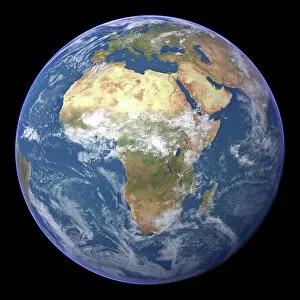
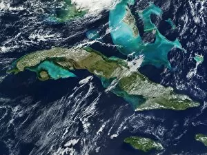
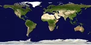
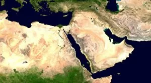
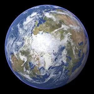
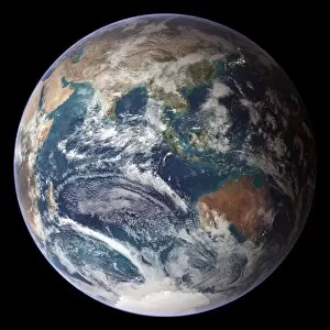
The spectroradiometer, a powerful tool used to measure the electromagnetic radiation in different wavelengths, has revolutionized our understanding of the world. From Africa to Cuba, from the Middle East to the Arctic, this device has provided us with invaluable insights into our planet. Satellite images captured by spectroradiometers have allowed us to observe and analyze various phenomena across the globe. Whether it is studying the vast landscapes of Africa or monitoring changes in Cuba's ecosystem, these images provide a comprehensive view of our Earth. In one image, we witness the breathtaking beauty of a whole Earth map taken by a spectroradiometer. This awe-inspiring snapshot showcases our planet's diverse topography and reminds us of its interconnectedness. Moving towards colder regions, satellite images reveal the winter sea ice in the east Siberian Sea. The true-color imagery obtained through moderate resolution imaging allows scientists to monitor changes in this crucial region and understand its impact on global climate patterns. Further westward lies Nelson River and Hudson Bay - both vividly depicted in an image from true-color moderate resolution imaging. These snapshots help researchers study water bodies' health and track any potential environmental shifts that may occur within them. As we shift southwards, we catch a glimpse of Gulf of Mexico's vibrant hues through moderate resolution imaging spectroradiometer's lens. This technology enables experts to monitor oceanic conditions and detect any anomalies that might affect marine life or coastal communities. Spectroradiometers also play a vital role in tracking severe weather events such as Typhoon Saomai and tropical storm Bopha or Hurricane Frances. By analyzing their spectral signatures, meteorologists can better predict their paths and intensity – potentially saving lives through early warnings. Additionally, these devices aid firefighters battling Australian bushfires by detecting smoke plumes using advanced spectral analysis techniques. Such information helps authorities strategize firefighting efforts more effectively while safeguarding lives and ecosystems alike. Finally, let's not forget the spectroradiometer's contribution in monitoring Tropical Storm Lane.