
Moderate Resolution Imaging Collection
"Unveiling the World's Secrets: Moderate Resolution Imaging Captures Earth's Marvels" From the vast plains of Africa to the vibrant landscapes of Cuba


All Professionally Made to Order for Quick Shipping
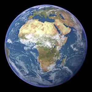
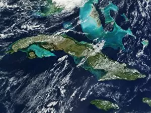
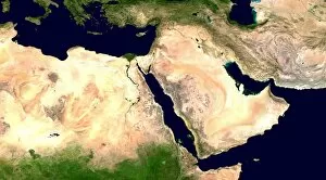
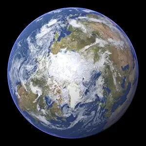
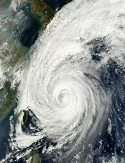
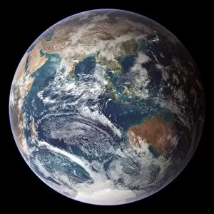
"Unveiling the World's Secrets: Moderate Resolution Imaging Captures Earth's Marvels" From the vast plains of Africa to the vibrant landscapes of Cuba, and from the enigmatic Middle East to the devastating aftermath of Typhoon Tokage, it has revolutionized our understanding of our planet. With its powerful satellite images, this technology allows us to witness nature's fury firsthand. In a remote corner of The Arctic, a satellite image reveals an icy wonderland where polar bears roam freely amidst frozen tundras. Meanwhile, in Southeast Asia, Typhoon Saomai and tropical storm Bopha leave behind trails of destruction that serve as reminders of nature's unpredictable force. As Hurricane Frances unleashes its wrath upon coastal regions, moderate resolution imaging provides invaluable insights into its path and intensity. In Australia, thick smoke billows across the sky as bushfires ravage through forests—a haunting reminder of climate change’s impact on our fragile ecosystems. Tropical Storm Lane churns in Pacific waters while tropical cyclones dance their deadly waltz elsewhere—moderate resolution imaging captures these swirling tempests with astonishing clarity. Over Canary Islands, a sandstorm engulfs everything in sight—an awe-inspiring spectacle captured by satellites high above. Meanwhile, forest fires rage across South America; moderate resolution imaging exposes their magnitude and devastation from above. These images serve as a call to action for conservation efforts worldwide. Moderate resolution imaging is not just about capturing breathtaking visuals; it is about understanding our planet better than ever before. It enables scientists and researchers to study weather patterns more accurately and aids governments in disaster response planning. With each new image captured by this remarkable technology comes greater knowledge about our world—its beauty but also its vulnerabilities. Moderate resolution imaging acts as a bridge between humanity and Mother Nature herself—a tool that empowers us to protect what we hold dear: our planet Earth.