
Continental Shelf Collection
The continental shelf, a fascinating feature of our Earth's topography and bathymetry, is a subject that never fails to captivate the curious minds


All Professionally Made to Order for Quick Shipping
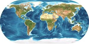
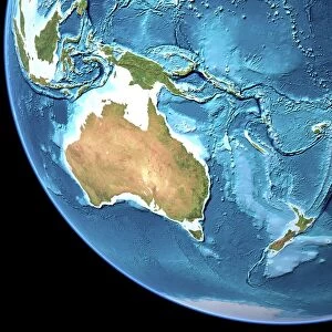
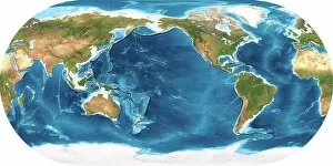
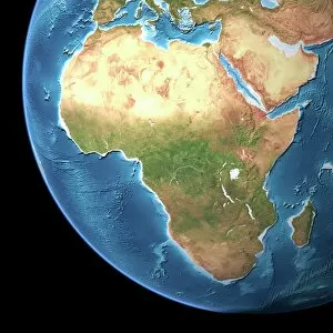
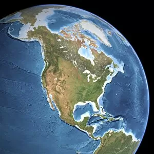
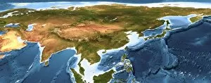
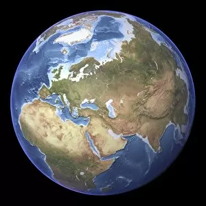
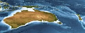
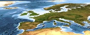
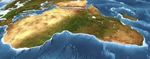
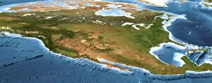
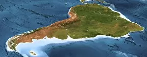
The continental shelf, a fascinating feature of our Earth's topography and bathymetry, is a subject that never fails to captivate the curious minds. From the vast expanses of Australia's topographic map to the intricate details on Africa's terrain, these maps provide us with a glimpse into the diverse landscapes that make up our planet. As we explore Earth through its topographic and bathymetric maps, we uncover hidden treasures beneath the ocean's surface. The continental shelf extends from each continent's shoreline before gradually descending into deeper waters, and is an underwater extension of the landmasses we tread upon. In Asia, breathtaking 3D artwork showcases this phenomenon in all its glory. With meticulous precision and artistic flair, it highlights how continents seamlessly merge with their submerged counterparts. Similarly, Europe’s captivating 3D artwork reveals an enchanting world where land meets sea in perfect harmony. Moving across North America and Eurasia, we witness the intricate patterns etched onto their respective topographic maps. These visual representations remind us of nature's remarkable ability to shape our surroundings over millions of years. Australia and New Zealand come alive through another stunning piece of 3D artwork. This masterpiece captures not only their unique geographical features but also showcases how they are connected by an expansive continental shelf beneath azure waters. Africa takes center stage once again as its vibrant 3D artwork unveils a tapestry of colors representing both land and sea. It serves as a reminder that even within this vast continent lies hidden beauty waiting to be discovered below its coastal shores. The continental shelf holds immense ecological significance as well; it provides vital habitats for countless marine species while also serving as potential sources for valuable resources such as oil and gas deposits. So next time you gaze at Earth’s magnificent landscapes or delve into detailed maps depicting its contours – whether it be Australia’s sprawling coastlines or Africa’s majestic shores – take a moment to appreciate the wonders lying beneath the surface.