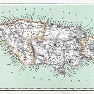
Home > North America > Jamaica > Maps
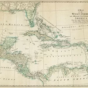
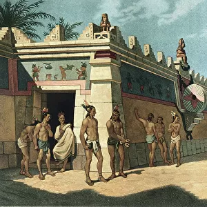
Map of Mexico and the Gulf of Mexico during the debarkage of Hernan Cortes (Fernando Cortes Monroy Pizarro Altamirano, 1485-1547, Spanish conquistador), 1519. Color lithography, 19th century
, 1519. Color lithography, 19th century")
![]()
Wall Art and Photo Gifts from Fine Art Finder
Map of Mexico and the Gulf of Mexico during the debarkage of Hernan Cortes (Fernando Cortes Monroy Pizarro Altamirano, 1485-1547, Spanish conquistador), 1519. Color lithography, 19th century
NWI4850926 Map of Mexico and the Gulf of Mexico during the debarkage of Hernan Cortes (Fernando Cortes Monroy Pizarro Altamirano, 1485-1547, Spanish conquistador), 1519. Color lithography, 19th century.; (add.info.: Map of Mexico and the Gulf of Mexico during the debarkage of Hernan Cortes (Fernando Cortes Monroy Pizarro Altamirano, 1485-1547, Spanish conquistador), 1519. Color lithography, 19th century.); Photo © North Wind Pictures
Media ID 38266650
© © North Wind Pictures / Bridgeman Images
Caribbean Central America Conquistador Cortes Cortez Cuba Cuban Jamaica Jamaican Geographical Map
FEATURES IN THESE COLLECTIONS
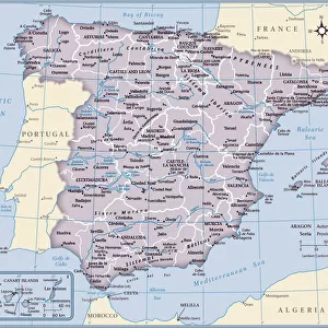
> Europe
> Spain
> Related Images
> Fine Art Finder
> Artists
> Artist Unknown
> Maps and Charts
> Related Images
> Maps and Charts
> Spain
> North America
> Cuba
> Maps
> North America
> Cuba
> Related Images
> North America
> Jamaica
> Maps
> North America
> Jamaica
> Related Images
EDITORS COMMENTS
This stunning color lithograph captures a pivotal moment in history - the debarkage of Hernan Cortes in Mexico in 1519. The map shows Mexico and the Gulf of Mexico as they would have appeared during this significant event, with intricate details that bring to life the landscape that Cortes and his men encountered.
Hernan Cortes, a Spanish conquistador known for his conquest of the Aztec Empire, is depicted here at a crucial point in his journey. As he set foot on Mexican soil, little did he know the impact his actions would have on the course of history.
The vibrant colors and detailed illustrations on this 19th-century print make it a captivating piece of art that not only showcases geographical features but also tells a story of exploration, colonialism, and conquest. From Cuba to Jamaica, from Europe to North America, this map highlights the interconnectedness of different regions during this era of discovery.
As we gaze upon this historical artifact, we are reminded of the bravery and ambition of explorers like Cortes who ventured into unknown territories in search of glory and riches. This map serves as a window into the past, allowing us to glimpse moments that shaped our world today.
MADE IN THE USA
Safe Shipping with 30 Day Money Back Guarantee
FREE PERSONALISATION*
We are proud to offer a range of customisation features including Personalised Captions, Color Filters and Picture Zoom Tools
SECURE PAYMENTS
We happily accept a wide range of payment options so you can pay for the things you need in the way that is most convenient for you
* Options may vary by product and licensing agreement. Zoomed Pictures can be adjusted in the Cart.