Home > Europe > United Kingdom > England > Maps
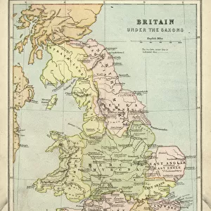
1737 Homann Heirs Map Of New England Georgia And Carolina

![]()
Wall Art and Photo Gifts from Universal Images Group (UIG)
1737 Homann Heirs Map Of New England Georgia And Carolina
1737, Homann Heirs Map of New England, Georgia and Carolina, and Virginia and Maryland
Universal Images Group (UIG) manages distribution for many leading specialist agencies worldwide
Media ID 38547897
© Artokoloro Quint Lox Limited
1737 Antique Map Latitude Longitude Mappa Mundi Old Antique Plan Old Antique View Ols Antique Map Rare Old Maps Topo
FEATURES IN THESE COLLECTIONS
> Asia
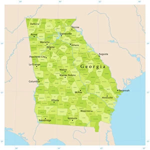
> Georgia
> Related Images
> Europe
> France
> Canton
> Landes
> Europe
> United Kingdom
> England
> Maps
> Historic
> Space exploration
> Maps and Charts
> Early Maps
> Maps and Charts
> Related Images
> Maps and Charts
> World
> Universal Images Group (UIG)
> History
> Historical Maps
EDITORS COMMENTS
Step back in time to the 18th century with this stunning print of the Homann Heirs Map of New England, Georgia and Carolina (1737). This exquisite map is a testament to the cartographic skills of Johann Baptist Homann's heirs, who meticulously detailed the geography and topography of these regions. The intricate illustration features lush forests, winding rivers, and rolling hills, giving us a glimpse into the natural beauty of America during this period.
The map also showcases the early settlements and trading routes that crisscrossed these territories. Note the presence of Native American tribes' lands, as well as European colonies like Virginia and Maryland. This historic document not only provides valuable insight into colonial-era exploration but also serves as a beautiful piece of art for any history enthusiast or collector.
Printed on high-quality paper, this vintage map is sure to be a treasured addition to any room. Its aged appearance adds an air of nostalgia and sophistication, making it perfect for framing or displaying proudly on your wall. Take a journey through time with this remarkable piece from Universal Images Group (UIG) - a true gem for anyone fascinated by cartography, geography, or historical discovery.
MADE IN THE USA
Safe Shipping with 30 Day Money Back Guarantee
FREE PERSONALISATION*
We are proud to offer a range of customisation features including Personalised Captions, Color Filters and Picture Zoom Tools
SECURE PAYMENTS
We happily accept a wide range of payment options so you can pay for the things you need in the way that is most convenient for you
* Options may vary by product and licensing agreement. Zoomed Pictures can be adjusted in the Cart.