Fraud Blocker Skip to main content

Home > Maps and Charts > Poland

Poland Collection (#4)

Poland is a country located in Central Europe, bordered by Germany to the west, the Czech Republic and Slovakia to the south, Ukraine and Belarus to the east

249 Items

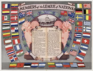
Background imagePoland Collection: Members of the League of Nations (colour litho)

Members of the League of Nations (colour litho)
7163177 Members of the League of Nations (colour litho) by English School, (20th century); Private Collection; (add.info.: Members of the League of Nations)

Background imagePoland Collection: City of Gdansk or Danzig Poland 1897

City of Gdansk or Danzig Poland 1897
Danzig map city Germany now Poland 1897 The Free City of Danzig (German: Freie Stadt Danzig; Polish: Gdańsk) was a semi-autonomous city-state that existed between 1920 and 1939

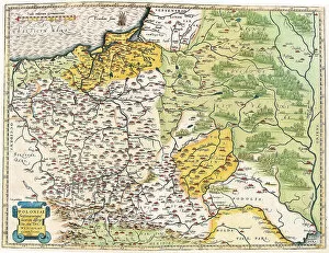
Background imagePoland Collection: Map of Poland, 1570 (engraving)

Map of Poland, 1570 (engraving)
LRI4704888 Map of Poland, 1570 (engraving) by Ortelius, Abraham (1527-98); Museo Navale di Pegli, Genoa, Italy; (add.info.: Poloniae finitimarumque locorum descriptio)

Background imagePoland Collection: Poznan and Krosno, Poland (engraving, 1572-1617)

Poznan and Krosno, Poland (engraving, 1572-1617)
LRI4716404 Poznan and Krosno, Poland (engraving, 1572-1617) by Braun, Georg (1541-1622) and Hogenberg, Franz (1535-90); Private Collection; (add.info.: Poznan and Krosno)

Background imagePoland Collection: Wroclaw, Poland, 1588 (engraving, 1572-1617)

Wroclaw, Poland, 1588 (engraving, 1572-1617)
LRI4714541 Wroclaw, Poland, 1588 (engraving, 1572-1617) by Hogenberg, Franz (1540-c.1590); Private Collection; (add.info.: Wratislavia (Wroclaw, Poland)

Background imagePoland Collection: Szczecin, Poland (engraving, 1588)

Szczecin, Poland (engraving, 1588)
LRI4714521 Szczecin, Poland (engraving, 1588) by Hogenberg, Franz (1540-c.1590); Private Collection; (add.info.: Alten Stettin (Szczecin)

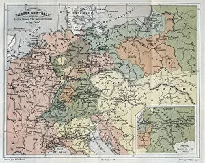
Background imagePoland Collection: Central Europe showing the historic sites and battlefields of 1792-1813 - Central Europe

Central Europe showing the historic sites and battlefields of 1792-1813 - Central Europe
XEE4154372 Central Europe showing the historic sites and battlefields of 1792-1813 - Central Europe indicating historic sites

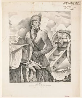
Background imagePoland Collection: Thaddeus Kosciuszko, the friend of Washington, 1839 (litho)

Thaddeus Kosciuszko, the friend of Washington, 1839 (litho)
5853976 Thaddeus Kosciuszko, the friend of Washington, 1839 (litho) by Girard, A. (fl.1839); Private Collection; (add.info)

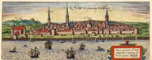
Background imagePoland Collection: Riga, Latvia (colour litho)

Riga, Latvia (colour litho)
2901917 Riga, Latvia (colour litho) by German School, (17th century); Private Collection; (add.info.: Inhabited by early Baltic tribes; settled by German merchants in 1158; Bishop Albert - of Livonia)

Background imagePoland Collection: Picture of Europe for July 1772, c. 1772 (engraving)

Picture of Europe for July 1772, c. 1772 (engraving)
2562139 Picture of Europe for July 1772, c.1772 (engraving) by English School, (18th century); Private Collection; (add.info)

Background imagePoland Collection: Map of Silesia, from an Atlas (colour litho)

Map of Silesia, from an Atlas (colour litho)
CHT212755 Map of Silesia, from an Atlas (colour litho) by Seutter, Georg MatthAaus (1678-1757); Bibliotheque des Arts Decoratifs, Paris, France; eArchives Charmet; German, out of copyright

Background imagePoland Collection: Gustave II Adolphe, dit le Grand ou le lion du Nord (1594-1632), roi de Suede

Gustave II Adolphe, dit le Grand ou le lion du Nord (1594-1632), roi de Suede
FIA5396803 Gustave II Adolphe, dit le Grand ou le lion du Nord (1594-1632), roi de Suede, chevauchant la carte de Pomeranie - Gustavus Adolphus before the map of Pomerania in the background

Background imagePoland Collection: The Third Partition of Poland, 1795 par Thomson, John (1777-c. 1840)

The Third Partition of Poland, 1795 par Thomson, John (1777-c. 1840)
FIA5405757 The Third Partition of Poland, 1795 par Thomson, John (1777-c. 1840). Etching, watercolour, 1814, Private Collection by Thomson

Background imagePoland Collection: Map of south of Frankfurt in Germany near Poland, 1570 (engraving)

Map of south of Frankfurt in Germany near Poland, 1570 (engraving)
LRI4704606 Map of south of Frankfurt in Germany near Poland, 1570 (engraving) by Ortelius, Abraham (1527-98); Museo Navale di Pegli, Genoa

Background imagePoland Collection: Map of northern Poland with the city of Dantzig, 1570 (engraving)

Map of northern Poland with the city of Dantzig, 1570 (engraving)
LRI4704540 Map of northern Poland with the city of Dantzig, 1570 (engraving) by Ortelius, Abraham (1527-98); Museo Navale di Pegli, Genoa, Italy; (add.info.: Thietmarsiae)

Background imagePoland Collection: Kalwarya Zebrzydowka (southeast of Cracow), Poland (engraving, 1572-1617)

Kalwarya Zebrzydowka (southeast of Cracow), Poland (engraving, 1572-1617)
LRI4716382 Kalwarya Zebrzydowka (southeast of Cracow), Poland (engraving, 1572-1617) by Braun, Georg (1541-1622) and Hogenberg

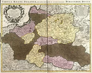
Background imagePoland Collection: Map of the Kingdom of Poland with the Duke of Lithuania (etching, 1730)

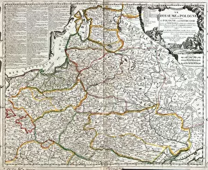
Map of the Kingdom of Poland with the Duke of Lithuania (etching, 1730)
LRI4706592 Map of the Kingdom of Poland with the Duke of Lithuania (etching, 1730) by Delisle, Guillaume (1675-1726); Private Collection; (add.info)

Background imagePoland Collection: Map of WRATISLAVA Bresslaw, from Civitates Orbis Terrarum

Map of WRATISLAVA Bresslaw, from Civitates Orbis Terrarum
STC138988 Map of WRATISLAVA Bresslaw, from Civitates Orbis Terrarum by Georg Braun (1541-1622) and Frans Hogenberg (1535-90) c.1572-1617 (coloured engraving) by Hoefnagel

Background imagePoland Collection: Map of Zamosc, from Civitates Orbis Terrarum by Georg Braun (1541-1622

Map of Zamosc, from Civitates Orbis Terrarum by Georg Braun (1541-1622
STC138958 Map of Zamosc, from Civitates Orbis Terrarum by Georg Braun (1541-1622) and Frans Hogenberg (1535-90) c.1572-1617 (coloured engraving) by Hoefnagel

Background imagePoland Collection: Nicolaus Copernicus (1473-1543) the Astronomer (oil on cardboard)

Nicolaus Copernicus (1473-1543) the Astronomer (oil on cardboard)
MNK129602 Nicolaus Copernicus (1473-1543) the Astronomer (oil on cardboard) by Matejko, Jan (1838-93); 41.5x52.5 cm; National Museum in Cracow

Background imagePoland Collection: The Holy Spirit with a Model of Ptolemys World, 1610 (oil on panel)

The Holy Spirit with a Model of Ptolemys World, 1610 (oil on panel)
NMG146017 The Holy Spirit with a Model of Ptolemys World, 1610 (oil on panel) by Han, Hermann (1574-1627/8); 122x87 cm; Muzeum Narodowe, Gdansk

Background imagePoland Collection: WW1 - The Enemys Eastern Frontier - 1914

WW1 - The Enemys Eastern Frontier - 1914
WW1 - The Enemys Eastern Frontier - The Splendid work of Russian Strategy. Pictorial map showing the strategy of Russian Commanders

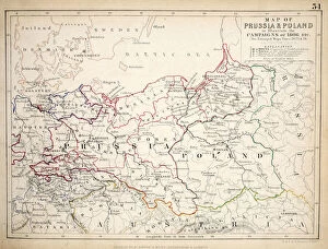
Background imagePoland Collection: Map of Prussia and Poland, published by William Blackwood and Sons, Edinburgh & London

Map of Prussia and Poland, published by William Blackwood and Sons, Edinburgh & London
746910 Map of Prussia and Poland, published by William Blackwood and Sons, Edinburgh & London, 1848 (hand-coloured engraving) by Johnston

Background imagePoland Collection: What we are to lose!, 1919 (colour litho)

What we are to lose!, 1919 (colour litho)
697899 What we are to lose!, 1919 (colour litho) by Oppenheim, Louis (1879-1936); Private Collection; (add.info.: Poster shows a picture graph of what Germany will lose if Silesia becomes part of)

Background imagePoland Collection: Map of the Kingdom of Poland, Duches of Lithuania and Livonia (Latvia) (Baltic Countries

Map of the Kingdom of Poland, Duches of Lithuania and Livonia (Latvia) (Baltic Countries
LRI4710568 Map of the Kingdom of Poland, Duches of Lithuania and Livonia (Latvia) (Baltic Countries) and Ukraine (etching, 1671) by Wit

Background imagePoland Collection: Poland (engraving, 1596)

Poland (engraving, 1596)
LRI4718165 Poland (engraving, 1596) by Mercator, Gerardus (1512-94); Private Collection; (add.info.: Polonia and Silesia, 1608)

Background imagePoland Collection: Antique map of Poland - today Lithuania (engraving, 1596)

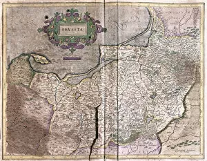
Antique map of Poland - today Lithuania (engraving, 1596)
LRI4716948 Antique map of Poland - today Lithuania (engraving, 1596) by Mercator, Gerardus (1512-94); Private Collection; (add.info.: Prussia)

Background imagePoland Collection: Map of Poznan and Gruczno, from Civitates Orbis Terrarum

Map of Poznan and Gruczno, from Civitates Orbis Terrarum
STC138953 Map of Poznan and Gruczno, from Civitates Orbis Terrarum by Georg Braun (1541-1622) and Frans Hogenberg (1535-90) c.1572-1617 (coloured engraving) by Hoefnagel

Background imagePoland Collection: Allegorie du partage de la Pologne entre Catherine II de Russie (1729-1796)

Allegorie du partage de la Pologne entre Catherine II de Russie (1729-1796)
FIA5402787 Allegorie du partage de la Pologne entre Catherine II de Russie (1729-1796), Stanislas II Augustus (Stanislaw August Poniatowski, 1732-1798)

Background imagePoland Collection: Plate from Memoirs and travels of Mauritius Augustus Count de Benyowsky (engraving)

Plate from Memoirs and travels of Mauritius Augustus Count de Benyowsky (engraving)
979811 Plate from Memoirs and travels of Mauritius Augustus Count de Benyowsky (engraving) by English School, (18th century); Private Collection; (add.info.: Plans of the Battle of Lelki)

Background imagePoland Collection: The Partition of Poland, 1772 (engraving)

The Partition of Poland, 1772 (engraving)
972692 The Partition of Poland, 1772 (engraving) by French School, (19th century); Private Collection; (add.info.: The Partition of Poland, 1772)

Background imagePoland Collection: The plan for the partition of Poland, 1772 (chromolitho)

The plan for the partition of Poland, 1772 (chromolitho)
1093450 The plan for the partition of Poland, 1772 (chromolitho) by French School, (19th century); Private Collection; (add.info.: The plan for the partition of Poland, 1772)

Background imagePoland Collection: Map of independent Poland with portrait of its president Jozef (Joseph

Map of independent Poland with portrait of its president Jozef (Joseph
XEE4188278 Map of independent Poland with portrait of its president Jozef (Joseph) Klemens Pilsudski (1867-1935) and the coat of arms

Background imagePoland Collection: Zamosc, Poland (engraving, 1572-1617)

Zamosc, Poland (engraving, 1572-1617)
LRI4716494 Zamosc, Poland (engraving, 1572-1617) by Braun, Georg (1541-1622) and Hogenberg, Franz (1535-90); Private Collection; (add.info.: Zamosc, Poland - Zamoscium, nova Poloniae (Zamosc)

Background imagePoland Collection: Map of the Duke of Pomerania (Poland) (etching, 1671)

Map of the Duke of Pomerania (Poland) (etching, 1671)
LRI4710182 Map of the Duke of Pomerania (Poland) (etching, 1671) by Wit, Frederick de (1630-1706); Private Collection; (add.info)

Background imagePoland Collection: Lowicz, Poland (engraving, 1572-1617)

Lowicz, Poland (engraving, 1572-1617)
LRI4716461 Lowicz, Poland (engraving, 1572-1617) by Braun, Georg (1541-1622) and Hogenberg, Franz (1535-90); Private Collection; (add.info.: Lowicz)

Background imagePoland Collection: Germany, Czechoslovakia and Poland (engraving, 1596)

Germany, Czechoslovakia and Poland (engraving, 1596)
LRI4718057 Germany, Czechoslovakia and Poland (engraving, 1596) by Mercator, Gerardus (1512-94); Private Collection; (add.info.: Saxoniae superioris Lusatiae Misniaeque descriptio, 1610: Germany)

Background imagePoland Collection: Swiebodzin, Poland (engraving, 1598)

Swiebodzin, Poland (engraving, 1598)
LRI4715538 Swiebodzin, Poland (engraving, 1598) by Hogenberg, Franz (1540-c.1590); Private Collection; (add.info.: The Stat Swybuschin in Nider Schlesien (Swiebodzin)

Background imagePoland Collection: detail of the King of Poland from a Renaissance map of Europe, Jacopo Russo (after), 1528

detail of the King of Poland from a Renaissance map of Europe, Jacopo Russo (after), 1528
2910984 detail of the King of Poland from a Renaissance map of Europe, Jacopo Russo (after), 1528 by Russo, Jacopo (15th century); (add.info.: Renaissance map of Europe, Jacopo Russo, 1528)

Background imagePoland Collection: Map of Cracow, from Civitates Orbis Terrarum by Georg Braun (1541-1622

Map of Cracow, from Civitates Orbis Terrarum by Georg Braun (1541-1622
STC121015 Map of Cracow, from Civitates Orbis Terrarum by Georg Braun (1541-1622) and Frans Hogenberg (1535-90), c.1572 (coloured engraving) by Hoefnagel

Background imagePoland Collection: Map of Warsaw, from Civitates Orbis Terrarum by Georg Braun (1541-1622

Map of Warsaw, from Civitates Orbis Terrarum by Georg Braun (1541-1622
CHT293685 Map of Warsaw, from Civitates Orbis Terrarum by Georg Braun (1541-1622) and Frans Hogenberg (1535-90), 1599 (coloured engraving) by Hoefnagel

Background imagePoland Collection: Map of Lublin, from Civitates Orbis Terrarum by Georg Braun (1541-1622

Map of Lublin, from Civitates Orbis Terrarum by Georg Braun (1541-1622
STC138952 Map of Lublin, from Civitates Orbis Terrarum by Georg Braun (1541-1622) and Frans Hogenberg (1535-90) c.1572-1617 (coloured engraving) by Hoefnagel

Background imagePoland Collection: Map of Warsaw, from Civitates Orbis Terrarum by Georg Braun (1541-1622

Map of Warsaw, from Civitates Orbis Terrarum by Georg Braun (1541-1622
STC138928 Map of Warsaw, from Civitates Orbis Terrarum by Georg Braun (1541-1622) and Frans Hogenberg (1535-90) c.1572-1617 (coloured engraving) by Hoefnagel

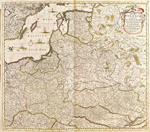
Background imagePoland Collection: Map of Poland and Lithuania (Engraving, 1717)

Map of Poland and Lithuania (Engraving, 1717)
LRI4712502 Map of Poland and Lithuania (Engraving, 1717) by Nolin, Jean-Baptiste (c.1657-1708); Private Collection; (add.info)

Background imagePoland Collection: Charity of Emperor Napoleon I (1769-1821) during the Polish campaign in January 1807

Charity of Emperor Napoleon I (1769-1821) during the Polish campaign in January 1807
JLJ4654342 Charity of Emperor Napoleon I (1769-1821) during the Polish campaign in January 1807: Emperor giving a pension of a hundred napoleons to Nerocki

Background imagePoland Collection: View of Dantzig (Gedanum) (present-day Gdansk), Poland (etching, 1572-1617)

View of Dantzig (Gedanum) (present-day Gdansk), Poland (etching, 1572-1617)
LRI4707383 View of Dantzig (Gedanum) (present-day Gdansk), Poland (etching, 1572-1617) by Hogenberg, Franz (1540-c.1590); Private Collection; (add.info)

Background imagePoland Collection: Map of Moscow (Russia), the Kingdom of Sweden, the Baltic Provinces and Part of Poland

Map of Moscow (Russia), the Kingdom of Sweden, the Baltic Provinces and Part of Poland
LRI4711219 Map of Moscow (Russia), the Kingdom of Sweden, the Baltic Provinces and Part of Poland (etching, 1717) by Nolin

Background imagePoland Collection: Map of Germania (Holy Empire), 1570 (engraving)

Map of Germania (Holy Empire), 1570 (engraving)
LRI4704403 Map of Germania (Holy Empire), 1570 (engraving) by Ortelius, Abraham (1527-98); Museo Navale di Pegli, Genoa, Italy; (add.info)


All Professionally Made to Order for Quick Shipping


-

Poland Collection

Poland is a country located in Central Europe, bordered by Germany to the west, the Czech Republic and Slovakia to the south, Ukraine and Belarus to the east, and Lithuania and Russia to the northeast. The country has a population of over 38 million people with Warsaw as its capital city. Poland's economy is one of the fastest-growing in Europe due to its skilled workforce, strategic location, and diversified industries such as agriculture, manufacturing, and services. The country also boasts numerous natural attractions including mountains, forests, lakes, rivers which make it an ideal destination for tourists seeking adventure or relaxation. Maps and charts are useful tools for navigating Poland's diverse landscapes while exploring its rich cultural heritage.
+

Our beautiful Wall Art and Photo Gifts include Framed Prints, Photo Prints, Poster Prints, Canvas Prints, Jigsaw Puzzles, Metal Prints and so much more

The Poland collection from Media Storehouse is a stunning compilation of vintage maps and charts that showcase the rich history, culture, and geography of Poland. Our collection features a wide range of maps and charts dating back to the 16th century, including detailed topographical maps, city plans, historical maps, and nautical charts. Each map or chart in our collection has been carefully selected for its artistic value as well as its historical significance. They are printed on high-quality paper using state-of-the-art printing technology to ensure that every detail is captured with precision. Whether you're looking to decorate your home or office with unique wall art or searching for an educational resource for students studying Polish history or geography, our collection offers something for everyone. From intricate city plans of Warsaw to colorful regional maps depicting the diverse landscapes of Poland's countryside, these prints are sure to impress anyone who appreciates fine art and cultural heritage.
+

What are Poland (Maps and Charts) art prints?

Poland art prints are a collection of high-quality, visually stunning prints that showcase the beauty and history of Poland. These prints feature detailed maps and charts that depict various regions, cities, landmarks, and historical events in Poland. They are perfect for anyone who loves Polish culture or wants to learn more about this fascinating country. The Poland art prints come in a variety of sizes and styles to suit any taste or decor. Whether you prefer vintage-style maps or modern abstract designs, there is something for everyone in this collection. These art prints are printed on premium quality paper using state-of-the-art printing technology to ensure vibrant colors and sharp details. They make great gifts for friends or family members who have an interest in Polish history or geography. If you're looking for beautiful artwork that celebrates the rich heritage of Poland, then the Poland art print collection is definitely worth checking out.
+

What Poland (Maps and Charts) art prints can I buy from Media Storehouse?

We offer a wide variety of Poland Maps and Charts art prints that are perfect for adding a touch of history and culture to your home or office decor. From vintage maps dating back centuries, to modern-day charts showcasing the country's topography, we have something for everyone. Some popular options include antique maps featuring the cities of Warsaw and Krakow, as well as detailed charts highlighting the natural beauty of Poland's forests, lakes, and mountains. Additionally, there are prints available that showcase important moments in Polish history such as the Battle of Grunwald or the Solidarity movement. Whether you're looking to add some historical flair to your living room or want to show off your love for all things Polish in your office space, we have plenty of options available. With high-quality printing techniques used on premium materials like fine art paper or canvas, these prints will be sure to impress anyone who sees them.
+

How do I buy Poland (Maps and Charts) art prints?

To purchase Poland art prints from Media Storehouse, you can browse our extensive collection of high-quality images online. Once you have found the print that you would like to purchase, simply select the size and framing options that suit your needs. We offer a range of different sizes for their art prints, so you can choose the perfect dimensions for your space. We also offer a variety of framing options to complement your decor style. Once you have made your selections, add the item to your cart and proceed to checkout. You will be prompted to enter your shipping information and payment details before completing your order. Buying Poland art prints from Media Storehouse is a simple process that allows you to bring beautiful artwork into your home or office with ease.
+

How much do Poland (Maps and Charts) art prints cost?

We offer a wide range of Poland art prints at varying prices. Our collection includes high-quality reproductions of vintage maps and charts that showcase the rich history and culture of Poland. The cost of each print depends on factors such as size, framing options, and printing materials. We take pride in providing our customers with affordable yet premium-quality art prints that are perfect for home or office decor. Whether you're looking to add a touch of elegance to your living space or want to give a unique gift to someone special, our Poland art prints are an excellent choice. Our team is committed to delivering exceptional customer service and ensuring that every purchase meets your expectations. So if you're interested in purchasing one of our beautiful Poland art prints, please browse through our collection today.
+

How will my Poland (Maps and Charts) art prints be delivered to me?

We take great care in delivering your Poland art prints to you. We use high-quality packaging materials to ensure that your print is protected during transit. Depending on the size of your order, we may ship it flat or rolled in a sturdy tube. When you receive your package, please inspect it carefully for any damage that may have occurred during shipping. If there are any issues with your order, please contact us immediately so we can assist you. We offer worldwide delivery options for our customers' convenience. Our team works hard to ensure that all orders are processed and shipped as quickly as possible. Please note that delivery times may vary depending on the destination country and shipping method selected at checkout. We hope you enjoy displaying your Poland art prints in your home or office.