Fraud Blocker Skip to main content

Home > Maps and Charts > Italy

Italy Collection (#6)

Italy is a country located in southern Europe, bordered by the Mediterranean Sea to the south and surrounded by several other countries including France

3,124 Items

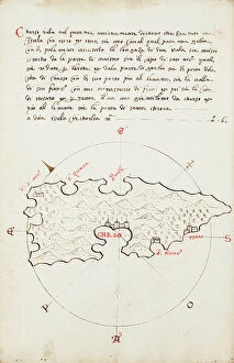
Background imageItaly Collection: Symi, cartographic survey of the Greek island, with handwritten notes on vellum

Symi, cartographic survey of the Greek island, with handwritten notes on vellum
MMM5474161 Symi, cartographic survey of the Greek island, with handwritten notes on vellum by Buondelmonti, Cristoforo (1385-1430); National Maritime Museum, London, UK; (add.info.: Symi)

Background imageItaly Collection: Pagoda of Chidambaram, Hindu temple, with illustration of the gopuram tower

Pagoda of Chidambaram, Hindu temple, with illustration of the gopuram tower and plan of the central structure
FLO4623824 Pagoda of Chidambaram, Hindu temple, with illustration of the gopuram tower and plan of the central structure. Handcoloured copperplate drawn

Background imageItaly Collection: Plan of the volcano Mt. Vesuvius after an eruption, and path of lava flow through Torre del Greco

Plan of the volcano Mt. Vesuvius after an eruption, and path of lava flow through Torre del Greco, Naples
FLO4574376 Plan of the volcano Mt. Vesuvius after an eruption, and path of lava flow through Torre del Greco, Naples. Handcoloured copperplate engraving from Bertuch's " Bilderbuch fur

Background imageItaly Collection: Geography map: representation of the Bay of Mexico, South Florida

Geography map: representation of the Bay of Mexico, South Florida and Yucatan in North America from an Atlas made by
VEN5030467 Geography map: representation of the Bay of Mexico, South Florida and Yucatan in North America from an Atlas made by the Italian cartographer Antonio Francesco Lucini (born 1605)

Background imageItaly Collection: Portrait of Luigi Ferdinando Marsili (1658-1730) Italian oceanographer

Portrait of Luigi Ferdinando Marsili (1658-1730) Italian oceanographer. Anonymous painting of the 18th century
VEN5027933 Portrait of Luigi Ferdinando Marsili (1658-1730) Italian oceanographer. Anonymous painting of the 18th century

Background imageItaly Collection: Architecture: plan for the project of the Mesola, fortified fortress of Ferrara

Architecture: plan for the project of the Mesola, fortified fortress of Ferrara, by Bastianino Serlio, 16th century
VEN5028133 Architecture: plan for the project of the Mesola, fortified fortress of Ferrara, by Bastianino Serlio, 16th century

Background imageItaly Collection: Christopher Columbus studies a map in his office in Spain, 15th century

Christopher Columbus studies a map in his office in Spain, 15th century. Colouring engraving of the 19th century
NWI4846345 Christopher Columbus studies a map in his office in Spain, 15th century. Colouring engraving of the 19th century.; (add.info.: Christopher Columbus (Cristoforo Colombo)

Background imageItaly Collection: First World War: France, Patriotic Map showing two French soldiers

First World War: France, Patriotic Map showing two French soldiers and an Italian soldier defending France under
LUX4740649 First World War: France, Patriotic Map showing two French soldiers and an Italian soldier defending France under the leadership of the Republic and his Phrygian cap, 1915

Background imageItaly Collection: Bronze statues of house gods from the Thermae bathhouse at Regio IX, Insula IV, 5

Bronze statues of house gods from the Thermae bathhouse at Regio IX, Insula IV, 5. Chromolithograph by J.G
FLO4687178 Bronze statues of house gods from the Thermae bathhouse at Regio IX, Insula IV, 5. Chromolithograph by J.G. Bach after an illustration by Miss Amy Butts from Emile Presuhn (1844-1878)

Background imageItaly Collection: Floor mosaic from the House of Epigrams, Regio V, Insula 1, 18

Floor mosaic from the House of Epigrams, Regio V, Insula 1, 18. Chromolithograph by Victor Steeger after an
FLO4687154 Floor mosaic from the House of Epigrams, Regio V, Insula 1, 18. Chromolithograph by Victor Steeger after an illustration by Geremia Discanno from Emile Presuhn (1844-1878)

Background imageItaly Collection: Floor mosaic from the new fullonica (fuller's shop), Regio VI, Insula XIV, 21

Floor mosaic from the new fullonica (fuller's shop), Regio VI, Insula XIV, 21
FLO4687150 Floor mosaic from the new fullonica (fuller's shop), Regio VI, Insula XIV, 21. Chromolithograph by Victor Steeger after an illustration by Geremia Discanno from Emile Presuhn (1844-1878)

Background imageItaly Collection: Marble bust of the owner from the House of Vesonius Primus, a fuller

Marble bust of the owner from the House of Vesonius Primus, a fuller. Chromolithograph by Victor Steeger after an
FLO4687114 Marble bust of the owner from the House of Vesonius Primus, a fuller. Chromolithograph by Victor Steeger after an illustration by Geremia Discanno from Emile Presuhn (1844-1878)

Background imageItaly Collection: Fountain from Regio VII.II.45, House of the Bear, Pompeii. Venus reclines above a blue sea of fishes

Fountain from Regio VII.II.45, House of the Bear, Pompeii. Venus reclines above a blue sea of fishes
FLO4686913 Fountain from Regio VII.II.45, House of the Bear, Pompeii. Venus reclines above a blue sea of fishes, with cupids in attendance

Background imageItaly Collection: Curious wall painting in muted colours from the oecus (salon)

Curious wall painting in muted colours from the oecus (salon) of the Casa del Meleagro or the House of Meleager, Reg
FLO4686886 Curious wall painting in muted colours from the oecus (salon) of the Casa del Meleagro or the House of Meleager, Reg. VI, Ins. IX, No. 2

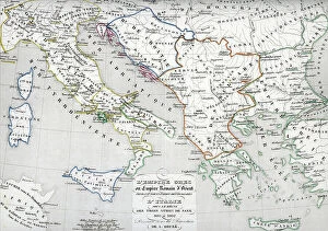
Background imageItaly Collection: Map of the Byzantine Empire during the occupation of Bulgarians and Italy during the reign of Otto I

Map of the Byzantine Empire during the occupation of Bulgarians and Italy during the reign of Otto I
ELD4928012 Map of the Byzantine Empire during the occupation of Bulgarians and Italy during the reign of Otto I, Otto II and Otto III Holy roman emperor

Background imageItaly Collection: First World War: France, Patriotic Map showing four young children in Italian, English

First World War: France, Patriotic Map showing four young children in Italian, English
LUX4738404 First World War: France, Patriotic Map showing four young children in Italian, English, Belgian and Russian soldier uniforms around the French flag

Background imageItaly Collection: First World War: France, Patriotic Map showing the five new nes of five allies under

First World War: France, Patriotic Map showing the five new nes of five allies under the protective leadership of
LUX4738234 First World War: France, Patriotic Map showing the five new nes of five allies under the protective leadership of France, entitled: For Law, for Liberty, Peace through Victory

Background imageItaly Collection: Cosmographia (Geography) by Ptolemy, 1477 (book)

Cosmographia (Geography) by Ptolemy, 1477 (book)
7415661 Cosmographia (Geography) by Ptolemy, 1477 (book); Bibliotheque Nationale, Paris, France; (add.info.: Claude Ptolemy (c.90-168) Cosmographia (Geography) Printed by Dominicus de Lapis Bologna

Background imageItaly Collection: Map of Portoferraio on Elba, c.1790 (manuscript)

Map of Portoferraio on Elba, c.1790 (manuscript)
7339364 Map of Portoferraio on Elba, c.1790 (manuscript) by Unknown artist, (18th century); 66x84 cm; National Maritime Museum, London, UK; (add.info.: Creator: Anonymous Single sheet. Col. ms)

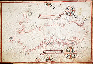
Background imageItaly Collection: Chart of the Mediterrean, showing Italy and the north African coast, 17th century (ink on vellum)

Chart of the Mediterrean, showing Italy and the north African coast, 17th century (ink on vellum)
7339119 Chart of the Mediterrean, showing Italy and the north African coast, 17th century (ink on vellum) by Unknown Artist, (17th century); 76.2x106.7 cm; National Maritime Museum, London

Background imageItaly Collection: Italian patriotic map showing two fighting eagles titled l'ultimo volo, 1914

Italian patriotic map showing two fighting eagles titled l'ultimo volo, 1914
LUX4743844 Italian patriotic map showing two fighting eagles titled l'ultimo volo, 1914; (add.info.: Italian patriotic map showing two fighting eagles titled l'ultimo volo)

Background imageItaly Collection: First World War: Patriotic map showing a bouquet of tricolor flower surrounded by angelot bearing

First World War: Patriotic map showing a bouquet of tricolor flower surrounded by angelot bearing the flags of
LUX4744965 First World War: Patriotic map showing a bouquet of tricolor flower surrounded by angelot bearing the flags of the allies

Background imageItaly Collection: First World War: Patriotic map showing the five flags of the allies with the commentary

First World War: Patriotic map showing the five flags of the allies with the commentary: They are also as many
LUX4744940 First World War: Patriotic map showing the five flags of the allies with the commentary: They are also as many, you will have to count with them

Background imageItaly Collection: Map of Sicily (Italy), during the First Punic War, 264 BC, with the territories of the Roman

Map of Sicily (Italy), during the First Punic War, 264 BC, with the territories of the Roman and Carthaginian empires
NWI4863549 Map of Sicily (Italy), during the First Punic War, 264 BC, with the territories of the Roman and Carthaginian empires, the Mamertines and the Emperor Hieron II (270-215 BC)

Background imageItaly Collection: Map of Italy showing political divisions before the unification of 1797 (Risorgimento)

Map of Italy showing political divisions before the unification of 1797 (Risorgimento). Color lithography
NWI4870950 Map of Italy showing political divisions before the unification of 1797 (Risorgimento). Color lithography.; (add.info)

Background imageItaly Collection: Map of Rome, 1676

Map of Rome, 1676
6116769 Map of Rome, 1676; (add.info.: Map of the centre of Rome, Italy, after a print by Giovanni Battista Falda dated 1676.); Photo © Ken Welsh. All rights reserved 2024

Background imageItaly Collection: Detail of portulan 4 by Augustin Roussin representing the city of Venice. Watercolour from 1630

Detail of portulan 4 by Augustin Roussin representing the city of Venice. Watercolour from 1630
JEB4878522 Detail of portulan 4 by Augustin Roussin representing the city of Venice. Watercolour from 1630. Municipal library of Marseille; (add.info)

Background imageItaly Collection: First World War: Patriotic map showing the five allied armed forces represented by children in

First World War: Patriotic map showing the five allied armed forces represented by children in uniform pose under an
LUX4744153 First World War: Patriotic map showing the five allied armed forces represented by children in uniform pose under an airship balloon called Alsace and entitled Victoire et Liberte

Background imageItaly Collection: Geographic map of the Greek Empire at the time of the Crusades

Geographic map of the Greek Empire at the time of the Crusades and of Italy under the reign of Emperor Frederic I
ELD4924811 Geographic map of the Greek Empire at the time of the Crusades and of Italy under the reign of Emperor Frederic I Barberossa, 1125-1200 (Map of Greek empire and Italy)

Background imageItaly Collection: Section through the Mausoleum of Hadrian in Parco Adriano, Rome, from Bartoli

Section through the Mausoleum of Hadrian in Parco Adriano, Rome, from Bartoli
FLO4679380 Section through the Mausoleum of Hadrian in Parco Adriano, Rome, from Bartoli. Copperplate engraving by Henry Moses from A Collection of Antique Vases, Altars, etc

Background imageItaly Collection: United States, Bomber Pilot's Printed Silk Cloth Map

United States, Bomber Pilot's Printed Silk Cloth Map
3032599 United States, Bomber Pilot's Printed Silk Cloth Map ; Private Collection; (add.info.: World War II, United States, Bomber Pilot's Printed Silk United States Army Air Force)

Background imageItaly Collection: Rome on the Tiber, The Vatican, 1700

Rome on the Tiber, The Vatican, 1700
2900912 Rome on the Tiber, The Vatican, 1700; (add.info.: Rome on the Tiber, The Vatican, 1700.); Buyenlarge Archive/UIG

Background imageItaly Collection: Fortifications at Nice, France, 1700

Fortifications at Nice, France, 1700
2900899 Fortifications at Nice, France, 1700; (add.info.: Throughout the ages the town changed hands many times. Its strategic location and port significantly contributed to its maritime strength)

Background imageItaly Collection: Map of Naples, c.1900 (engraving)

Map of Naples, c.1900 (engraving)
533313 Map of Naples, c.1900 (engraving); (add.info.: Map of Naples, Italy, circa 1902, from the 10th edition of Encyclopaedia Britannica.); Encyclopaedia Britannica/UIG

Background imageItaly Collection: Map of Italy with Sicily and Naples, c.1900 (engraving)

Map of Italy with Sicily and Naples, c.1900 (engraving)
532989 Map of Italy with Sicily and Naples, c.1900 (engraving); (add.info.: Map of central and southern Italy with insets map of Sicily and Naples, circa 1902)

Background imageItaly Collection: Caesar, Gallic War: Ariovisti Clades (litho)

Caesar, Gallic War: Ariovisti Clades (litho)
8636508 Caesar, Gallic War: Ariovisti Clades (litho) by English School, (20th century); Private Collection; (add.info.: Ariovisti Clades)

Background imageItaly Collection: Adriatic chart, c.1620 (vellum)

Adriatic chart, c.1620 (vellum)
7339786 Adriatic chart, c.1620 (vellum) by Unknown Artist, (17th century); 41x60 cm; National Maritime Museum, London, UK; (add.info.: Creator)

Background imageItaly Collection: Chart of Moscow and the Black Sea, 1554 (vellum)

Chart of Moscow and the Black Sea, 1554 (vellum)
7339650 Chart of Moscow and the Black Sea, 1554 (vellum) by Agnese, Battista (c.1500-64); 26x40 cm; National Maritime Museum, London, UK; (add.info.: Creator: Johan B. Agnese Moscaw oder Reuss')

Background imageItaly Collection: Chrso, 1590 (Manuscript)

Chrso, 1590 (Manuscript)
7339637 Chrso, 1590 (Manuscript) by Antonio, Millo (16th century); 31x205 cm; National Maritime Museum, London, UK; (add.info.: Creator: Millo, Antonio Bound sheet. Ms. Additional Places: Cres)

Background imageItaly Collection: Map of Lampedusa, Sicily, 1803 (engraving)

Map of Lampedusa, Sicily, 1803 (engraving)
7339532 Map of Lampedusa, Sicily, 1803 (engraving) by Dalrymple, Alexander (18th-19th century); 48.5x64 cm; National Maritime Museum, London

Background imageItaly Collection: Cosimo I de Medici (Cosimo I de Medici, 1519-1574) planning the conquest of Siena in 1555. Detail

Cosimo I de Medici (Cosimo I de Medici, 1519-1574) planning the conquest of Siena in 1555. Detail
BEN5475972 Cosimo I de Medici (Cosimo I de Medici, 1519-1574) planning the conquest of Siena in 1555. Detail. With a compass and a map on his desk, he is looking for a combat strategy

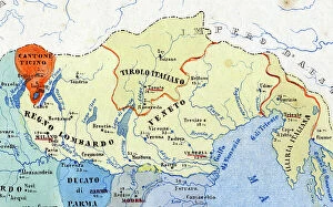
Background imageItaly Collection: Primary cities of Italy, their population and historical division - statistics of the individual

Primary cities of Italy, their population and historical division - statistics of the individual states"
FGL5504190 Primary cities of Italy, their population and historical division - statistics of the individual states", detail of the territories marked in yellow in the eastern part of the north

Background imageItaly Collection: A city in Libya after the Cosmographia of Julius Solinus (14th century). In the middle row

A city in Libya after the Cosmographia of Julius Solinus (14th century). In the middle row
GIA5033683 A city in Libya after the Cosmographia of Julius Solinus (14th century). In the middle row, in the center and on the left you can recognize Sabratha and Leptis Magna.; (add.info)

Background imageItaly Collection: Geography : map representing the Americas with the traces of the voyages of the navigator

Geography : map representing the Americas with the traces of the voyages of the navigator Christopher Columbus to
VEN5031147 Geography : map representing the Americas with the traces of the voyages of the navigator Christopher Columbus to the New World.; (add.info)

Background imageItaly Collection: Frontispice of the atlas ' Theatre of the World' (Theatrum Orbis Terrarum)

Frontispice of the atlas " Theatre of the World" (Theatrum Orbis Terrarum) by Abraham Ortelius (1528-1598)
VEN5030419 Frontispice of the atlas " Theatre of the World" (Theatrum Orbis Terrarum) by Abraham Ortelius (1528-1598), Dutch cartographer in an Italian edition, late 16th century

Background imageItaly Collection: First World War: Patriotic Map showing five young women representing the Allied countries in their

First World War: Patriotic Map showing five young women representing the Allied countries in their symbolic dress
LUX4745083 First World War: Patriotic Map showing five young women representing the Allied countries in their symbolic dress, 1915

Background imageItaly Collection: Geographic map of the French Empire and Kingdom of Italy in 1809

Geographic map of the French Empire and Kingdom of Italy in 1809 (Map of french empire and kingdom of Italy)
ELD4925058 Geographic map of the French Empire and Kingdom of Italy in 1809 (Map of french empire and kingdom of Italy, 1809) Engraving from " Atlas Universel" by Houze

Background imageItaly Collection: Map of the Eastern Empire after the fall of Constantinople by the French Crusaders in 1204

Map of the Eastern Empire after the fall of Constantinople by the French Crusaders in 1204
ELD4927970 Map of the Eastern Empire after the fall of Constantinople by the French Crusaders in 1204 and map of Italy during the Guelphs and Ghibellin fights (Guelfi e ghibellini)


All Professionally Made to Order for Quick Shipping


-

Italy Collection

Italy is a country located in southern Europe, bordered by the Mediterranean Sea to the south and surrounded by several other countries including France, Switzerland, Austria, and Slovenia. The country has a population of approximately 60 million people and its capital city is Rome. Italy is known for its rich history, culture, art, architecture, fashion industry and cuisine and has a diverse landscape with mountains in the north and beaches along the coastlines. Italy's economy relies heavily on tourism as well as industries such as agriculture, manufacturing and services. The country also plays an important role in international politics as a member of the European Union (EU) and United Nations (UN).
+

Our beautiful Wall Art and Photo Gifts include Framed Prints, Photo Prints, Poster Prints, Canvas Prints, Jigsaw Puzzles, Metal Prints and so much more

The Italy collection from Media Storehouse is a stunning assortment of wall art and framed prints that showcase the beauty, history, and culture of Italy. Our collection features an extensive range of maps and charts that depict various regions, cities, landmarks, and historical events in Italy. These artworks are available in different sizes to suit any space or decor style. Whether you're a lover of Italian cuisine or architecture, our collection has something for everyone. You can choose from vintage-style maps that capture the essence of old-world charm or modern designs that reflect contemporary trends. Each print is made using high-quality materials to ensure longevity and durability. The Italy collection is perfect for anyone who wants to add a touch of Italian elegance to their home or office decor. With its rich history, breathtaking landscapes, and vibrant culture - there's no better way to celebrate all things Italian than with these beautiful artworks.
+

What are Italy (Maps and Charts) art prints?

Italy art prints are a collection of high-quality, visually stunning prints that showcase the beauty and history of Italy. These prints feature detailed maps and charts of various regions in Italy, including cities such as Rome, Florence, Venice, and Naples. The artwork is created using advanced printing techniques to ensure that each print captures the intricate details of the original map or chart. The result is a beautiful piece of art that not only looks great on your wall but also provides an educational insight into Italian geography. These art prints are perfect for anyone who loves travel or has an interest in Italian culture. They make excellent gifts for friends or family members who have visited Italy or plan to do so in the future. These Italy art prints offer a unique way to appreciate the beauty and complexity of one of Europe's most fascinating countries.
+

What Italy (Maps and Charts) art prints can I buy from Media Storehouse?

We offer a wide range of Italy art prints that are perfect for adding a touch of Italian charm to your home or office. You can choose from vintage maps, antique charts, and contemporary designs that showcase the beauty and diversity of Italy's landscapes, cities, and regions. Some popular options include detailed maps of Rome, Florence, Venice, Naples, Sicily, Tuscany, and the Amalfi Coast. These prints feature intricate illustrations of famous landmarks such as the Colosseum, St. Peter's Basilica, Ponte Vecchio Bridge or Mount Etna. In addition to city maps you can also find regional maps highlighting areas like Lake Como or Cinque Terre. For those interested in history there are historic charts depicting ancient Roman Empire territories. Whether you're looking for a unique gift or simply want to decorate your own space with beautiful artwork inspired by Italy's rich culture and heritage Media Storehouse has something for everyone.
+

How do I buy Italy (Maps and Charts) art prints?

To purchase Italy art prints from Media Storehouse, you can browse our extensive collection of high-quality prints online. Simply search for the specific print you are looking for or browse through the Italy category to find a selection of maps and charts that capture the beauty and history of this iconic country. Once you have found your desired print, select the size and format that best suits your needs. You can choose from a range of options including framed or unframed prints, canvas wraps, or mounted prints. To complete your purchase, simply add the item to your cart and follow the checkout process. Payment options may vary depending on your location but typically include credit card or PayPal. With our secure online ordering system, you can be confident in purchasing authentic Italy art prints that will make a stunning addition to any home or office decor.
+

How much do Italy (Maps and Charts) art prints cost?

We offer a wide range of Italy art prints at varying prices. Our collection includes vintage maps, contemporary charts, and artistic interpretations of Italy's geography. The cost of each print depends on several factors such as the size, material, and framing options chosen by the customer. We strive to provide affordable yet high-quality art prints that cater to different tastes and preferences. Our selection features various styles ranging from classic black-and-white designs to colorful illustrations that capture the beauty of Italy's landscapes. Whether you're looking for a unique piece to decorate your home or office or searching for a thoughtful gift for someone who loves Italy, our collection has something for everyone. With our easy-to-use website and secure payment system, ordering your favorite Italy art print is just a few clicks away.
+

How will my Italy (Maps and Charts) art prints be delivered to me?

We take pride in delivering your Italy art prints with utmost care. We use high-quality packaging materials to ensure that your print arrives in perfect condition. Your art print will be rolled up carefully and placed inside a sturdy cardboard tube for protection during transit. We work with trusted courier partners who are experienced in handling delicate items like art prints. Once your order is dispatched, you will receive a tracking number so you can monitor the progress of your delivery. Our team also ensures that all necessary customs paperwork is completed accurately and efficiently to avoid any delays or additional charges at the destination country. We understand how important it is for our customers to receive their orders promptly and securely. That's why we strive to provide reliable delivery services that meet our customers' expectations every time.