Fraud Blocker Skip to main content

Home > Maps and Charts > Abraham Ortelius

Abraham Ortelius Collection (#2)

Ortelius Atlas Rediscovered: A Visual Journey Around the Globe

374 Items

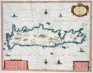
Background imageAbraham Ortelius Collection: Map showing the Island of Crete, c. 1570 (coloured engraving)

Map showing the Island of Crete, c. 1570 (coloured engraving)
BAL42826 Map showing the Island of Crete, c.1570 (coloured engraving) by Ortelius, Abraham (1527-98); O Shea Gallery, London, UK; Flemish, out of copyright

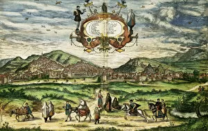
Background imageAbraham Ortelius Collection: Map of Granada, from Civitates Orbis Terrarum (coloured engraving)

Map of Granada, from Civitates Orbis Terrarum (coloured engraving)
AIS5366589 Map of Granada, from Civitates Orbis Terrarum (coloured engraving) by Braun, Georg (1541-1622) and Hogenberg, Franz (1535-90); Biblioteca Universidad, Salamanca

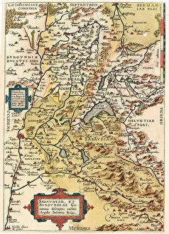
Background imageAbraham Ortelius Collection: Map of Burgundy and Savoy, 1570 (engraving)

Map of Burgundy and Savoy, 1570 (engraving)
LRI4704387 Map of Burgundy and Savoy, 1570 (engraving) by Ortelius, Abraham (1527-98); Museo Navale di Pegli, Genoa, Italy; (add.info)

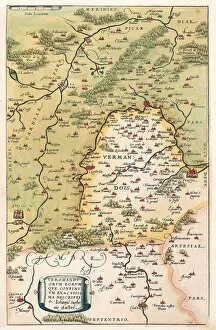
Background imageAbraham Ortelius Collection: Map of Vermandois and Picardy in Gaul (France), 1570 (engraving)

Map of Vermandois and Picardy in Gaul (France), 1570 (engraving)
LRI4704350 Map of Vermandois and Picardy in Gaul (France), 1570 (engraving) by Ortelius, Abraham (1527-98); Museo Navale di Pegli, Genoa

Background imageAbraham Ortelius Collection: Map of Bourges and the region of the centre in Gaul (France), 1570 (engraving)

Map of Bourges and the region of the centre in Gaul (France), 1570 (engraving)
LRI4704305 Map of Bourges and the region of the centre in Gaul (France), 1570 (engraving) by Ortelius, Abraham (1527-98); Museo Navale di Pegli, Genoa

Background imageAbraham Ortelius Collection: Typus Orbis Terrarum, portulan (engraving, 1570)

Typus Orbis Terrarum, portulan (engraving, 1570)
LRI4703971 Typus Orbis Terrarum, portulan (engraving, 1570) by Ortelius, Abraham (1527-98); Biblioteca Civica Berio, Genoa, Italy; (add.info.: Map " Typus Orbis Terrarum")

Background imageAbraham Ortelius Collection: The Azores, according to the Atlas of Ortelius, 1584

The Azores, according to the Atlas of Ortelius, 1584
GIA4730750 The Azores, according to the Atlas of Ortelius, 1584. by Ortelius, Abraham (1527-98) (after); Private Collection; (add.info.: The Azores, according to the Atlas of Ortelius)

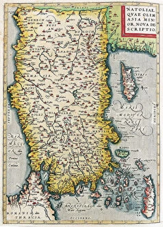
Background imageAbraham Ortelius Collection: Map of Asia Minor (Istanbul and Turkey with the islands of Rhodes and Cyprus)

Map of Asia Minor (Istanbul and Turkey with the islands of Rhodes and Cyprus)
LRI4705006 Map of Asia Minor (Istanbul and Turkey with the islands of Rhodes and Cyprus), 1570 (engraving) by Ortelius, Abraham (1527-98); Museo Navale di Pegli, Genoa, Italy; (add.info.: Natoliae)

Background imageAbraham Ortelius Collection: Map of Palestine, 1570 (engraving)

Map of Palestine, 1570 (engraving)
LRI4704986 Map of Palestine, 1570 (engraving) by Ortelius, Abraham (1527-98); Museo Navale di Pegli, Genoa, Italy; (add.info)

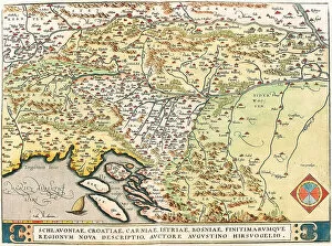
Background imageAbraham Ortelius Collection: Map of Slavonia, Croatia, Bosnia and Dalmatia, 1570 (engraving)

Map of Slavonia, Croatia, Bosnia and Dalmatia, 1570 (engraving)
LRI4704845 Map of Slavonia, Croatia, Bosnia and Dalmatia, 1570 (engraving) by Ortelius, Abraham (1527-98); Museo Navale di Pegli, Genoa, Italy; (add.info.: Schlavoniae, Croatiae, Carniae, Istriae)

Background imageAbraham Ortelius Collection: Map of northern Italy, 1570 (engraving)

Map of northern Italy, 1570 (engraving)
LRI4704759 Map of northern Italy, 1570 (engraving) by Ortelius, Abraham (1527-98); Museo Navale di Pegli, Genoa, Italy; (add.info.: Larii Lacus Vulgo Tertorii Romani Fori Iulii)

Background imageAbraham Ortelius Collection: Map of south of Frankfurt in Germany near Poland, 1570 (engraving)

Map of south of Frankfurt in Germany near Poland, 1570 (engraving)
LRI4704606 Map of south of Frankfurt in Germany near Poland, 1570 (engraving) by Ortelius, Abraham (1527-98); Museo Navale di Pegli, Genoa

Background imageAbraham Ortelius Collection: Map of northern Poland with the city of Dantzig, 1570 (engraving)

Map of northern Poland with the city of Dantzig, 1570 (engraving)
LRI4704540 Map of northern Poland with the city of Dantzig, 1570 (engraving) by Ortelius, Abraham (1527-98); Museo Navale di Pegli, Genoa, Italy; (add.info.: Thietmarsiae)

Background imageAbraham Ortelius Collection: Hekla volcano in Iceland. Atlas of Abraham Ortelius, Amsterdam 1588

Hekla volcano in Iceland. Atlas of Abraham Ortelius, Amsterdam 1588
GIA4745313 Hekla volcano in Iceland. Atlas of Abraham Ortelius, Amsterdam 1588. by Ortelius, Abraham (1527-98); Private Collection; (add.info.: Hekla volcano in Iceland)

Background imageAbraham Ortelius Collection: Former port of Syracuse (Sicily) - in 'Atlas'by Abrahm Ortelius

Former port of Syracuse (Sicily) - in "Atlas"by Abrahm Ortelius
GIA4783810 Former port of Syracuse (Sicily) - in " Atlas" by Abrahm Ortelius, 1583. by Ortelius, Abraham (1527-98); Private Collection; (add.info)

Background imageAbraham Ortelius Collection: Map of Europe, 1587 (hand-coloured engraving)

Map of Europe, 1587 (hand-coloured engraving)
985729 Map of Europe, 1587 (hand-coloured engraving) by Ortelius, Abraham (1527-98) (after); 40.8x28.5 cm; Private Collection; (add.info.: Map of Europe)

Background imageAbraham Ortelius Collection: Autograph letter signed to his nephew, Jacob Cool (Jacobus Colius), Antwerp

Autograph letter signed to his nephew, Jacob Cool (Jacobus Colius), Antwerp
2634796 Autograph letter signed to his nephew, Jacob Cool (Jacobus Colius), Antwerp, 2 February 1595 (pen & ink on paper) by Ortelius

Background imageAbraham Ortelius Collection: Map of the Russian empire in the sixteenth century, copy of an original of 1571

Map of the Russian empire in the sixteenth century, copy of an original of 1571
CHT205700 Map of the Russian empire in the sixteenth century, copy of an original of 1571 (colour litho) by Ortelius, Abraham (1527-98) (after); Bibliotheque des Arts Decoratifs, Paris

Background imageAbraham Ortelius Collection: Map of Persia, from the Theatrum Orbis Terrarum, pub

Map of Persia, from the Theatrum Orbis Terrarum, pub
STC101839 Map of Persia, from the Theatrum Orbis Terrarum, pub. by Abraham Ortelius (1527-98) Antwerp, c.1590 (engraving) by Dutch School

Background imageAbraham Ortelius Collection: Map of Africa and the Arabian Peninsula, (hand-coloured engraving)

Map of Africa and the Arabian Peninsula, (hand-coloured engraving)
1195418 Map of Africa and the Arabian Peninsula, (hand-coloured engraving) by Ortelius, Abraham (1527-98) (after); 37x43, 5 cm; Private Collection; Photo eChristies Images; Flemish, out of copyright

Background imageAbraham Ortelius Collection: Portrait of the cartographer Abraham Ortelius (colour engraving)

Portrait of the cartographer Abraham Ortelius (colour engraving)
AIS5366558 Portrait of the cartographer Abraham Ortelius (colour engraving) by Unknown Artist, (16th century); Biblioteca Universidad, Salamanca

Background imageAbraham Ortelius Collection: Cadiz, Spain, etching after a drawing by Joris Hoefnagel

Cadiz, Spain, etching after a drawing by Joris Hoefnagel
AIS5348117 Cadiz, Spain, etching after a drawing by Joris Hoefnagel by Hoefnagel, Joris (1542-1600) (after); Historic Archives of the City of Barcelona, Barcelona

Background imageAbraham Ortelius Collection: Map of Greece with the Peloponnese and the islands, 1570 (engraving)

Map of Greece with the Peloponnese and the islands, 1570 (engraving)
LRI4704831 Map of Greece with the Peloponnese and the islands, 1570 (engraving) by Ortelius, Abraham (1527-98); Museo Navale di Pegli, Genoa

Background imageAbraham Ortelius Collection: Map of the Mediterranean islands of Sicily, Sardinia, Corfu, Malta, Djerba and Elba

Map of the Mediterranean islands of Sicily, Sardinia, Corfu, Malta, Djerba and Elba
LRI4704794 Map of the Mediterranean islands of Sicily, Sardinia, Corfu, Malta, Djerba and Elba, 1570 (engraving) by Ortelius, Abraham (1527-98); Museo Navale di Pegli, Genoa

Background imageAbraham Ortelius Collection: Map of the Kingdom of Naples in Italy, 1570 (engraving)

Map of the Kingdom of Naples in Italy, 1570 (engraving)
LRI4704786 Map of the Kingdom of Naples in Italy, 1570 (engraving) by Ortelius, Abraham (1527-98); Museo Navale di Pegli, Genoa

Background imageAbraham Ortelius Collection: Map of Tuscany in Italy, 1570 (engraving)

Map of Tuscany in Italy, 1570 (engraving)
LRI4704766 Map of Tuscany in Italy, 1570 (engraving) by Ortelius, Abraham (1527-98); Museo Navale di Pegli, Genoa, Italy; (add.info.: Thusciae)

Background imageAbraham Ortelius Collection: Map of Italy, 1570 (engraving)

Map of Italy, 1570 (engraving)
LRI4704705 Map of Italy, 1570 (engraving) by Ortelius, Abraham (1527-98); Museo Navale di Pegli, Genoa, Italy; (add.info)

Background imageAbraham Ortelius Collection: Map of Salsburg in Austria, 1570 (engraving)

Map of Salsburg in Austria, 1570 (engraving)
LRI4704633 Map of Salsburg in Austria, 1570 (engraving) by Ortelius, Abraham (1527-98); Museo Navale di Pegli, Genoa, Italy; (add.info)

Background imageAbraham Ortelius Collection: Map of Saxonia, Thuringia in Germany, 1570 (engraving)

Map of Saxonia, Thuringia in Germany, 1570 (engraving)
LRI4704551 Map of Saxonia, Thuringia in Germany, 1570 (engraving) by Ortelius, Abraham (1527-98); Museo Navale di Pegli, Genoa, Italy; (add.info.: Saxoniae, Misniae, Thuringiae)

Background imageAbraham Ortelius Collection: Map of northern Germany with the city of Kuden, 1570 (engraving)

Map of northern Germany with the city of Kuden, 1570 (engraving)
LRI4704514 Map of northern Germany with the city of Kuden, 1570 (engraving) by Ortelius, Abraham (1527-98); Museo Navale di Pegli, Genoa, Italy; (add.info.: Thietmarsiae)

Background imageAbraham Ortelius Collection: Map of the Boulonnais territory, Artois and French Flanders (France), 1570 (engraving)

Map of the Boulonnais territory, Artois and French Flanders (France), 1570 (engraving)
LRI4704334 Map of the Boulonnais territory, Artois and French Flanders (France), 1570 (engraving) by Ortelius, Abraham (1527-98); Museo Navale di Pegli, Genoa

Background imageAbraham Ortelius Collection: Map of Gaul (France), 1570 (engraving)

Map of Gaul (France), 1570 (engraving)
LRI4704293 Map of Gaul (France), 1570 (engraving) by Ortelius, Abraham (1527-98); Museo Navale di Pegli, Genoa, Italy; (add.info.: Galliae regni potentiss. nova descriptio)

Background imageAbraham Ortelius Collection: Description of Spain. Geography map from 'Theatrum Orbis Terrarum'

Description of Spain. Geography map from "Theatrum Orbis Terrarum"
LRI4704264 Description of Spain. Geography map from " Theatrum Orbis Terrarum" by Abraham Ortelius (1527-1598), 1570 Genes, Museo Navale by Ortelius

Background imageAbraham Ortelius Collection: Description of the European continent, Geography map from 'Theatrum Orbis Terrarum

Description of the European continent, Geography map from "Theatrum Orbis Terrarum
LRI4704249 Description of the European continent, Geography map from " Theatrum Orbis Terrarum, 1570 by Ortelius, Abraham (1527-98); Museo Navale di Pegli, Genoa

Background imageAbraham Ortelius Collection: Description of the Asian continent, Geography map from 'Theatrum Orbis Terrarum'

Description of the Asian continent, Geography map from "Theatrum Orbis Terrarum"
LRI4704201 Description of the Asian continent, Geography map from " Theatrum Orbis Terrarum", 1570 by Ortelius, Abraham (1527-98); Museo Navale di Pegli, Genoa

Background imageAbraham Ortelius Collection: Palestine and Egypt after the Atlas of Abraham Ortelius, Amsterdam, 1588

Palestine and Egypt after the Atlas of Abraham Ortelius, Amsterdam, 1588
GIA4743416 Palestine and Egypt after the Atlas of Abraham Ortelius, Amsterdam, 1588. by Ortelius, Abraham (1527-98); Private Collection; (add.info)

Background imageAbraham Ortelius Collection: representation of a marine monster mi horse mi sea snake

representation of a marine monster mi horse mi sea snake
GIA4791844 representation of a marine monster mi horse mi sea snake. Plate from an edition of " Theatrum Orbis Terrarum" by cartographer Abraham Ortelius (1527-1598), 1584 by Ortelius

Background imageAbraham Ortelius Collection: The ancient port of Syracuse in Sicily after the 'Atlas'of Abrahm Ortelius

The ancient port of Syracuse in Sicily after the "Atlas"of Abrahm Ortelius
GIA4731174 The ancient port of Syracuse in Sicily after the " Atlas" of Abrahm Ortelius, 1583. by Ortelius, Abraham (1527-98) (after); Private Collection; (add.info)

Background imageAbraham Ortelius Collection: World Map, early 18th century (coloured engraving)

World Map, early 18th century (coloured engraving)
STC205021 World Map, early 18th century (coloured engraving) by Aa, Pieter Van der (1659-1733); Private Collection; (add.info)

Background imageAbraham Ortelius Collection: Asia: Map of the continent including Japan and the East Indies with part of New Guinea, c

Asia: Map of the continent including Japan and the East Indies with part of New Guinea, c
BON111183 Asia: Map of the continent including Japan and the East Indies with part of New Guinea, c.1580 (coloured engraving) by Ortelius

Background imageAbraham Ortelius Collection: Map of Ancient Egypt - by Abraham Ortelius, Antwerp, 1595

Map of Ancient Egypt - by Abraham Ortelius, Antwerp, 1595
LSE4102711 Map of Ancient Egypt - by Abraham Ortelius, Antwerp, 1595 by Ortelius, Abraham (1527-98); Private Collection; (add.info.: Map of Ancient Egypt - by Abraham Ortelius, Antwerp)

Background imageAbraham Ortelius Collection: Abraham Ortelius (engraving)

Abraham Ortelius (engraving)
978713 Abraham Ortelius (engraving) by English School, (19th century); Private Collection; (add.info.: Abraham Ortelius. Illustration for The Handbook to Autographs by Frederick G Netherclift (c 1880)

Background imageAbraham Ortelius Collection: Map of Florida, c. 1584 (hand-coloured engraving)

Map of Florida, c. 1584 (hand-coloured engraving)
945069 Map of Florida, c.1584 (hand-coloured engraving) by Ortelius, Abraham (1527-98); HistoryMiami, Florida, USA; eHistoryMiami; Flemish, out of copyright

Background imageAbraham Ortelius Collection: The Planisphere, cartography of Anversa, 1571

The Planisphere, cartography of Anversa, 1571
3565028 The Planisphere, cartography of Anversa, 1571 by Ortelius, Abraham (1527-98); (add.info.: The Planisphere by Abraham Ortelius, cartography of Anversa)

Background imageAbraham Ortelius Collection: A sailing ship firing its cannon, detail from a map of the Pacific, China and America

A sailing ship firing its cannon, detail from a map of the Pacific, China and America
OPT84597 A sailing ship firing its cannon, detail from a map of the Pacific, China and America, 1599 (coloured engraving) (see also 18634) by Ortelius, Abraham (1527-98); Private Collection; Flemish

Background imageAbraham Ortelius Collection: The Americas, 1592 (hand-coloured engraving)

The Americas, 1592 (hand-coloured engraving)
986218 The Americas, 1592 (hand-coloured engraving) by Ortelius, Abraham (1527-98); Private Collection; (add.info.: The Americas. From Theatrum Orbis Terrarum, by Abraham Ortelius (1527-1598)

Background imageAbraham Ortelius Collection: A Map of Great Britain, 1587 (hand coloured engraving)

A Map of Great Britain, 1587 (hand coloured engraving)
985972 A Map of Great Britain, 1587 (hand coloured engraving) by Ortelius, Abraham (1527-98); Private Collection; (add.info.: A Map of Great Britain)

Background imageAbraham Ortelius Collection: Asia, 1592 (hand-coloured engraving)

Asia, 1592 (hand-coloured engraving)
986219 Asia, 1592 (hand-coloured engraving) by Ortelius, Abraham (1527-98); Private Collection; (add.info.: Asia. From Theatrum Orbis Terrarum, by Abraham Ortelius (1527-1598)


All Professionally Made to Order for Quick Shipping


-

Why Choose Us?

We are a leading provider of Art Prints and Photo Gifts since 2003, working in partnership with a range of Sporting Clubs, Charities, Museums and Picture Libraries. A large share of profits from any of their images will go directly towards supporting that charity or club. Our archive of images is carefully curated to bring you a wide range of subjects, including landscapes, wildlife, architecture, and more. We ship from our partner labs in the UK, USA, EU (Netherlands) and Australia.
+

How do I place an order?

Ordering is quick & easy - Just follow 5 Simple Steps:
  1. Find your image: Use our search box or browse our online photo Collections to find the image you want.

  2. Choose your print format: Select your desired product and add it to your cart.

  3. Enter your details: If you're a returning customer, simply enter your email address and password, and we'll fill in your billing and shipping address details. All personal details are held securely and are fully GDPR compliant. As standard, we remove all Personally Identifiable Information after 12 months.

  4. Pay for your purchase: We use state-of-the-art security for online shopping and do not have access to your card details.

  5. Sit back and relax: We'll email you confirmation of your order and when it's dispatched. Registered customers can also track orders in the 'My Account' area.

+

How do I pay for an order?

You can pay for your order with most of the major credit and debit cards, or PayPal. For added security, major financial institutions process payment details separately and securely on our behalf. We do not have access to your online payment card details. Online payments are preferred however we do take phone orders. For UK customers only we accept cheques issued against a UK bank.
+

Is my data safe?

We take data security very seriously. We do not have access to your full card details and all payments are requested over a fully secure connection. Additionally, we fully comply with current European and GDPR legislation, and automatically remove all personal data after at most 12 months (unless you have an account with us and have signed in recently). We also have a strict opt-in policy and would never sell your personal details. Your data is only used to fulfill your order promptly and efficiently.
+

Is wall art ready to hang?

For quick and easy installation all wall art, including framed prints, canvas prints and metal prints are supplied with a ready to hang solution on the back. Generally, saw tooth hangers are applied as they allow wall art to hang flush against the wall. The serrated edge of the hanger prevents the frame from shifting or tilting when hung.
+

Are the photo prints fade resistant?

Yes, we use archival quality photo paper photographic paper for vivid reproduction Prints are an accurate representations of the original artwork, which is preserved for artistic character and authenticity. We guarantee they match previews shown on our web site