Fraud Blocker Skip to main content

19th Century Style Collection (#8)

Step back in time with the enchanting 19th century style, where elegance and sophistication reigned supreme

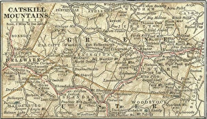
Background image19th Century Style Collection: Map of the Catskill Mountains, New York, c.1900 (engraving)

Map of the Catskill Mountains, New York, c.1900 (engraving)
533423 Map of the Catskill Mountains, New York, c.1900 (engraving); (add.info.: Map of Catskill Mountains, New York, circa 1902)

Background image19th Century Style Collection: Map of Ladysmith, c.1900 (engraving)

Map of Ladysmith, c.1900 (engraving)
533405 Map of Ladysmith, c.1900 (engraving); (add.info.: Map of Ladysmith, South Africa, circa 1902, from the 10th edition of Encyclopaedia Britannica.); Encyclopaedia Britannica/UIG

Background image19th Century Style Collection: Map of Johannesburg, c.1900 (engraving)

Map of Johannesburg, c.1900 (engraving)
533402 Map of Johannesburg, c.1900 (engraving); (add.info.: Map of Johannesburg, South Africa, circa 1902, from the 10th edition of Encyclopaedia Britannica.); Encyclopaedia Britannica/UIG

Background image19th Century Style Collection: Map of Saint Helena Island, c.1900 (engraving)

Map of Saint Helena Island, c.1900 (engraving)
533393 Map of Saint Helena Island, c.1900 (engraving); (add.info.: Map of Saint Helena Island, circa 1902, from the 10th edition of Encyclopaedia Britannica.); Encyclopaedia Britannica/UIG

Background image19th Century Style Collection: Map of Solomon Islands, c.1900 (engraving)

Map of Solomon Islands, c.1900 (engraving)
533372 Map of Solomon Islands, c.1900 (engraving); (add.info.: Map of Solomon Islands, Bougainville, South Pacific, circa 1902)

Background image19th Century Style Collection: Map of islands in the South Pacific, c.1900 (engraving)

Map of islands in the South Pacific, c.1900 (engraving)
533367 Map of islands in the South Pacific, c.1900 (engraving); (add.info.: Map of New Hebrides Islands, Santa Cruz Islands, Loyalty Islands, and New Caledonia, circa 1902)

Background image19th Century Style Collection: Map of Guam, c.1900 (engraving)

Map of Guam, c.1900 (engraving)
533357 Map of Guam, c.1900 (engraving); (add.info.: Map of Guam or Guajan Island (U.S.), circa 1902, from the 10th edition of Encyclopaedia Britannica.); Encyclopaedia Britannica/UIG

Background image19th Century Style Collection: Map of the north extension of Kurile Islands, c.1900 (engraving)

Map of the north extension of Kurile Islands, c.1900 (engraving)
533332 Map of the north extension of Kurile Islands, c.1900 (engraving); (add.info.: Map of the north extension of Kurile Islands (then part of Japan), circa 1902

Background image19th Century Style Collection: Map of Sicily, c.1900 (engraving)

Map of Sicily, c.1900 (engraving)
533317 Map of Sicily, c.1900 (engraving); (add.info.: Map of Sicily, Italy, circa 1902, from the 10th edition of Encyclopaedia Britannica.); Encyclopaedia Britannica/UIG

Background image19th Century Style Collection: Map of East India Islands with New Guinea, c.1900 (engraving)

Map of East India Islands with New Guinea, c.1900 (engraving)
533036 Map of East India Islands with New Guinea, c.1900 (engraving); (add.info.: Map of East India Islands, with an inset of New Guinea, circa 1902)

Background image19th Century Style Collection: Map of China, c.1900 (engraving)

Map of China, c.1900 (engraving)
533028 Map of China, c.1900 (engraving); (add.info.: Map of China, circa 1902, from the 10th edition of Encyclopaedia Britannica.); Encyclopaedia Britannica/UIG

Background image19th Century Style Collection: Map of Arabia with part of Turkey and Oman, c.1900 (engraving)

Map of Arabia with part of Turkey and Oman, c.1900 (engraving)
533009 Map of Arabia with part of Turkey and Oman, c.1900 (engraving); (add.info.: Map of Arabia, Turkey, Oman, Aden, with insets map of Jerusalem and Palestine, circa 1902)

Background image19th Century Style Collection: Map of Turkey, c.1900 (engraving)

Map of Turkey, c.1900 (engraving)
533006 Map of Turkey, c.1900 (engraving); (add.info.: Map showing the historical boundaries of Turkey in Asia, circa 1902)

Background image19th Century Style Collection: Map of Russia with inset of St. Petersburg, c.1900 (engraving)

Map of Russia with inset of St. Petersburg, c.1900 (engraving)
532995 Map of Russia with inset of St. Petersburg, c.1900 (engraving); (add.info.: Map of Russia, with an inset of St. Petersburg, circa 1902)

Background image19th Century Style Collection: Map of Channel Islands, c.1900 (engraving)

Map of Channel Islands, c.1900 (engraving)
533278 Map of Channel Islands, c.1900 (engraving); (add.info.: Map of Channel Islands, United Kingdom, circa 1902, from the 10th edition of Encyclopaedia Britannica.); Encyclopaedia Britannica/UIG

Background image19th Century Style Collection: Map of the northwestern part of South America, c.1900 (engraving)

Map of the northwestern part of South America, c.1900 (engraving)
533259 Map of the northwestern part of South America, c.1900 (engraving); (add.info.: Map of northwest South America: Colombia, Venezuela, British Guiana, Ecuador, Peru, and Bolivia, circa 1902)

Background image19th Century Style Collection: Map of Mexico, c.1900 (engraving)

Map of Mexico, c.1900 (engraving)
533250 Map of Mexico, c.1900 (engraving); (add.info.: Map of Mexico, circa 1902, from the 10th edition of Encyclopaedia Britannica.); Encyclopaedia Britannica/UIG

Background image19th Century Style Collection: Map of Nevada and Utah, c.1900 (engraving)

Map of Nevada and Utah, c.1900 (engraving)
533228 Map of Nevada and Utah, c.1900 (engraving); (add.info.: Map of Nevada and Utah, United States, with an inset map of Salt Lake City, circa 1902)

Background image19th Century Style Collection: Map of Colorado, c.1900 (engraving)

Map of Colorado, c.1900 (engraving)
533216 Map of Colorado, c.1900 (engraving); (add.info.: Map of Colorado, United States, circa 1902, from the 10th edition of Encyclopaedia Britannica.); Encyclopaedia Britannica/UIG

Background image19th Century Style Collection: Map of Montana, c.1900 (engraving)

Map of Montana, c.1900 (engraving)
533209 Map of Montana, c.1900 (engraving); (add.info.: Map of Montana, United States, circa 1902, from the 10th edition of Encyclopaedia Britannica.); Encyclopaedia Britannica/UIG

Background image19th Century Style Collection: Map of Oklahoma and the Indian Territory, c.1900 (engraving)

Map of Oklahoma and the Indian Territory, c.1900 (engraving)
533207 Map of Oklahoma and the Indian Territory, c.1900 (engraving); (add.info.: Map of Oklahoma and the Indian Territory, United States, circa 1902)

Background image19th Century Style Collection: Map of San Diego, c.1900 (engraving)

Map of San Diego, c.1900 (engraving)
532854 Map of San Diego, c.1900 (engraving); (add.info.: Map of San Diego, California, circa 1900, from the 10th edition of Encyclopaedia Britannica.); Encyclopaedia Britannica/UIG

Background image19th Century Style Collection: Map of Iowa, c.1900 (engraving)

Map of Iowa, c.1900 (engraving)
533195 Map of Iowa, c.1900 (engraving); (add.info.: Map of Iowa, United States, circa 1902, from the 10th edition of Encyclopaedia Britannica.); Encyclopaedia Britannica/UIG

Background image19th Century Style Collection: Map of northern Ohio, c.1900 (engraving)

Map of northern Ohio, c.1900 (engraving)
533164 Map of northern Ohio, c.1900 (engraving); (add.info.: Map of the northern part of Ohio, United States, circa 1902, from the 10th edition of Encyclopaedia Britannica)

Background image19th Century Style Collection: Map of Alabama, c.1900 (engraving)

Map of Alabama, c.1900 (engraving)
533151 Map of Alabama, c.1900 (engraving); (add.info.: Map of Alabama, United States, circa 1902, from the 10th edition of Encyclopaedia Britannica.); Encyclopaedia Britannica/UIG

Background image19th Century Style Collection: Map of Rio De Janeiro, c.1900 (engraving)

Map of Rio De Janeiro, c.1900 (engraving)
532842 Map of Rio De Janeiro, c.1900 (engraving); (add.info.: Map of Rio De Janeiro, circa 1900, from the 10th edition of Encyclopaedia Britannica.); Encyclopaedia Britannica/UIG

Background image19th Century Style Collection: Map of Pittsburgh, c.1900 (engraving)

Map of Pittsburgh, c.1900 (engraving)
532828 Map of Pittsburgh, c.1900 (engraving); (add.info.: Map of Pittsburgh, circa 1900, from the 10th edition of Encyclopaedia Britannica.); Encyclopaedia Britannica/UIG

Background image19th Century Style Collection: Map of Peking, c.1900 (engraving)

Map of Peking, c.1900 (engraving)
532822 Map of Peking, c.1900 (engraving); (add.info.: Map of Peking (Beijing), China, circa 1900, from the 10th edition of Encyclopaedia Britannica.); Encyclopaedia Britannica/UIG

Background image19th Century Style Collection: Map of Omaha, c.1900 (engraving)

Map of Omaha, c.1900 (engraving)
532813 Map of Omaha, c.1900 (engraving); (add.info.: Map of Omaha, Nebraska, circa 1902, from the 10th edition of Encyclopaedia Britannica.); Encyclopaedia Britannica/UIG

Background image19th Century Style Collection: Map of Quebec, Canada, c.1900 (engraving)

Map of Quebec, Canada, c.1900 (engraving)
533080 Map of Quebec, Canada, c.1900 (engraving); (add.info.: Map of Quebec, Canada, with insets of Quebec City and Montreal, circa 1902)

Background image19th Century Style Collection: Map of Milwaukee, c.1900 (engraving)

Map of Milwaukee, c.1900 (engraving)
532798 Map of Milwaukee, c.1900 (engraving); (add.info.: Map of Milwaukee, Wisconsin, circa 1900, from the 10th edition of Encyclopaedia Britannica.); Encyclopaedia Britannica/UIG

Background image19th Century Style Collection: Map of Japan and Korea, c.1900 (engraving)

Map of Japan and Korea, c.1900 (engraving)
533031 Map of Japan and Korea, c.1900 (engraving); (add.info.: Map of Japan and Korea, with insets of Kurile Islands, Liu-Kiu Islands and Formosa, circa 1902)

Background image19th Century Style Collection: Map of southern India with Bombay, c.1900 (engraving)

Map of southern India with Bombay, c.1900 (engraving)
533019 Map of southern India with Bombay, c.1900 (engraving); (add.info.: Map showing historical boundaries of Southern India with inset map of Bombay (now Mumbai) and the Malay Peninsula

Background image19th Century Style Collection: Map of Italy, c.1900 (engraving)

Map of Italy, c.1900 (engraving)
532983 Map of Italy, c.1900 (engraving); (add.info.: Map of Italy, with insets of Rome and Venice, circa 1902, from the 10th edition of Encyclopaedia Britannica.); Encyclopaedia Britannica/UIG

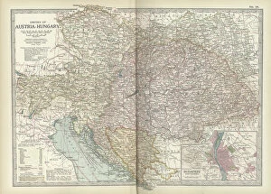
Background image19th Century Style Collection: Map of the Empire of Austria-Hungary, c.1900 (engraving)

Map of the Empire of Austria-Hungary, c.1900 (engraving)
532977 Map of the Empire of Austria-Hungary, c.1900 (engraving); (add.info.: Map of Empire of Austria-Hungary and inset of Budapest and Vicinity, circa 1902)

Background image19th Century Style Collection: Map of the southwestern part of the German Empire, c.1900 (engraving)

Map of the southwestern part of the German Empire, c.1900 (engraving)
532961 Map of the southwestern part of the German Empire, c.1900 (engraving); (add.info.: Map of the southwestern German Empire, circa 1902)

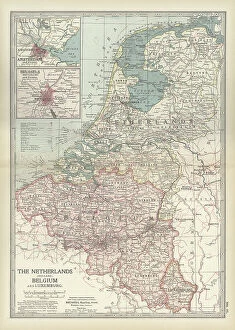
Background image19th Century Style Collection: Map of Netherlands and Belgium, c.1900 (engraving)

Map of Netherlands and Belgium, c.1900 (engraving)
532956 Map of Netherlands and Belgium, c.1900 (engraving); (add.info.: Map showing the historical boundaries of Netherlands, Belgium, Luxemburg, with insets of Amsterdam and Brussels, circa 1902)

Background image19th Century Style Collection: Map of Spain with Portugal and Andorra, c.1900 (engraving)

Map of Spain with Portugal and Andorra, c.1900 (engraving)
532952 Map of Spain with Portugal and Andorra, c.1900 (engraving); (add.info.: Map of Spain with Portugal and Andorra, with insets of the Azores Islands, Canary Islands, and Madeira Island)

Background image19th Century Style Collection: Map of France, c.1900 (engraving)

Map of France, c.1900 (engraving)
532942 Map of France, c.1900 (engraving); (add.info.: Map of northern France with insets showing the provinces of France and Paris and Vicinity, circa 1902)

Background image19th Century Style Collection: Map of England and Wales, c.1900 (engraving)

Map of England and Wales, c.1900 (engraving)
532924 Map of England and Wales, c.1900 (engraving); (add.info.: Map of England and Wales, with Hereford, Monmouth, Gloucester, Somerset, and parts of Worchester and Wiltshire, circa 1902)

Background image19th Century Style Collection: Map of London, England, c.1900 (engraving)

Map of London, England, c.1900 (engraving)
532921 Map of London, England, c.1900 (engraving); (add.info.: Map of London, England, and vicinity, circa 1902, from the 10th edition of Encyclopaedia Britannica.); Encyclopaedia Britannica/UIG

Background image19th Century Style Collection: Map of England and Wales, c.1900 (engraving)

Map of England and Wales, c.1900 (engraving)
532903 Map of England and Wales, c.1900 (engraving); (add.info.: Map showing the historical boundaries of northern England and Wales, including insets of Liverpool, Manchester and Vicinity)

Background image19th Century Style Collection: Map of Central Europe, c.1900 (engraving)

Map of Central Europe, c.1900 (engraving)
532900 Map of Central Europe, c.1900 (engraving); (add.info.: Map of Central Europe, circa 1902, From the 10th edition of Encyclopaedia Britannica.); Encyclopaedia Britannica/UIG

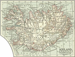
Background image19th Century Style Collection: Map of Iceland, c.1900 (engraving)

Map of Iceland, c.1900 (engraving)
533307 Map of Iceland, c.1900 (engraving); (add.info.: Map of Iceland showing glaciers (Jokull), fjords and other geographical features, circa 1902

Background image19th Century Style Collection: Map of Marseille, France, c.1900 (engraving)

Map of Marseille, France, c.1900 (engraving)
533294 Map of Marseille, France, c.1900 (engraving); (add.info.: Map of Marseille, France, circa 1902, from the 10th edition of Encyclopaedia Britannica.); Encyclopaedia Britannica/UIG

Background image19th Century Style Collection: Map of Rome, c.1900 (engraving)

Map of Rome, c.1900 (engraving)
532848 Map of Rome, c.1900 (engraving); (add.info.: Map of Rome, circa 1900, from the 10th edition of Encyclopaedia Britannica.); Encyclopaedia Britannica/UIG

Background image19th Century Style Collection: Map of South America, c.1900 (engraving)

Map of South America, c.1900 (engraving)
533256 Map of South America, c.1900 (engraving); (add.info.: Map of South America with inset maps of Isthmus of Panama, Galapagos Islands and Trinidad, circa 1902)

Background image19th Century Style Collection: Map of Washington State, c.1900 (engraving)

Map of Washington State, c.1900 (engraving)
533220 Map of Washington State, c.1900 (engraving); (add.info.: Map of Washington State, United States, circa 1902, from the 10th edition of Encyclopaedia Britannica.); Encyclopaedia Britannica/UIG


All Professionally Made to Order for Quick Shipping

Step back in time with the enchanting 19th century style, where elegance and sophistication reigned supreme. Transport yourself to a bygone era with the iconic Railway Children original UK one-sheet poster, capturing the essence of this timeless period. Jenny Agutter's captivating performance in The Railway Children (1970) epitomizes the grace and poise that defined this era. Immerse yourself in nature's beauty with the majestic Monkey puzzle tree (araucaria imbricata), a symbol of strength and resilience that graced many Victorian gardens. Discover the elusive Thylacinus cynocephalus, also known as the Tasmanian Tiger or Thylacine, an intriguing creature from this era shrouded in mystery. Indulge in tales of aristocracy and intrigue through Kind Hearts And Coronets, a classic film showcasing opulent costumes and lavish settings reminiscent of high society during this period. Explore Whitby through an exquisite map that transports you to its picturesque streets lined with charming cottages and historic landmarks. Uncover history's secrets through antique maps like Ireland's intricate cartography or Tasmania's rugged coastlines; each telling stories of exploration and discovery. Delve into human anatomy with detailed illustrations depicting our backbone including ribs and pelvis - a testament to scientific advancements during this time. Marvel at antique colored illustrations such as Geological map of England and Wales, which showcase not only geological wonders but also highlight artistic craftsmanship prevalent throughout the 19th century. Let The Railway Children whisk you away on a nostalgic journey filled with innocence, adventure, and heartfelt moments that capture the spirit of this remarkable era. Finally, immerse yourself in Heroes Of The Trojan War - tales passed down through generations embodying bravery amidst epic battles - reminding us that even centuries later these stories continue to captivate our imagination. Embrace all things 19th century style.